As we get ready to celebrate 50 years since man landed Apollo 11 on the Moon this July, I recently had the privilege of visiting a location on Earth that resembles a lunar landing. The White Pocket area of Paria Canyon-Vermilion Cliffs National Monument, a spot that feels out of this world, is nestled between Page, Arizona and Kanab, Utah. It’s guarded by remote, and rugged terrain, so it sees far fewer visitors each year than its neighbors at Zion, Bryce and the Grand Canyon. However, each year its recognition among photographers and adventurers grows.
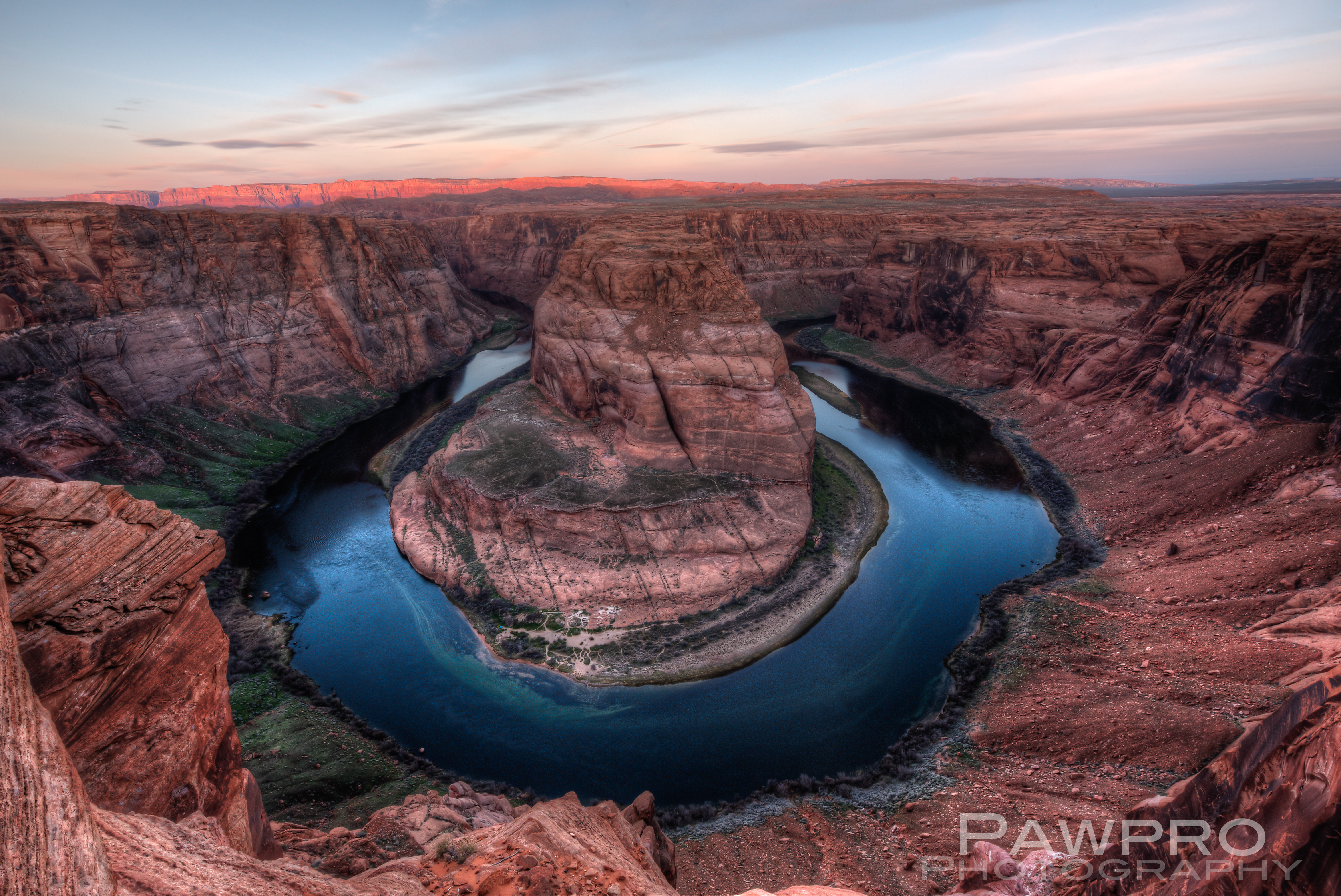
If you’ve visited Horseshoe Bend, AZ for a sunrise photo facing west you couldn’t miss the Vermilion Cliffs and the Paria Plateau 10 miles in the distance because the first light of sunrise illuminates this elevated, red rock wilderness before anything else.
This 112,500 acre “island in the sky”, as some have referred to it, is accessed from the west and north sides via Kanab and 89A where the dramatic step off becomes invisible once you’re on it. Stretches of 89A are said to roughly follow the path of early Franciscan explorers, as well as the route taken by early Mormons on their way to be married at the nearest temple. Once you’re off the pavement, it’s a long trail to reach these relatively small geological masterpieces on primitive paths mostly maintained by usage.
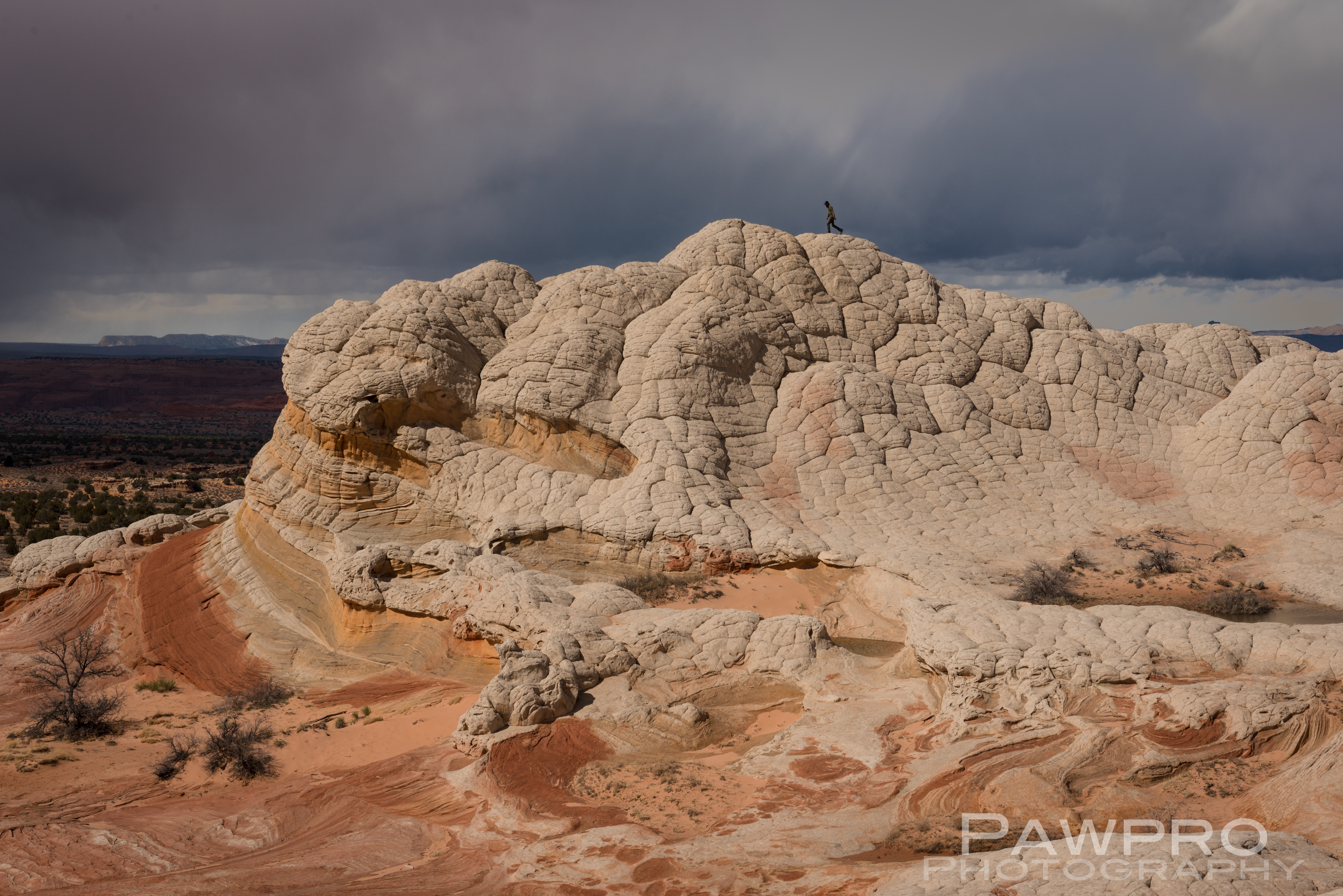
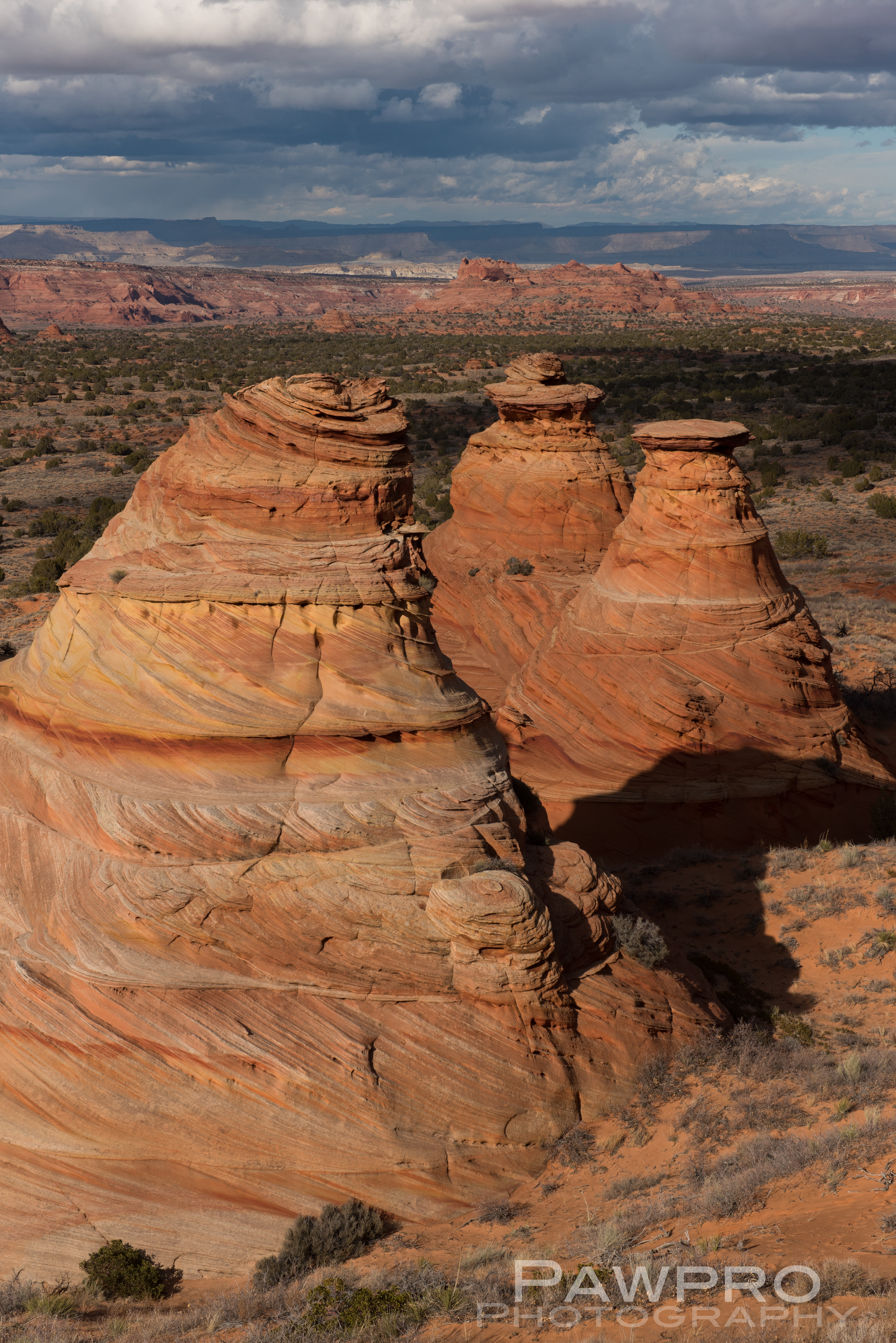
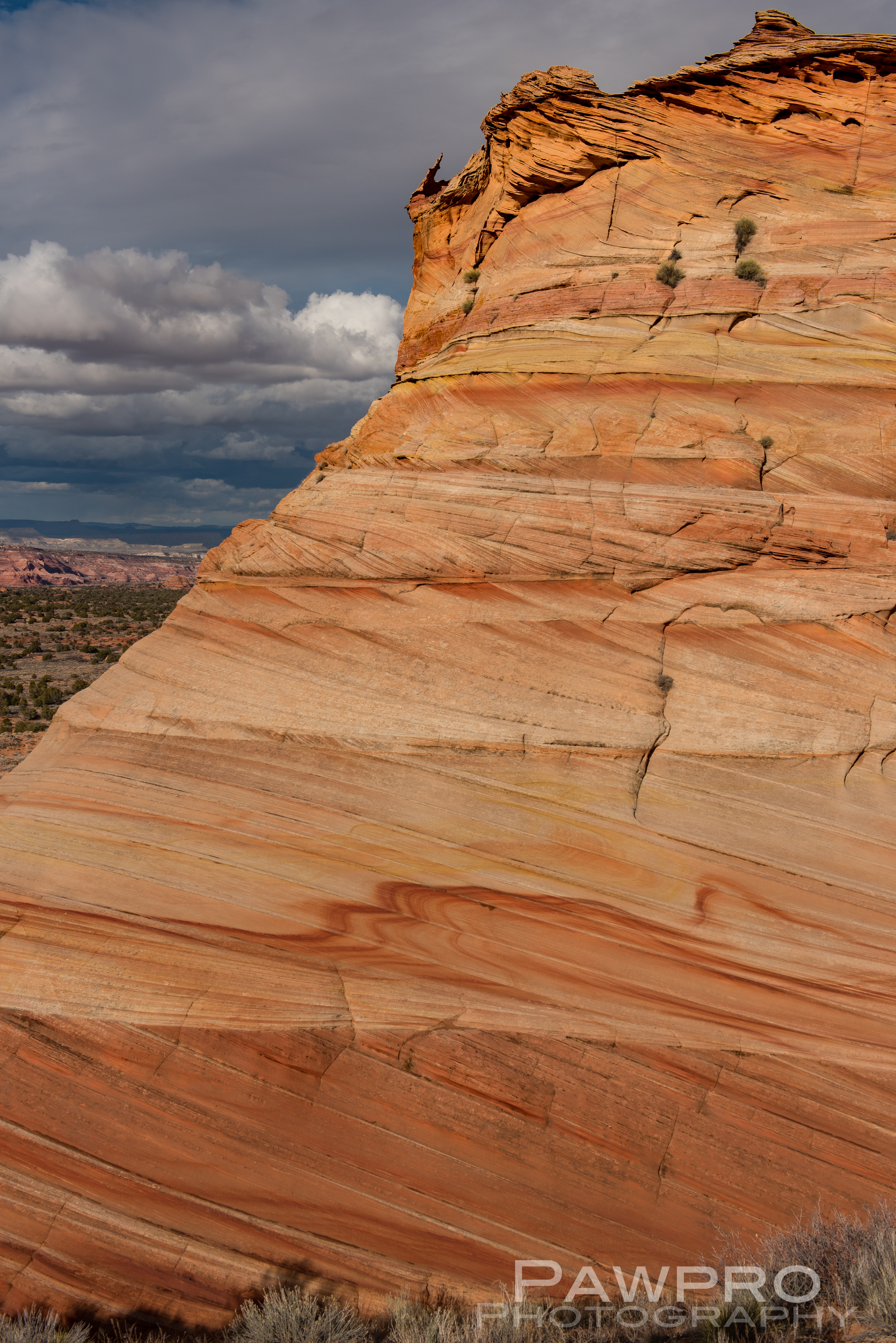
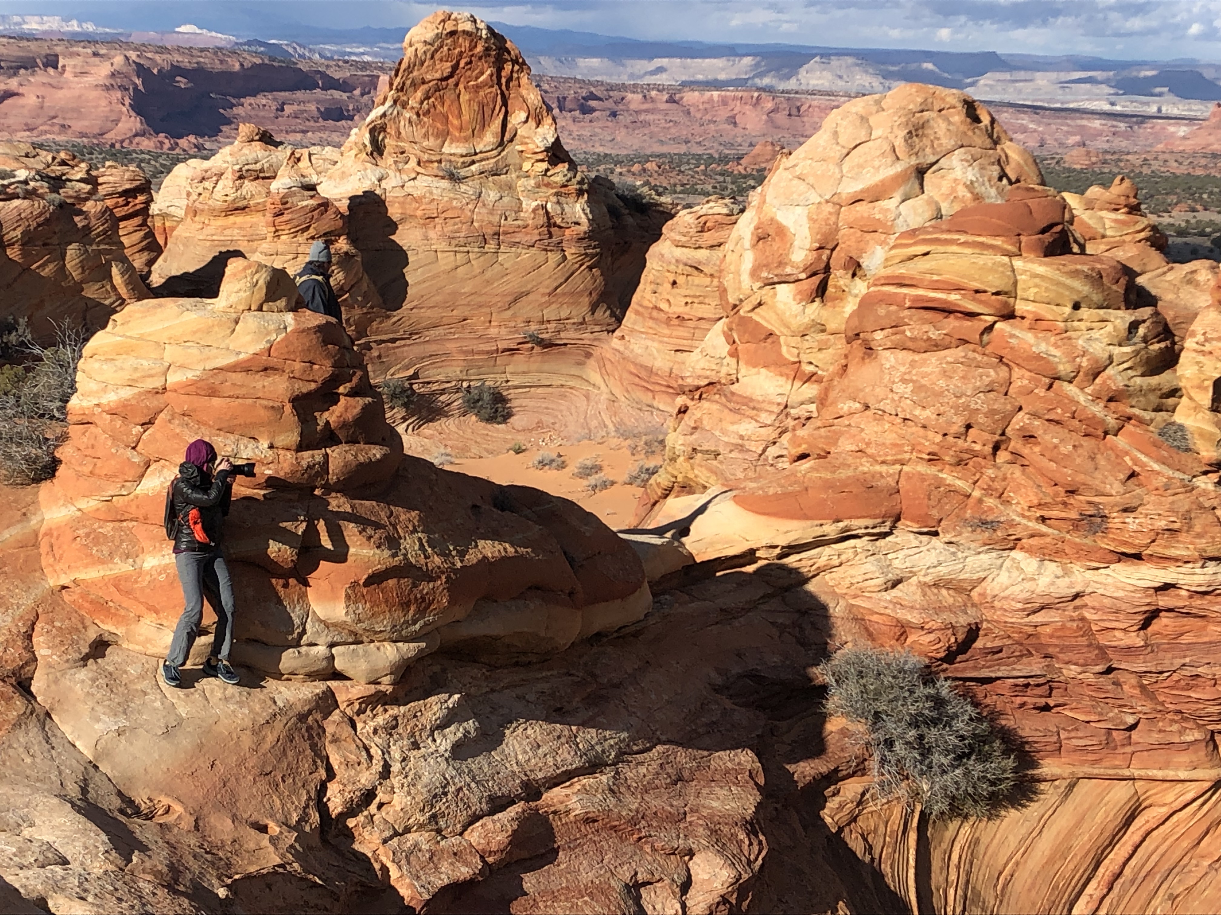
Geologically, White Pocket is one of a kind with its relatively thin, drippy coating of white stone resembling cauliflower or brain matter on the surface–giving rise to the lunar sensation. Just beneath is the striated, slick rock, sedimentary, Navajo, red 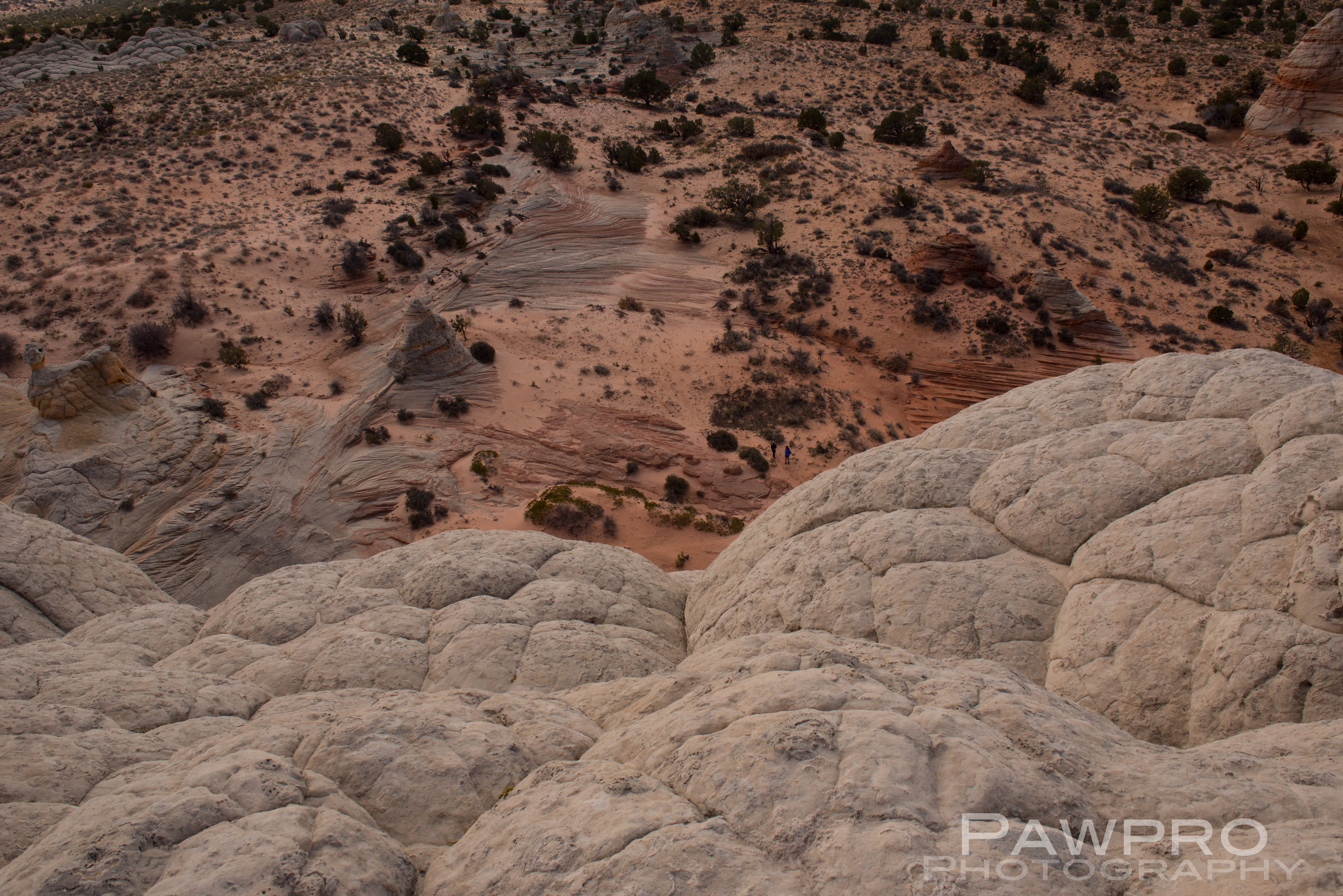
sandstone of varied hardness so common in the area. What’s uncommon is the well-preserved and chaotic layering where time and clearly violent movement tell the untold, almost photographic, story of what occurred here. Some geologists theorize that the area was created by a massive sand slide during the Jurassic Period, probably triggered by an earthquake, where soft, saturated sediment deep below the surface rapidly descended over a large pond or oasis resulting in unstable pockets of
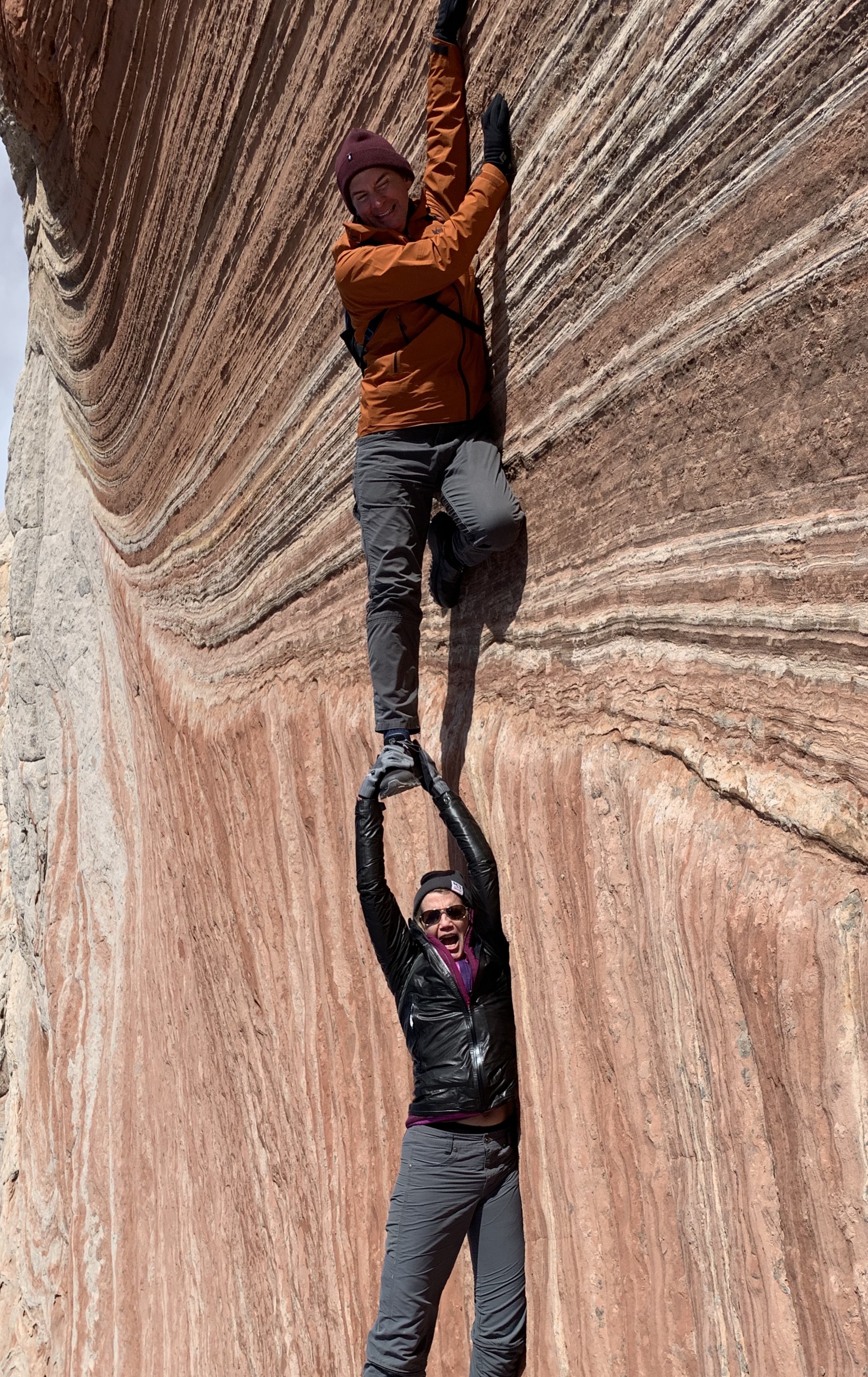
trapped water and wet sand shifting, burping and bending beneath as if layers of rubber. As sedimentary layers settled under the weight of the new surface, trapped water bubbled and migrated, forcing its way to different places in volcanic-like movements of soil. What’s left are a varied and unusual array of hoodoos, fins, cones, ridges and ravines coated in white polygonal shaped icing that at times can resemble marble cake. There is the unmistakable feeling that while the rock was still wet a large hand was sculpting and working it; as if you were dropped inside the deep layered topography of paints—red, orange, yellow, pink, and white– within a Van Gogh painting where heavy-handed brush strokes and the gouges and smears of a palette knife prevailed to create masterful depth. That’s as close as I can come to describing it. Hopefully, the photos help.
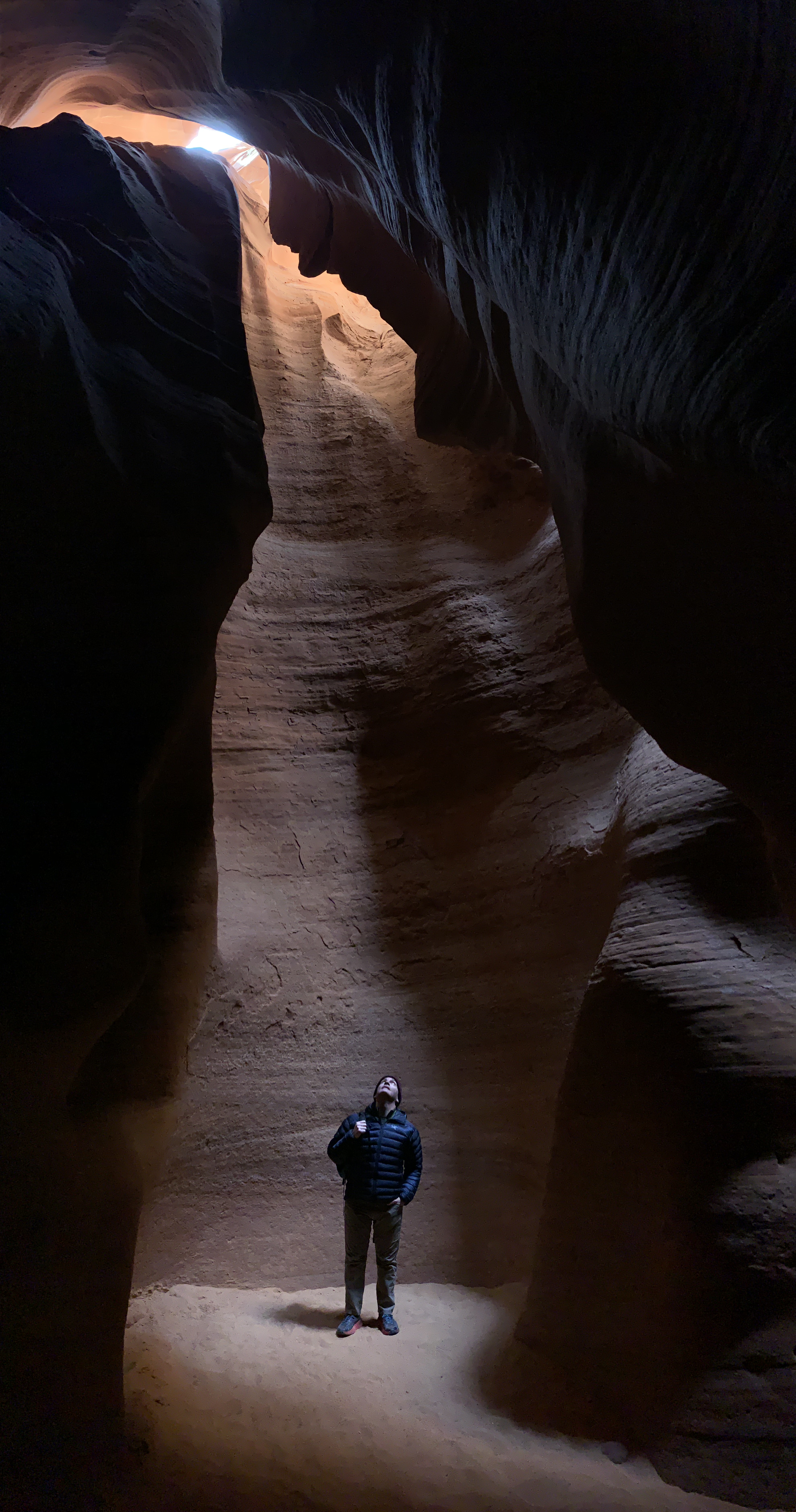
White Pocket Gallery


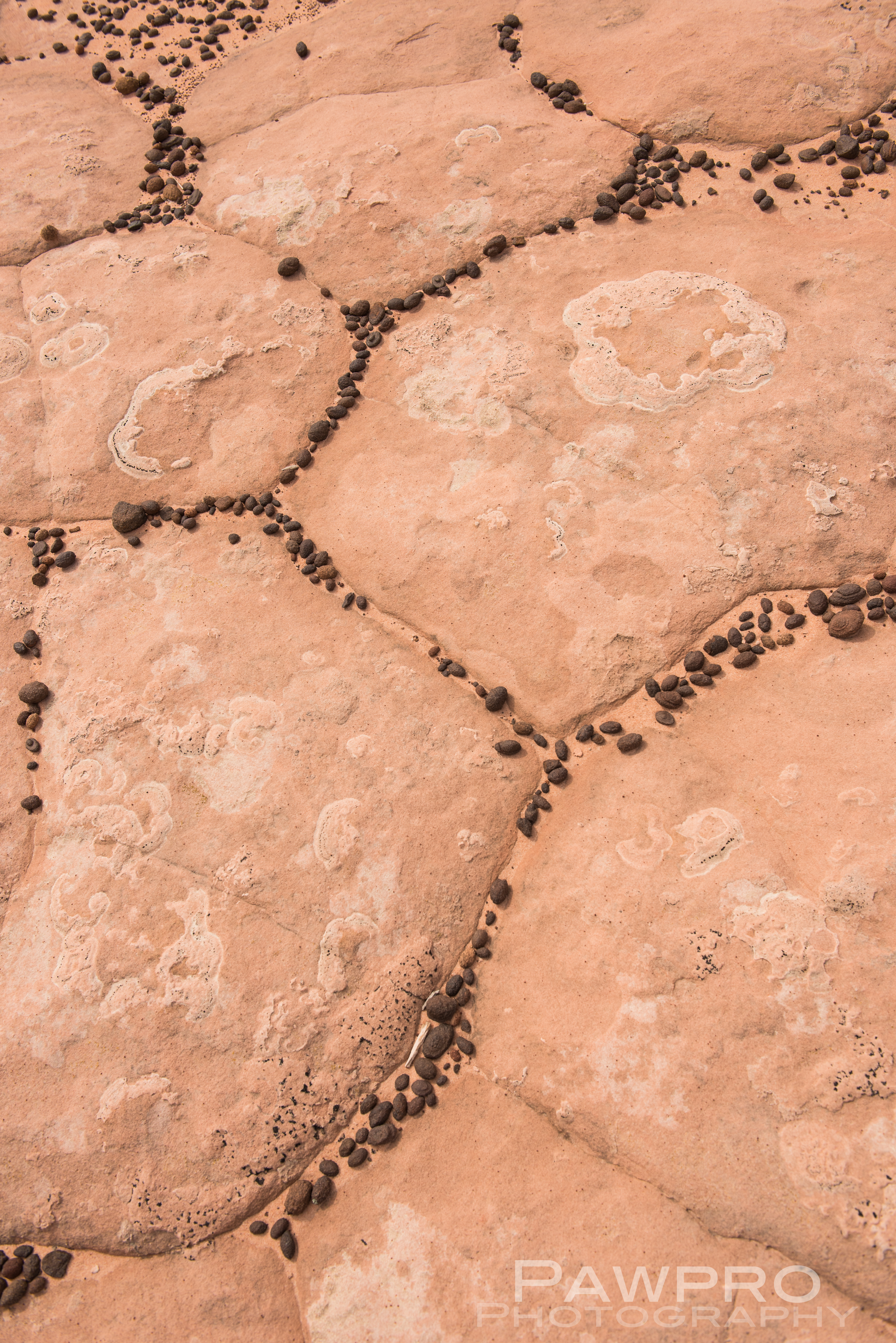
We learned that the little black pebbles in-between many of the fractured polygonal formations are called Moqui Marbles which are iron oxide concretions that form underground where iron minerals collect in the form of a shell with a sandstone core. Similar formations were discovered on Mars in 2004 by the Mars Exploration Rover.
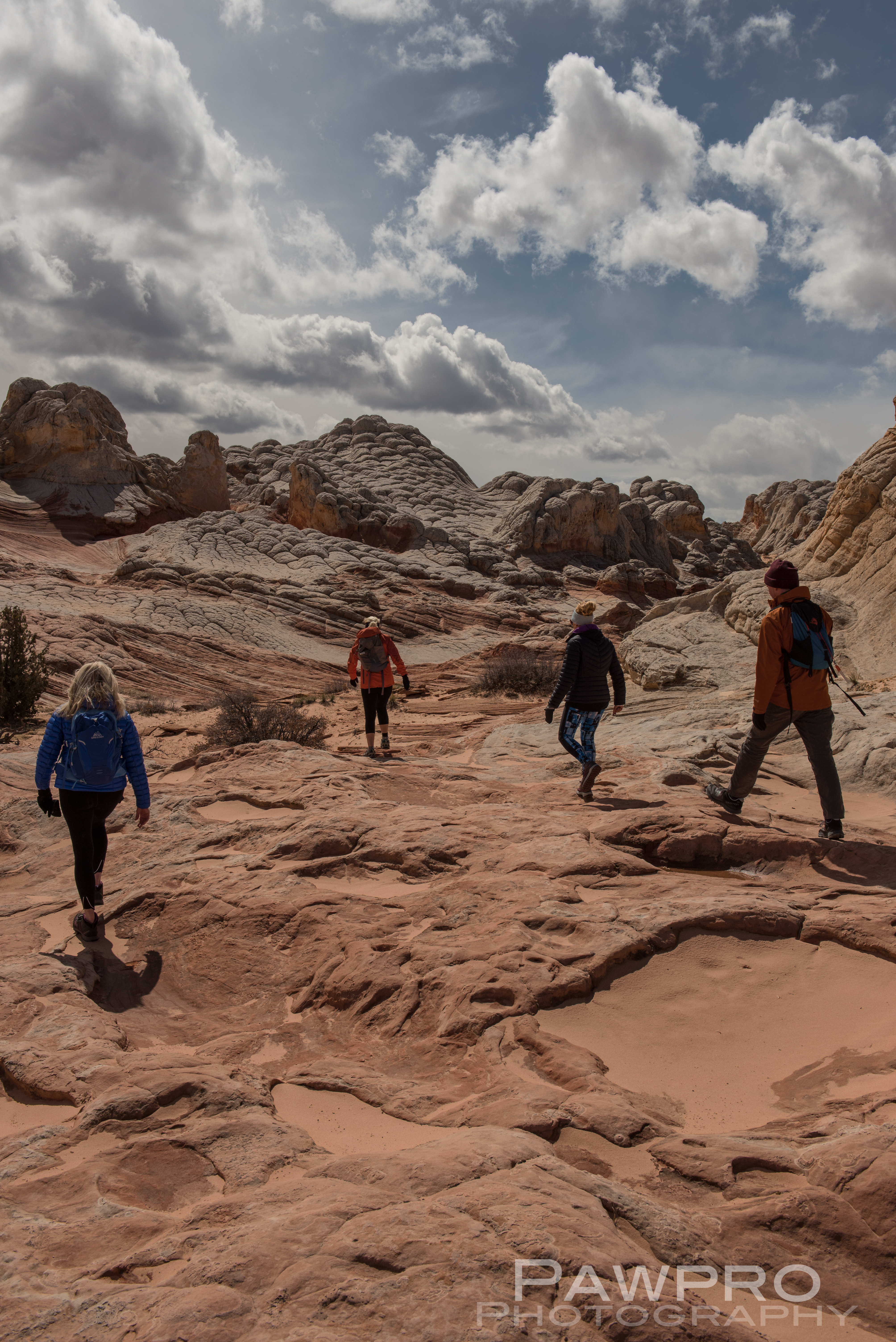
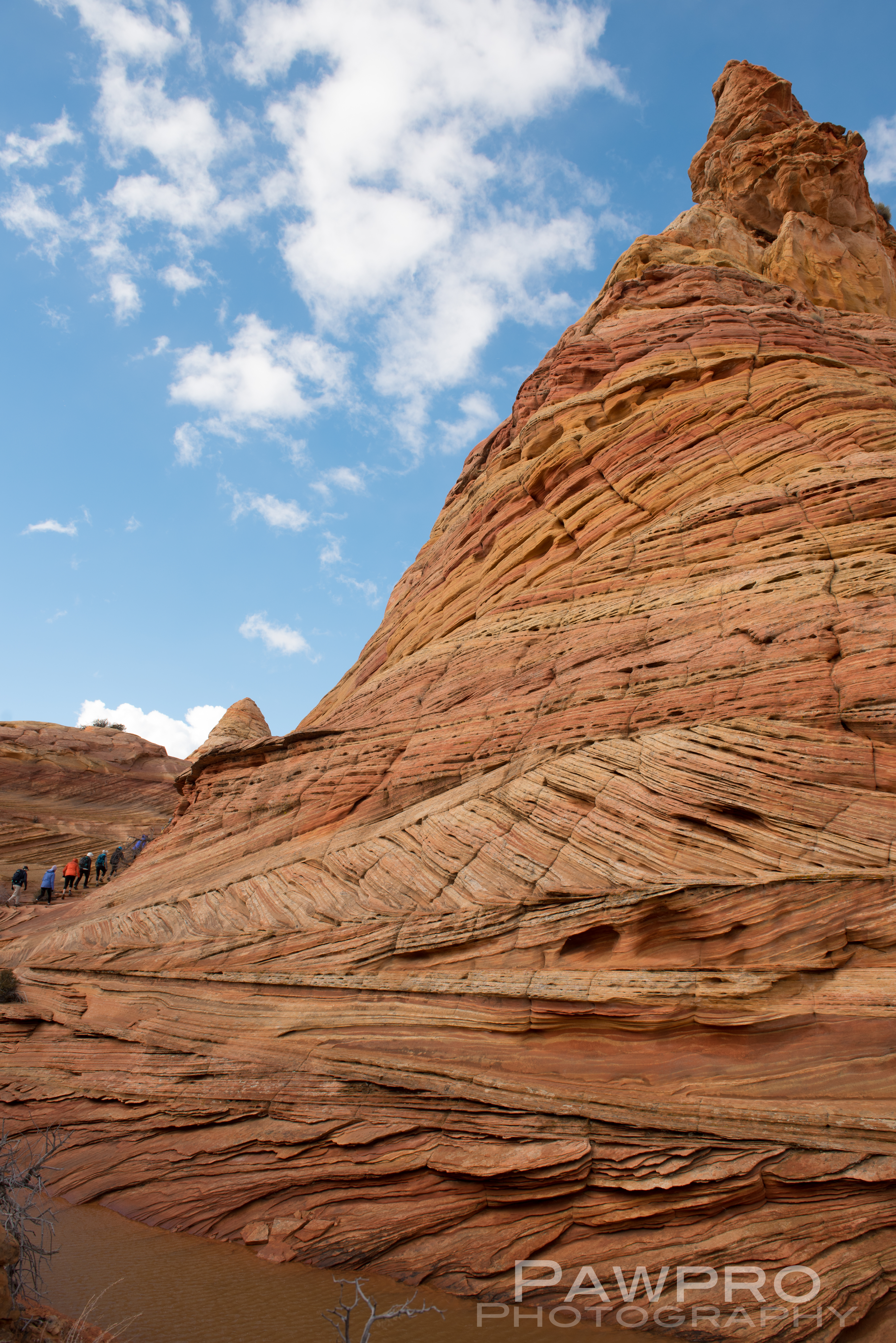
Nearby is the more well-known, North Coyote Buttes commonly referred to as, The Wave, where access is limited to 20 visitors a day by lottery, and South Coyote Buttes which requires daily permits and limits, as well–even if you have a guide. (BLM Coyote Buttes Permits) White Canyon doesn’t require a permit. The Bureau of Land Management (BLM) oversees all of these areas.
South Coyote Buttes Gallery


Getting There
I considered trying to access South Coyote Buttes on my own, BLM permits in hand, but was glad I didn’t once I saw the conditions. The roads are tough and require a true high clearance, 4X4 vehicle. Your basic AWD, rental vehicle probably won’t cut it in the deep sand, potential deep mud, combined with steep inclines, large rocks and ditches. It’s also easy to forget the elevation because of the plateau. As with any mountainous region, conditions can change quickly. I spent most of the day in the area that started out with sunny blue skies, but quickly devolved into a disorienting, extended snow squall. If you get stranded or stuck you’re not likely to see a passerby until the next day. Ignorance, isolation and preparedness are formidable and the most common predators of visitors, say the locals. Even if you have the proper vehicle and feel comfortable behind the wheel in these conditions, navigating the infrequently marked, dirt trails, from one area to another could be another wheel spinner.
That being said, I can’t imagine how hot and uncomfortable it must be here in the summer months, an added danger for visitors. To me, March, April, and October are an ideal time to visit for this very reason. The temperatures can vary wildly but generally remains in a manageable range. Again, visitors must stay aware of conditions and be prepared for quick changes.
Our Guides and What I Wore?
Witnessing the Native American petroglyphs, abandoned and deteriorating corrals and cabins now protected within this National Monument makes a visitor imagine what life was like for those early inhabitants. Early Native Americans–especially Puebloans– were thought to use the area for refuge while moving from one area to the next. During the wild, wild, west the formations functioned as hideouts. The remote, small, wooden structures along the primitive one lane roads are served by the ubiquitous wind mill-powered wells spinning nearby; an ode to turn of the century West. I imagined hearing the squeak of the spinning blades during the still of the night.
We chugged along safe and sound in our large SUVs equipped with satellite phones in case of an emergency. Getting stuck and having to spend the night out here is a reality for any visitor—no matter how prepared. Our guides from Dreamland
Safaris Tours were professional, well-equipped, knowledgeable and fun—most importantly. Each guide had their own individual style and stories about the places we visited. We had a great time getting to know them. (#DreamlandSafariTours)
We were treated to many archeological and geological artifacts throughout the exploration, but reminded not to take souvenirs.
As far as my outwear, I was happy to have many layers to keep myself warm as the temperature fluctuated and then dropped precipitously. During the snow squall the wind was howling and the temperature probably dropped 20˚, or more. A hard shell is a must to stop the wind and to stay dry. As a person who can feel cold when the temperature drops below 72˚ F, I am a big proponent of wool base layers, or any base layer for much of the year.
Being comfortable and knowing what you need in terms of layers is a learned skill. (See more specific selections below.) It’s different for each person. If you want to be certain you have the right outerwear, you must do some homework and know what works for you–wool, synthetic, down, fitted or loose, bluesign®, ethically sourced, etc. I prefer efficient, fitted, lightweight layers that breath and dry quickly, so that I don’t feel restricted by my clothing. And, always be prepared for the unexpected, whether that’s heat or cold. As far as shoes are concerned, a hiking shoe for extra traction will be helpful on this mild hiking experience. You might also want to wear gaiters to keep the sand out of your shoes, but it’s not a necessity.
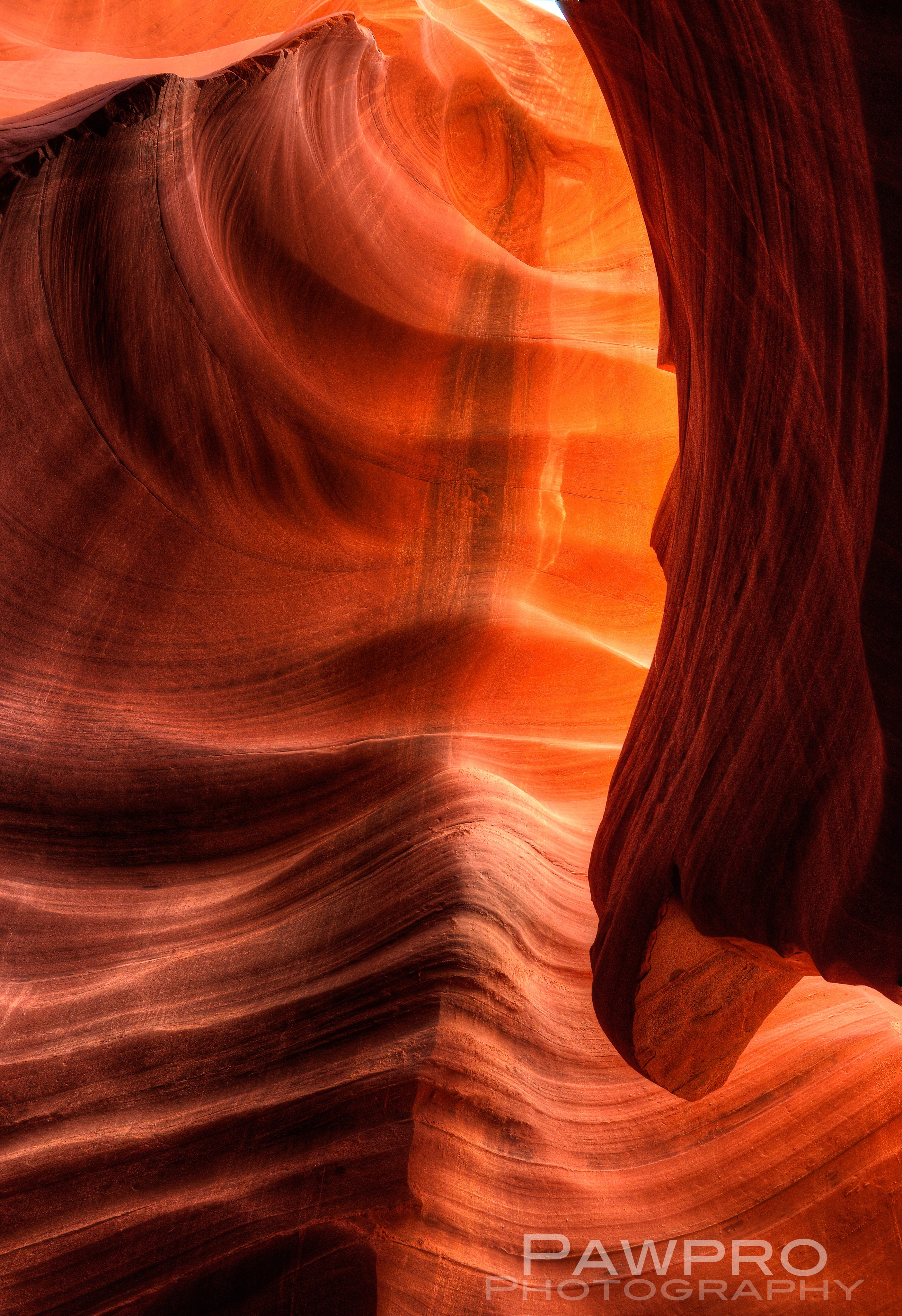
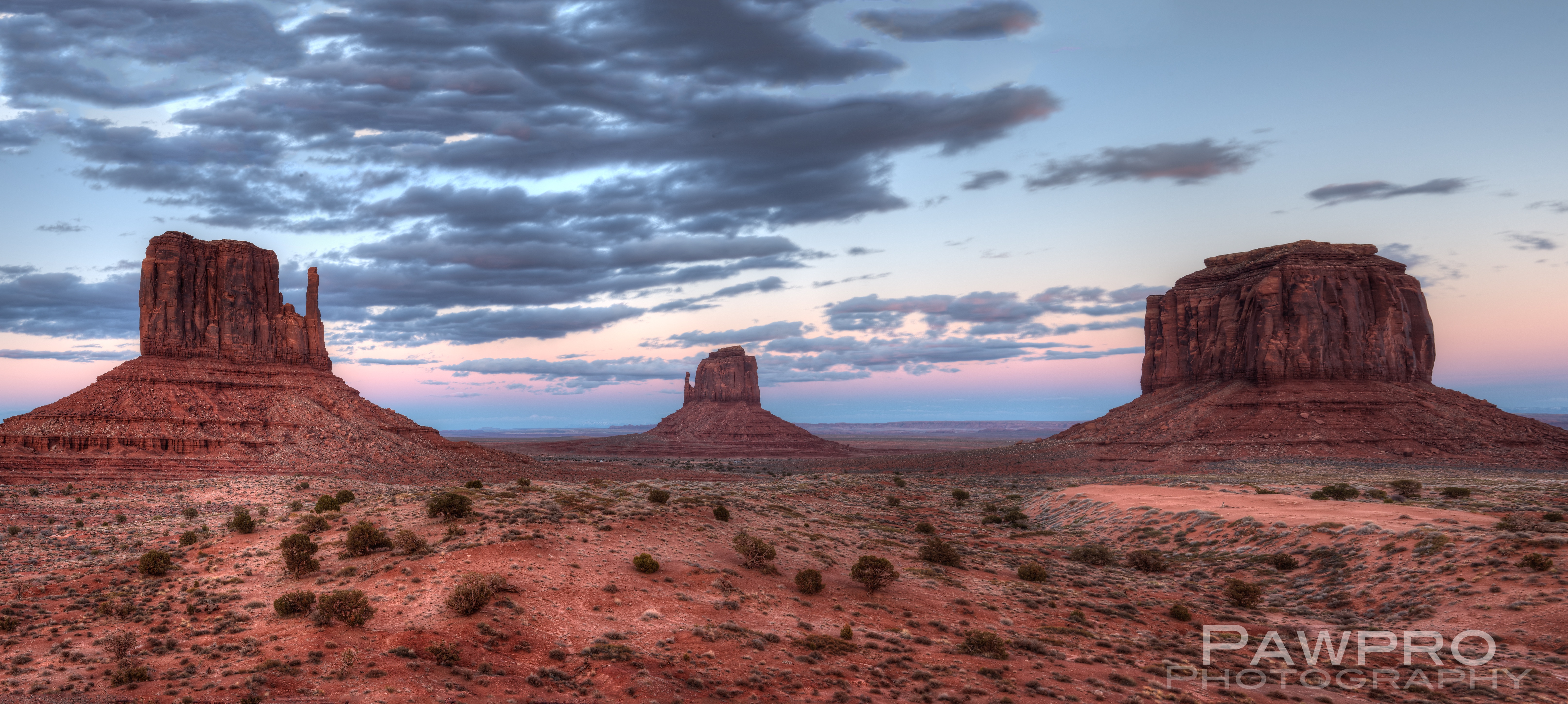
During this adventure I also ran in the Antelope Half Marathon, visited Monument Valley, as well as several slot canyons. Check back for posts about those experiences very soon. Please do me a favor and take a moment to follow me here on my blog and on Instagram–especially if you found this entry helpful. More to come!
© Amy Linn Doherty and Pawpro Media 2009-2019.
Unauthorized use and/or duplication of this material without express and written permission from this blog’s author and/or owner is strictly prohibited. Excerpts and links may be used, provided that full and clear credit is given to Amy Linn Doherty with appropriate and specific direction to the original content.
OUTERWEAR
•250 weight wool base layer (#Smartwool, #KariTraa, #REI, #Odlo are my favorites.)
•lightweight polar tech fleece (#OutdoorResearch Deviator or Patagonia R1/R2® w/ Polartec®, Alpha® Power Grid™ fleece is lightweight and efficient.)
•synthetic or down mid-layer (Patagonia Nano Air®, Arc’teryx Atom LT® are my favorites)
•Lightweight, Waterproof, Hard Shell Gore-tex® (The North Face® HyperAir® a favorite of mine because it’s lightweight and breathable.)
•wool socks #Stance ®, Smartwool®, REI®
•Fleece, Wind Stopping Gloves
•Hiking shoe or mid-boot (Salomon® Outline)
#WhitePocket, #PariaCanyon_VermilionCliffs, #Dreamlandsafaris, #PageAZ, #Bryce, #Zion, #FindYourPark, #OutdoorPhotography, #adventurevacations, #hiking, #travelphotography, #amydohertyphotos, #landscape photography, #kanab, #89A, #geology, #redrock, #southwest, #Arcteryx, #OR, #Patagonia, #outerwear, #outerwearguru, #whattowear, #hikingclothing #Navajo, #PublicLands, #ProtectPublicLands, #lunarlanding, #outofthisworld, #REI, #OptOutside, #ForceofNature, #AntelopeCanyon, #slotcanyon, #VacationRaces, #AntelopeCanyonHalfMarathon #MoquiMarbles
Sources:
- http://www.americansouthwest.net/arizona/coyote_buttes/south-coyote-buttes.html
- https://www.nationalgeographic.com/magazine/2012/02/vermilion-cliffs-national-monument/
- https://www.dreamlandtours.net/day-tours/tours-of-the-paria-canyon-vermillion-cliffs-national-monument/white-pocket-photography-tour/
- https://www.dreamlandtours.net/day-tours/tours-of-the-paria-canyon-vermillion-cliffs-national-monument/white-pocket-photography-tour/
- https://www.amusingplanet.com/2013/03/white-pocket-vermilion-cliffs-national.html
