Blackwater National Wildlife Refuge: A Sinking Treasure

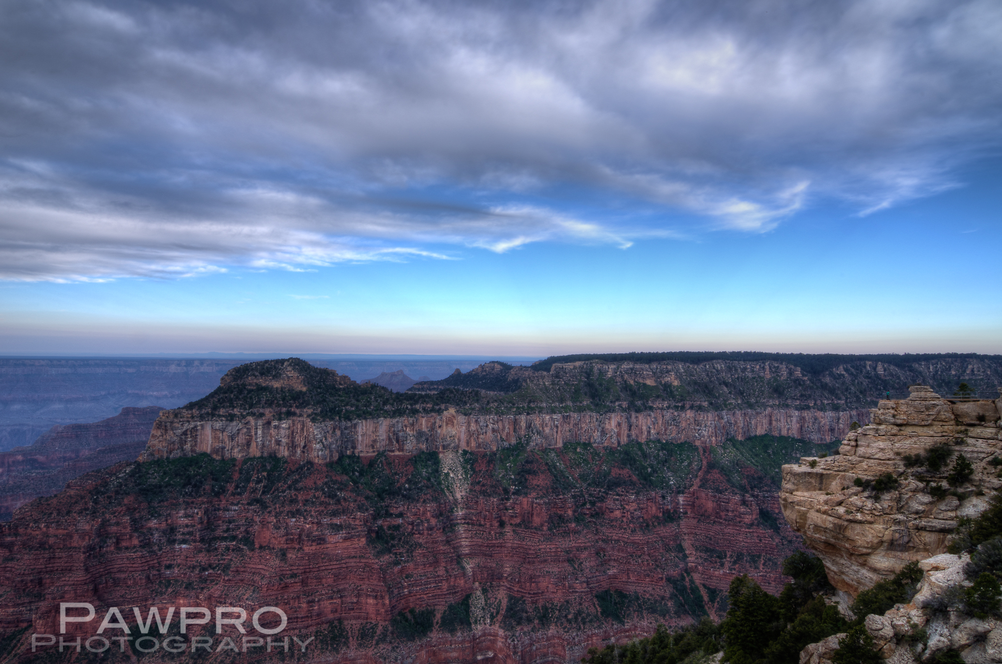
Got a sinking feeling?

If thinking about the COVID-19 Pandemic, the impending presidential election, climate change and the myriad environmental challenges we face gives you a sinking feeling, that sensation might be more accurate than you know—especially if you live on the Eastern shore of the U.S.  The Mid-Atlantic Region, part of the North American Continental Plate, especially along the east coast, is sinking, while at the same time sea level is rising here.  This subsidence of the land or isostatic rebound, as it is called, is thought to be the result of glacial melting, which allows other portions of the plate to rise as the massive weight of melting ice sheets decreases.  In contrast, glacial melting in Alaska and Iceland for instance, also part of the North American Continental Plate, are causing the land there to rise and the sea level to lower.  This double whammy of natural and manmade environmental changes might make you think, “Run for the hills!”.  However, unlike a seesaw, the rise and fall is not uniform across the plate but undulating much like a piece of warm elastic.  This was news to me.  I knew about sea level rise, but not the land sinking.  

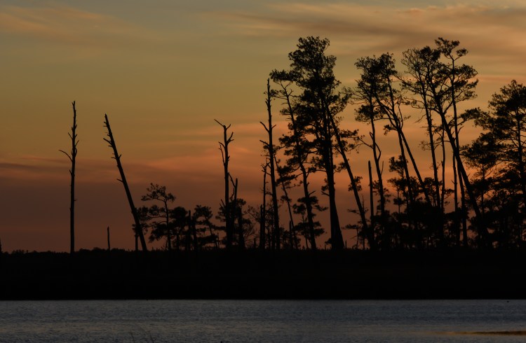
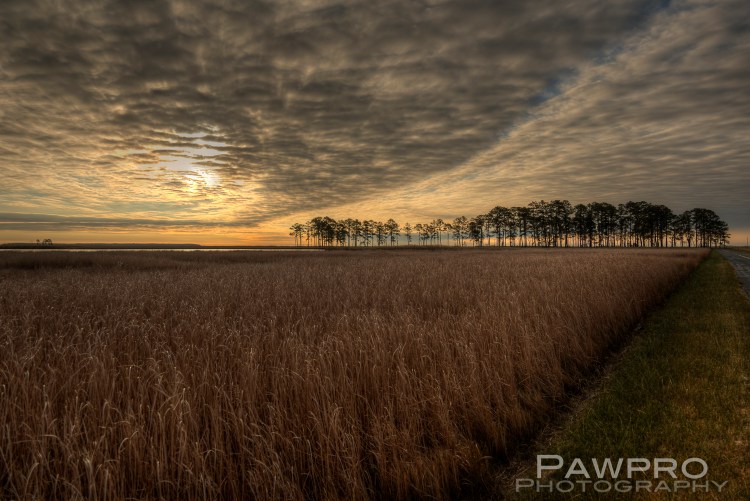
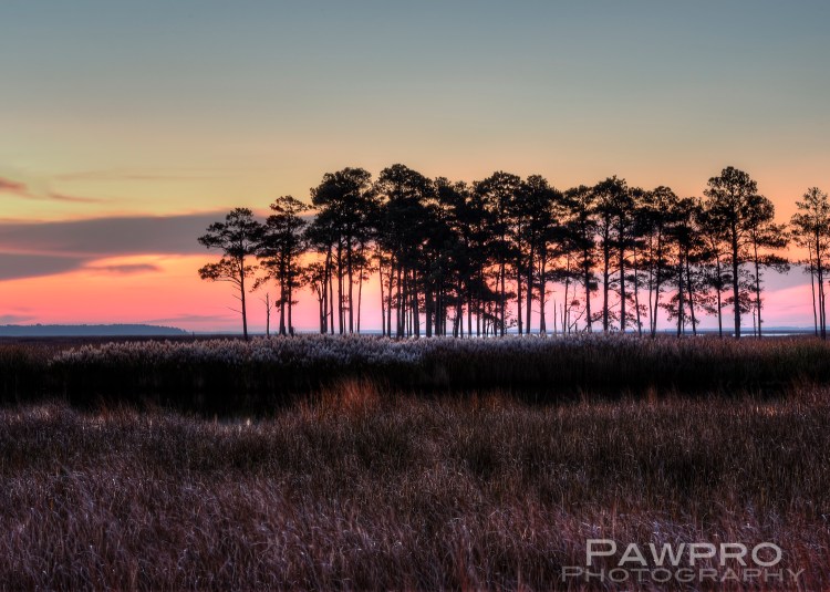
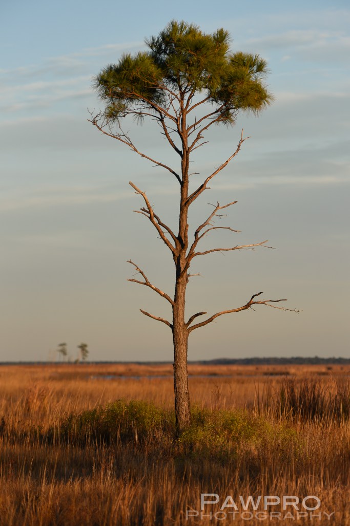
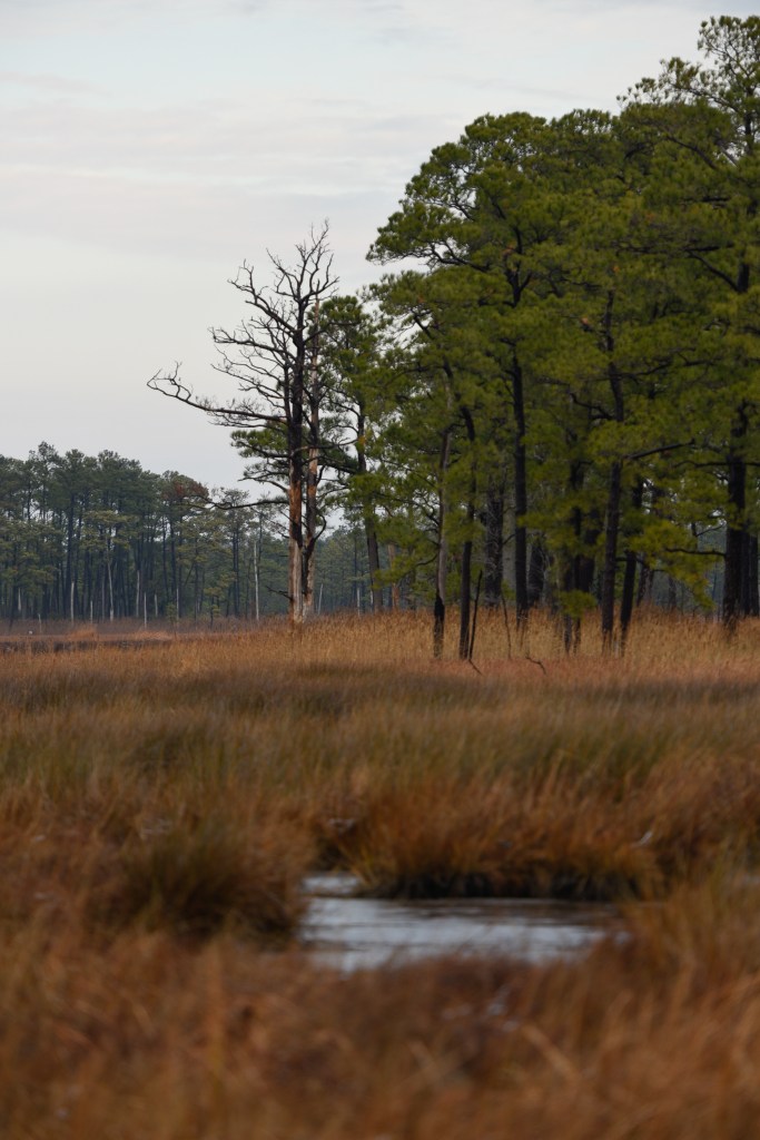
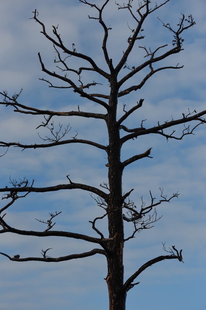
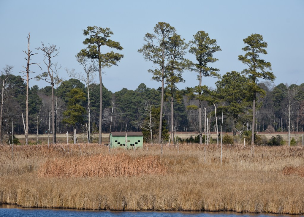
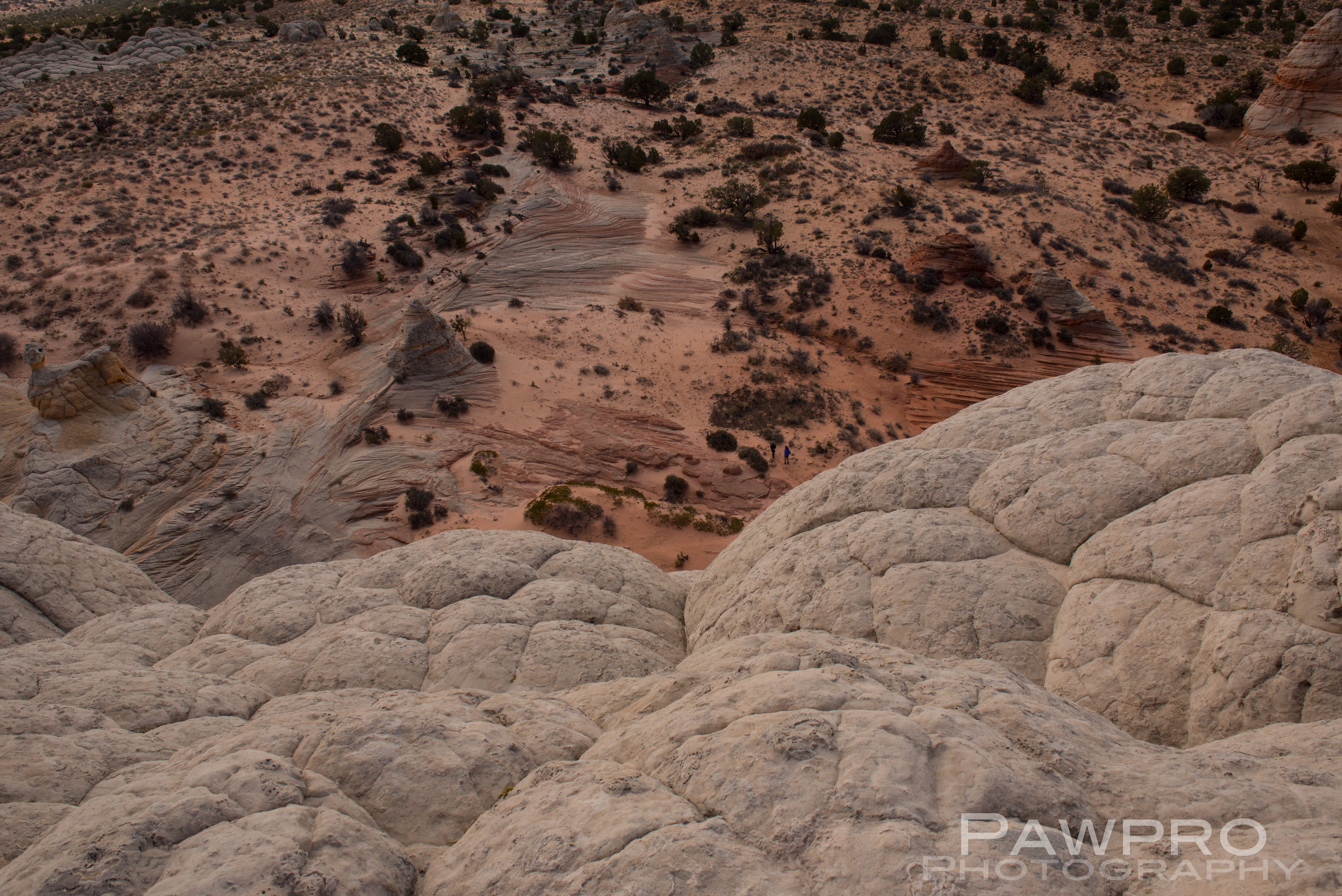
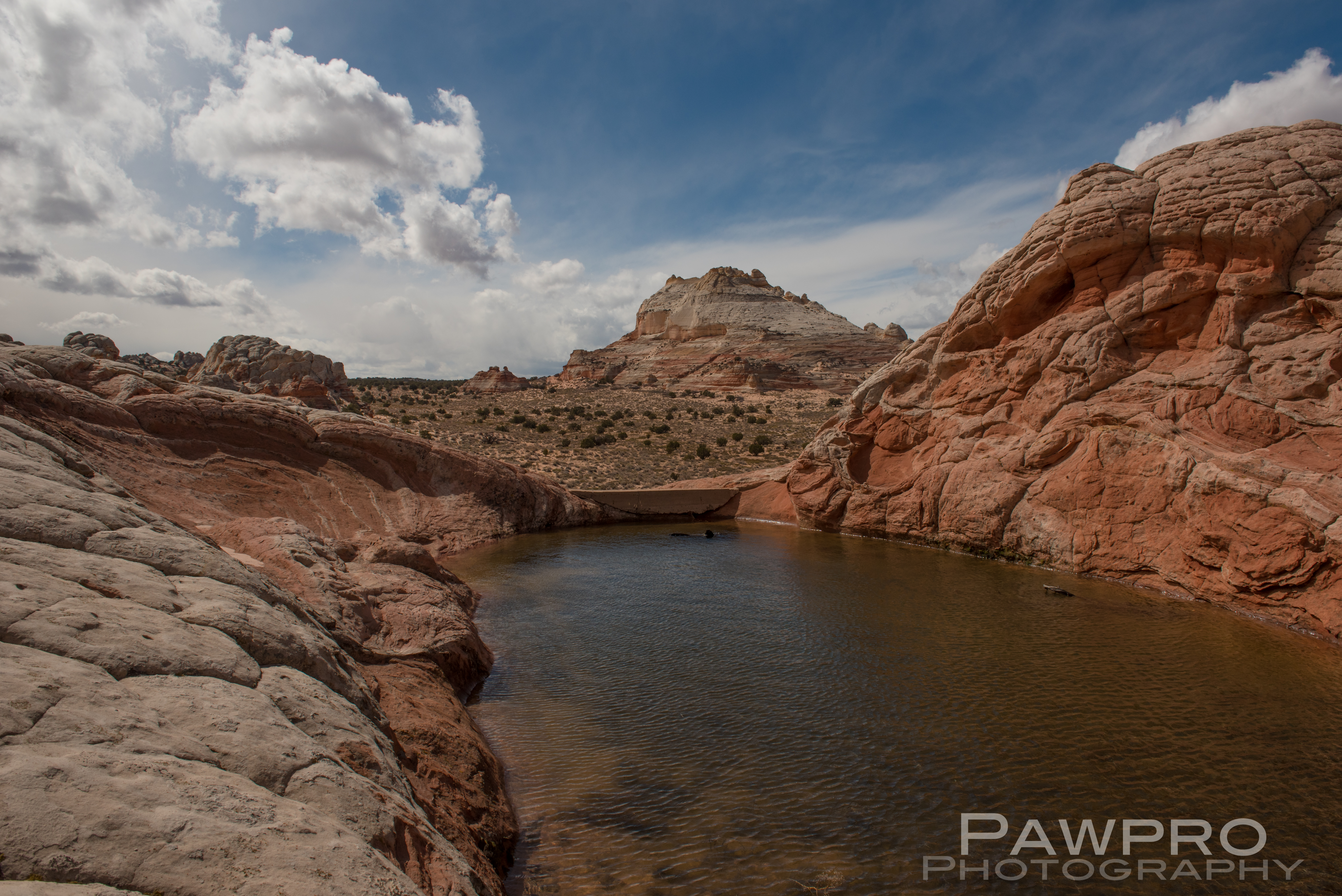
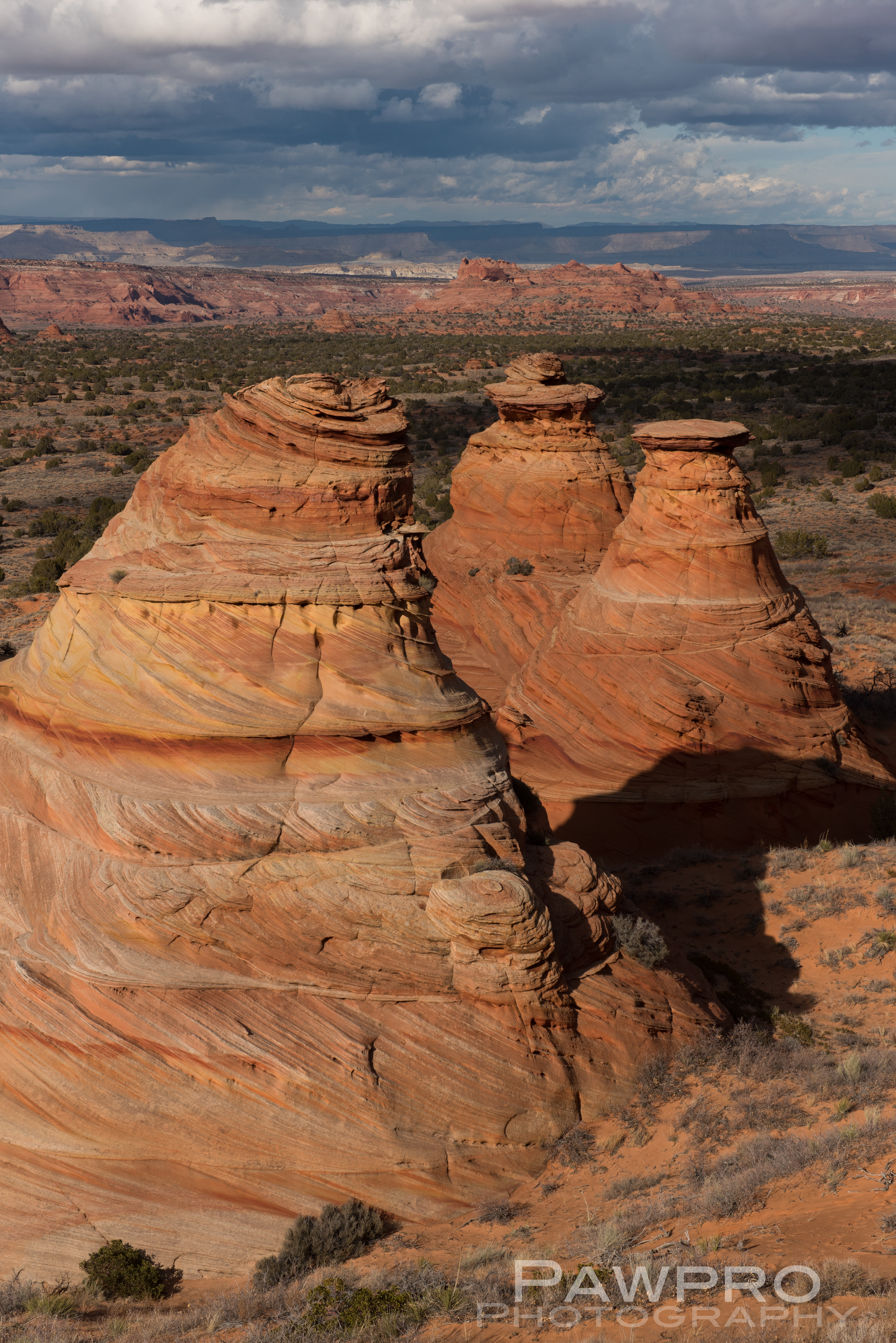
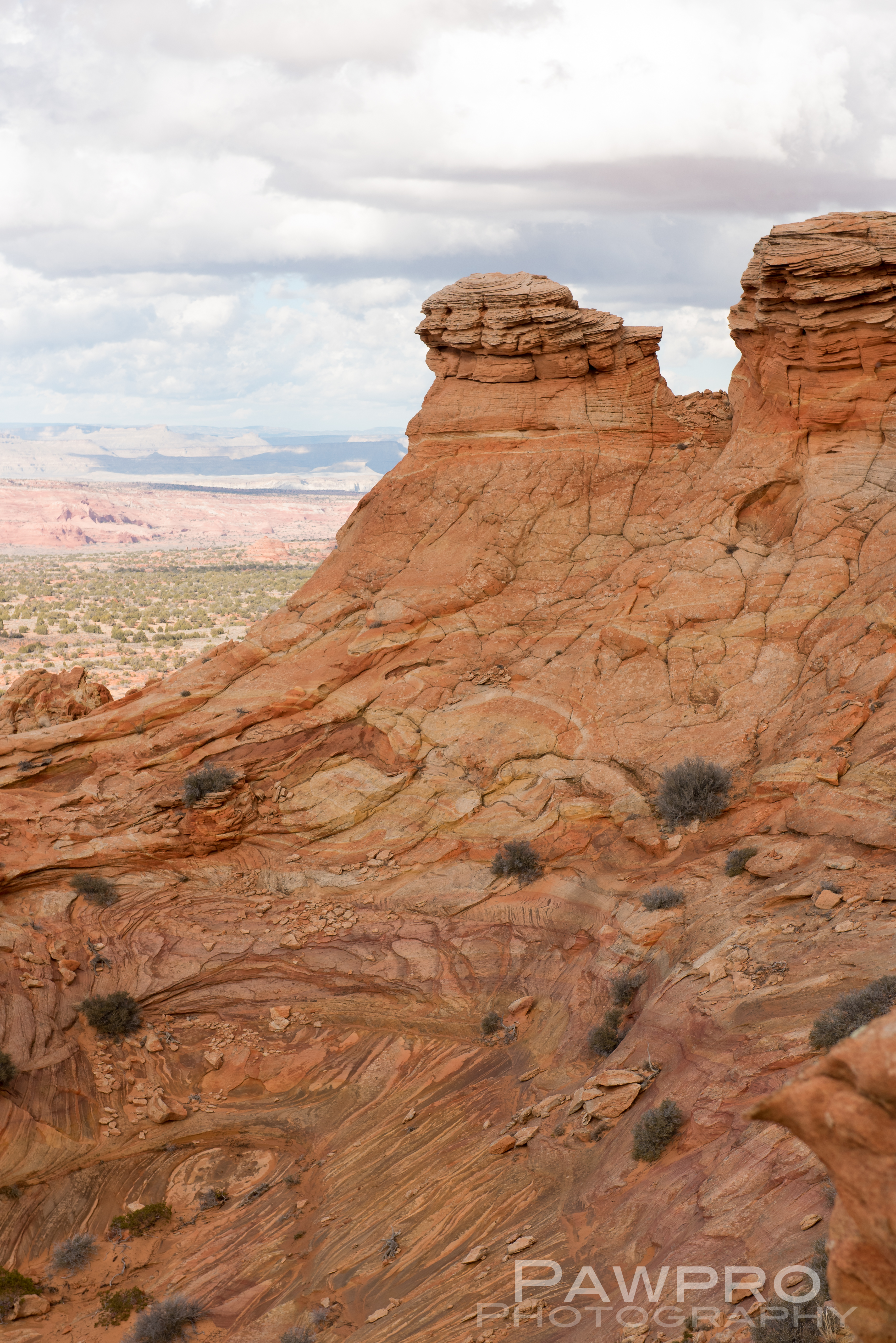
Blackwater National Wildlife Refuge (BNWR) in Cambridge, Maryland is a case study for researchers and scientists studying these simultaneous climate forces, which makes the region particularly valuable and vulnerable. Here the changes aren’t theoretical, they are happening at an accelerated rate and can be seen clearly in the ghost forests, the easily flooded roadways, the disappearance of some wildlife species, and the encroaching water at local doorsteps. 


Follow the Public Lands’ Money

Further complicating these landscape and environmental challenges, the 50 plus year bipartisan marriage between the Land Water Conservation Fund (LWCF) and the energy industry could go down the drain if the President’s proposed 2021 Budget is approved.  Despite public comments of support via Twitter by the President for full and permanent funding of LWCF within the proposed legislation (S.3422) The Great American Outdoors Act, the true math shows the proposed budget for National Parks is cut by roughly $500 million for 2021.  The new bipartisan legislation, with the support of 59 Senators from both sides of the aisle, seeks to remedy the routine raiding and re-directing of LWCF funds to other non-public land uses.  As an example, in 2019, of the $900 million deposited to the LWCF, only $495 million actually made it to LWCF projects which flies in the face of a $20 billion backlog of maintenance and infrastructure needs within public lands, and over $22 billion LWCF dollars diverted over 55 years of its history.  The President has also led an effort to open once protected lands out west to mining and private enterprise.

Standing on solid ground and the facts at Blackwater National Wildlife Refuge

Blackwater National Wildlife Refuge, a beneficiary of LWCF money, is comprised of roughly 28,000 acres of wetlands, forest and open water. In his 11 years at this wetland refuge, Matt Whitbeck, resident wildlife biologist has seen changes in a decade that one might expect to occur over the course of a century. He co-authored a report in 2013 with The Conservation Fund and the National Audubon Society detailing the accelerated rate of sea level rise. The report also forecasts the loss of the marsh by 2100 and the realization that maintaining the current footprint of the refuge isn’t possible. He supports the new non-traditional approach that seeks to preserve and acquire land where the marsh is likely to migrate in hopes of a better long term survival strategy.


A New Strategy In Preservation: Let it Move

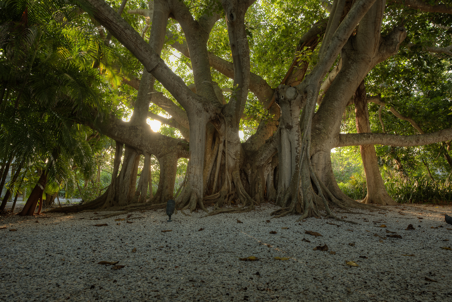
Since becoming a refuge in 1933 areas that were once forested are now drowning and transitioning to wetlands, and in other areas what was once marsh has become open water.  It has been reported that some 5000 acres of coastal wetlands have been lost or converted to open water since the 1930s.  As the land sinks and sea level rises the wetland is migrating from its 1933 borders and officials are trying to stay ahead of the up slope movement of the wetlands and how that will impact the refuge, the wildlife and the local community. 

1938 Blackwater National Wildlife Refuge, photo courtesy BNWR
1974 Blackwater National Wildlife Refuge, photo courtesy BNWR
1989 Blackwater National Wildlife Refuge, photo courtesy of BNWR

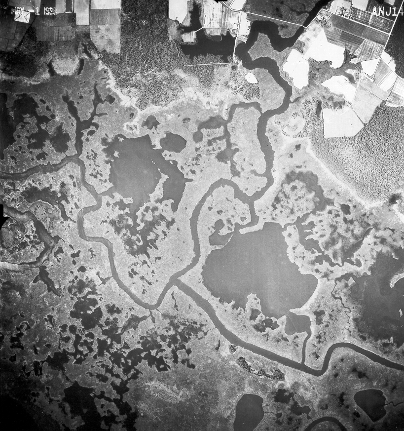
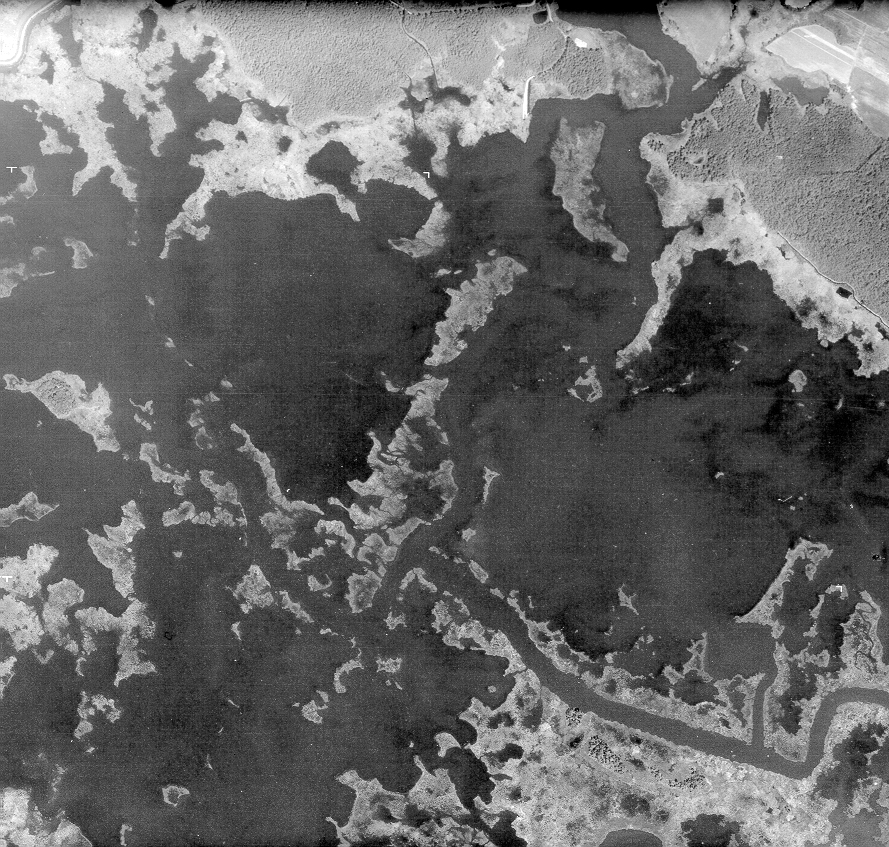
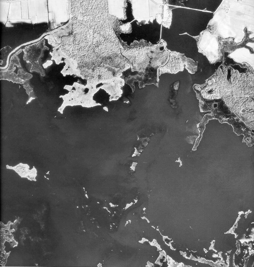
The Blackwater River was dredged in 2017 bringing up 26,000 cubic yards of mud to a submerged area of marsh, and plugged with 220,000 sprigs of native water-loving vegetation.  This effort is a more traditional approach that tries to keep the marsh closer to its current footprint.  In a new approach,  The Land and Water Conservation Fund has assisted in the acquisition of large upland land parcels as they become available where researchers and surveyors expect the refuge to continue its march in hopes that identifying and protecting these areas will be a better approach to preservation. 

The LWCF has always enjoyed bipartisan support, investing earmarked energy drilling revenues, rather than tax dollars, back into conservation of public lands and support for national parks since the ‘60s.  However, in all these years it has yet to receive permanent funding from Congress despite being a widely supported, budgetary mainstay on both sides of the political aisle. Given recent environmental rollbacks related to coal production and clean water regulations, the lack of permanent funding as well as the diversion of funds away from LWCF and national parks is cause for alarm.  At Blackwater, as an example, water quality monitoring is now being handled by a team of individuals and non-profit conservation groups as staffing at the refuge has been shrinking under the stress of rising costs and flat line funding.

. . . decreases protection for our Nation’s waters and does not support the objective of restoring and maintaining ‘the chemical, physical and biological integrity’ of these waters.”  Michael Honeycutt, chairman, EPA Science Advisory Board

Furthermore, recent rollbacks in E.P.A clean water restrictions, driven by the Trump Administration, threaten to rewind years of progress—not just here at Blackwater, but nationally. This, coupled with the budgetary threats to LWCF, puts these environmental treasures at tremendous risk. Given the President’s pattern to conceal his genuine intent, his Twitter-promises to LWCF seem to belie a different truth for public lands–one that does not seek to protect but to profit, no matter the cost to the land.

Moonrise over Blackwater National Refuge

The wetland water of Blackwater National Wildlife Refuge, adjacent to the Chesapeake Bay, is still challenged by pollutants.  The rollbacks remove protections for seasonal/ephemeral waterways, ground water, or sources not adjacent to large bodies of water allowing industrial and agricultural chemical dumping, pesticide use and the destruction or filling in of natural wetlands in construction projects even though it’s well established that pollutants find their way into the greater water supply system via wildlife or unseen connectivity.  The E.P.A’s very own advisory council reports that these rollbacks lack justification and defy scientific impacts to the greater watershed systems.  It’s hard to imagine that there’s any denial of the connectivity of natural watershed systems—some of which may be hard to trace.  Similarly, the rejection and undermining of science is what Matt Whitbeck points to as one of his greatest concerns.  He makes the point that science by its very definition is unbiased, but he’s seen that belief challenged. His job is to protect this habitat for the wildlife that thrives within it, and the global forces behind the changes described are presenting a risk to wildlife and humans alike.  He shows visitors the undeniable sea level changes, and lets them come to their own conclusions.

BNWR Visitors Center

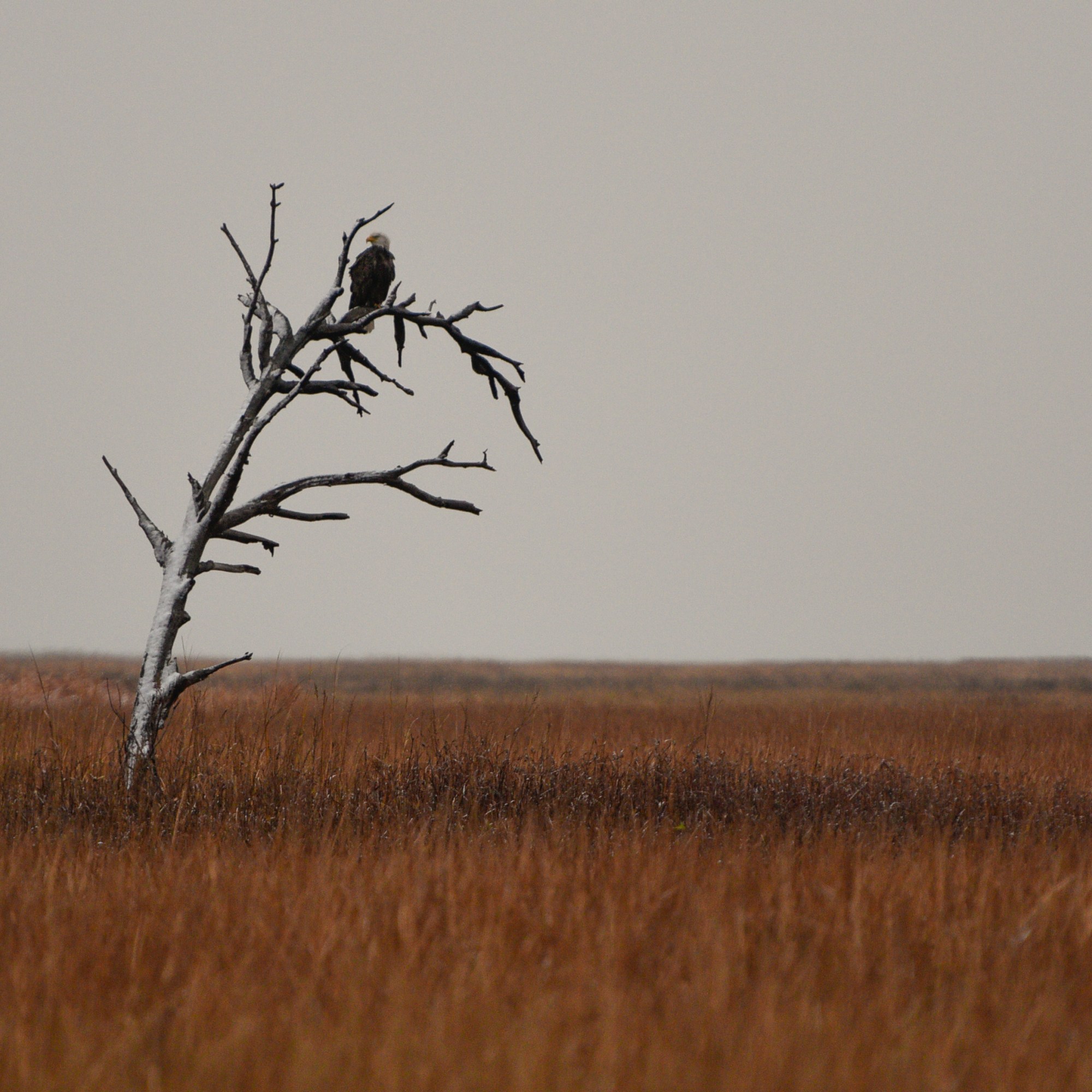
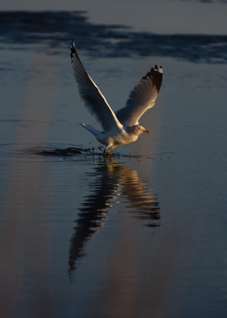
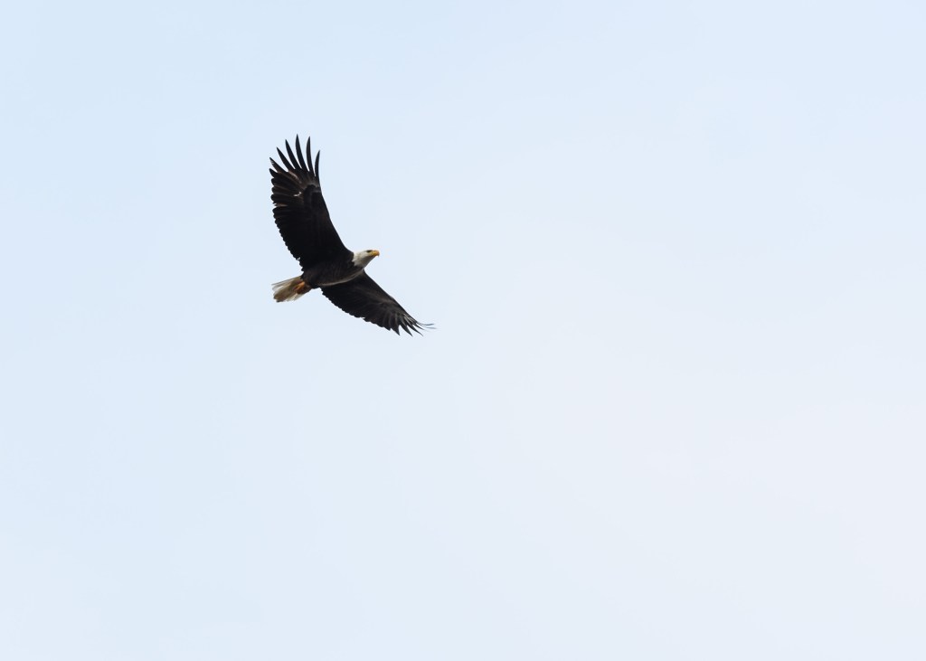
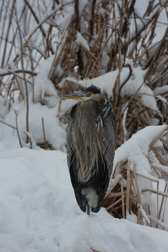
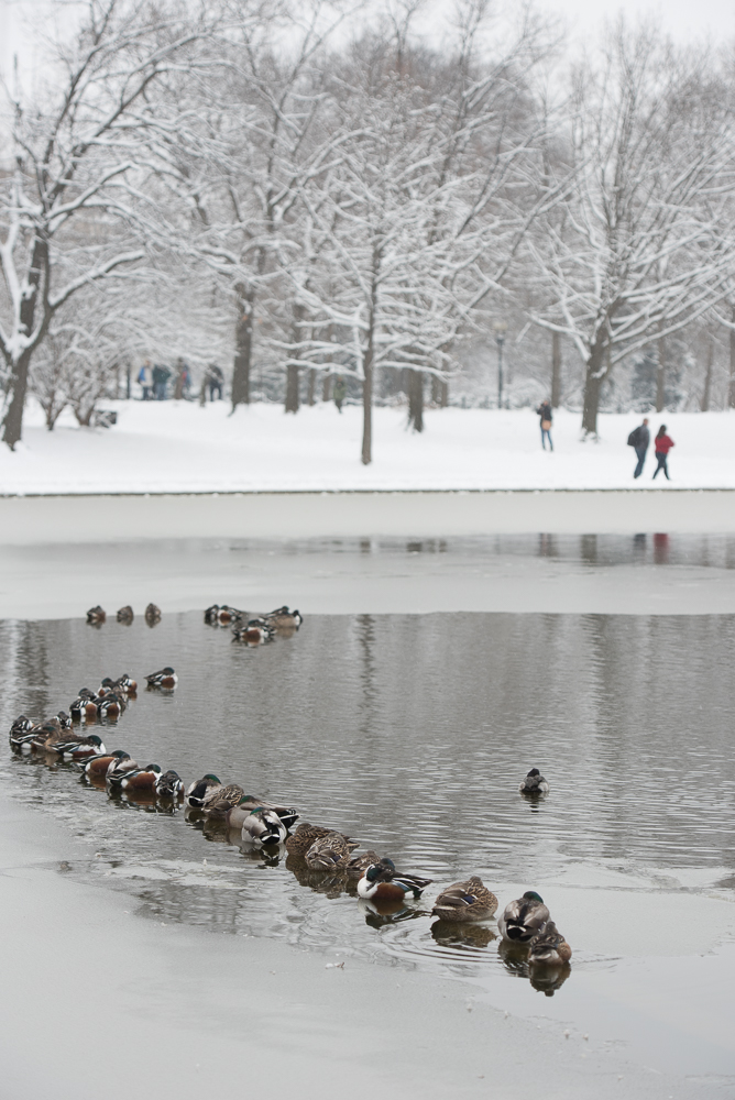
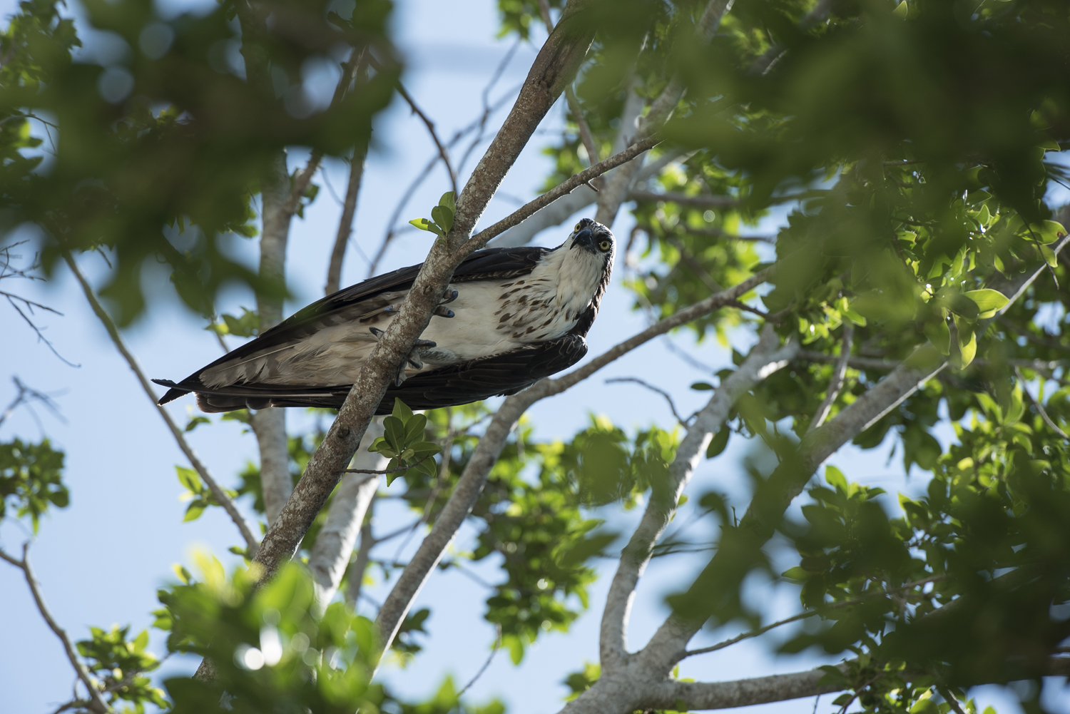
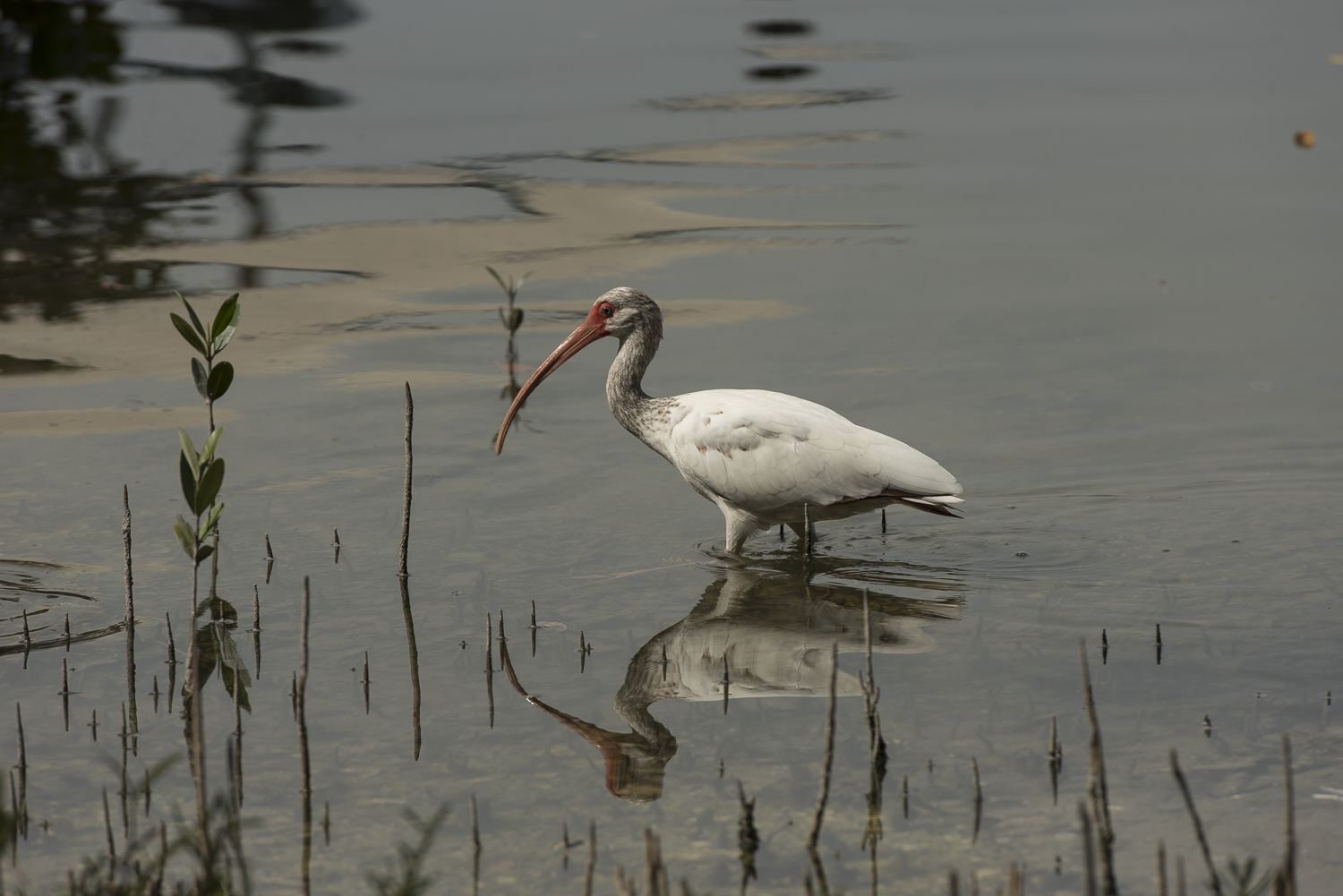
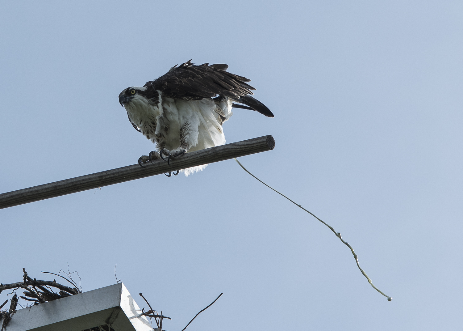
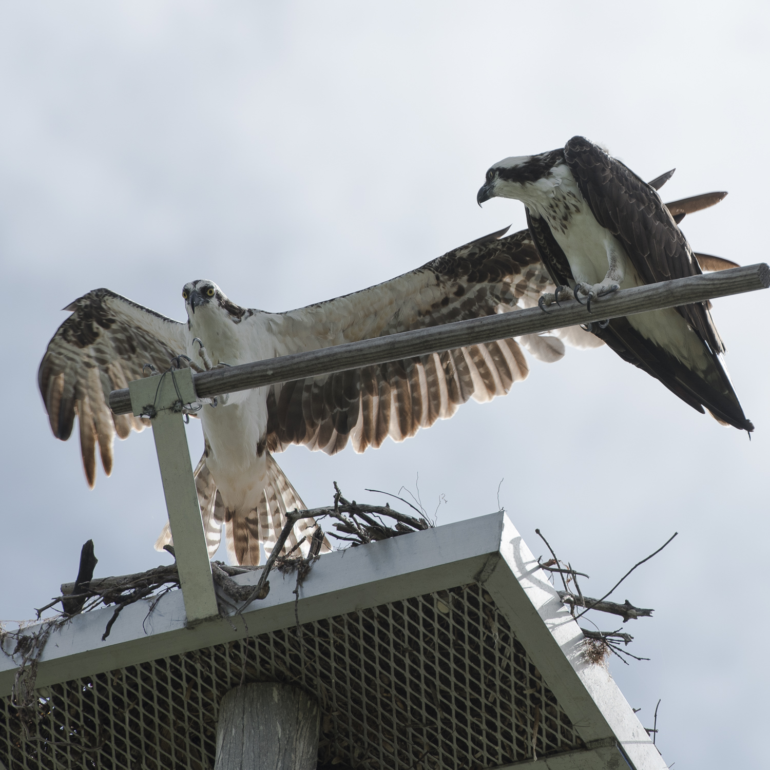
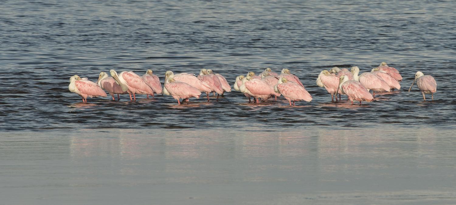
Besides serving as a filtering system for the bay and a buffer during storms, the marsh is also one of the largest breeding grounds for American Eagles and other migratory birds along the east coast.  No longer considered an endangered species, the breeding eagle population is strong at Blackwater.  It’s a favorite spot for bird watchers,  photographers, kayakers, fishermen, hunters and cyclists.  Younger visitors may not recall a time when eagles and osprey were endangered because of the widespread use of the pesticide DDT which interrupted normal breeding and poisoned the birds via contaminated water from direct or runoff water sources and contaminated fish they consumed.  Additionally, the refuge is still recovering from damage caused by the vegetation ravaging rodent called Nutria, whose apparent eradication has not been officially confirmed, but expected.


An Unexpected Discovery

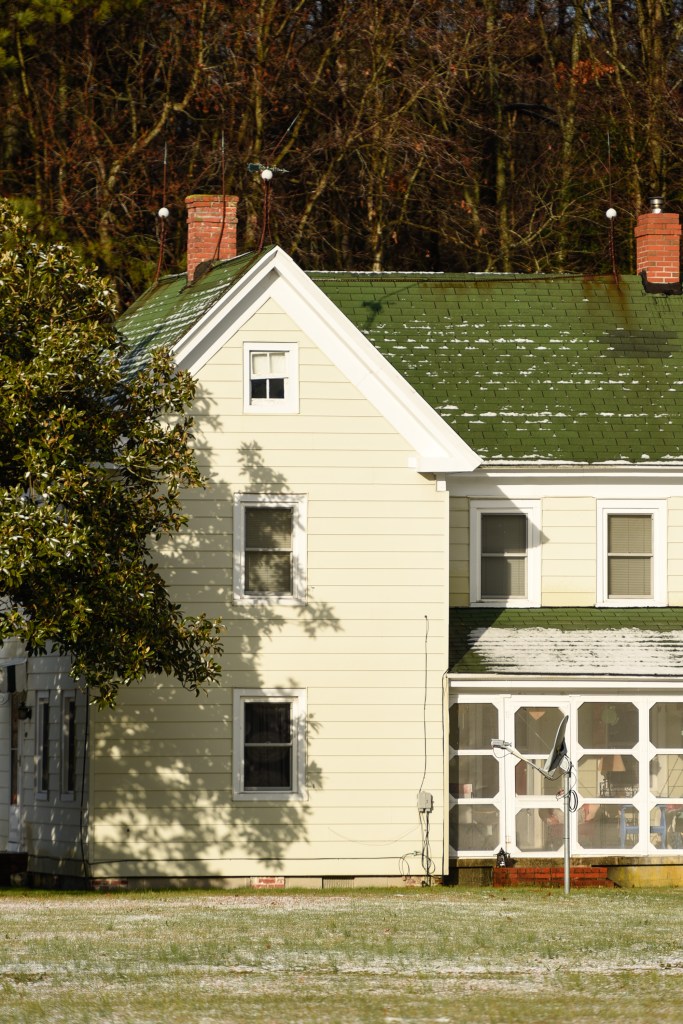
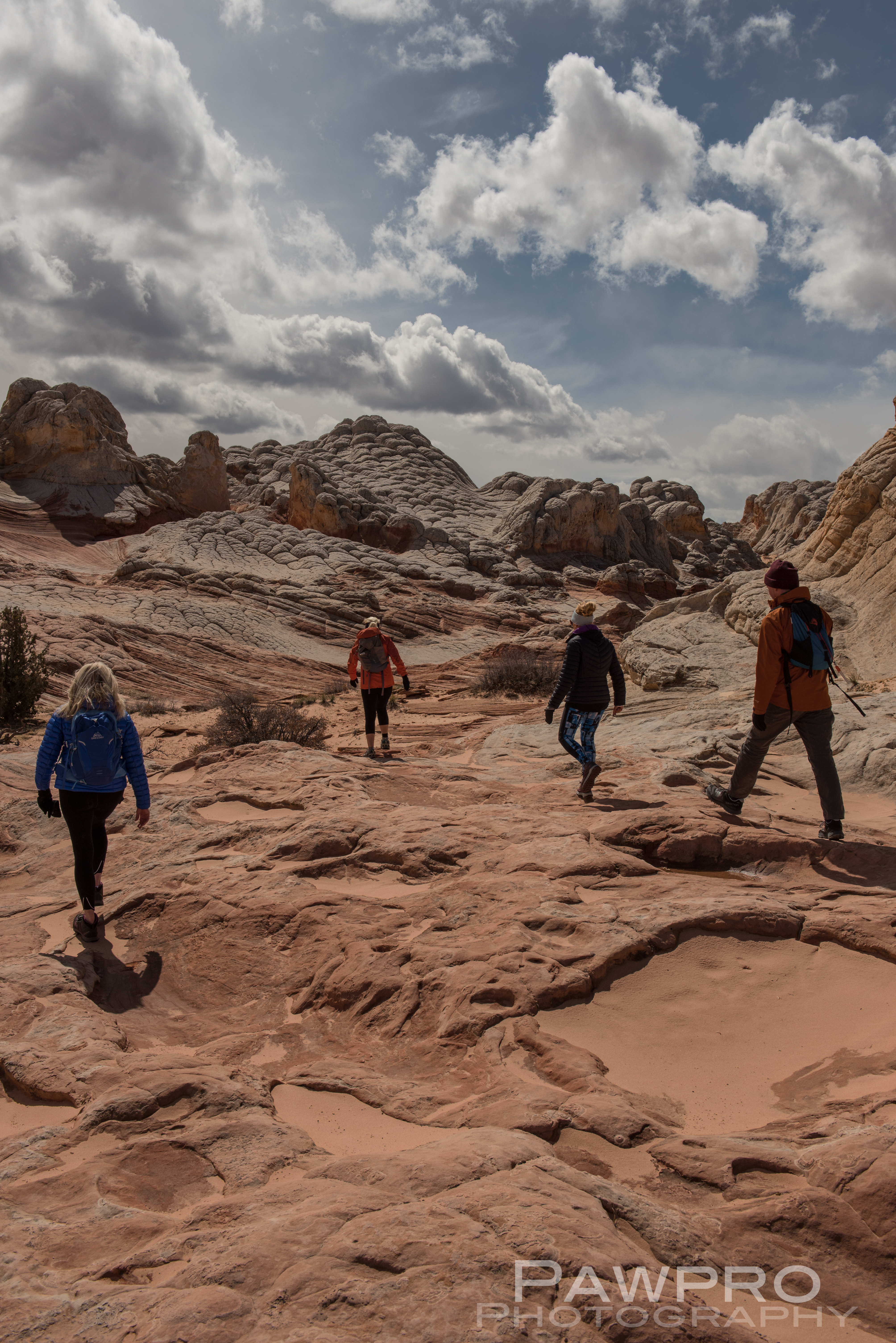
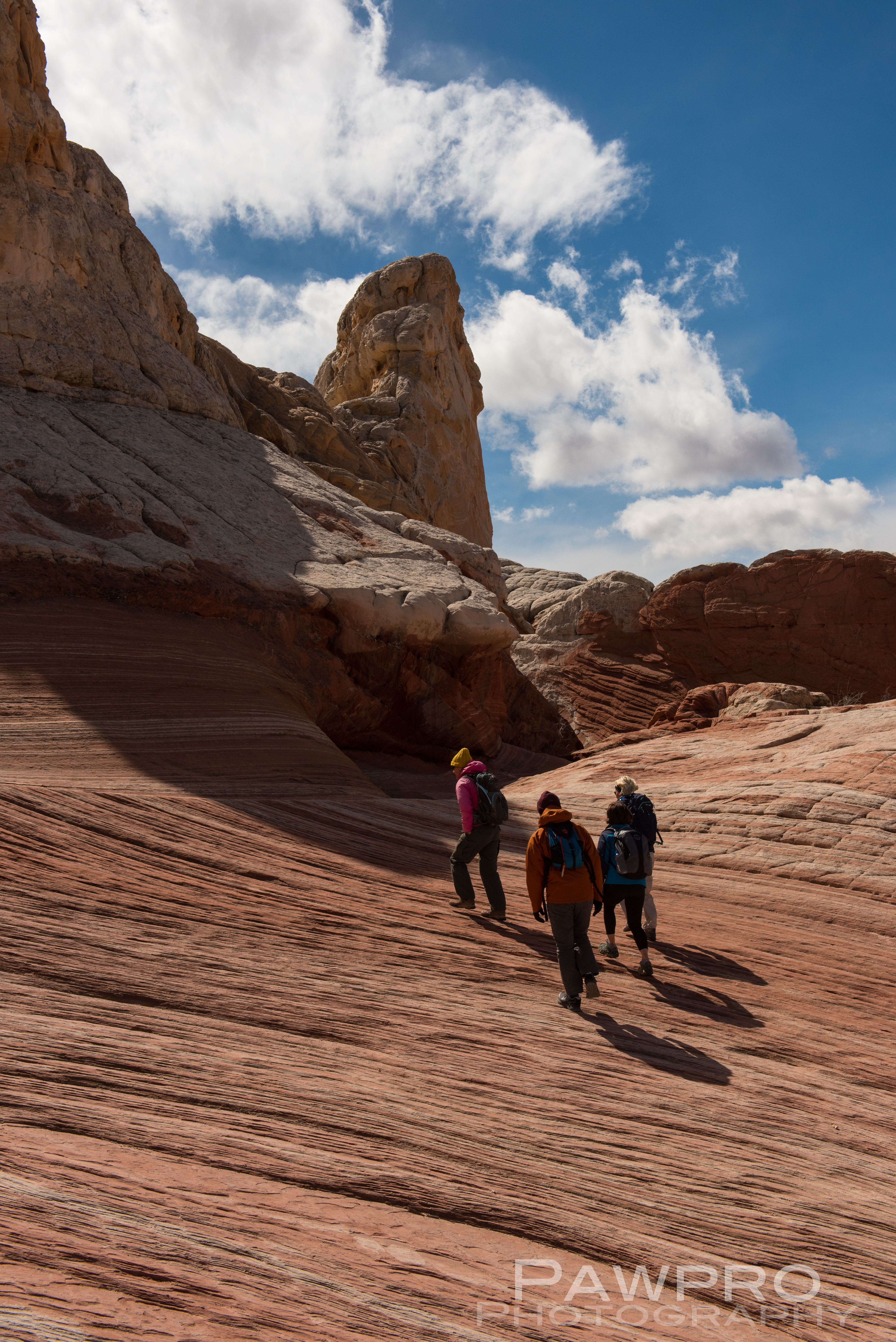
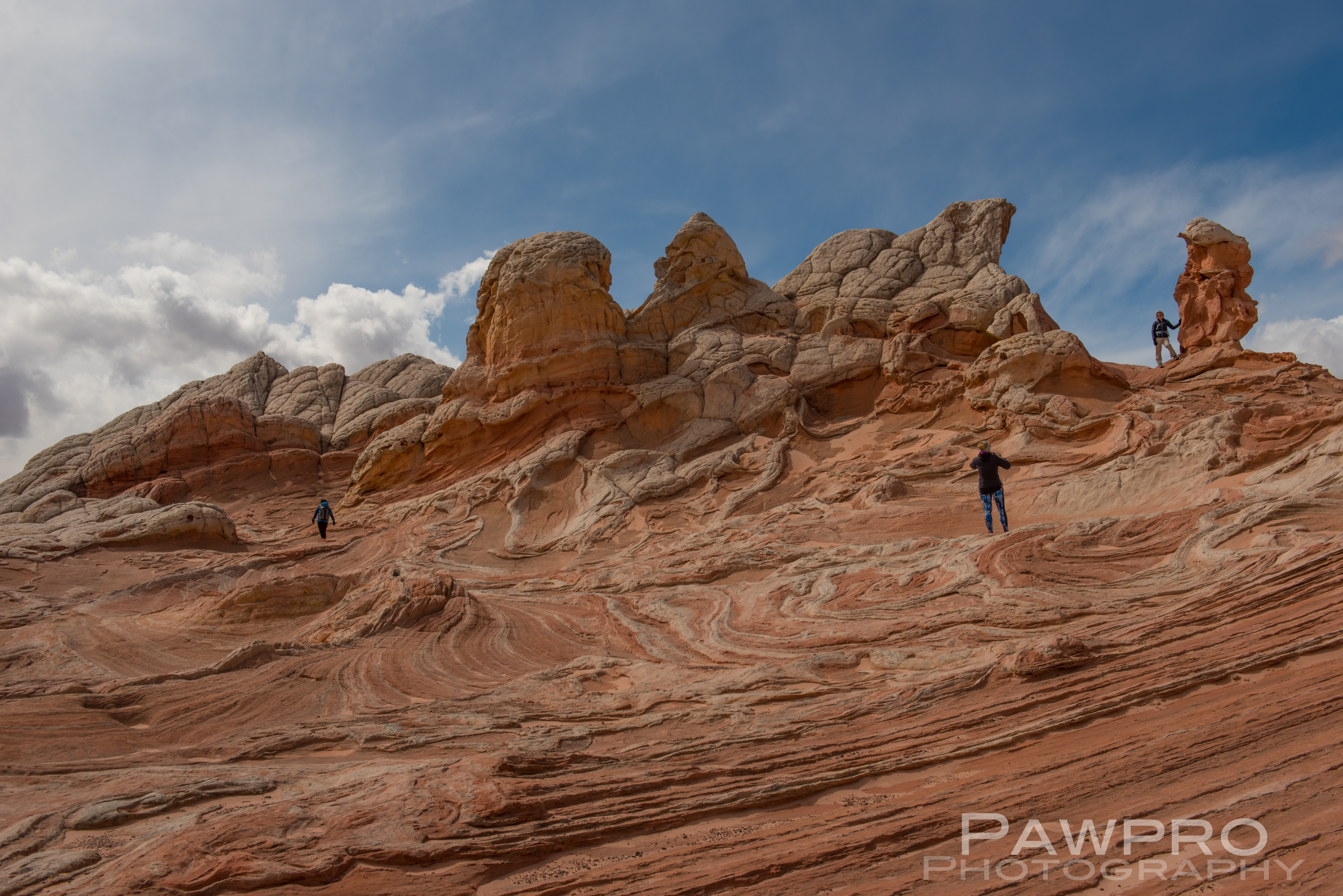
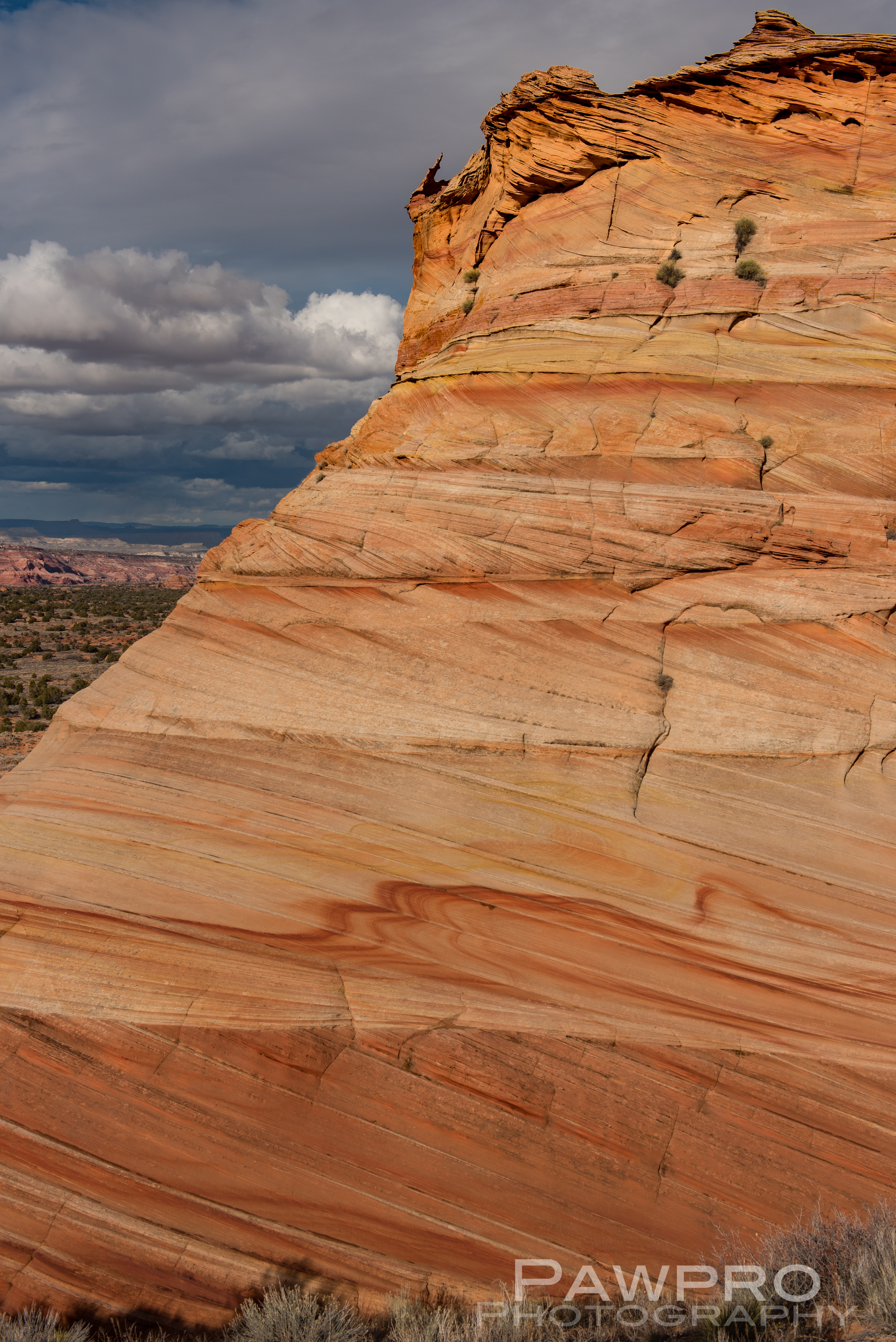
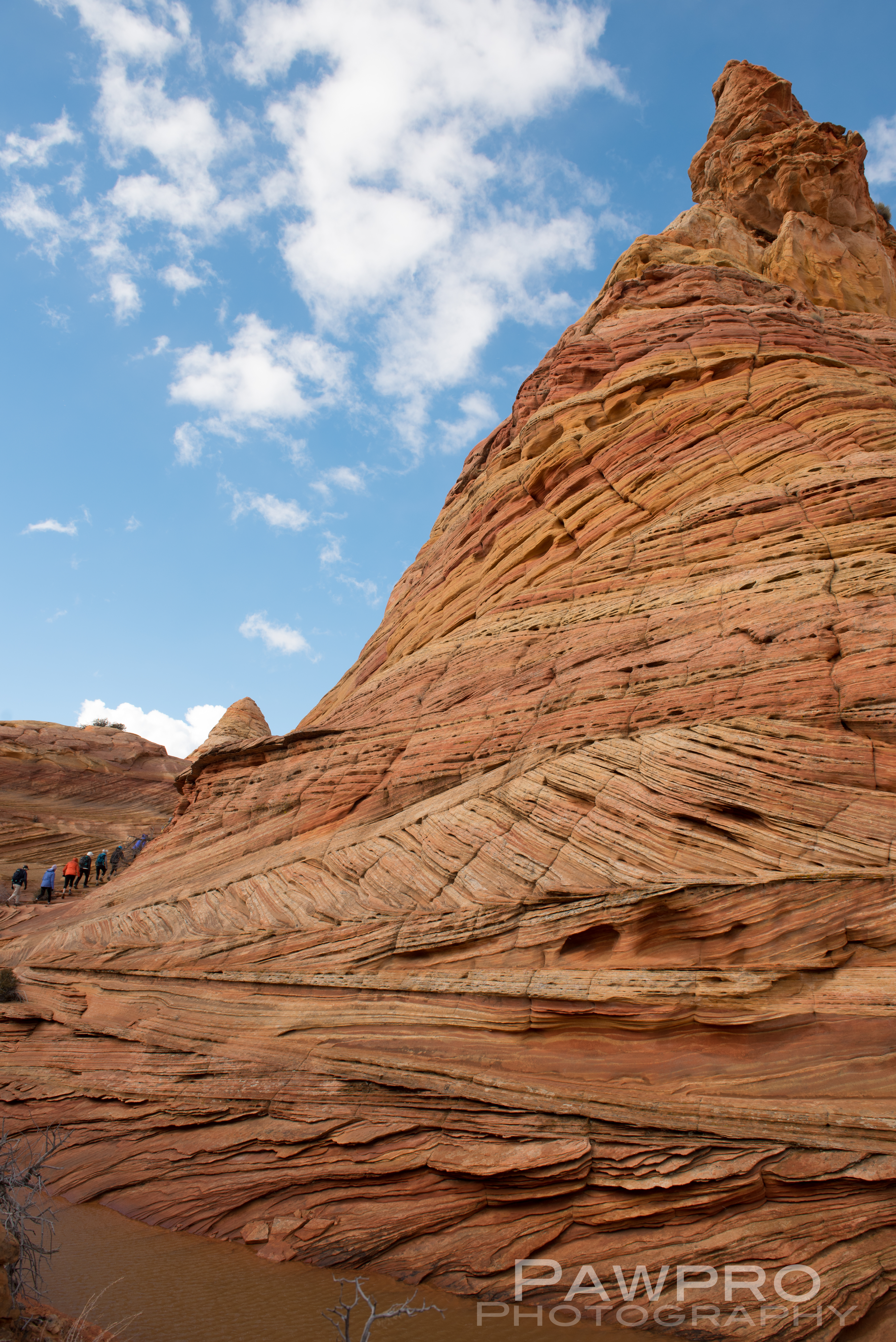
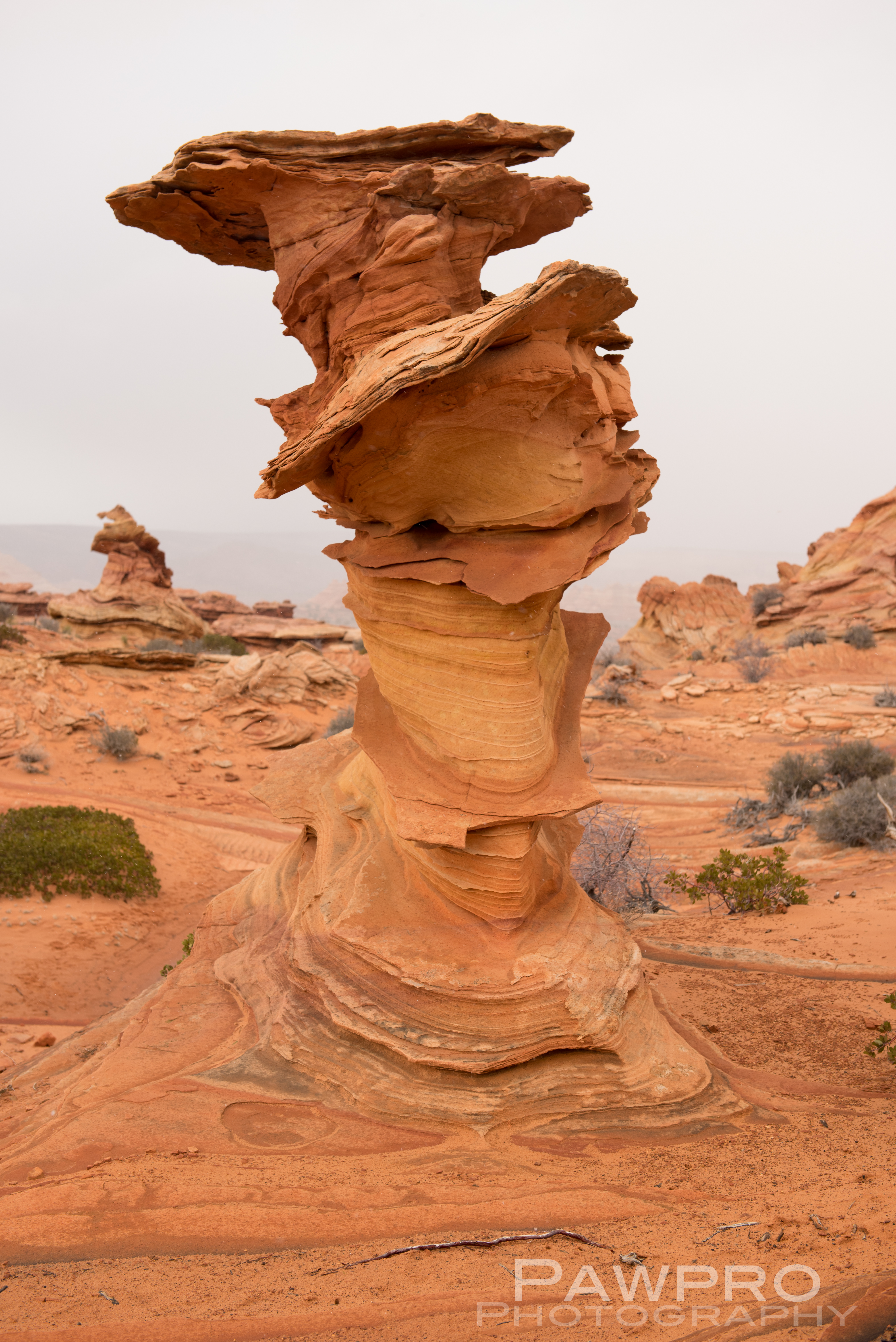
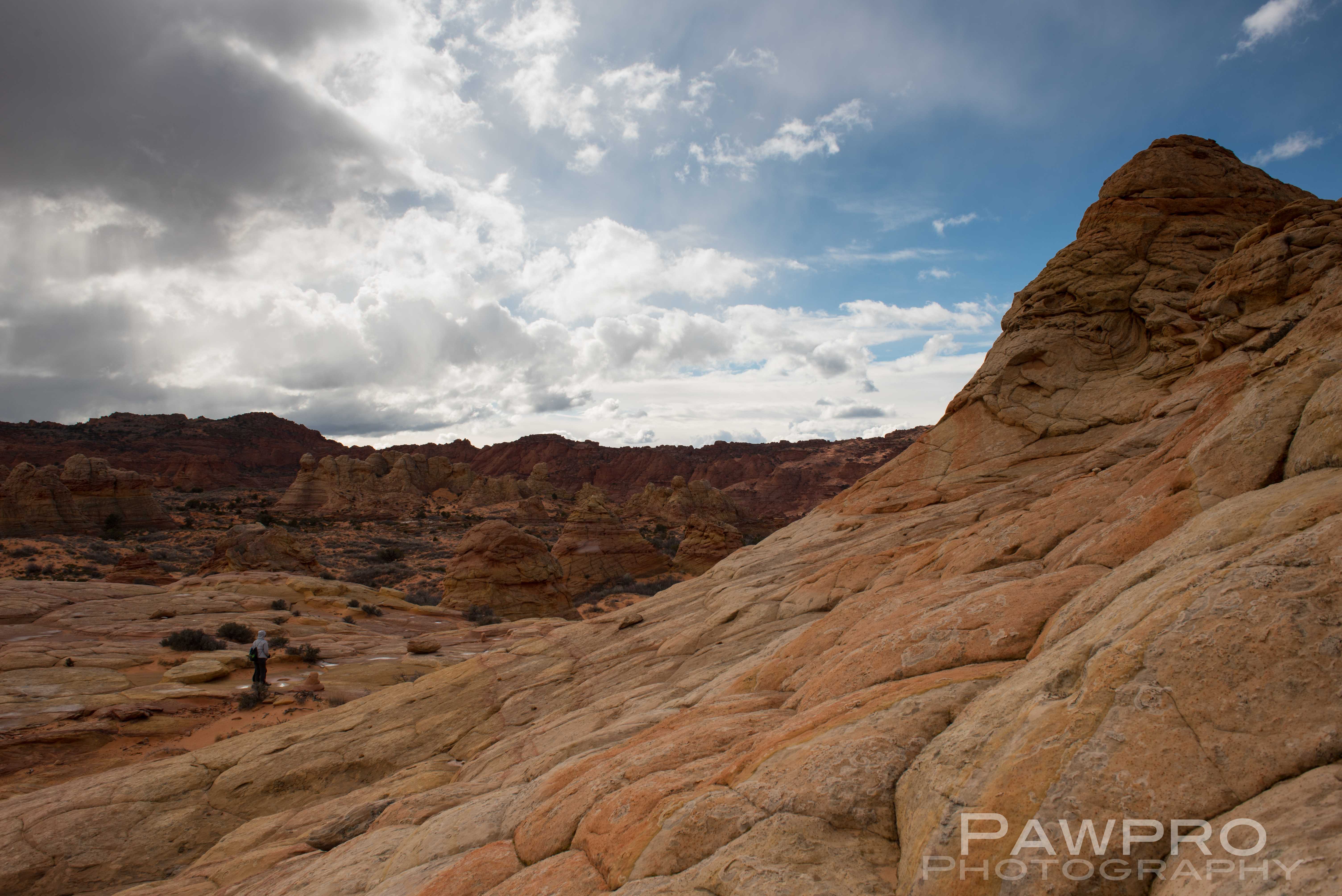
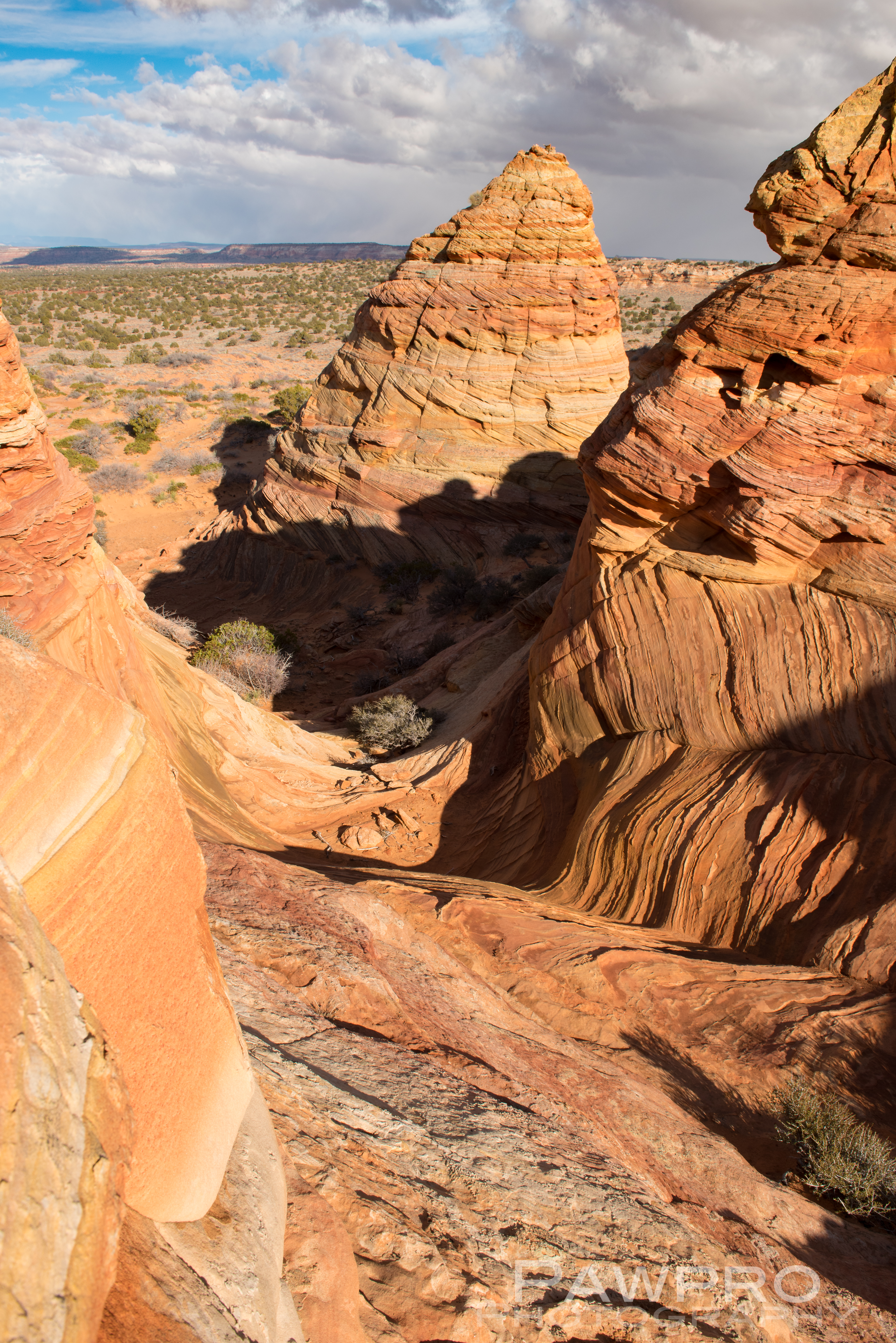
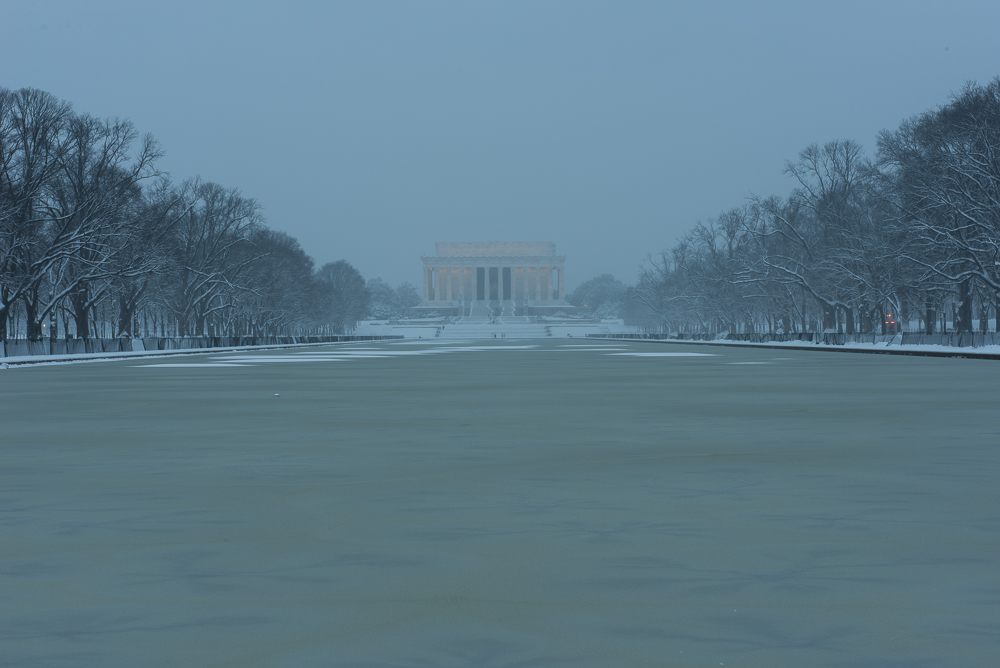
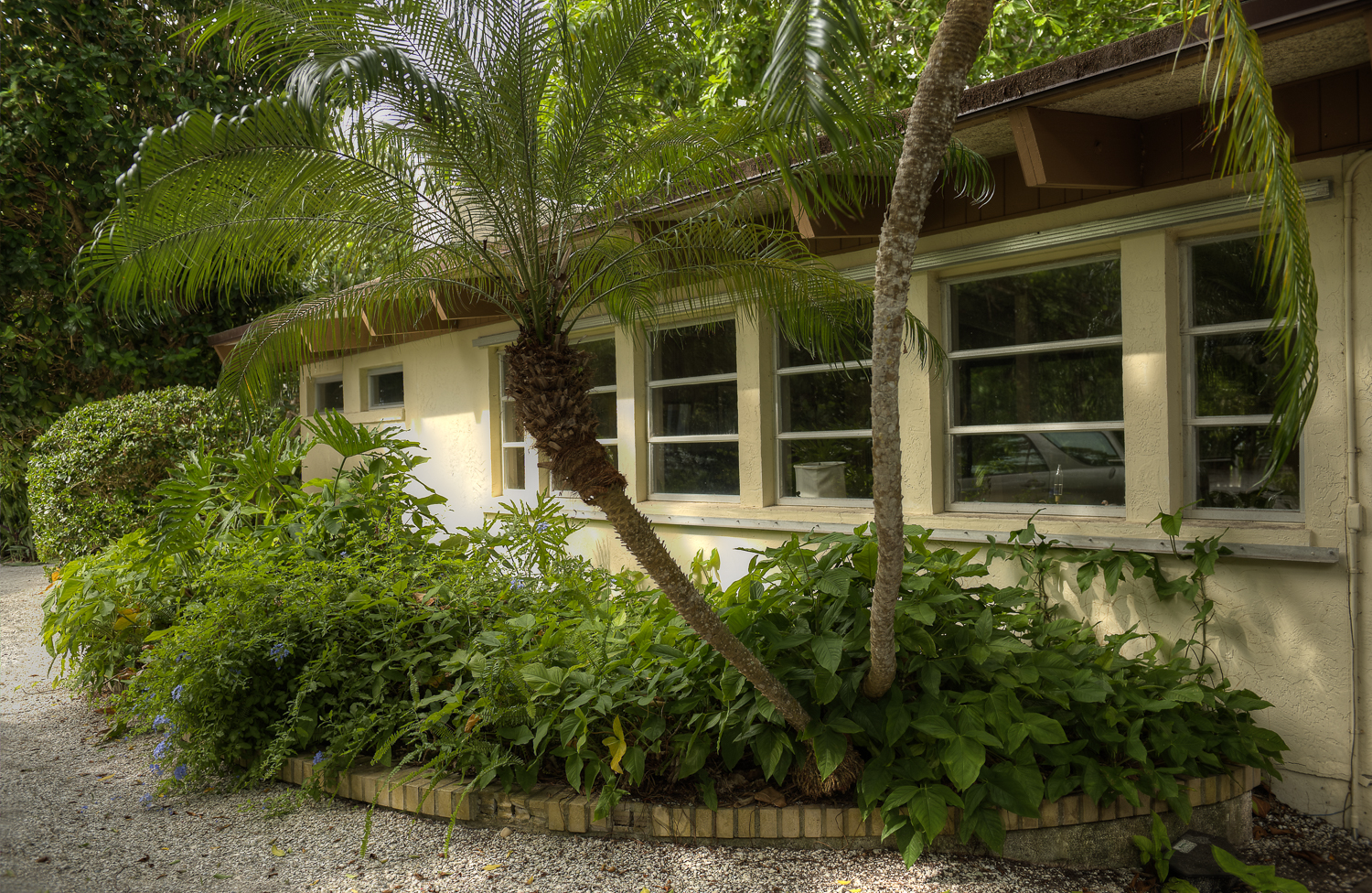
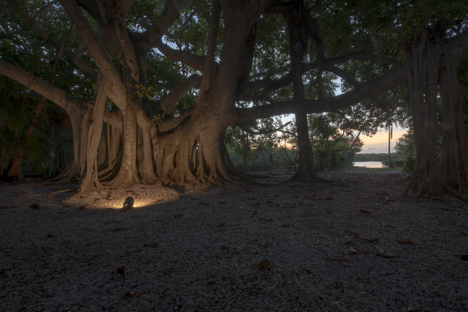
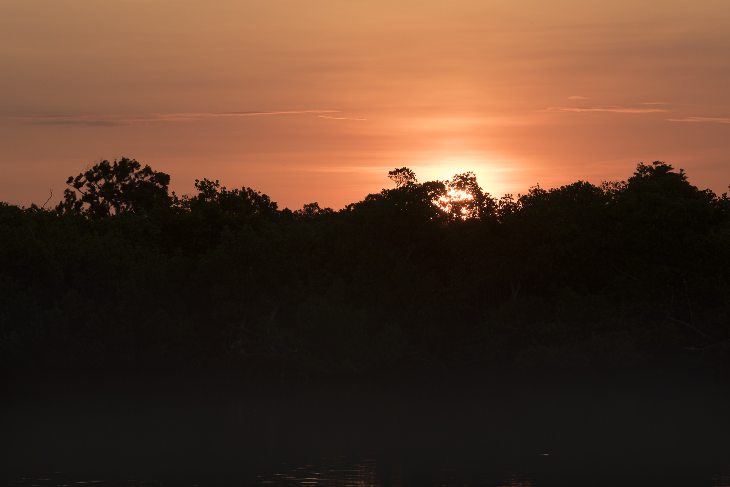
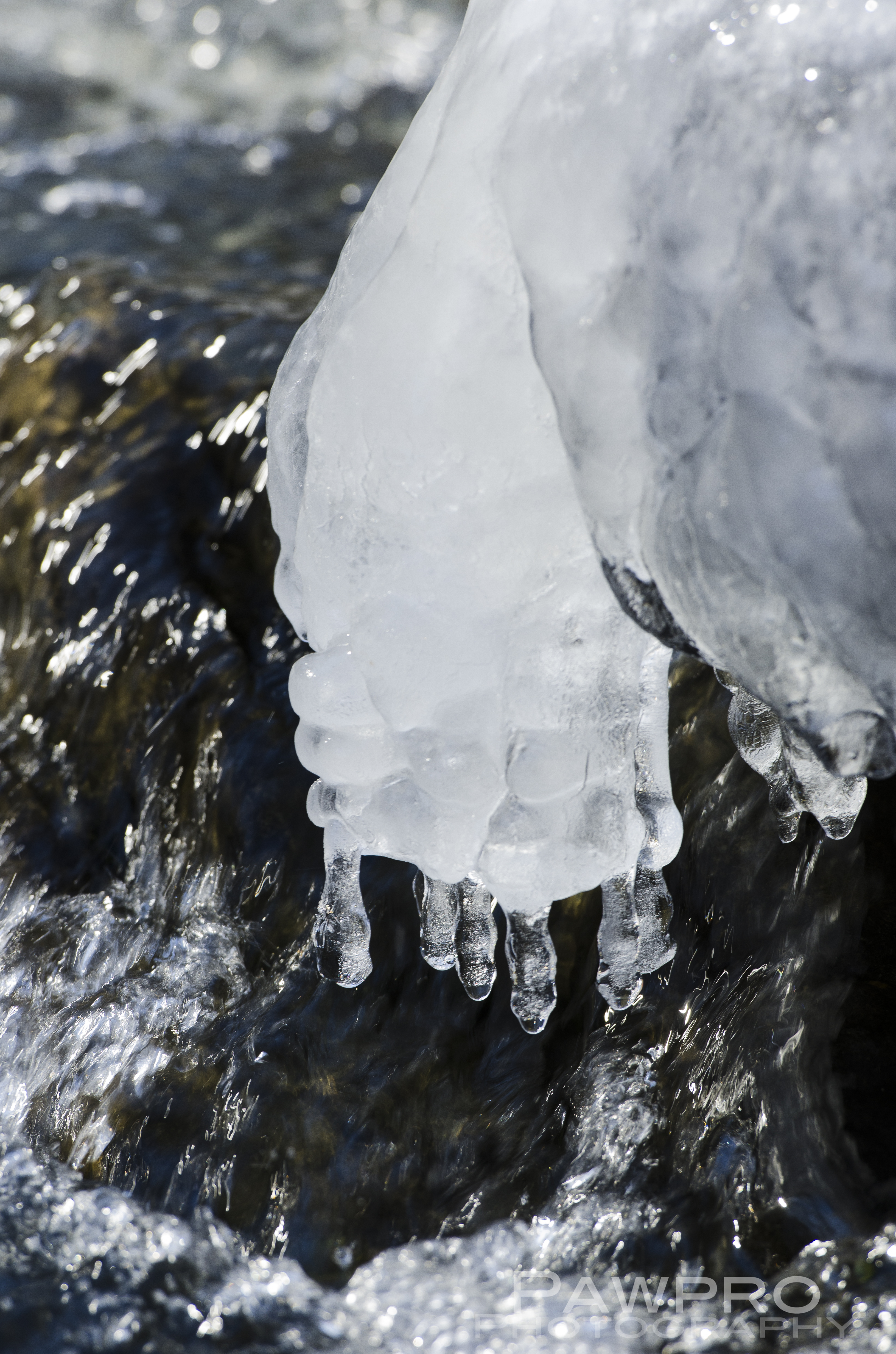
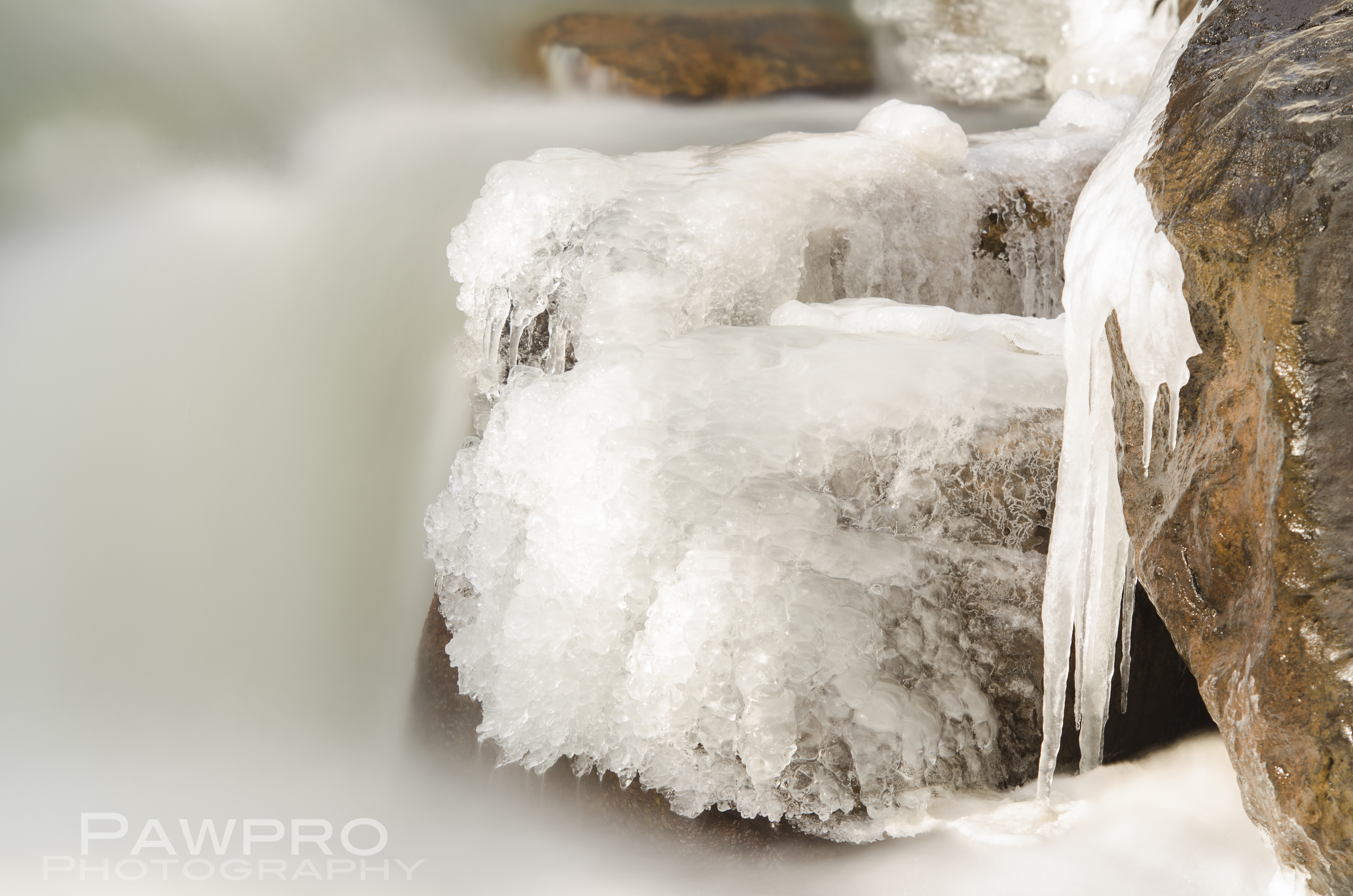
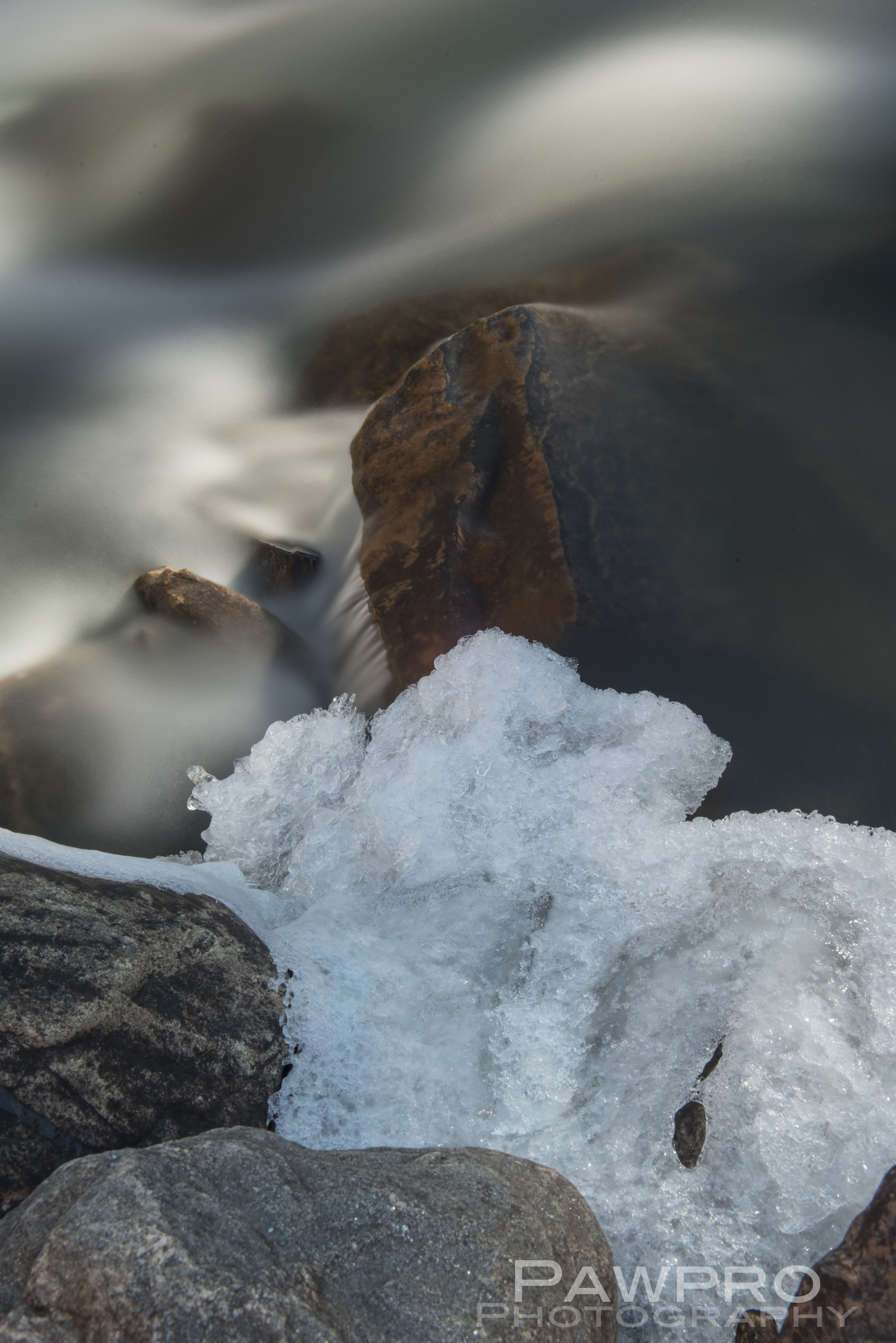
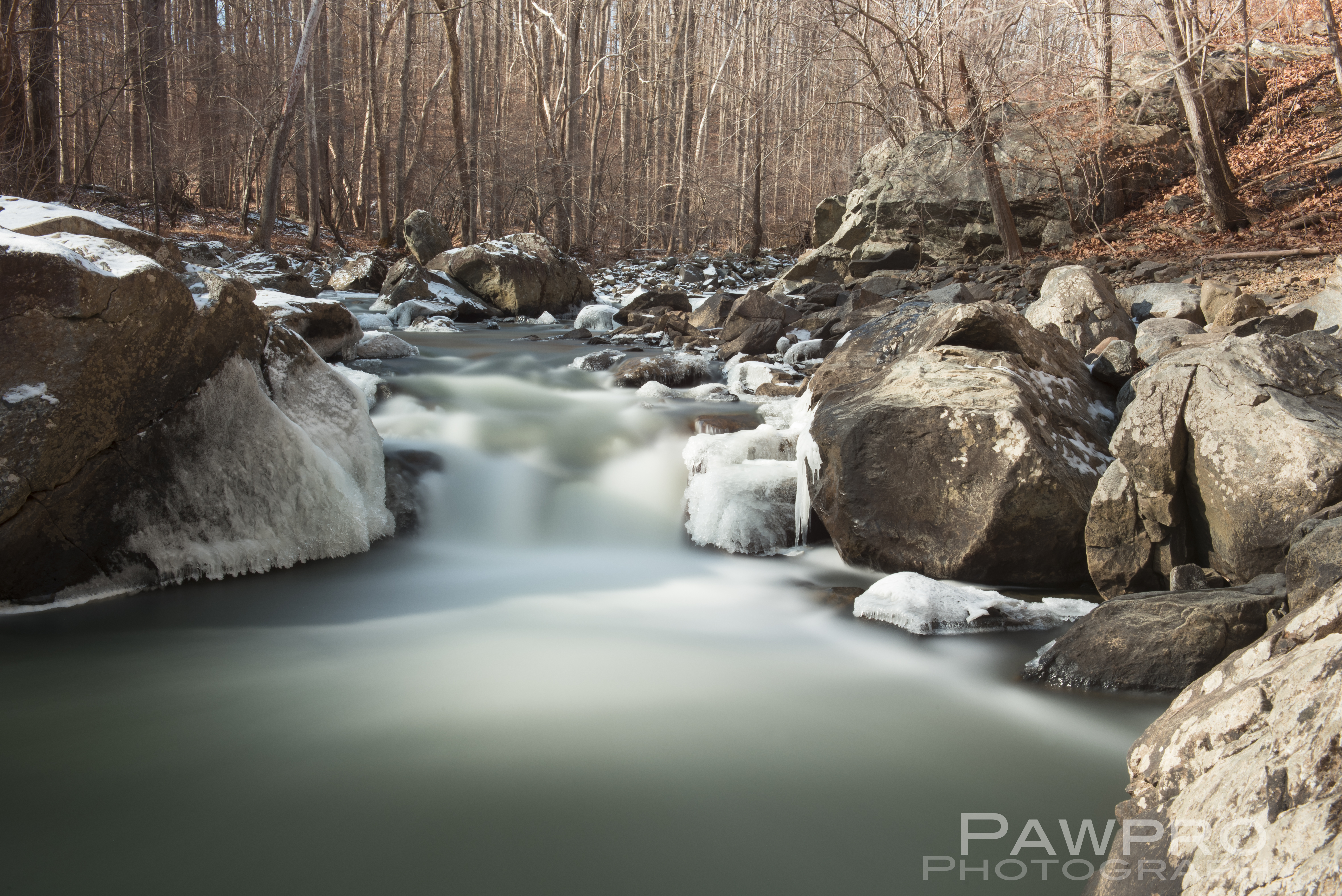
I only discovered Blackwater Refuge two years ago, during a weekend trip, and now I find myself visiting and exploring frequently in the early morning to capture photos of the landscape and the wildlife.  It’s less than two hours from Washington, D.C.  I usually arrive before dawn.  Once I turn off the main road to the shore points, time slows.  It’s quiet here, even in the summer.   In the winter it feels abandoned.  I usually see something new each visit: a quality to the light, a chance encounter with an eagle or some other creature.  On this day it’s snowing lightly. The air and wildlife move about freely in a quiet rush of feeding and surveying.  I’m an intruder and watched by the wildlife and the locals.  The flat land lets the wind glide along with little interruption which adds to the feeling of remoteness and wildness.  In the winter, the unfettered, damp wind can be brutally cold.  Cambridge, Maryland’s business district is fifteen minutes away, buffered by a multitude of farms of varying sizes and conditions.  The occasional car will pass.  I’m noticed immediately by a dog when I stop at dawn to take a photo of an older farm house decorated for Christmas.  I move along not wanting to cause disruption, but I may be too late for that. 

A Legend Lived Here

As if the wetland isn’t reason enough to protect this area, it’s also the home to one of the greatest American heroes of the Underground Railroad—Harriet Tubman, who escaped slavery herself and returned approximately 13 times to lead other enslaved people to freedom.  (The Harriet Tubman Museum is a must stop here. https://visitdorchester.org/harriet-tubman-museum-educational-center/)  Driving the area, one can only imagine the physical, 19th Century hardships one would endure trying to navigate, surreptitiously, on foot. 

This is a place and a story I will continue to document, to preserve, and to protect. If you visit, please leave no trace.

©Amy Linn Doherty and Pawpro Media

Unauthorized use and/or duplication of this material without express and written permission from this blog’s author and/or owner is strictly prohibited.  Excerpts and links may be used, provided that full and clear credit is given to Amy Linn Doherty with appropriate and specific direction to the original content.


sources

Scott Neuman, Colin Slyer, Trump Administration Cuts Back Federal Protection For Streams And Wetlands, www.npr.org/2020/01/23/798809951/trump-administration-is-rolling-back-obama-era-protections-for-smaller-waterways?utm_term=nprnews&utm_medium=social&utm_campaign=npr&utm_source=facebook.com&fbclid=IwAR3BPp2pqXzZ5h04ENqycfUQXHZcK6c8LvMrdmSf1o83_OM3NVLWqGLiKGc&fbclid=IwAR0i53fZ7C1JevBFGUQBKBblrirpx9_CCKhgKuwX373Tw-wHjI_f-rF1DQQ , NPR, January 23, 2020 10:37 AM ET, Updated at 3:20 p.m.,

Coral Davenport, Trump Removes Pollution Controls on Streams and Wetlands, January 22, 2019, http://www.google.com/amp/s/www.nytimes.com/2020/01/22/climate/trump-environment-water.amp.html, The New York Times

Daniel Strain, The Future of Maryland’s Blackwater Marsh, January 14, 2015, www.climate.gov/news-features/features/future-marylands-blackwater-marsh , Climate.gov

https://www.lwcfcoalition.com/tools, fact sheets, LWCF General Fact Sheet, Great American Outdoors Fact Sheet

Ledges & Laces

AngelsLanding-7077

We’ve all seen the photos of a hiker out on a precipice, dangerously close to a ledge, witnessing a vista from a spot that’s presumably taken hours to reach. It’s what all hikers and outdoor enthusiasts dream about—myself included.

I love encouraging people to get off the couch or outside exploring but I fear the ubiquity of the person on a precipice photo makes some complacent about their preparation to reach these spots and is encouraging faster deterioration of fragile geological sites.  Each summer season sees many accidents at national parks and monuments—in so many cases people underestimate the dangers or damage they might cause.

_PAW9049-2

The infamous shots of Horseshoe Bend are a perfect example.  In and of itself it’s not a very strenuous place to reach. If you’re in average good health and can walk a mile this is an easy walk from a nearby parking lot.  Yet, people die there because they are distracted, careless about the dangers, and careless about dressing properly.  

On a recent sunrise visit to Horseshoe Bend I watched as a young woman approached a raw section of the rim—without a railing—wearing a flimsy, leather soled sandal.  This red rock ledge is covered in fine sand and pebbles on top hard flat rocks offering a perfect spot for viewing and photos, but also a perfect potential for slipping.  It was a damp, thirty-some degree morning with a steady, brisk wind that makes one move stiffly.  There are sections with a railing and there are sections without.  This young woman stood near the rim without a railing to take her selfie, back to the edge, obviously cold, and sure enough one of her feet slipped away from her.  She was lucky because she slipped away from the edge.  All I could do was shake my head and be grateful I hadn’t just watched her fall to her death—something I’m sure I couldn’t handle.

AngelsLanding-7397

Similarly while I was climbing down from Angel’s Landing at Zion National Park a few years ago, I witnessed parents standing behind as their twelve, or so, year-old daughter slid down an embankment on her bottom and jumped off to a landing less than two feet wide, facing a shear drop off into a canyon over 1,000 ft down, wearing a basic pair of worn sneakers.  If she had misjudged the landing, slipped ever so little, caught an edge on the rock face or done anything that caused her to need more room for a landing she would have been gone.  There was no precaution in her movement.

She might have also taken someone with her as she grasped for anything when she realized she was falling. Stupid, careless, thoughtless, reckless, I feel.  Even if she had the proper shoes this was an eye bulging situation to witness.  Again, I was thankful, as were the others watching in terror with me, that we hadn’t just witnessed the death of this young girl.  It’s almost as if the chains and railings give visitors a false sense of safety, and that folks are sure there will be protections or warning signs—even where the dangers are glaringly obvious.  In that case, I’m not even certain the parents recognized the situation they had allowed to occur.  (I can’t even bring myself to call it a tragedy averted because, to me, a tragedy is something you don’t or can’t see coming.  This was an obvious and unnecessary risk.)

And as for those who climb out upon overhangs, I know it makes for a great photo, but remember you’re standing on a natural ledge in the process of natural erosion.  One day it will fall, and are you sure you want to cause it to fall. Do you wish to go with it?  In many cases it seems there is no regard for the places and their preservation.  There is an insatiable need to possess them—not just witness them.  The least you can do is wear appropriate shoes. Sneakers and basic athletic shoes are intended for pavement or prepared surfaces, as a rule.  There is a great deal of engineering and design behind a good hiking shoe–really.  It’s not any different than buying tires for your car, except it’s you getting your feet trail ready.  Call ahead and talk to park officials or search online sites that provide a preview of conditions and logistics, so you know what to expect.  Yes, it takes time.  Yes, it will make the experience better.

_PAW9074_5_6_7_tonemapped

Here’s the thing, National park visitation has spiked in the last six years, and the number of park rangers patrolling has declined along with their budgets. Keep these statistics in mind from Steve Sullivan, Permits Program Manager at the Grand Canyon, as you take a ledge or head out on an unfamiliar trail: each year at the Grand Canyon alone the National Park Service engages on average to 297 search and rescues, and 1,067 emergency service responses.  In May of 2016, on a single day there were over 1,000 people attempting some version of a rim-to-rim hike.  For every park visitor, nationwide, there is 1 park ranger for every 180,000 visitors, according to National Park Service data.  They are overburdened and under funded and the current administration doesn’t appear to have any regard or remedy for improving those stats.

You’ve probably heard the camping motto “Leave no trace.” meaning there should be no trace you visited—no trash, nothing left behind.  No trace can also include creating a situation where visitors disregard risks and need to be rescued or evacuated.  It’s a drain on a National Park system that’s already struggling to manage.  Please think and plan ahead before you visit a park, and take precautions all the way down to the shoes you choose to wear.


Hughes, Trevor and Chavez, Trevor. “Death on the trail: More Americans visit nation parks, but fewer rangers on patrol.” USA Today, Published June 29, 2019, updated July 9, 2019. Accessed August 31, 2019 https://www.usatoday.com/story/news/nation/2019/06/29/national-parks-rangers-vanishing-putting-visitors-risk/1503627001/

Copyright Amy Linn Doherty and Pawpro Media

Unauthorized use and/or duplication of this material without express and written permission from this blog’s author and/or owner is strictly prohibited.  Excerpts and links may be used, provided that full and clear credit is given to Amy Linn Doherty with appropriate and specific direction to the original content.

Lunar-Like Landing at White Pocket and South Coyote Buttes

As we get ready to celebrate 50 years since man landed Apollo 11 on the Moon this July, I recently had the privilege of visiting a location on Earth that resembles a lunar landing. The White Pocket area of Paria Canyon-Vermilion Cliffs National Monument, a spot that feels out of this world, is nestled between Page, Arizona and Kanab, Utah. It’s guarded by remote, and rugged terrain, so it sees far fewer visitors each year than its neighbors at Zion, Bryce and the Grand Canyon. However, each year its recognition among photographers and adventurers grows.

WhitePocketRidgeHiker

If you’ve visited Horseshoe Bend, AZ for a sunrise photo facing west you couldn’t miss the Vermilion Cliffs and the Paria Plateau 10 miles in the distance because the first light of sunrise illuminates this elevated, red rock wilderness before anything else.

_PAW9087_8_9_tonemapped
Horseshoe Bend with Paria Canyon-Vermilion Cliffs getting first light.

This 112,500 acre “island in the sky”, as some have referred to it, is accessed from the west and north sides via Kanab and 89A where the dramatic step off becomes invisible once you’re on it.  Stretches of 89A are said to roughly follow the path of early Franciscan explorers, as well as the route taken by early Mormons on their way to be married at the nearest temple.  Once you’re off the pavement, it’s a long trail to reach these relatively small geological masterpieces on primitive automobile paths mostly maintained by usage.

Geologically, White Pocket is one of a kind with its relatively thin, drippy coating of white stone resembling cauliflower or brain matter on the surface–giving rise to the lunar sensation.  Just beneath is the striated, slick rock, sedimentary, Navajo, red sandstone of various hardnesses, so common to the area.

WhitePocketCauliflowerRock

WhitePocketHikers

What’s uncommon is the well-preserved and chaotic layering where time and clearly violent movement tell the untold, almost photographic, story of what occurred here. Some geologists theorize that the area was created by a massive sand slide during the Jurassic Period, probably triggered by an earthquake, where soft, saturated sediment deep below the surface rapidly descended over a large pond or oasis resulting in unstable pockets of trapped water and wet sand shifting, burping, bending beneath like layers of rubbery rock.

As sedimentary layers settled under the weight of the new surface, trapped water bubbled and migrated, forcing its way to different places in volcanic-like movements of soil.  What’s left are a varied and unusual array of hoodoos, fins, cones, ridges and ravines coated in white polygonal shaped icing that at times can resemble marble cake. There is the unmistakable feeling that while the rock was still wet a large hand was sculpting and working it; as if you were dropped inside the deep layered topography of paints—red, orange, yellow, pink, and white– within a Van Gogh painting where heavy-handed brush strokes and the gouges and smears of a palette knife prevailed to create a masterful depth.  That’s as close as I can come to describing it.  Hopefully, the photos help.

MoquiMarbles
Moqui Marbles

White Pocket Gallery

We learned that the little black pebbles in-between many of the fractured polygonal formations are called Moqui Marbles which are iron oxide concretions that form underground where iron minerals collect in the form of a shell with a sandstone core.  Similar formations were discovered on Mars in 2004 by the Mars Exploration Rover.

Nearby is the more well-known, North Coyote Buttes commonly referred to as, The Wave, where access is limited to 20 visitors a day by lottery, and South Coyote Buttes which requires daily permits and limits, as well–even if you have a guide. (BLM Coyote Buttes Permits)  White Canyon doesn’t require a permit.  The Bureau of Land Management (BLM) oversees all of these areas.

South Coyote Buttes Gallery

SouthCoyoteButtesThreeTeepees
South Coyote Buttes colorful teepees.
SouthCoyoteButtesNavajoSndstone
CoyoteButtesTeepeestrata

Getting There

I considered trying to access South Coyote Buttes on my own, BLM permits in hand, but was glad I didn’t once I saw the conditions.  The roads are tough and require a true high clearance, 4X4 vehicle.  Your basic AWD, rental vehicle probably won’t cut it in the deep sand, potential deep mud, combined with steep inclines, large rocks and ditches. It’s also easy to forget the elevation because of the plateau.  As with any mountainous region, conditions can change quickly.  I spent most of the day in the area that started out with sunny blue skies, but quickly devolved into a disorienting, extended snow squall.  If you get stranded or stuck you’re not likely to see a passerby until the next day. Ignorance, isolation and preparedness are formidable and the most common predators of visitors, say the locals. Even if you have the proper vehicle and feel comfortable behind the wheel in these conditions, navigating the infrequently marked, dirt trails, from one area to another could be another wheel spinner.

That being said, I can’t imagine how hot and uncomfortable it must be here in the summer months, an added danger for visitors.  To me, March, April, and October are an ideal time to visit for this very reason.  The temperatures can vary wildly but generally remains in a manageable range.  Again, visitors must stay aware of conditions and be prepared for quick changes.

Our Guides and What I Wore?

Witnessing the Native American petroglyphs, abandoned and deteriorating corrals and cabins now protected within this National Monument makes a visitor imagine what life was like for those early inhabitants. Early Native Americans–especially Puebloans– were thought to use the area for refuge while moving from one area to the next.  During the wild, wild, west the formations functioned as hideouts.  The remote, small, wooden structures along the primitive one lane roads are served by the ubiquitous wind mill-powered wells spinning nearby; an ode to turn of the century West. I imagined hearing the squeak of the spinning blades during the still of the night.

We chugged along safe and sound in our large SUVs equipped with satellite phones in case of an emergency.  Getting stuck and having to spend the night out here is a reality for any visitor—no matter how prepared.  Our guides from Dreamland

Safaris Tours were professional, well-equipped, knowledgeable and fun—most importantly.   Each guide had their own individual style and stories about the places we visited. We had a great time getting to know them. (#DreamlandSafariTours)

img_5950
Goofing around

We were treated to many archeological and geological artifacts throughout the exploration, but reminded not to take souvenirs.

img_5973

As far as my outwear, I was happy to have many layers to keep myself warm as the temperature fluctuated and then dropped precipitously. During the snow squall the wind was howling and the temperature probably dropped 20˚, or more.  A hard shell is a must to stop the wind and to stay dry.  As a person who can feel cold when the temperature drops below 72˚ F, I am a big proponent of wool base layers, or any base layer for much of the year.

Being comfortable and knowing what you need in terms of layers is a learned skill. (See more specific selections below.) It’s different for each person. If you want to be certain you have the right outerwear, you must do some homework and know what works for you–wool, synthetic, down, fitted or loose, bluesign®, ethically sourced, etc.  I prefer efficient, fitted, lightweight layers that breath and dry quickly, so that I don’t feel restricted by my clothing.  And, always be prepared for the unexpected, whether that’s heat or cold.  As far as shoes are concerned, a hiking shoe for extra traction will be helpful on this mild hiking experience.  You might also want to wear gaiters to keep the sand out of your shoes, but it’s not a necessity.

During this adventure I also ran in the Antelope Half Marathon, visited Monument Valley, as well as several slot canyons.  Check back for posts about those experiences very soon. Please do me a favor and take a moment to follow me here on my blog and on Instagram–especially if you found this entry helpful. More to come!

© Amy Linn Doherty and Pawpro Media 2009-2019.

Unauthorized use and/or duplication of this material without express and written permission from this blog’s author and/or owner is strictly prohibited.  Excerpts and links may be used, provided that full and clear credit is given to Amy Linn Doherty with appropriate and specific direction to the original content.


OUTERWEAR

•250 weight wool base layer (#Smartwool, #KariTraa, #REI, #Odlo are my favorites.)

•lightweight polar tech fleece (#OutdoorResearch Deviator or Patagonia R1/R2® w/ Polartec®, Alpha® Power Grid™ fleece is lightweight and efficient.)

•synthetic or down mid-layer (Patagonia Nano Air®, Arc’teryx Atom LT® are my favorites)

•Lightweight, Waterproof, Hard Shell Gore-tex® (The North Face® HyperAir® a favorite of mine because it’s lightweight and breathable.)

•wool socks #Stance ®, Smartwool®, REI®

•Fleece, Wind Stopping Gloves

•Hiking shoe or mid-boot (Salomon® Outline)


#WhitePocket, #PariaCanyon_VermilionCliffs, #Dreamlandsafaris, #PageAZ, #Bryce, #Zion, #FindYourPark, #OutdoorPhotography, #adventurevacations, #hiking, #travelphotography, #amydohertyphotos, #landscape photography, #kanab, #89A, #geology, #redrock, #southwest, #Arcteryx, #OR, #Patagonia, #outerwear, #outerwearguru, #whattowear, #hikingclothing #Navajo, #PublicLands, #ProtectPublicLands, #lunarlanding, #outofthisworld, #REI, #OptOutside, #ForceofNature, #AntelopeCanyon, #slotcanyon, #VacationRaces, #AntelopeCanyonHalfMarathon #MoquiMarbles

Sources:

  1.  http://www.americansouthwest.net/arizona/coyote_buttes/south-coyote-buttes.html
  2. https://www.nationalgeographic.com/magazine/2012/02/vermilion-cliffs-national-monument/
  3. https://www.dreamlandtours.net/day-tours/tours-of-the-paria-canyon-vermillion-cliffs-national-monument/white-pocket-photography-tour/
  4. https://www.dreamlandtours.net/day-tours/tours-of-the-paria-canyon-vermillion-cliffs-national-monument/white-pocket-photography-tour/
  5. https://www.amusingplanet.com/2013/03/white-pocket-vermilion-cliffs-national.html

Happy 100th Grand Canyon: And Many More?

What started as a crazy Grand Canyon notion among an assorted group of empty nesters, mid-lifers, one twenty-something, and an eleven-year-old from Northern Virginia became a collective reality, and a substantial Southwestern adventure accomplishment for me and my son back in 2014.PAW4953GrandCanyonboyhiker

All I wanted to do was take my youngest child–on the precipice of becoming a teenager–on a memorable, somewhat significant trip.  In all honesty, I had never heard of hiking the Grand Canyon from rim-to-rim, and I certainly never imagined doing it in one day.  The more conventional experience is to hike down to the famed Phantom Ranch, spend a night or two camping at the bottom of the canyon, and then hike out to the North Rim.  Instead, we were going to hike from one rim to the other in one day

Ranging in age from 11 to 62, our group of 15 men and women, and one child hiked the rim-to-rim in 2014.  This undertaking includes 23.4 miles, 11.5 hours, 7 miles down the South Rim, 9 miles across, and 7 vertical, winding miles up and out to the North Rim.  Weather conditions can make any crossing experience vastly different and more-or-less extreme from one day to the next.

SouthKaibabRestStopPawpro
Entering Cedar Ridge

This isn’t a hike recommended by park rangers, I assume because hikers so frequently misjudge hydration and fitness needs even for the shorter hikes, and become stranded.  Indeed, not long after we attempted this hike the National Park Service made similar hiking groups acquire a Special Use Permit in order to attempt a rim-to-rim in a group of this size.  You’ll see online that some websites specifically discourage rim-to-rim hiking, while others promote ultra-style, rim-to-rim-to-rim runs of the canyon, and the like.  All I can tell you is, as we began our ascent up to the North Rim, we passed a tiny helipad, and minutes later a small aircraft took off with a woman who had reportedly broken her ankle.  The risks and logistics are real, and the rescues difficult, not guaranteed, and expensive.

PAW_5012GrandCanyonRimtoRim

PAW_5030GrandCanyonrimtorim

PAW_5020GrandCanyon

That said, we too had a new hip in the group, knees that needed replacement, tendinitis, tight IT Bands, lower back issues, poison ivy, and blisters.  In fact, my son had been rushed to an urgent care after landing in Phoenix two days earlier because of a sudden ear infection. So, while we were a tough, conditioned group–most of whom met via a 6a.m., all-year-round, outdoor, boot camp–we had plenty of potential health issues that could have become an issue at any point.

An Early Start

The day of the hike started at 4:40 AM when we all met outside our South Rim cabins to catch the shuttle to the South Kaibab Trailhead, the shorter, but more steep way down.  It was an ideal 38˚F.  We were told no water is guaranteed on these trails until you hit the bottom, so everyone carries their own.  We paused at the start of the trail in the company of other hiking groups heading out for adventures of their own.

PAW_5047
Along the South Kaibab Trail of the Grand Canyon.

By the time we reached the bottom the temperature could reach 90˚F or higher, but we were lucky and these extreme conditions didn’t materialize on this late May day. However, there was a little lightning as we hiked, another regular threat, but it stayed well in the distance. (Distance being a relative term on foot and within the Grand Canyon.) We each also carried a change of clothes and toiletries for when we reached the North Rim Lodge, which seemed more like a dream as the day progressed and the miles underfoot accumulated.

GrandCanyonTrailPawpro0432
Hiking within the canyon, lightning in the distance.

We marveled at the awesome natural spectacle of the early morning canyon, the tips of the layered, red rock walls painted with a warm glow of sunlight as our feet and toes hammered down the well-traversed, sometimes stepped trail, spattered by mule dung and giant, puddles of vaporizing mule urine that by the time we reached the North Rim functioned as smelling salts for at least one in the group–me.  I can only imagine how more intense this smell would have been on a hot day.

As we descended, the excitement grew as we caught the first glimpses of the distant, calm, emerald green portion of the Colorado River we would soon cross on the heavy gauge wire and plank suspension bridge.PAW_5102GrandCanyonbridge

We stopped and ate the boxed lunches at Phantom Ranch, which we’d pre-arranged via the National Park Service system. Some of us soaked our feet in the super cold water of the nearby stream, which was a mistake I would later regret.

img_1133
Soaking my feet mistake.

Rain, thunder and lightning could not dampen the group spirit as we headed towards our last break at the encampment called Cottonwood early in the long 5400 foot climb up the North Kaibab Trail.  The average grade is 21%.   We took only two extended breaks during the day to eat and use the rustic, hole in the ground bathroom facilities, and limited our time at these spots.  We wanted to finish in daylight, but were prepared with headlamps if we didn’t make it in time.  We nibbled on trail mix and various incarnations of jerky.  We continued to be amazed by the grandeur of the canyon at every turn, but more and more our gazes remained on our feet, and the strikes of the hiking poles getting deeper as we began the long climb out.

As the Day Wore On

While we stopped and posed for photos frequently on the way down, this activity became an unnecessary use of valuable time and energy on the climb out.  I had developed a few blisters, and the pounding of my toes within shoes not quite sized right had started taking a toll. At least that was the slightly dehydrated thinking that was going through my brain. The camera mounted on my forehead was beginning to chafe the skin as it bounced up and down, but that pain was nothing compared to the one manifesting in my feet and thought process.  I had long since packed away my Nikon D7000.  I took only two photos on the climb out, while being chided by the climber sporting a new hip for not taking in all the scenic points behind me.  I was in too much pain.  Plus, I failed to dry my feet completely after soaking them in the stream earlier, which spurred the hot spots developing.  During some relentlessly steep stretches and endless switchbacks my breathing sounded as if I had just completed a series of wind sprints.  “I was in better than average shape.” I was saying to myself, “And this climb is kicking my ass!”  Thinking back, I was probably carrying too much water and too much camera gear, AND had spent too much time making sure my son was eating and drinking enough.

In the end, it was the 11-year-old and twenty-something who finished first, youth and two days of antibiotics working their magic, I tell myself.  The rest of us finished in small clusters, grateful for the chance, the place, the cool temperatures, and the camaraderie.  We had all done it!  We had successfully hiked the Grand Canyon from rim-to-rim in one day.

PAW_5181_2_3GrandCanyonNorthRimSunrise

We spent a glorious night at the North Rim Lodge.  I couldn’t tell you what I ate that night.  The dining room overlooks the canyon.  We could see the lights of the South Rim as nighttime came.  My son fell asleep at dinner, the table served as his pillow.  We woke the next morning to the full scale glory of a sunrise at the Grand Canyon’s North Rim.

This slideshow requires JavaScript.

These places face a growing threat–economically and environmentally.  The Grand Canyon was officially protected and preserved 100 years ago so that future generations can enjoy it.  We must remember we aren’t the first, and we shouldn’t be the last to see it and experience it.

© Amy Linn Doherty and Pawpro Media 2009-2019.

Unauthorized use and/or duplication of this material without express and written permission from this blog’s author and/or owner is strictly prohibited.  Excerpts and links may be used, provided that full and clear credit is given to Amy Linn Doherty with appropriate and specific direction to the original content.

Snow a Welcome Change to DC Scenery.

dcsnow2019pawpromedia-7136
Constitution Gardens benches in a blanket of snow.

dcsnow2019pawpromedia-7145
Beside the Lincoln Memorial Reflecting Pool

dcsnow2019pawpromedia-7149
Despite the government shutdown and the snow, National Park Service workers clear the walkways, predawn, to keep them passable and safe.

dcsnow2019pawpromedia-7158
Lincoln Memorial during snow storm 2019

dcsnow2019pawpromedia-7169
The fenced up Washington Monument

dcsnow2019pawpromedia-7181

dcsnow2019pawpromedia-7195
Geese resting and huddled for warmth in the Capital Gardens pond


dcsnow2019pawpromedia-7211
Geese landing in the Constitution Gardens pond w/ Washington Monument in the background

dcsnow2019pawpromedia-7229
Constitution Gardens geese in snow storm

dcsnow2019pawpromedia-7280
Blue Heron on the bank of Constitution Gardens Pond

dcsnow2019pawpromedia-7296
Einstein Memorial decorated with snow in front of National Academy of Sciences where one quote reads, “The right to search for truth implies also a duty; one must not conceal any part of what one has recognized to be true.” Albert Einstein

dcsnow2019pawpromedia-7322
First visitors to Constitution Gardens as snow continues to fall.

dcsnow2019pawpromedia-7324
Washington wakes and starts enjoying the snow.

Photo Journal: A Close-Up on Captiva Island, Florida, Under a Big Banyan

You never know what will come of your friendships with neighbors.  In the fall of 2002, my husband, children and I moved into a home in Northern Virginia which backed up to a much older, Antietam, farm house with trellis anchored flowers growing up the white siding layered with generations of paint.  For years we heard about our neighbor’s home in Captiva, Florida.  Last year we travelled with her to St. Louis for the total eclipse, and this year we dared to ask if we could see her Captiva home.

_PAW9448_49_50_tonemapped

In July, I spent a week exploring this property with my family, and enjoying the benefits of the Gulf to inlet sized property–a rarity these days in Captiva, as most of the lots have been broken into smaller parcels.  We could fish, kayak or paddle board off the back dock, and as we did, had a Manatee and a Dolphin swim within an arm’s length of the dock.  My son and niece were thrilled at the sighting, and so was I.  In nearly thirty years of visiting Florida, I hadn’t taken the time to go see these trusting, docile creatures nearly decimated by boaters, pollution, and development.

Osprey in Captiva
Resident Osprey on the property.

_PAW9912_3_4_5_tonemapped

_PAW9709

If that wasn’t enough of a treat, we also were privileged to have a family of Osprey living on manmade, nesting pedestals high in the tree line.  All day long we were witness to their pattern of eating on a shaded dead branch of a large laurel in the front, over the driveway, and then napping within the shade of the huge Banyan tree out back.  We were also privy to their privy, if you will.  They are fairly impressive in this activity, as well, if you think of it as a type of spitting contest.  Couldn’t help but get a photo of this!

_PAW0275

_PAW0297

This was just the beginning of the intrinsic and natural beauty we witnessed while staying in the circa 1949 Florida style home, which had a certain Frank Lloyd Wright simple, humble, sensibility to its design.  Thankfully, it wasn’t posh, but it was comfortable, practical, and nostalgic.  Each bedroom had a private bath, as well as a screened common area and family room.

_PAW9695_6_7_tonemapped

_PAW9723_4_tonemapped

CaptivaBanyanTreePawpro

The pièce de résistance was a mature Banyan tree in the rear of the property, so large you could only really appreciate the size of its canopy from the water off the back.  At night, lit by landscape lights, it was the centerpiece  and visible from most all rooms.  Had I not stubbed my toe badly on the first day, I would have climbed up to see what views might exist from high in its branches.  Though, the giant Banana Spiders with equally large webs were an substantial deterrent to that climb. I’ve read they are relatively non-aggressive.  No one ventured beyond the first level of branches.

Across the inlet off the dock on the rear of the property is Buck Key Preserve which is a kayaker’s dream with a sizable cove and at least one canal maintained by the Army Corp of Engineers. The cove was frequently used as safe harbor for small craft during several coastal storms through the years. There’s even an abandoned boat in there that ran aground during a storm and the owner just ended up living there for some period of time.  You can still see his reclining chair.  _PAW9465_6_7_tonemapped

_PAW9407

The canal is also safe harbor for many of the exotic birds that inhabit the area.  It’s a great spot for photographers and bird watching, or a great place to escape the Sun for a while.  Just down the road is another treasure for biking and bird watching.  Ding Darling State Wildlife Refuge hosts many exotic species of birds including the Roseate Spoonbill. 

_PAW9791

There was concern about Red Tide in the area during my visit, but we didn’t notice it near the house.  On the beach we did notice a number of dead blow fish washing up and even a dead sea turtle. There was also word of a dead whale down the beach on Sanibel Island.

A Photographers Dream

From a photographers point of view it was overflowing with worthy material–as long as you brought your bug spray and can endure some heat.  I got a rude welcome when I went out for my first sunrise on the dock and neglected to put some on.  I didn’t make that mistake again, but suffered with the bites from that one morning for a while.  I could have easily filled my days with just photographing the Osprey, but that would have meant I missed so many other shots.  During any point of the day the light on the Banyan tree changed and highlighted different features.

I’ll be back in Captiva to enjoy the canals of Buck Key and the wildlife in and around it.  This is one of those areas you visit and remember why we protect land from overdevelopment and certain animals threatened by development.  On the beach, the nests of many sea turtles were marked for protection.  These areas and these animals are priceless and deserve continued protections under the Endangered Species Act.

Periodically, I teach a travel photography class at the REI, Tysons Corner, VA.  The class is free but space is limited, so please reserve your spot by going to the Classes and Events area of the REI website.  Don’t have a date for the next class, but I will announce it here well in advance.

If you’re interested in the class, please do me a favor and follow me on Facebook or Instagram, @PawproMedia.  Thanks so much!

In my next post, I’ll focus on a recent trip to the Alps and the Tour du Mont Blanc, a.k.a #TMB.

© Amy Linn Doherty and Pawpro Media 2009-2019.

Unauthorized use and/or duplication of this material without express and written permission from this blog’s author and/or owner is strictly prohibited.  Excerpts and links may be used, provided that full and clear credit is given to Amy Linn Doherty with appropriate and specific direction to the original content.

#captivaisland #photoblog

A Difficult Winter Run

A walk through Difficult Run Stream in Great Falls, VA in the middle of our second blast of real cold this winter.  This stream feeds into Great Falls National Park, and offers a not so secret on-foot backdoor entrance to the park. Its trail connects to many of the Great Falls trail hikes within the park.

I will admit, I love DC in the spring the most, but I also enjoy the unique sights of an icy Potomac and C&O canal.

Hope you enjoy the sights, as well.

Cairn/Difficult Run Stream
The delicate balance of a cairn along Difficult Run Stream in Great Falls, VA.

A total coincidence and complete aside, I write this as I learn that a majority of the members of the advisory board for the National Park Service have resigned out of frustration with Secretary Zinke.  Hard to believe we, as a country, don’t universally want to protect and support the stewardship of the natural places of beauty in our country, which, in most cases, took millions of years to create.  I couldn’t help but think the cairn photo in this post is a perfect metaphor for the delicate balance between protecting these priceless places that nature has created against the backdrop of today’s conflicted U.S.

The circumstances certainly give me pause following my December commitment to donate a portion of my holiday sales to the National Park Foundation, as it’s not clear what the Department of the Interior’s commitment is to the National Parks.  Not that it’s a tremendous amount, but it sure would be nice to know a donation isn’t a waste of time. And, if we can’t give to the National Parks without trepidation, we’ll lose them, I fear. #FindYourPark? Maybe not. Have they heard about this thing called the Outdoor Recreation Industry employing 7.6 million people, and consumers to the tune of $887 billion spent annually (Outdoor Industry Association, “Outdoor Industry Economy Report”, Outdoorindustry.org, 4/25/2017)?