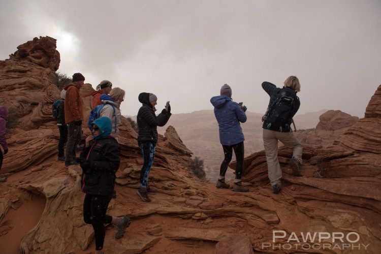
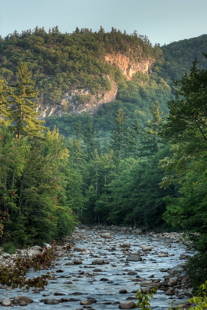
During this stay-at-home period of the pandemic I’ve had a lot of songs running through my head, but the ’80’s classic, Should I Stay or Should I Go has dominated, of late. I’m not really even a big fan of The Clash, or am I? Hard to know, at this point.
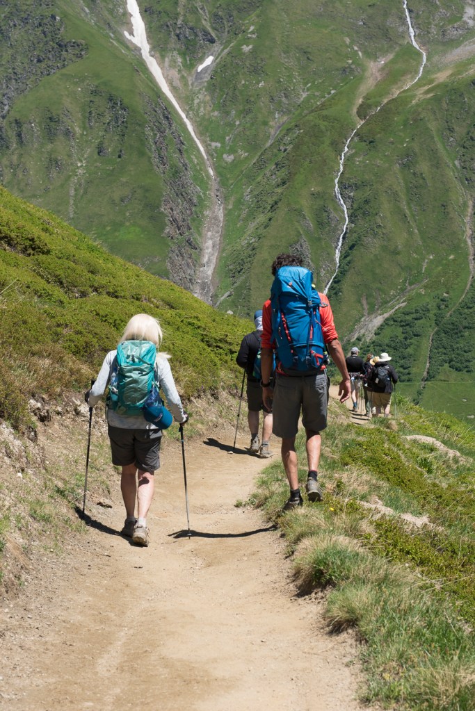
As the world sits at home collectively trying to avoid the COVID-19 virus, millions undoubtedly need to evaluate upcoming travel plans. Looking forward thirty, sixty, ninety days what is the best plan of action and when should you cancel reservations? I’m wondering the same. I have plans to travel out West to photograph Glacier National Park in late June with multiple reservations still on the books. I thought as I evaluate whether to cancel or maintain my plans it might be a useful subject to write about for others.
Of course, if we, in the U.S., aren’t collectively successful at lowering the curve of the outbreaks this discussion will be for naught, and nobody will be going anywhere. I certainly maintain hope that that won’t be the case. I have no desire to put myself or any destination’s local population at greater risk. Everything hinges on achieving a declining trend by April 30. It’s hard to predict or know, since we’ve never experienced anything like this, whether there will be a definitive ruling on resuming full activity, or whether there will be some sort of roll out based on a particular areas status and rate of infection of the traveler’s home. It’s impossible to know how a roll out will look. Yesterday, I watched news coverage of a protest in Lansing, Michigan against the continuation of stay-at-home orders, while in stark contrast the Outer Banks of North Carolina will not allow non-permanent resident homeowners access to their homes as of March 20. A few of those Outer Banks’ residents are suing Dare County where these homes are located. No doubt different regions of the country are experiencing this pandemic from different points of view.
At the same time, I’m trying to support local businesses and business in general. The outdoor industry, as an example, provides 5 million jobs in the U.S. and generates around $778 billion in economic output, according to information from The Land Water Conservation Fund. Not to mention, during a time of political conflict and clashes, National Parks and public lands are overwhelmingly popular and unifying environments for Americans and foreign visitors, alike.
Dr. Fauci, Director of the National Institute of Allergy and Infectious Diseases has explained virus predictions, as they relate to the various models designed to anticipate the spread and toll of the virus’ U.S. outbreak, are only as good as the assumptions used to build them. The same can be said for trying to predict the status of the pandemic in any given country or area in the next few months—all based on assumptions that may or may not come true. And, without being too pessimistic, it’s easy to imagine that there’s a clean start and stop to this threat, but Dr. Fauci put that idea to rest, as well. He said it’s not likely we will get a national all clear. It’s more likely that a return to normal will happen in stages.
My trip to Glacier National is scheduled for the last two weeks of June. I have reservations up and down the eastern side of the park and as far north as Waterton Lakes Park in Alberta, Canada. I was looking forward to that segment in particular. We are suppose to stay at The Prince of Wales Hotel overlooking the lake. At the time of this writing, the normal cancelation policy applies which is a full refund up till three days prior to my arrival. The bigger question is whether we would be able to cross the border by then.
I haven’t purchased airline tickets, thankfully, so I’m holding off on that purchase until I have a better sense of the general travel advisories. I do wonder whether it makes some sense to go ahead and purchase a ticket at the lower rates I see for routes, while demand is down, with the assumption that if travel is still restricted I’ll be able to adjust my flight to a later date or get a refund. If they’re doing that now, I would hope the same would apply down the road, but that’s a gamble.
As of Friday April 3 following many complaints from consumers about airlines not offering returns for canceled or significantly changed flights, the U.S. Department of Transportation announced it will require foreign and domestic airlines to provide speedy refunds to passengers holding tickets for canceled or significantly altered schedules. Those holding tickets who choose not to fly are not eligible for these refunds. Baggage fees and other extra fees should also be refunded under the same conditions.
Most hotels are allowing cancelations with varying limitations. For instance as of April 3, 2020 Hyatt is waiving change and cancelation fees for reservations existing or made April 1, 2020 or before for arrivals through June 30, 2020. Hyatt does have some restrictions for reservations made April 2, 2020 through June 30, 2020 for any future date related to “select Destination properties” and special event rates. As of this writing, Marriott International says there’s no fee for cancelations or changes to existing reservations or new reservations for travel at any future date, including prepaid rates, as long as the cancelation is made before June 30, 2020. Airbnb is allowing cancelations for check-ins between March 14 and April 30, and owners are being partially compensated by the hosting site for these COVID-19 related losses. My Airbnb reservation doesn’t fall within these dates, but I still have time to cancel based on the normal cancelation policy of the property owner. Each property has unique cancelation policies outside of the current COVID-19 cancelation allowances timeframe. Be sure to read the cancellation policy for any property you have booked.
I cannot fathom why anyone would want to go on a cruise of any kind for the foreseeable future given the nightmares we’ve watch unfold on ships all over the world. Nevertheless, Disney Cruise Lines is offering passengers refunds for trips booked for March thru April, or the option to rebook within a 15 month window for it’s various routes.
In an informal poll of the folks who I know are traveling in June, most are holding off on a final decision until the end of April. One or two are largely resolved to cancel their trips in an abundance of caution, but most want to wait and see a little while longer before abandoning a much anticipated trip.
So, for now, I am holding on to my hotel reservations because there’s no harm in doing so, right now. I plan to reassess at the end of April and again mid or late May, keeping an eye on the specific area and service providers I will rely on during this trip. What are the guidelines for visitors, as well as the mood of the area where I might want to visit? I’ve been in touch with the hotels where I plan to stay and I’m paying close attention to what and how they answer my questions. Are the borders I’m crossing passable?. As a last resort, I have considered driving, rather than flying, and camping along the way, but I have to see if that’s feasible, too. Many camp grounds are closed to overnight visitors, as well. No way of knowing how those locales may adapt as the course of this pandemic plays out in the U.S.
Any leisure travel that’s scheduled for April or early May is likely refundable, and I would proceed with getting that process started now. If you have travel in May I think the statement from Dr. Fauci about a national all clear is particularly useful. Many stay-at-home and shelter-in-place orders are through the end of April or slightly beyond. In Virginia, where I live, ours goes through June 10 (unless rescinded sooner), while in Montana the restrictions are open ended, so it’s important to know the rules of the state where you’re headed, not just your home state.
Stay well and plan carefully as you proceed with your travel plans. The link below from Travel Weekly contains links to many hotels, cruise and airlines for your reference.
My second year documenting and visiting the astounding Kenilworth Aquatic Gardens in full bloom–water lilies and lotus’. This place makes you feel transported to somewhere far away. Good news though, it’s in D.C! These photos were taken in July.
A recent trip to New River Gorge was an effort to keep a ball rolling on two long-standing projects. For many years I’ve researched my family’s ancestry, and West Virginia is a central part of that work. I can trace… Read more: Discovering West Virginia’s Mining Heritage and Scenic Trails
If thinking about the COVID-19 Pandemic, the impending presidential election, climate change and the myriad environmental challenges we face gives you a sinking feeling, that sensation might be more accurate than you know—especially if you live on the Eastern shore of the U.S. The Mid-Atlantic Region, part of the North American Continental Plate, especially along the east coast, is sinking, while at the same time sea level is rising here. This subsidence of the land or isostatic rebound, as it is called, is thought to be the result of glacial melting, which allows other portions of the plate to rise as the massive weight of melting ice sheets decreases. In contrast, glacial melting in Alaska and Iceland for instance, also part of the North American Continental Plate, are causing the land there to rise and the sea level to lower. This double whammy of natural and manmade environmental changes might make you think, “Run for the hills!”. However, unlike a seesaw, the rise and fall is not uniform across the plate but undulating much like a piece of warm elastic. This was news to me. I knew about sea level rise, but not the land sinking.
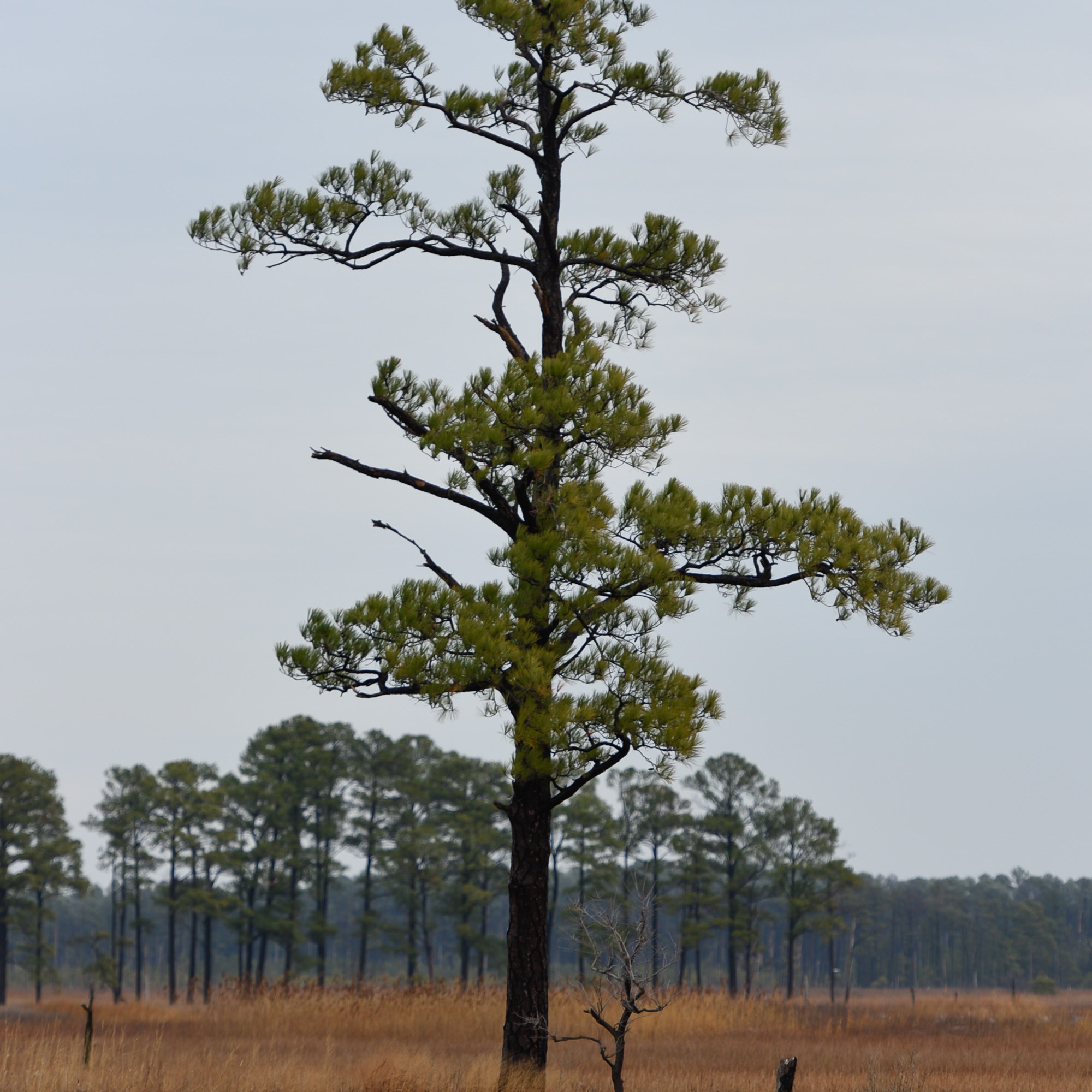
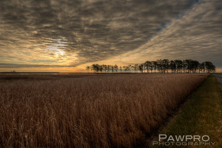
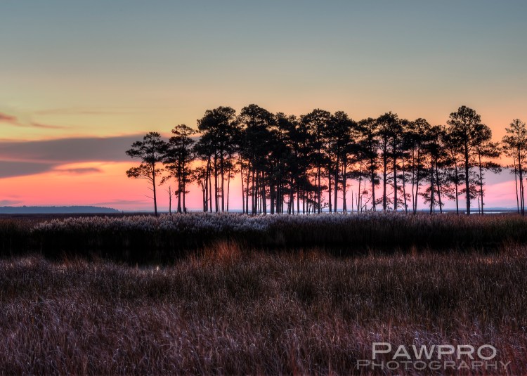
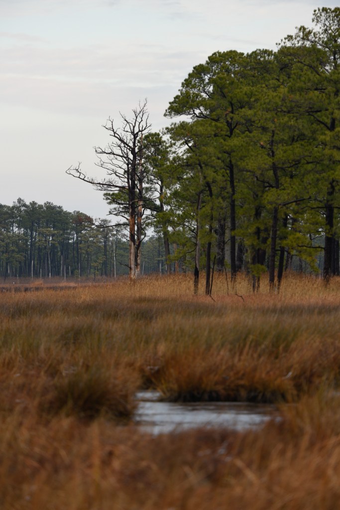
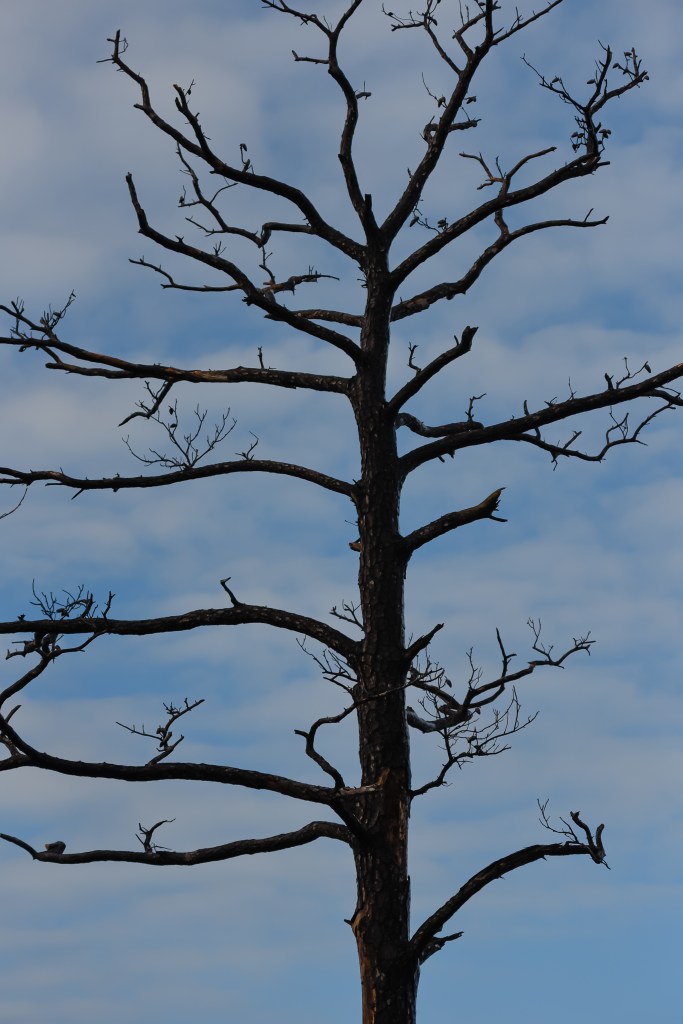
Blackwater National Wildlife Refuge (BNWR) in Cambridge, Maryland is a case study for researchers and scientists studying these simultaneous climate forces, which makes the region particularly valuable and vulnerable. Here the changes aren’t theoretical, they are happening at an accelerated rate and can be seen clearly in the ghost forests, the easily flooded roadways, the disappearance of some wildlife species, and the encroaching water at local doorsteps.
Follow the Public Lands’ Money
Further complicating these landscape and environmental challenges, the 50 plus year bipartisan marriage between the Land Water Conservation Fund (LWCF) and the energy industry could go down the drain if the President’s proposed 2021 Budget is approved. Despite public comments of support via Twitter by the President for full and permanent funding of LWCF within the proposed legislation (S.3422) The Great American Outdoors Act, the true math shows the proposed budget for National Parks is cut by roughly $500 million for 2021. The new bipartisan legislation, with the support of 59 Senators from both sides of the aisle, seeks to remedy the routine raiding and re-directing of LWCF funds to other non-public land uses. As an example, in 2019, of the $900 million deposited to the LWCF, only $495 million actually made it to LWCF projects which flies in the face of a $20 billion backlog of maintenance and infrastructure needs within public lands, and over $22 billion LWCF dollars diverted over 55 years of its history. The President has also led an effort to open once protected lands out west to mining and private enterprise.
Standing on solid ground and the facts at Blackwater National Wildlife Refuge
Blackwater National Wildlife Refuge, a beneficiary of LWCF money, is comprised of roughly 28,000 acres of wetlands, forest and open water. In his 11 years at this wetland refuge, Matt Whitbeck, resident wildlife biologist has seen changes in a decade that one might expect to occur over the course of a century. He co-authored a report in 2013 with The Conservation Fund and the National Audubon Society detailing the accelerated rate of sea level rise. The report also forecasts the loss of the marsh by 2100 and the realization that maintaining the current footprint of the refuge isn’t possible. He supports the new non-traditional approach that seeks to preserve and acquire land where the marsh is likely to migrate in hopes of a better long term survival strategy.
A New Strategy In Preservation: Let it Move
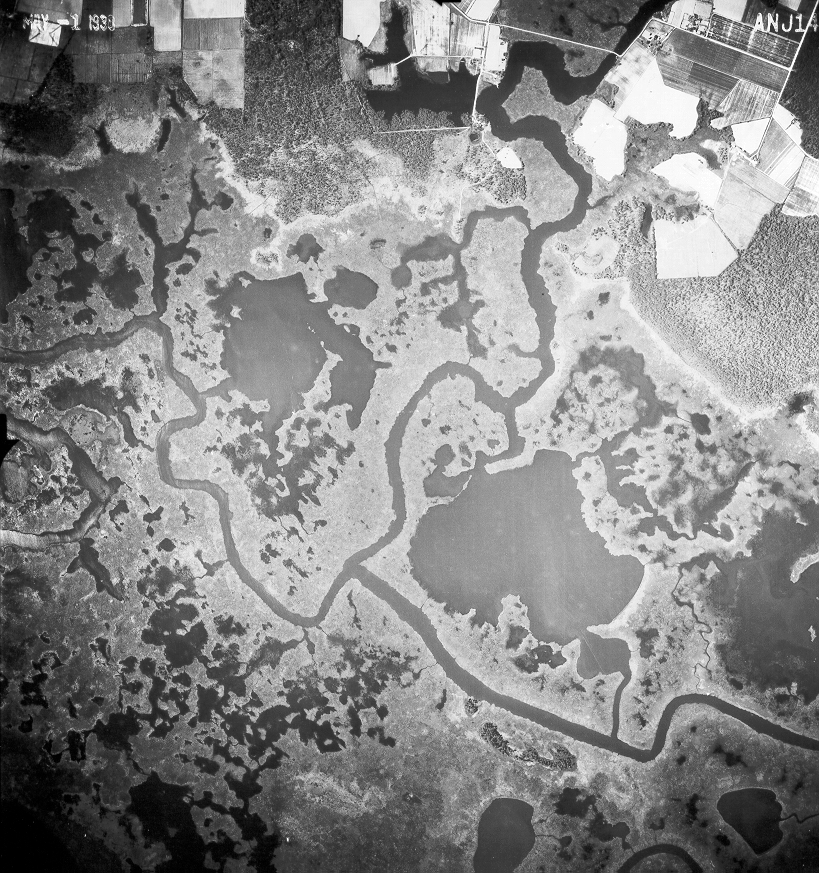
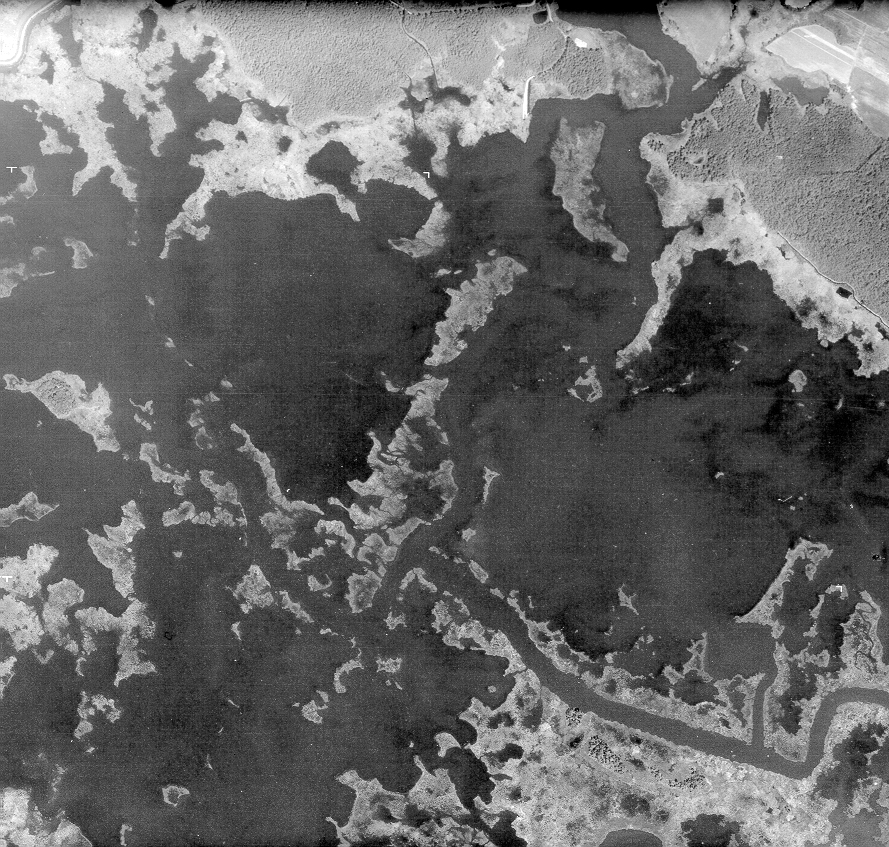
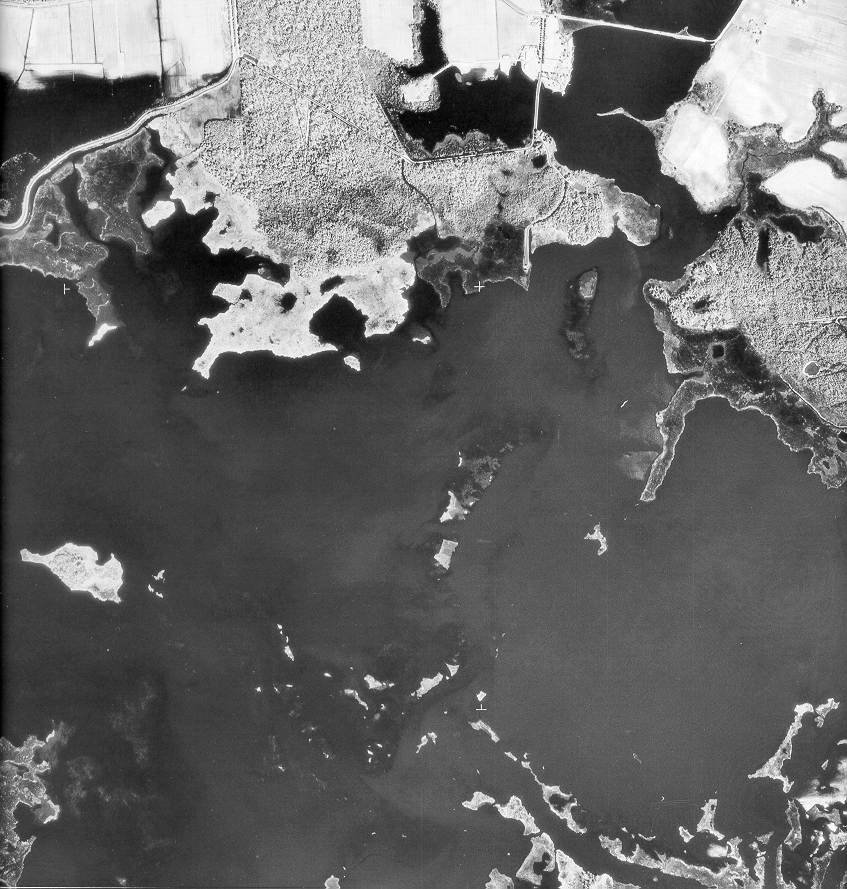
Since becoming a refuge in 1933 areas that were once forested are now drowning and transitioning to wetlands, and in other areas what was once marsh has become open water. It has been reported that some 5000 acres of coastal wetlands have been lost or converted to open water since the 1930s. As the land sinks and sea level rises the wetland is migrating from its 1933 borders and officials are trying to stay ahead of the up slope movement of the wetlands and how that will impact the refuge, the wildlife and the local community.
1938 Blackwater National Wildlife Refuge, photo courtesy BNWR1974 Blackwater National Wildlife Refuge, photo courtesy BNWR1989 Blackwater National Wildlife Refuge, photo courtesy of BNWR
The Blackwater River was dredged in 2017 bringing up 26,000 cubic yards of mud to a submerged area of marsh, and plugged with 220,000 sprigs of native water-loving vegetation. This effort is a more traditional approach that tries to keep the marsh closer to its current footprint. In a new approach, The Land and Water Conservation Fund has assisted in the acquisition of large upland land parcels as they become available where researchers and surveyors expect the refuge to continue its march in hopes that identifying and protecting these areas will be a better approach to preservation.
The LWCF has always enjoyed bipartisan support, investing earmarked energy drilling revenues, rather than tax dollars, back into conservation of public lands and support for national parks since the ‘60s. However, in all these years it has yet to receive permanent funding from Congress despite being a widely supported, budgetary mainstay on both sides of the political aisle. Given recent environmental rollbacks related to coal production and clean water regulations, the lack of permanent funding as well as the diversion of funds away from LWCF and national parks is cause for alarm. At Blackwater, as an example, water quality monitoring is now being handled by a team of individuals and non-profit conservation groups as staffing at the refuge has been shrinking under the stress of rising costs and flat line funding.
” . . . decreases protection for our Nation’s waters and does not support the objective of restoring and maintaining ‘the chemical, physical and biological integrity’ of these waters.” Michael Honeycutt, chairman, EPA Science Advisory Board
Furthermore, recent rollbacks in E.P.A clean water restrictions, driven by the Trump Administration, threaten to rewind years of progress—not just here at Blackwater, but nationally. This, coupled with the budgetary threats to LWCF, puts these environmental treasures at tremendous risk. Given the President’s pattern to conceal his genuine intent, his Twitter-promises to LWCF seem to belie a different truth for public lands–one that does not seek to protect but to profit, no matter the cost to the land.
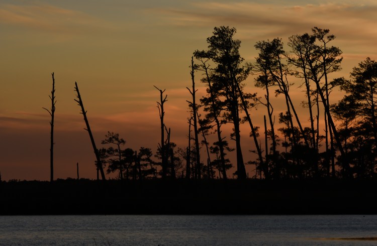
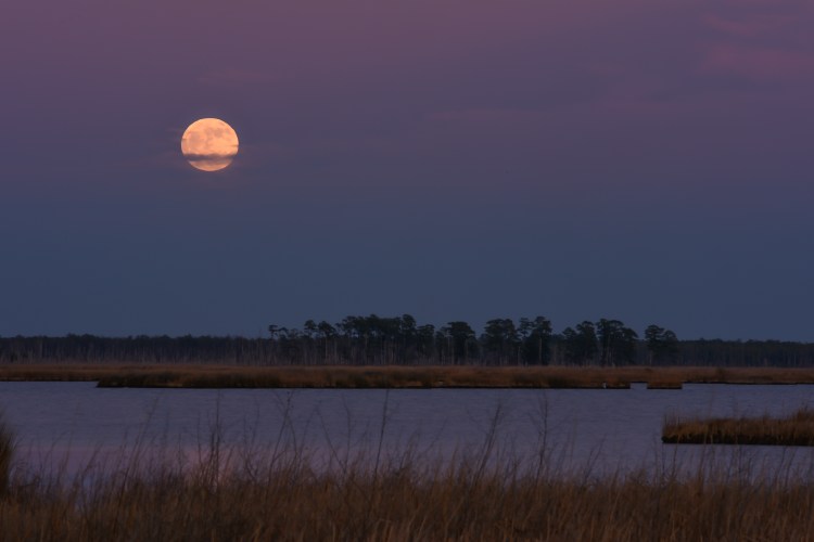
Moonrise over Blackwater National Refuge
The wetland water of Blackwater National Wildlife Refuge, adjacent to the Chesapeake Bay, is still challenged by pollutants. The rollbacks remove protections for seasonal/ephemeral waterways, ground water, or sources not adjacent to large bodies of water allowing industrial and agricultural chemical dumping, pesticide use and the destruction or filling in of natural wetlands in construction projects even though it’s well established that pollutants find their way into the greater water supply system via wildlife or unseen connectivity. The E.P.A’s very own advisory council reports that these rollbacks lack justification and defy scientific impacts to the greater watershed systems. It’s hard to imagine that there’s any denial of the connectivity of natural watershed systems—some of which may be hard to trace. Similarly, the rejection and undermining of science is what Matt Whitbeck points to as one of his greatest concerns. He makes the point that science by its very definition is unbiased, but he’s seen that belief challenged. His job is to protect this habitat for the wildlife that thrives within it, and the global forces behind the changes described are presenting a risk to wildlife and humans alike. He shows visitors the undeniable sea level changes, and lets them come to their own conclusions.
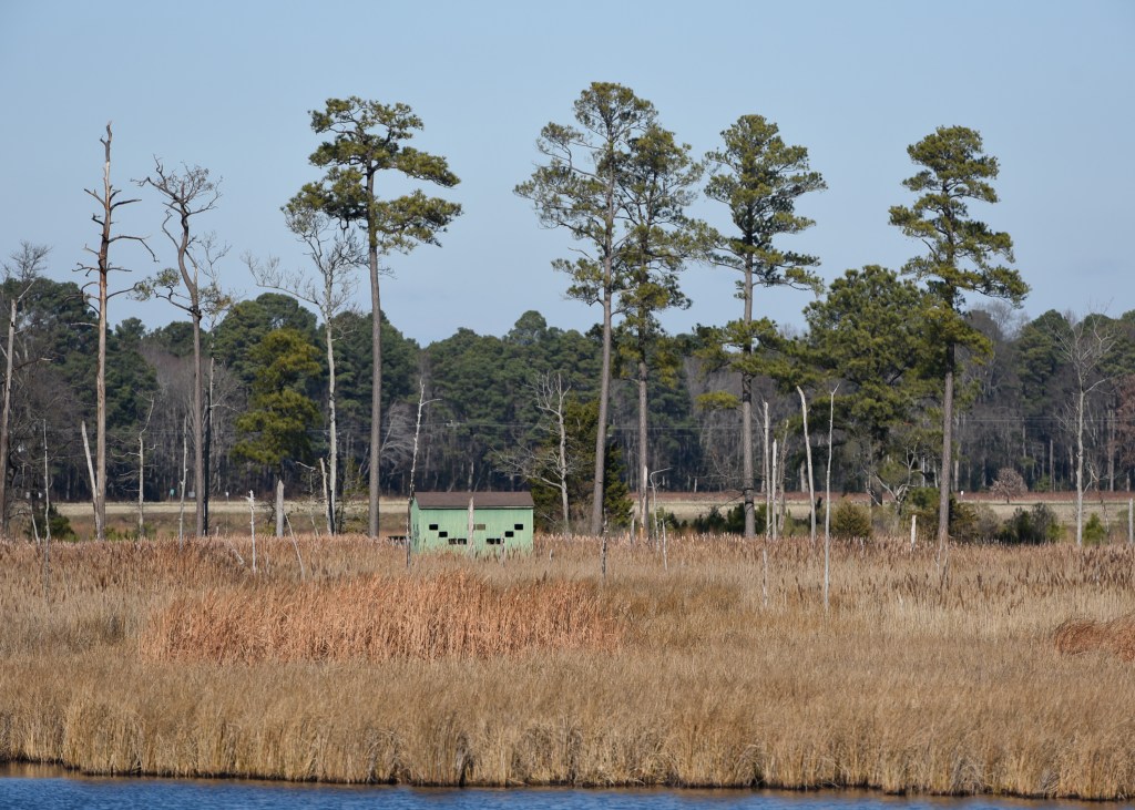
BNWR Visitors Center
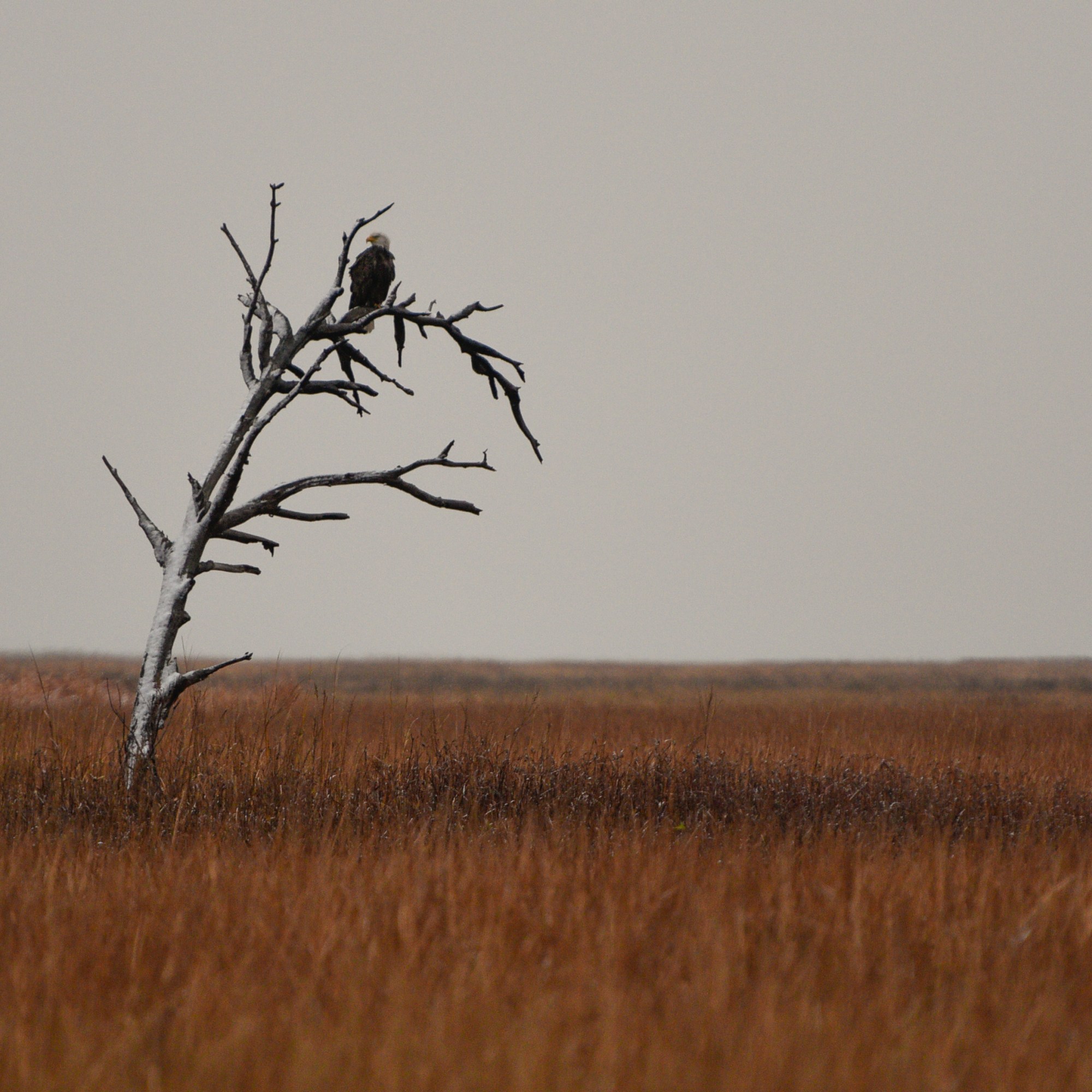
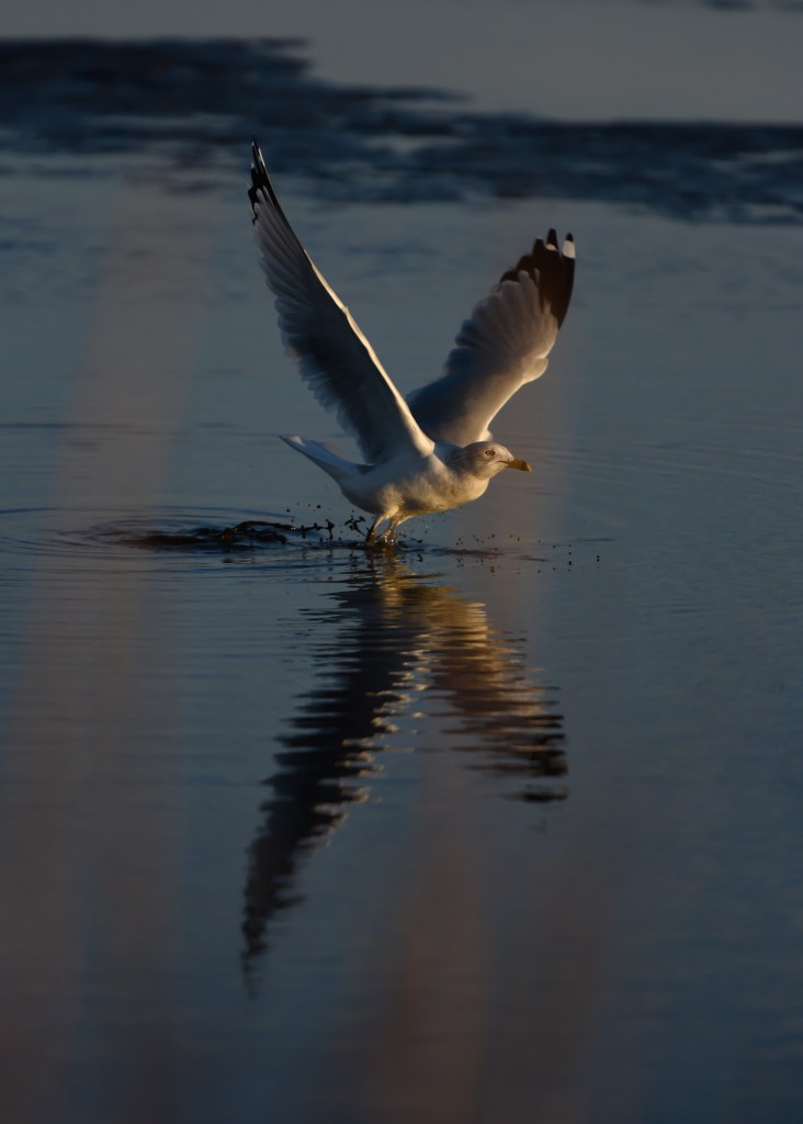
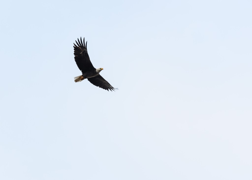
Besides serving as a filtering system for the bay and a buffer during storms, the marsh is also one of the largest breeding grounds for American Eagles and other migratory birds along the east coast. No longer considered an endangered species, the breeding eagle population is strong at Blackwater. It’s a favorite spot for bird watchers, photographers, kayakers, fishermen, hunters and cyclists. Younger visitors may not recall a time when eagles and osprey were endangered because of the widespread use of the pesticide DDT which interrupted normal breeding and poisoned the birds via contaminated water from direct or runoff water sources and contaminated fish they consumed. Additionally, the refuge is still recovering from damage caused by the vegetation ravaging rodent called Nutria, whose apparent eradication has not been officially confirmed, but expected.
An Unexpected Discovery
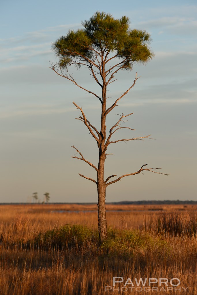
I only discovered Blackwater Refuge two years ago, during a weekend trip, and now I find myself visiting and exploring frequently in the early morning to capture photos of the landscape and the wildlife. It’s less than two hours from Washington, D.C. I usually arrive before dawn. Once I turn off the main road to the shore points, time slows. It’s quiet here, even in the summer. In the winter it feels abandoned. I usually see something new each visit: a quality to the light, a chance encounter with an eagle or some other creature. On this day it’s snowing lightly. The air and wildlife move about freely in a quiet rush of feeding and surveying. I’m an intruder and watched by the wildlife and the locals. The flat land lets the wind glide along with little interruption which adds to the feeling of remoteness and wildness. In the winter, the unfettered, damp wind can be brutally cold. Cambridge, Maryland’s business district is fifteen minutes away, buffered by a multitude of farms of varying sizes and conditions. The occasional car will pass. I’m noticed immediately by a dog when I stop at dawn to take a photo of an older farm house decorated for Christmas. I move along not wanting to cause disruption, but I may be too late for that.
A Legend Lived Here
As if the wetland isn’t reason enough to protect this area, it’s also the home to one of the greatest American heroes of the Underground Railroad—Harriet Tubman, who escaped slavery herself and returned approximately 13 times to lead other enslaved people to freedom. (The Harriet Tubman Museum is a must stop here. https://visitdorchester.org/harriet-tubman-museum-educational-center/) Driving the area, one can only imagine the physical, 19th Century hardships one would endure trying to navigate, surreptitiously, on foot.
This is a place and a story I will continue to document, to preserve, and to protect. If you visit, please leave no trace.
Unauthorized use and/or duplication of this material without express and written permission from this blog’s author and/or owner is strictly prohibited. Excerpts and links may be used, provided that full and clear credit is given to Amy Linn Doherty with appropriate and specific direction to the original content.
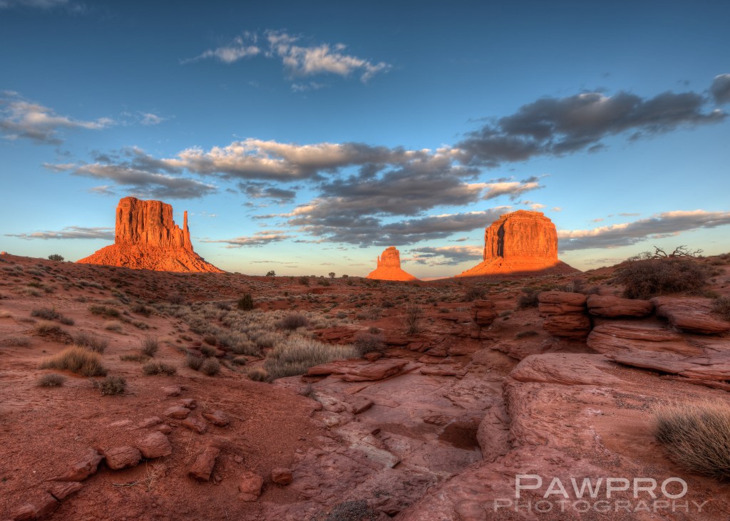
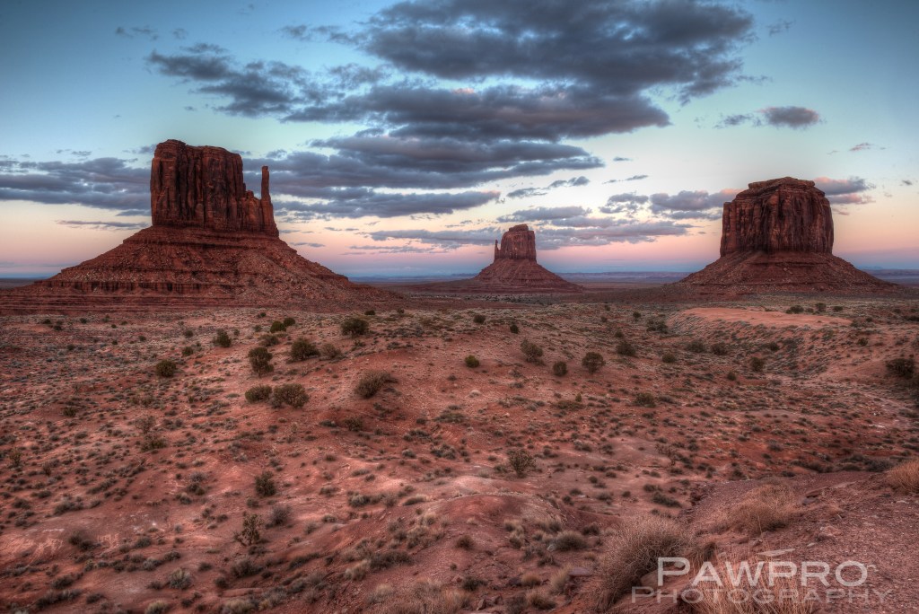
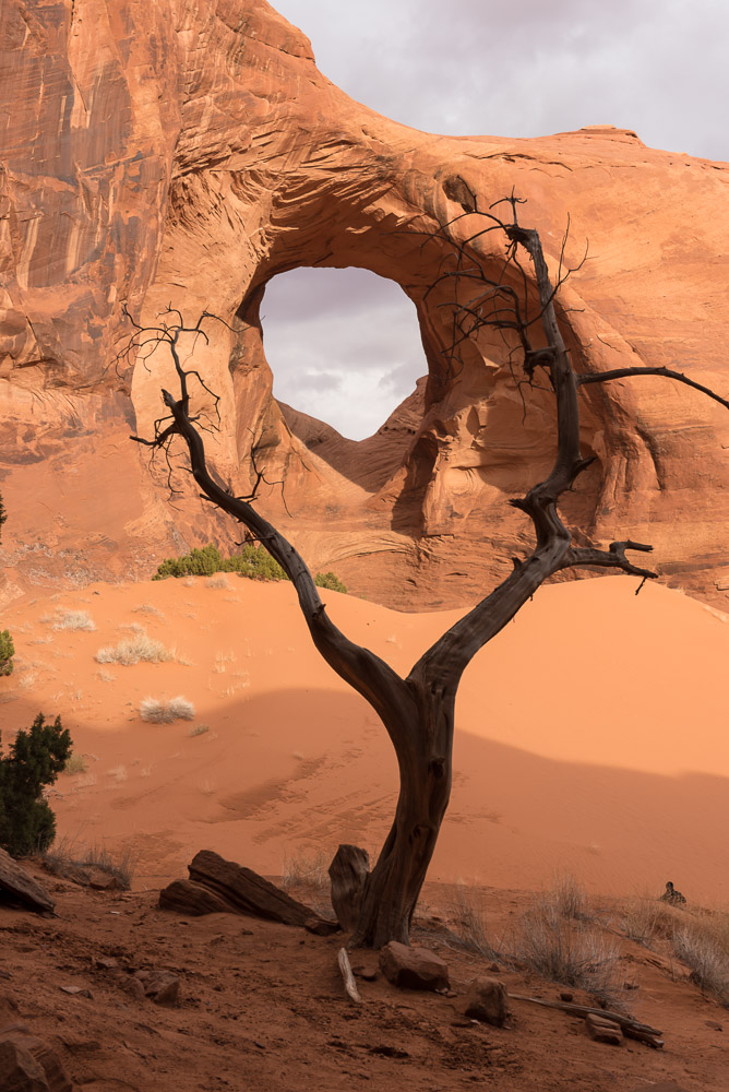
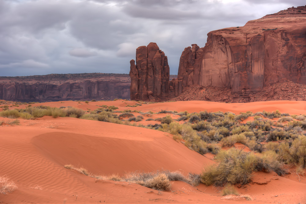
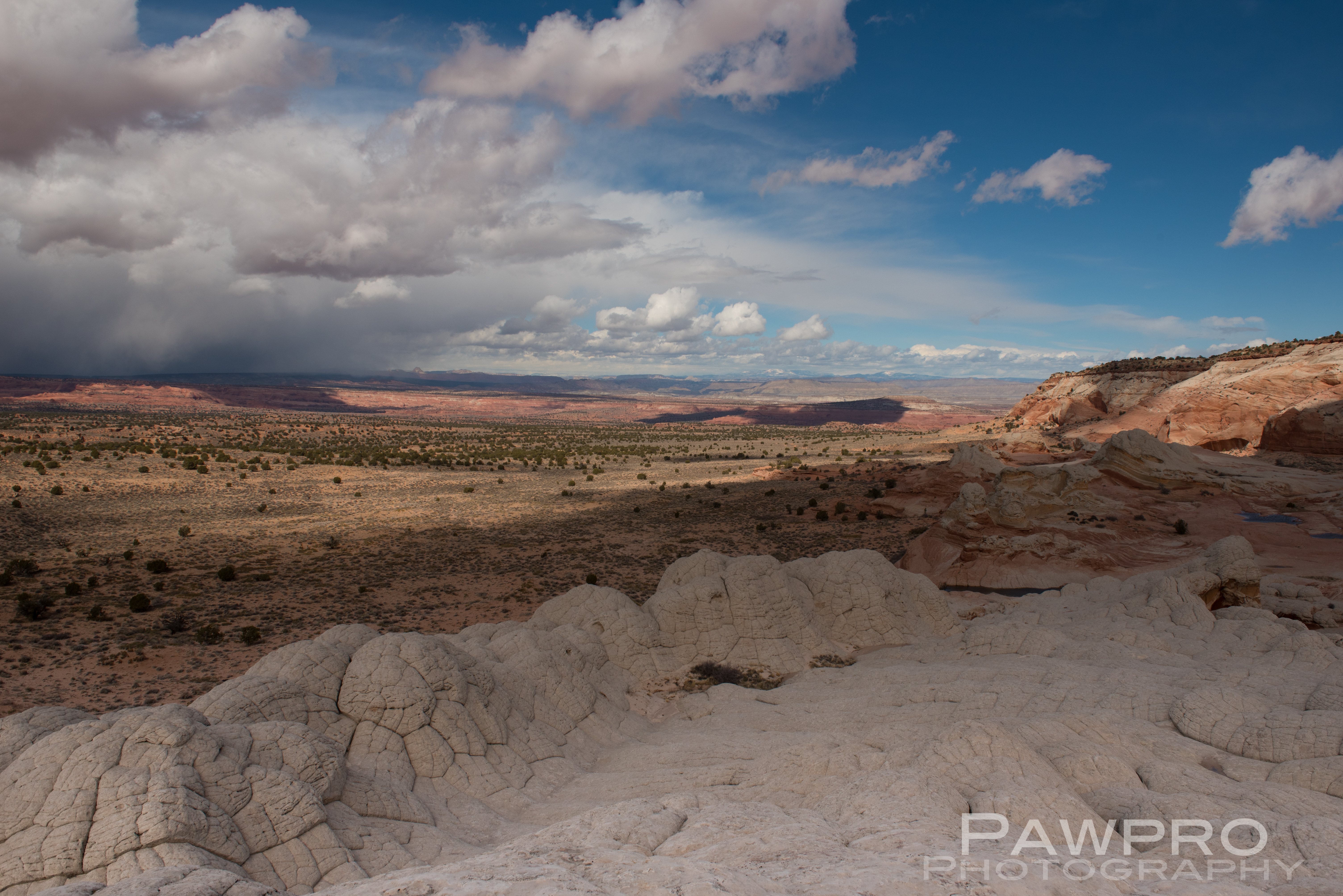
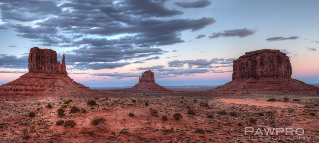
I visited a spot last year in the U.S. Southwest that filled my imagination as a child. This was a place I’d seen only in drawings and animated in cartoons by Chuck Jones and Maurice Noble, until I realized at some point, I’m not sure exactly when, that the red rock buttes and mesas really existed. Unfortunately, there was no Road Runner speeding across the landscape thwarting elaborate traps designed by Wile E. Coyote in hopes of capturing that fast, fast fowl using products and supplies mail ordered from the fictitious, but vastly stocked, Acme, Co. Of course, I am describing Monument Valley situated along the Utah and Arizona borders, one of the most recognizable spots in the Southwest.
Years ago I passed through the area while part of a team of 10 supporting a cyclist competing in Race Across America, but it was dusk as our caravan of three vehicles arrived and there was no time for touring. As I recall, I spent the night awake editing video segments in an RV, largely unaware of the beauty surrounding me. I promised myself I would return.
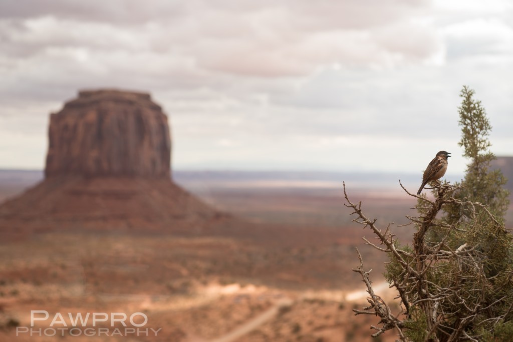
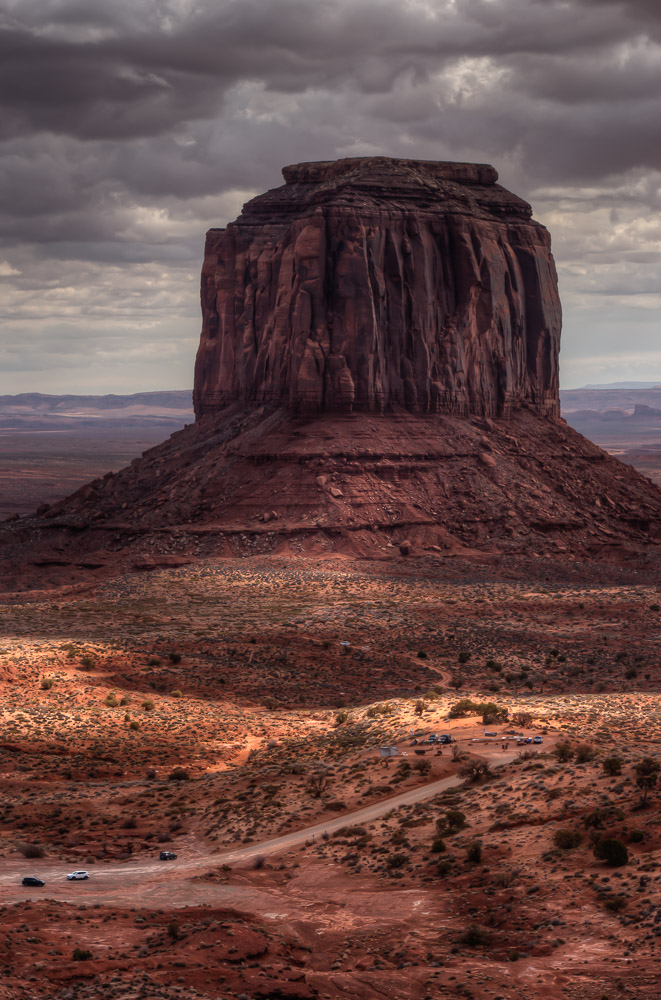
The photographic epicenter of this area, if it’s possible to pick one, is the East and West Mittens located in Monument Valley Navajo Tribal Park, as well as the now equally iconic landmark 15 minutes away on the way to Mexican Hat commonly referred to as Forrest Gump Point, where the Tom Hanks’ character stopped his coast-to-coast-to-coast run along US Highway 163 in front of a line of iconic buttes and spires.
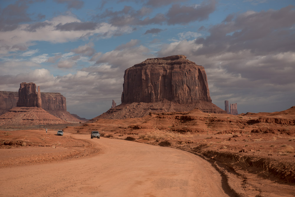
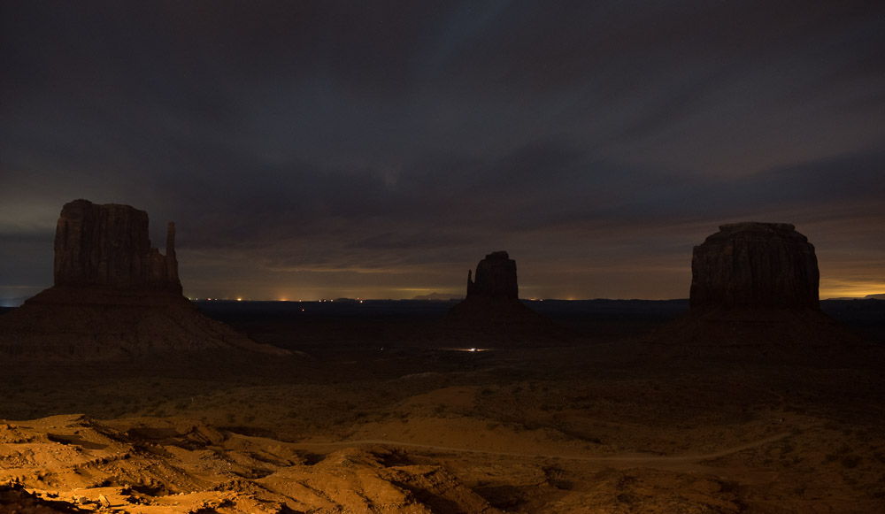
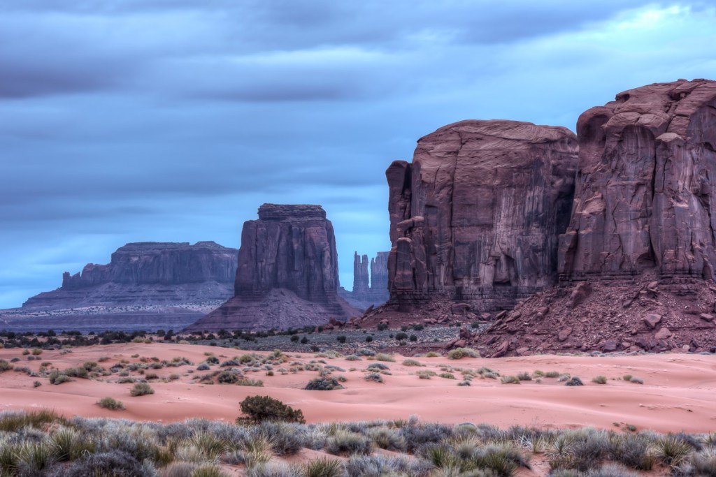
To be as close as possible to the formations, I chose to stay at The View Hotel, perched perfectly atop a plateau overlooking the famous buttes that resemble a left and right mitten jutting out from the ground. From this vantage the two buttes are flanked on the right by Merrick Butte, each seemingly perfectly spaced from the other, but at different depths. I couldn’t help but attempt a nighttime shot from the balcony (each room has good view) because we arrived late and the sky is so dark the buttes are lost in the blackness. I knew they were out there.
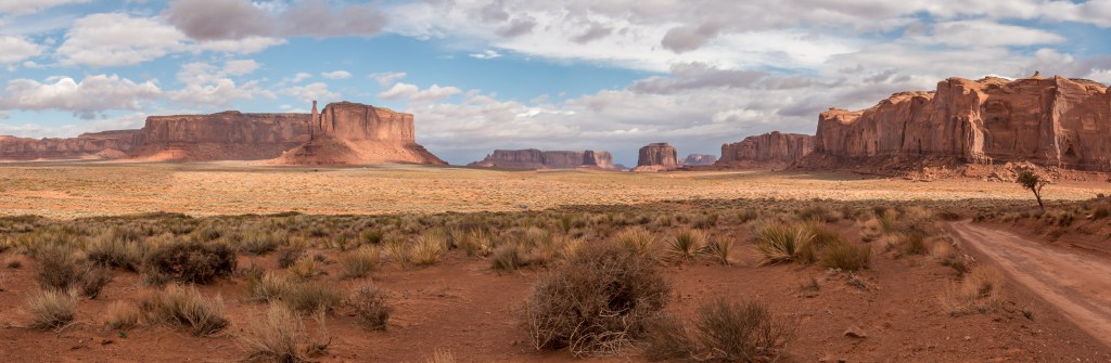
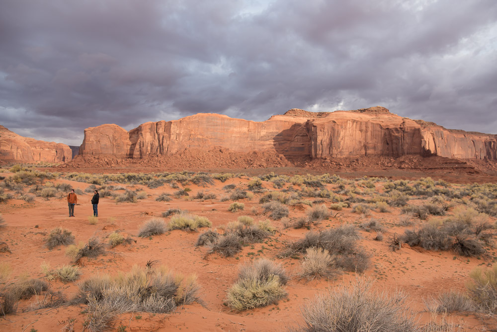
We visited in early March so the air was still cold. The overall area has been experiencing greater precipitation and flooding in the last few years. There is a 28 mile gravel road looping the buttes for cars to explore the area, but many venture out on foot, as well. Group and private tours are also offered by Navajo approved groups and some will take you beyond the standard loop to see deeper into the Navajo countryside. I’ve never visited in the summer months, so I can’t speak to how hot it must get here during that time.
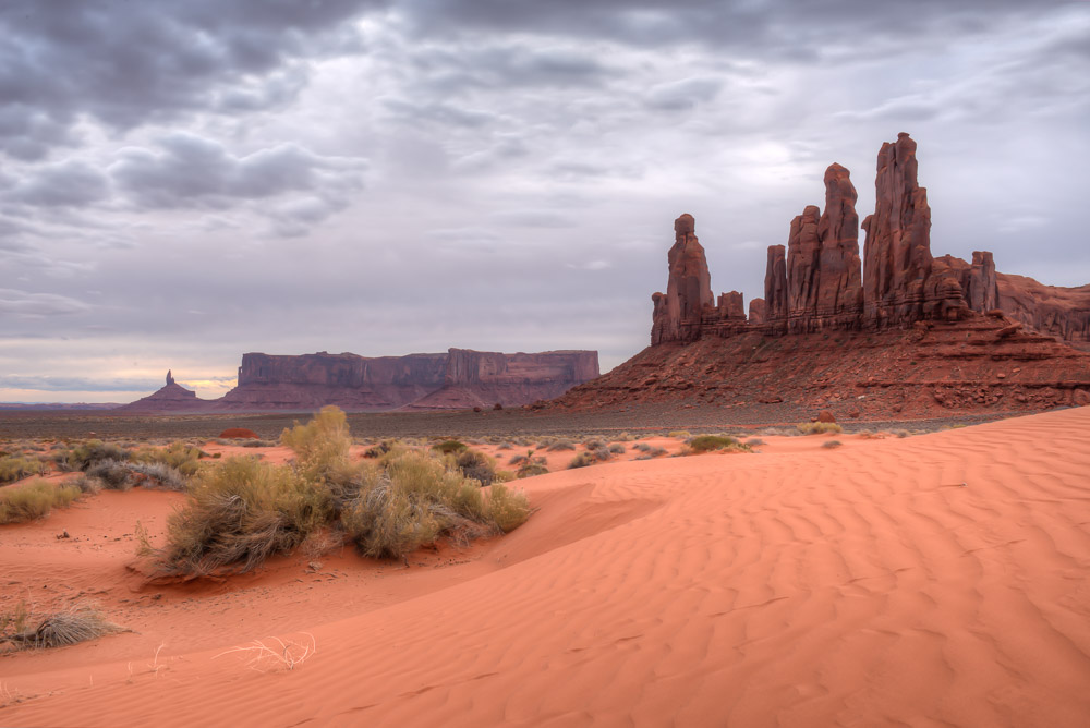
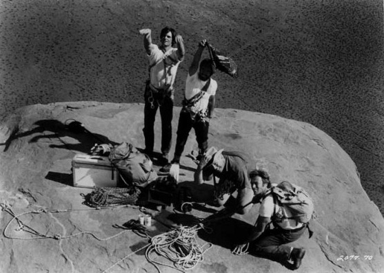
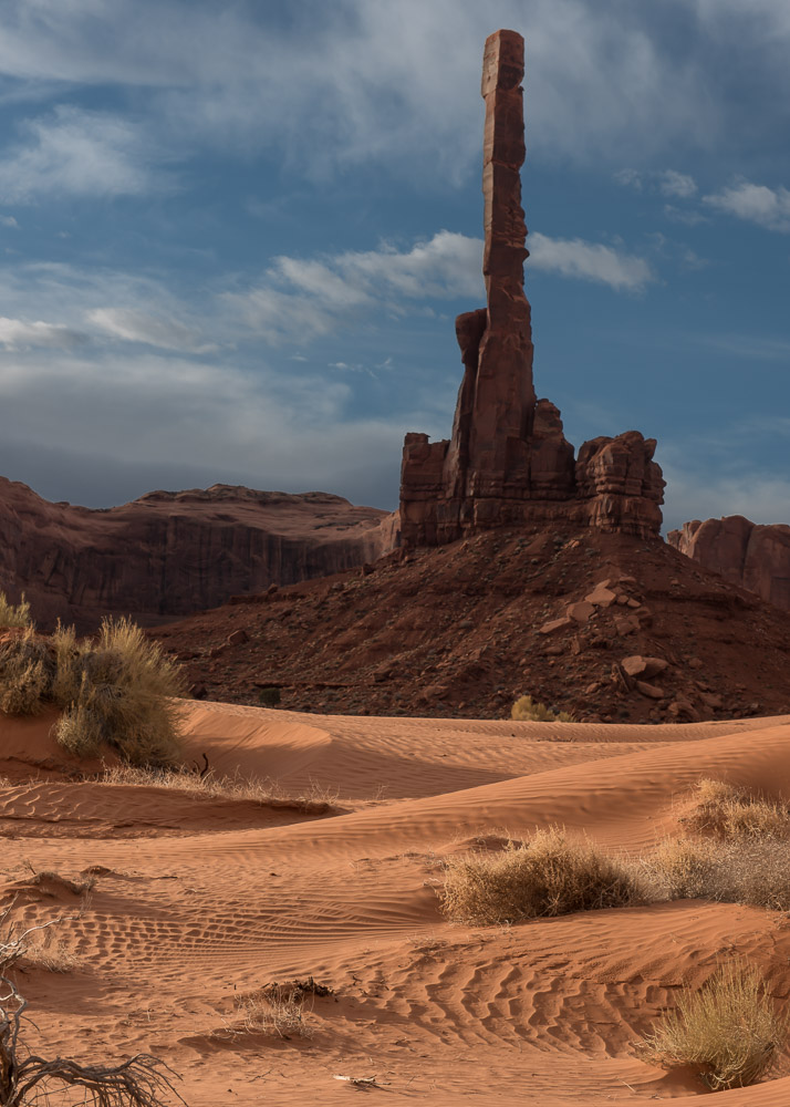
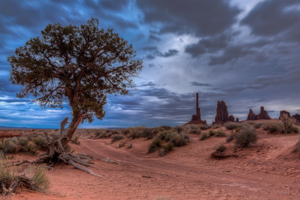
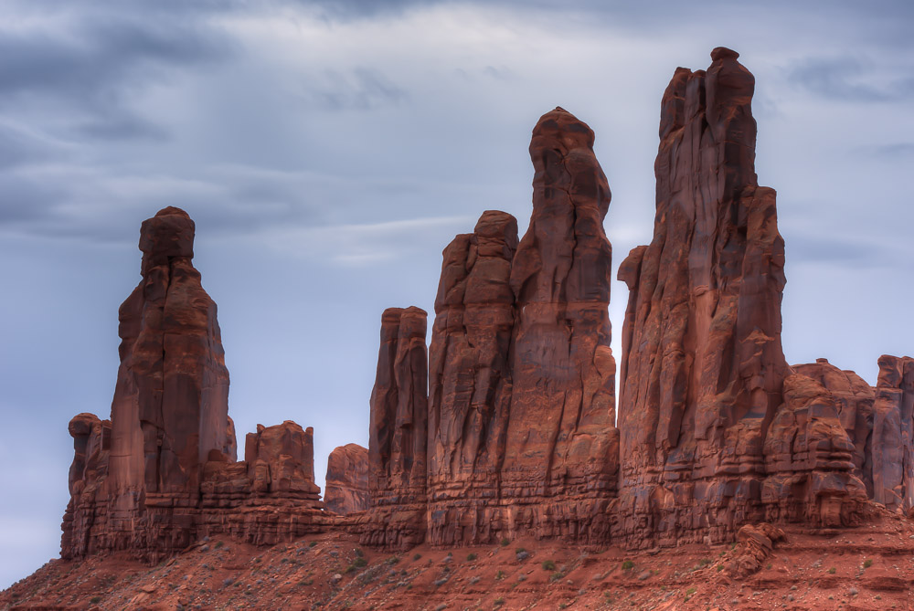
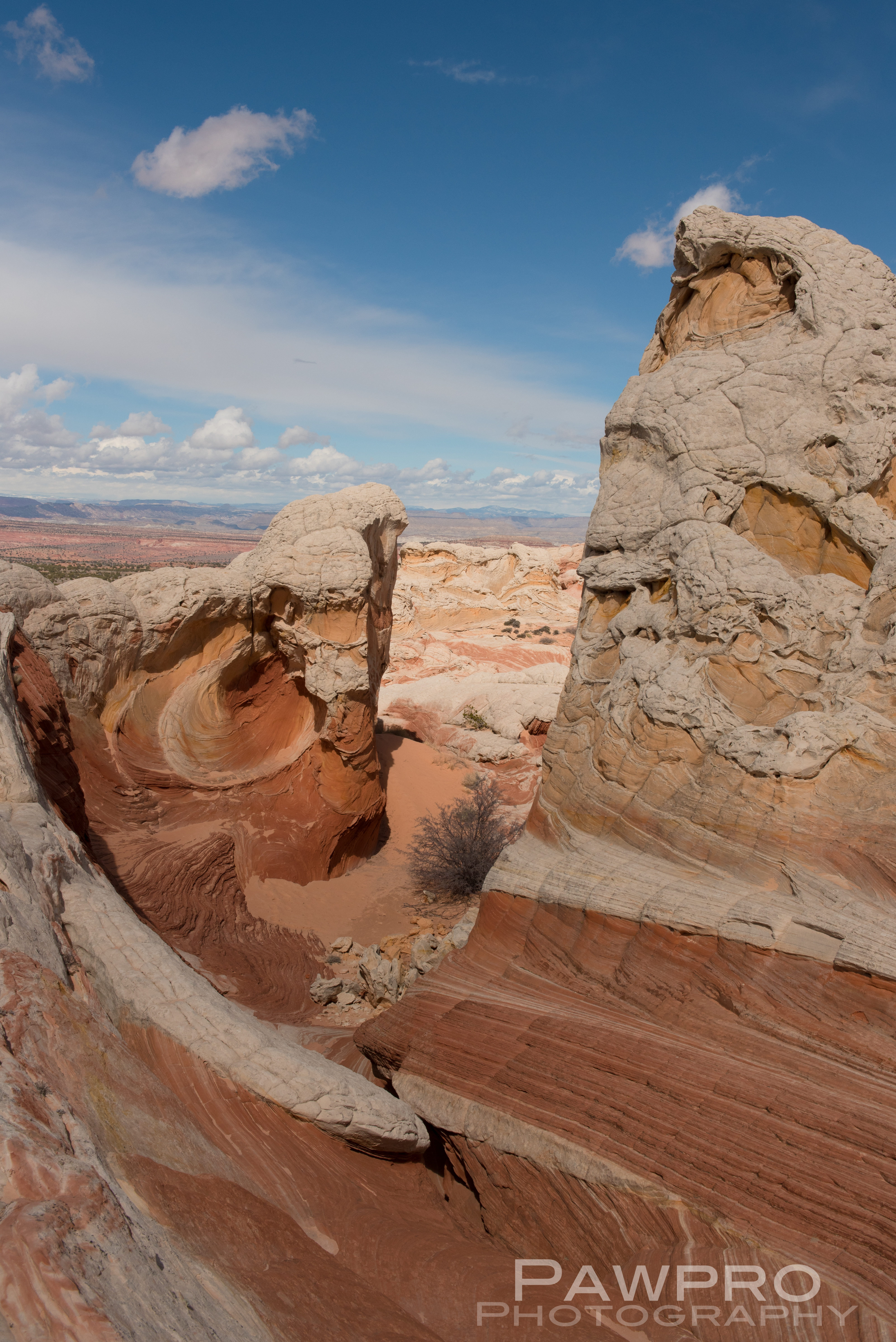
I scheduled a guide with Phillips Photography Tours for sunrise. Tule (pronounced like the Swedish car box brand) met me in the lobby of the hotel and within minutes we were headed down the dirt and gravel road beyond where tourist are allowed to venture on their own. The mittens were starting to emerge from the darkness. The tour owner had been thorough enough to send me an email the night before to let me know the weather was likely to be very cloudy at our original meeting time, so we pushed the start time to a little later. Tule took me out to the Totem Pole, a red rock spire once, and probably last, climbed by Clint Eastwood as he filmed the movie Eiger Sanction in 1974. The film industry has had a long love affair with Monument Valley ever since John Ford started featuring the area in John Wayne Westerns back in the 1930’s. It was indeed a cloudy morning, so sunrise wasn’t much to brag about, but it didn’t matter. I spent several hours moving from spot to spot taking photos of the landscape and other details I found interesting.
Archive production photo of Clint Eastwood and George Kennedy on top of Totem Pole in 1974.Phillips Photography Tour
After lunch, Tule took me out for a second tour of a different area within Monument Valley. Slowly and carefully we made our way up to a higher vantage point. Somehow he maneuvered the vehicle to the top of a mound that I wouldn’t have thought possible. What had started as a cloudy day had evolved into a John Ford Western worthy sky—sunny with patches of puffy clouds drifting between the vastness and the buttes providing a greater sense of drama and depth to my photos.
Totem Pole (Nikon750, 24-70mm, ISO 100, f 9.0, 1/125)
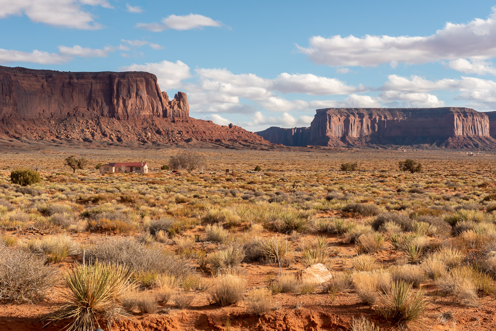
Driving around we passed several homesteads where Navajo families live within the shadows of these red rock buttes and mesas familiar to the world. Often these homes have no electricity or plumbing but they’ve lived in these locations for years and years with no desire to leave even though conditions can be severe, especially as the residents advance in age and the roads become impassable at times during the winter. Tule spoke of these elder residents with great respect. There is a strong effort within the Navajo community to preserve their culture for younger generations to witness and practice. Tourism and patronage of places such as The View Hotel and Monument Valley Navajo Tribal Park are ways to support the greater Navajo community.
Nikon D750, 24 -70mm, ISO 100, f16, HDR 1/30, 1/60, 1/125Tule and Peter
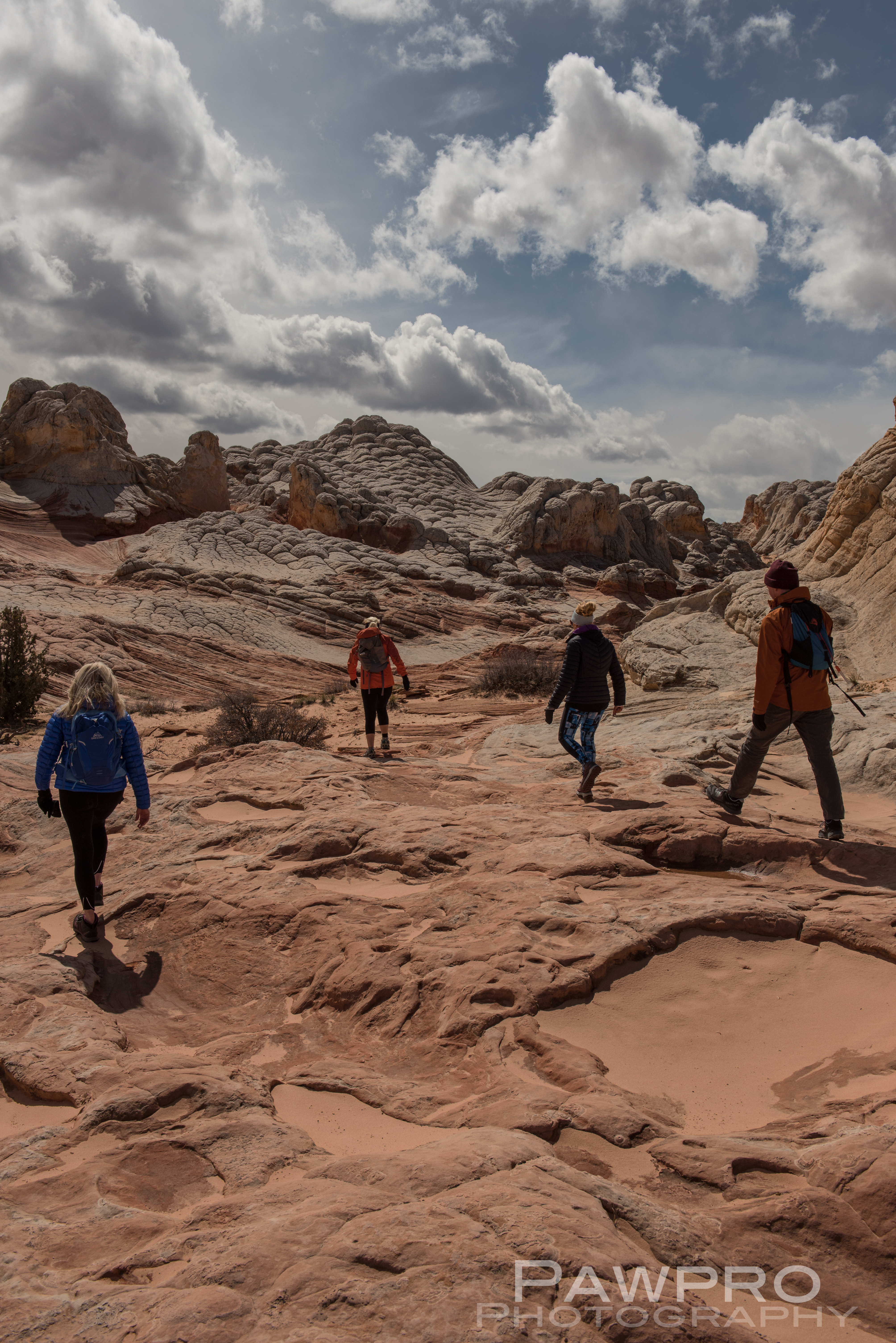
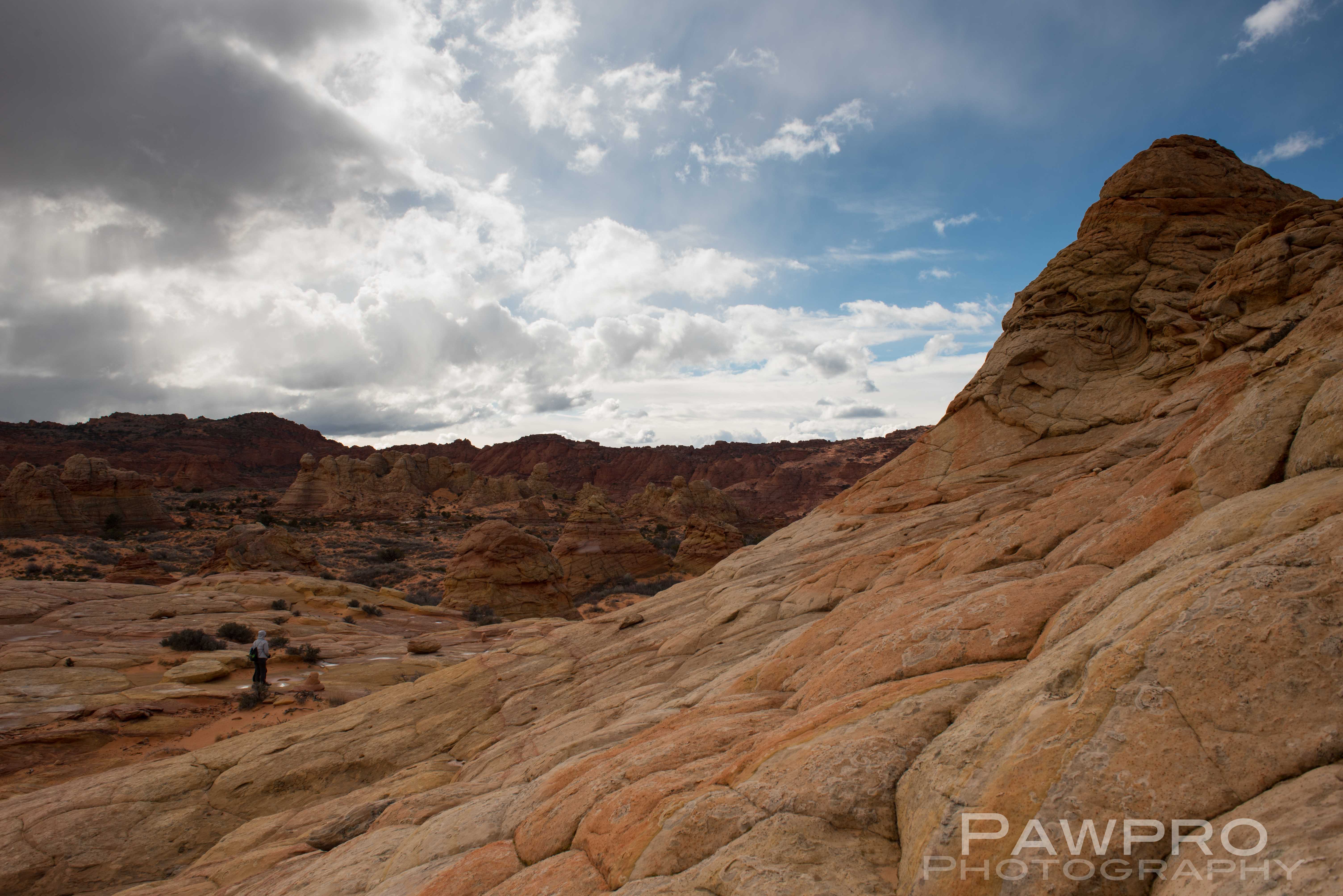
We retreated back to The View Hotel restaurant and enjoyed a comforting meal which was perfect—not fancy but filling and very good. I had a soup and could barely stay awake from a very full day of photography. I was up before dawn the next morning heading to Page, AZ to run the Antelope Half Marathon the following day. I wished I had another day there. I timed it so I arrived before dawn at Horseshoe Bend part of Glen Canyon National Recreation Area (https://pawpromedia.com/2019/09/22/ledges-laces/), and then headed for an adventure in White Pocket, atop of Paria Plateau (http://pawpromedia.com/2019/03/31/lunar-like-landing-at-white-pocket-and-south-coyote-buttes/).
My next post will address whether to keep or cancel future travel plans amid the national quarantine related to COVID-19. I’ve got some decisions to make, too. Look for it soon. Goodness knows I have plenty of time to write it!
Please take a moment to follow, share or like this post. The gesture helps make more posts possible. Thank you!
Unauthorized use and/or duplication of this material without express and written permission from this blog’s author and/or owner is strictly prohibited. Excerpts and links may be used, provided that full and clear credit is given to Amy Linn Doherty with appropriate and specific direction to the original content.
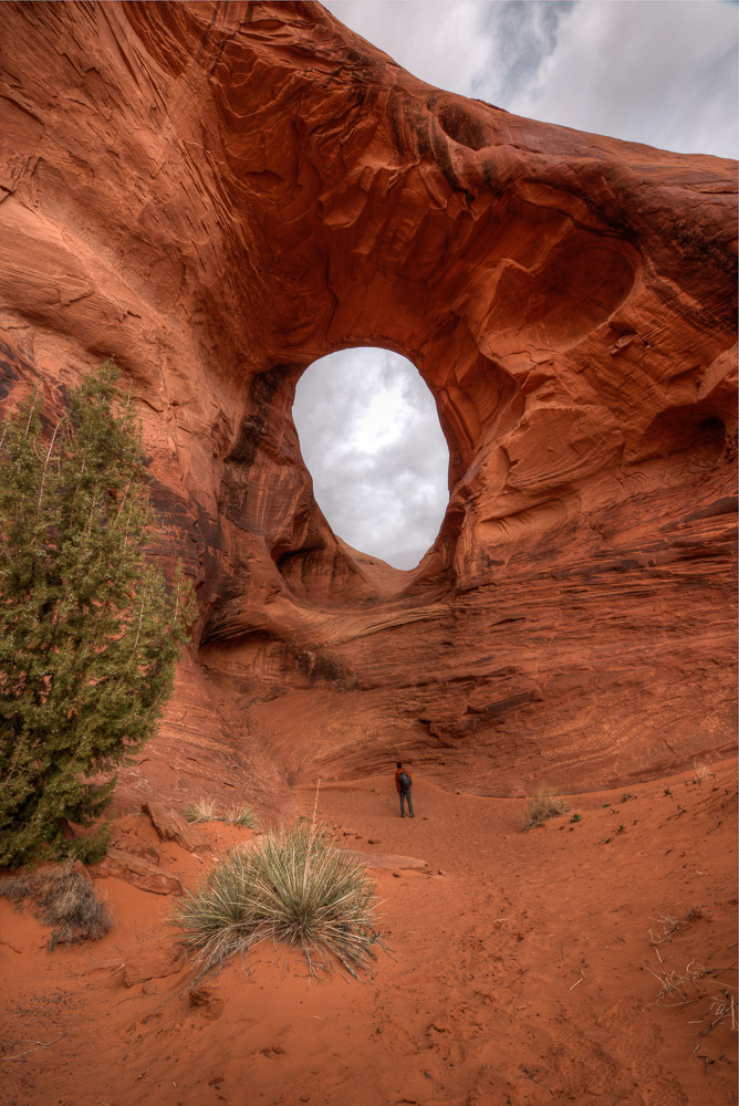
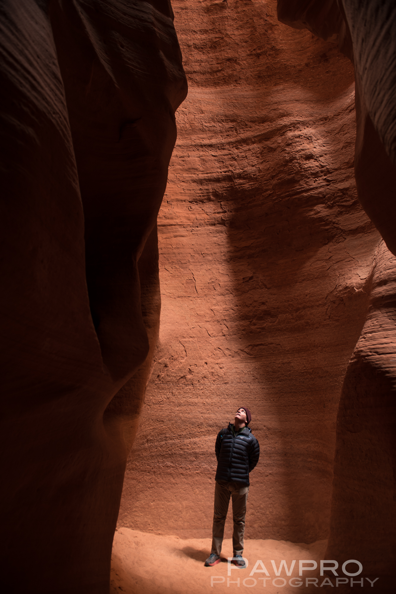
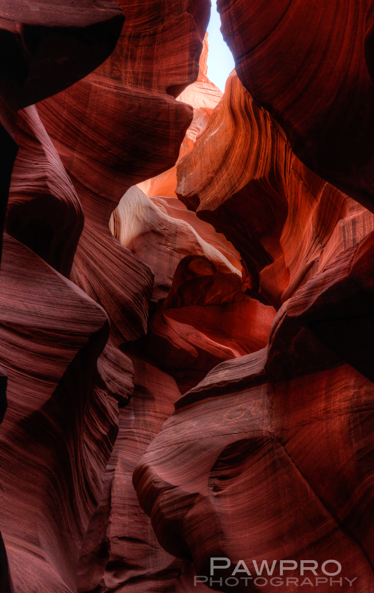
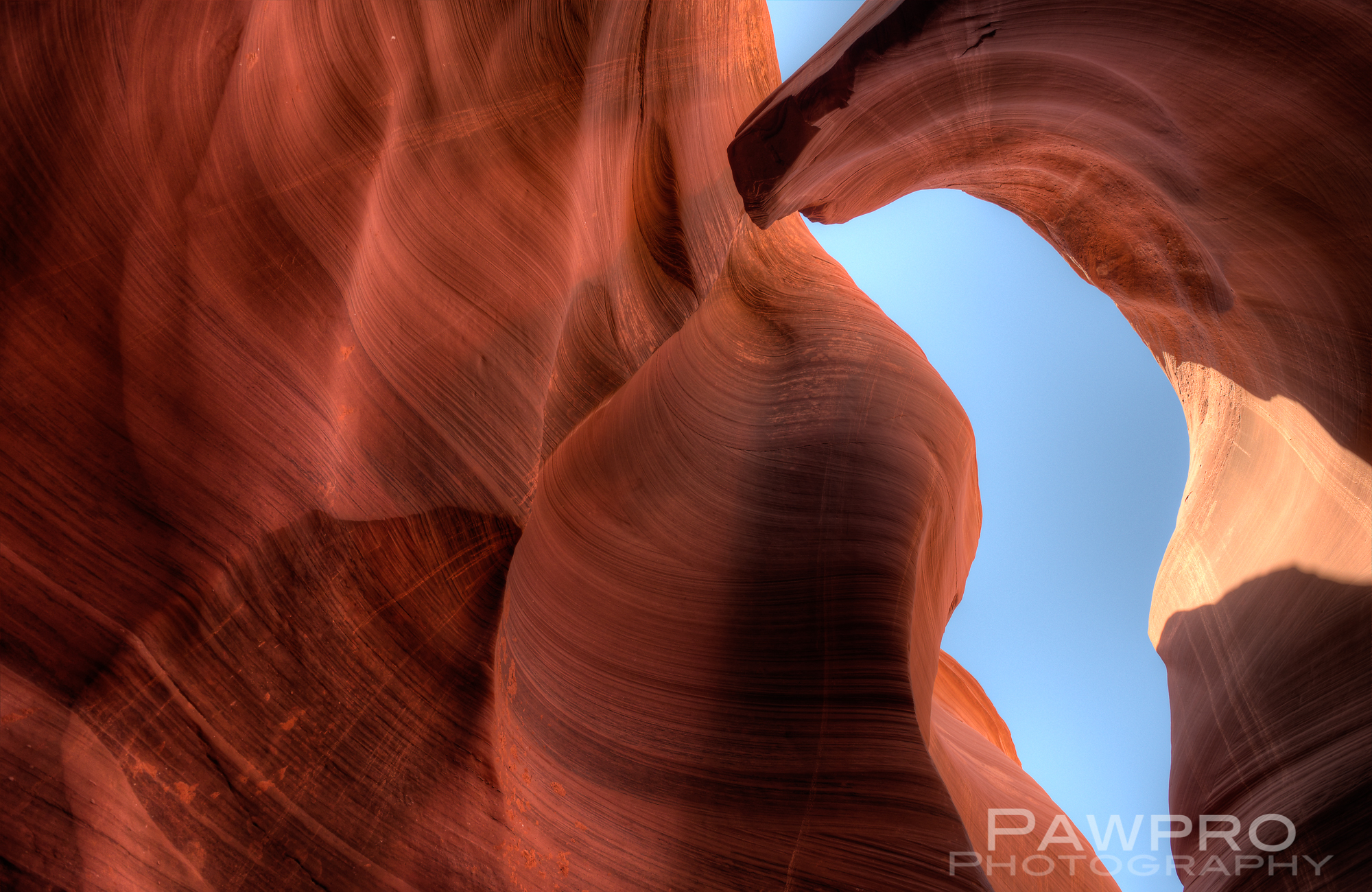
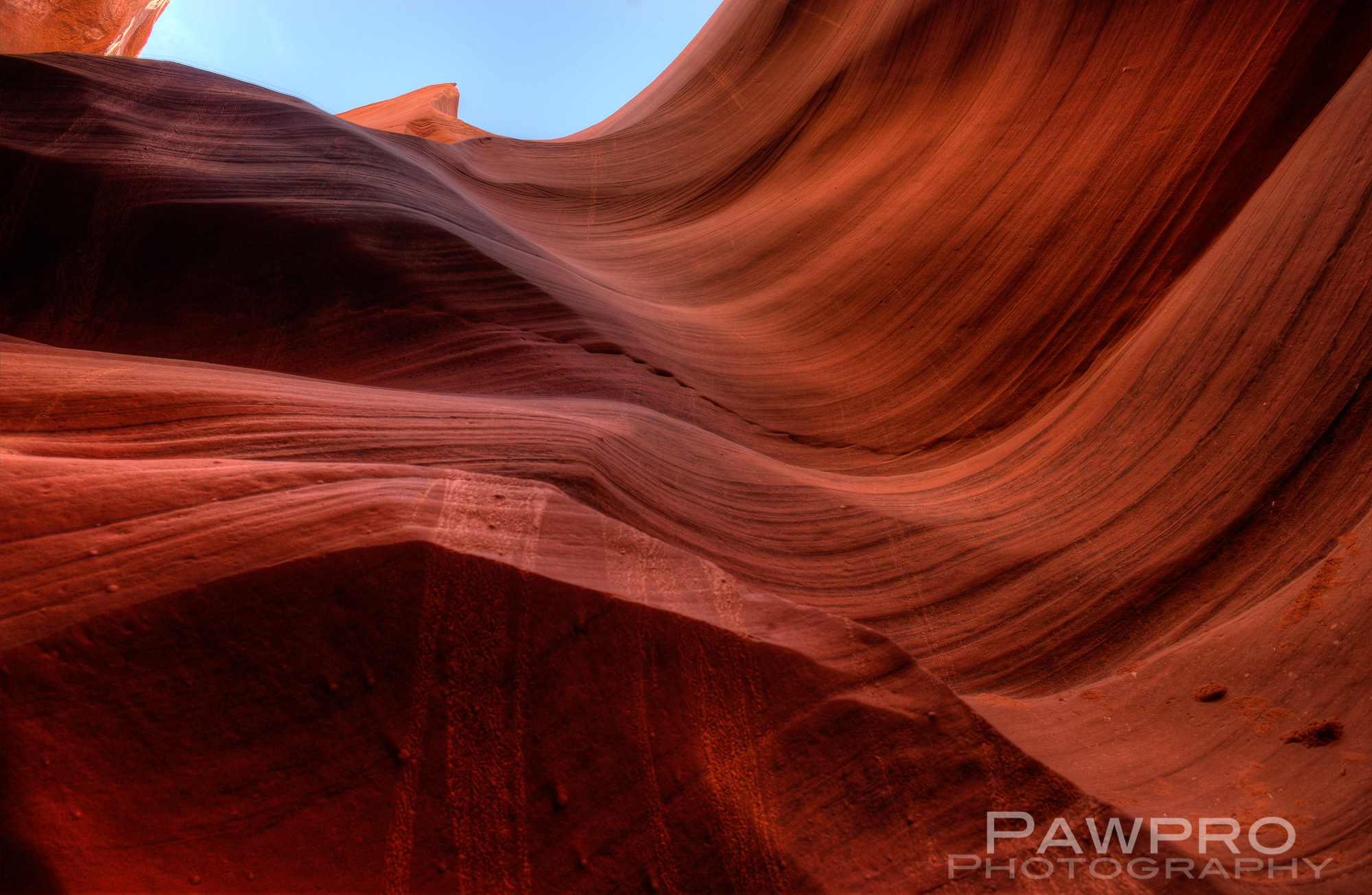
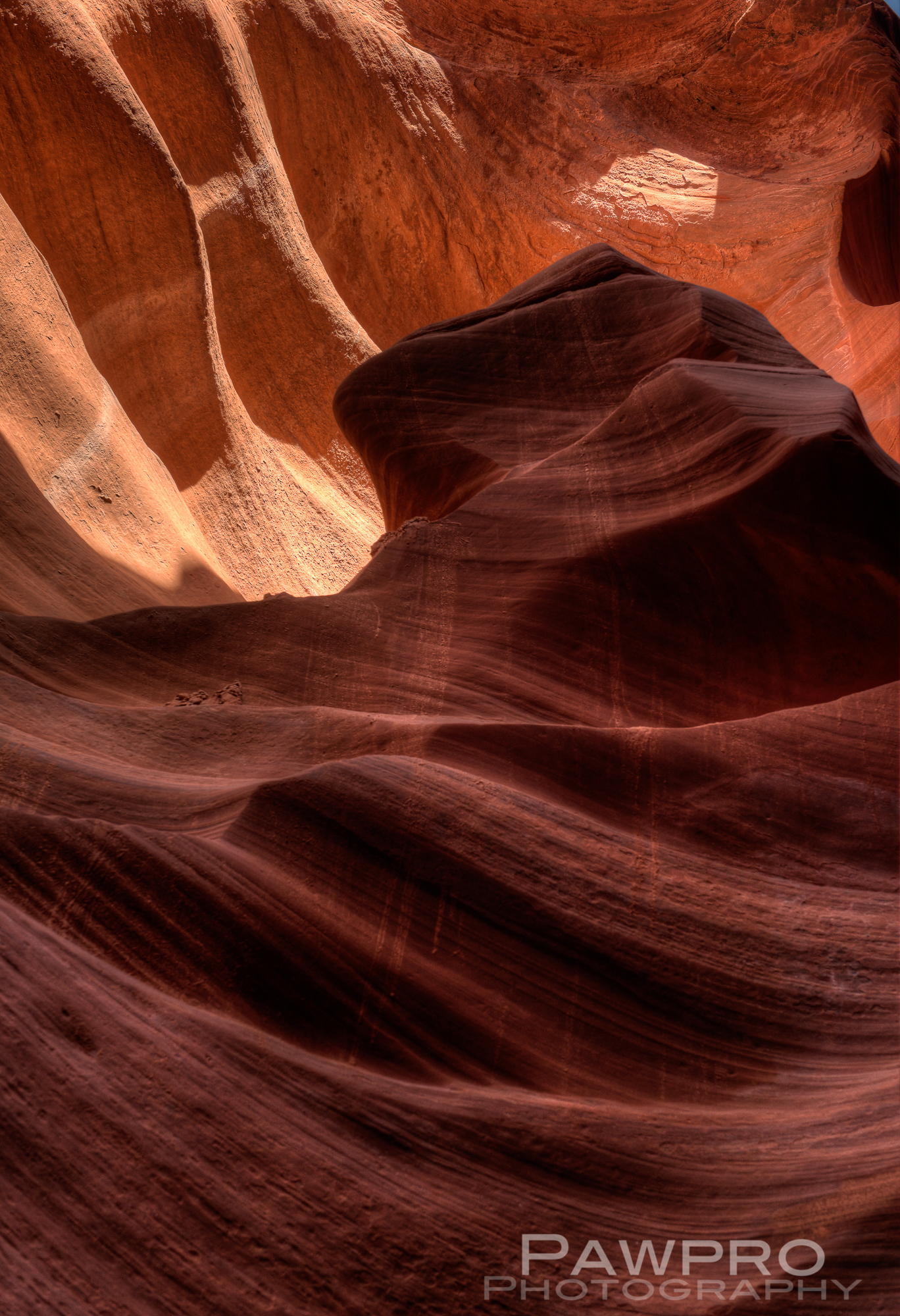
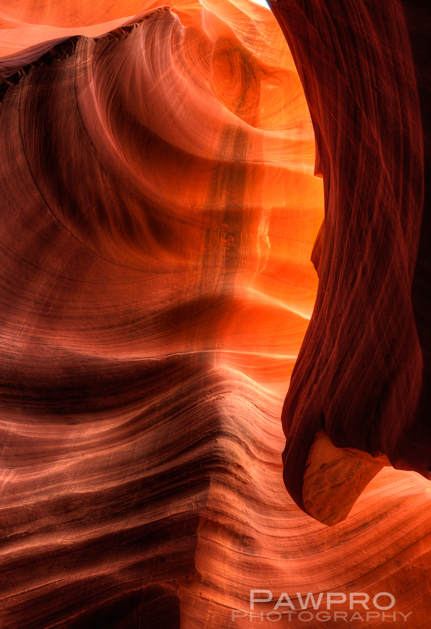
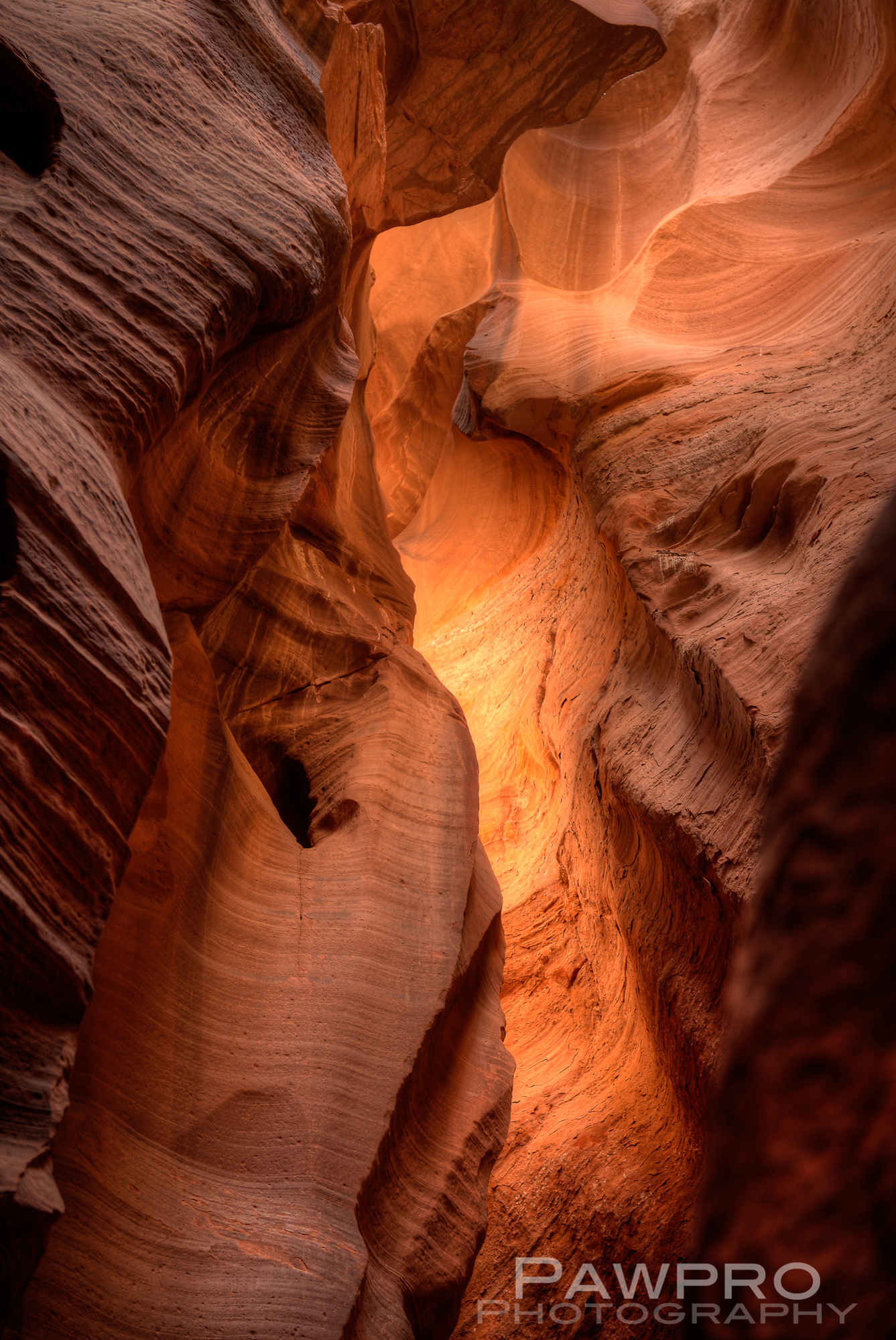
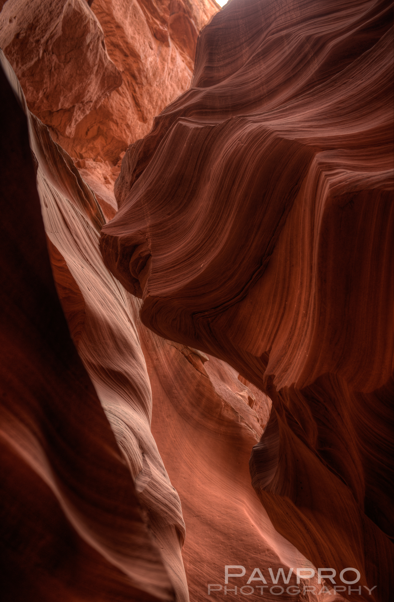
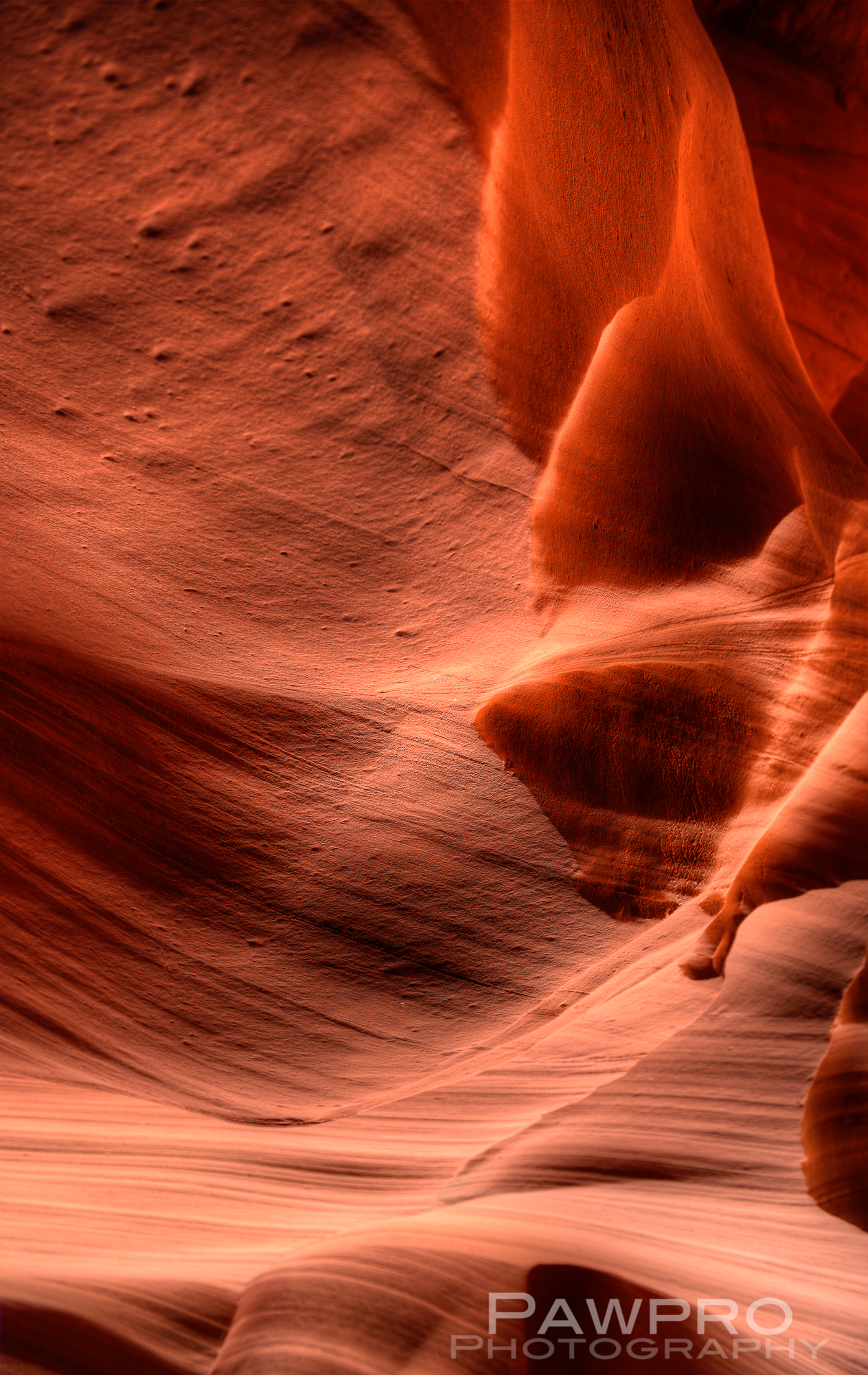
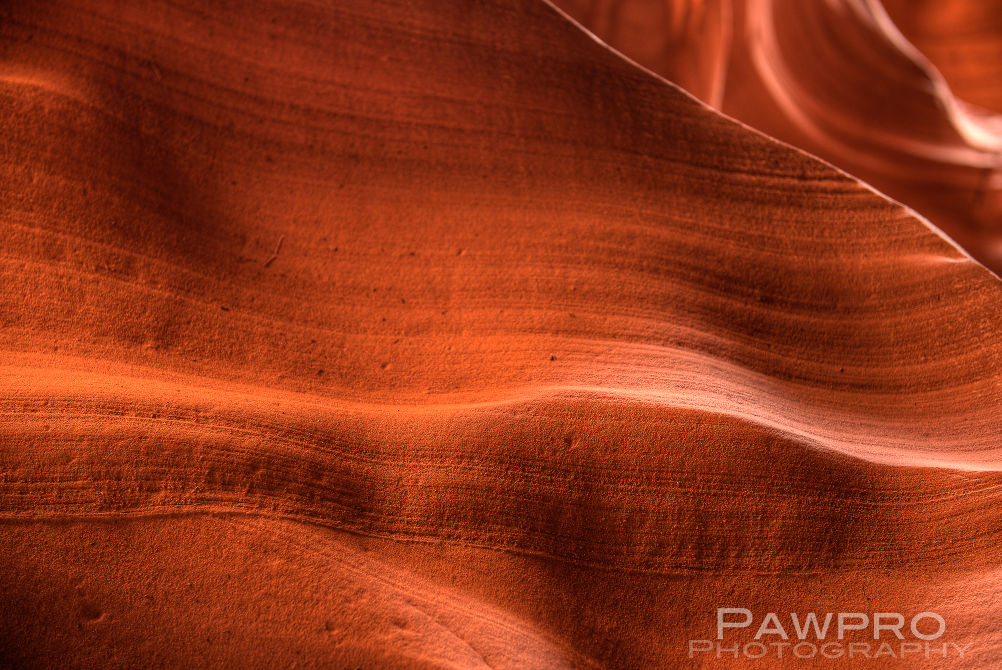
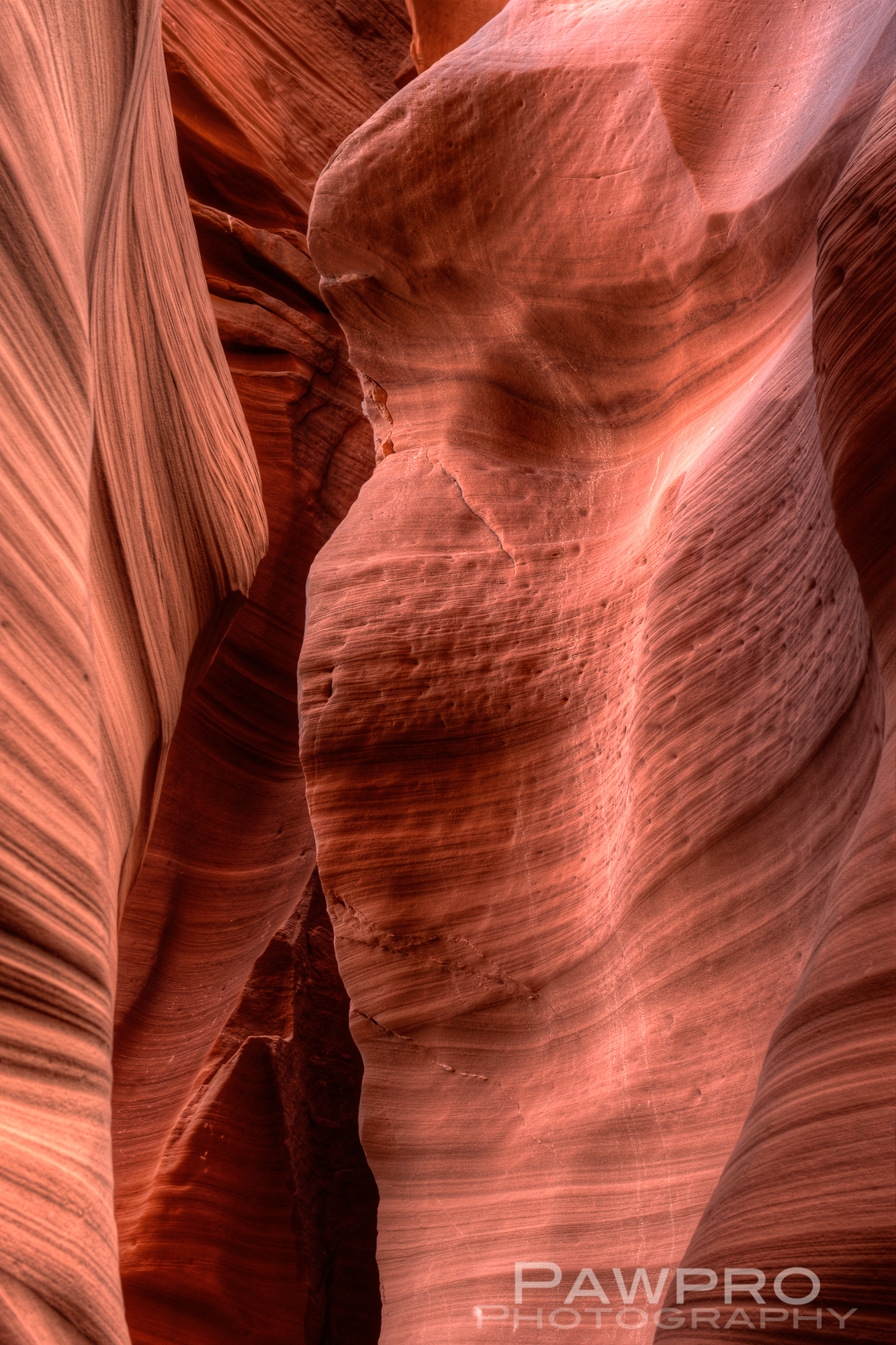
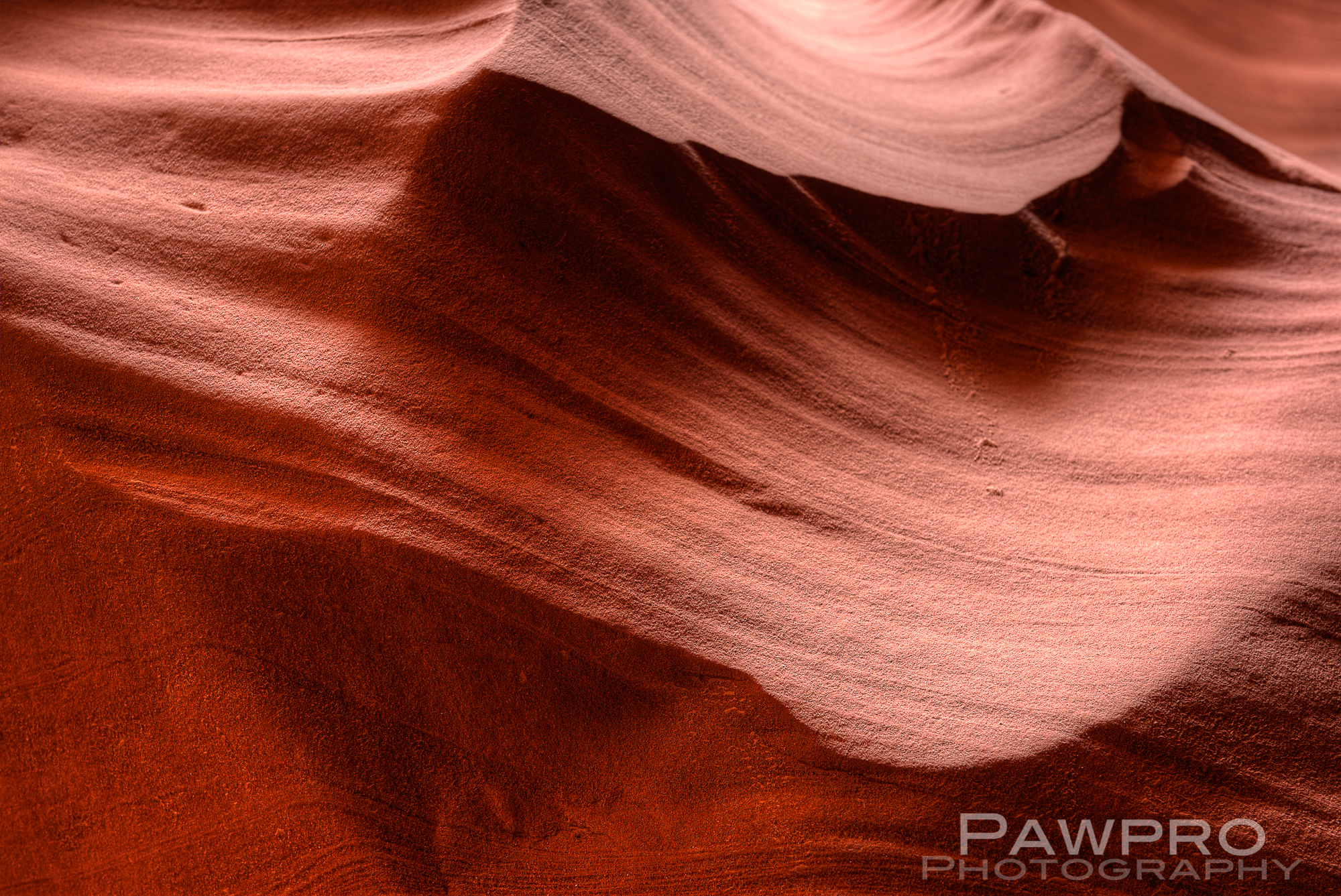
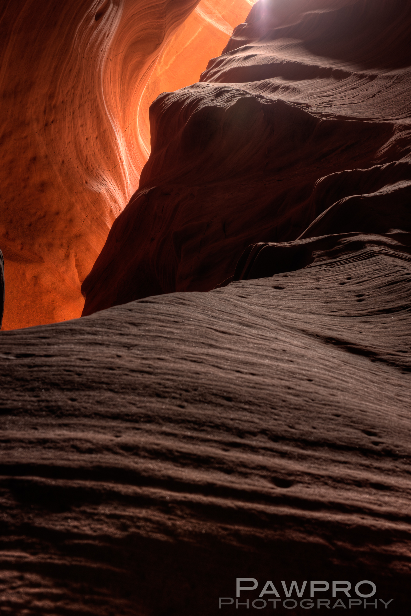
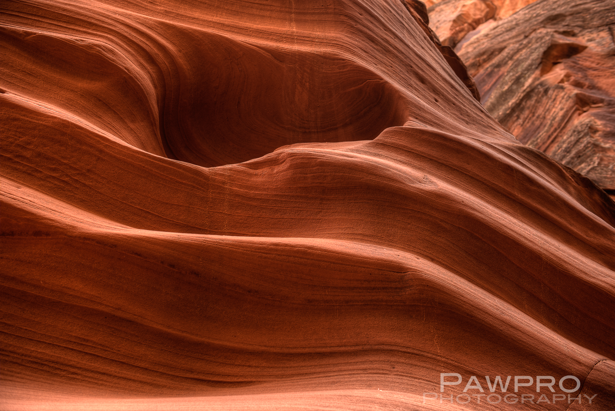
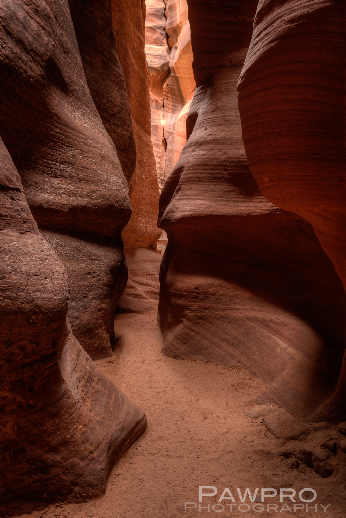
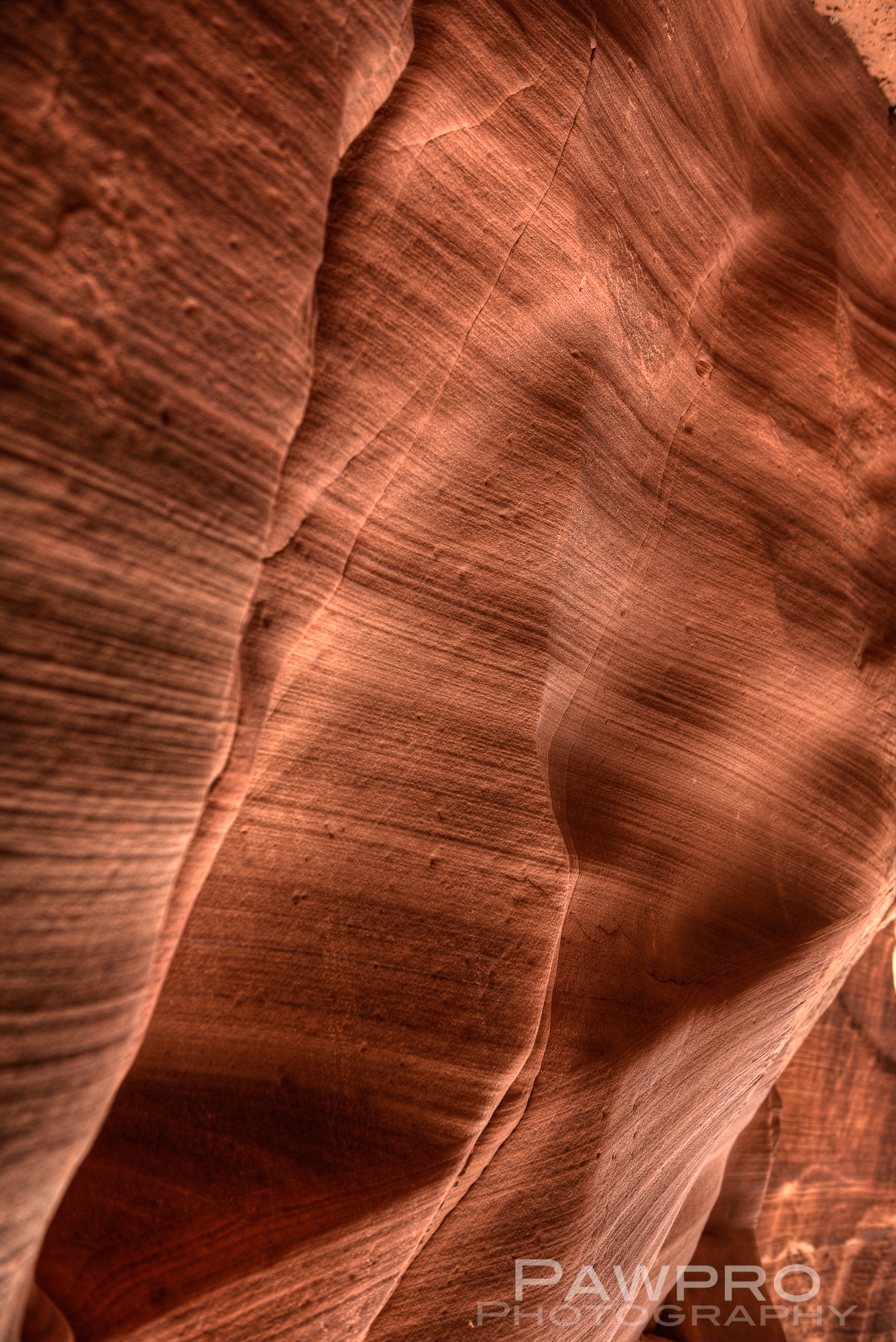
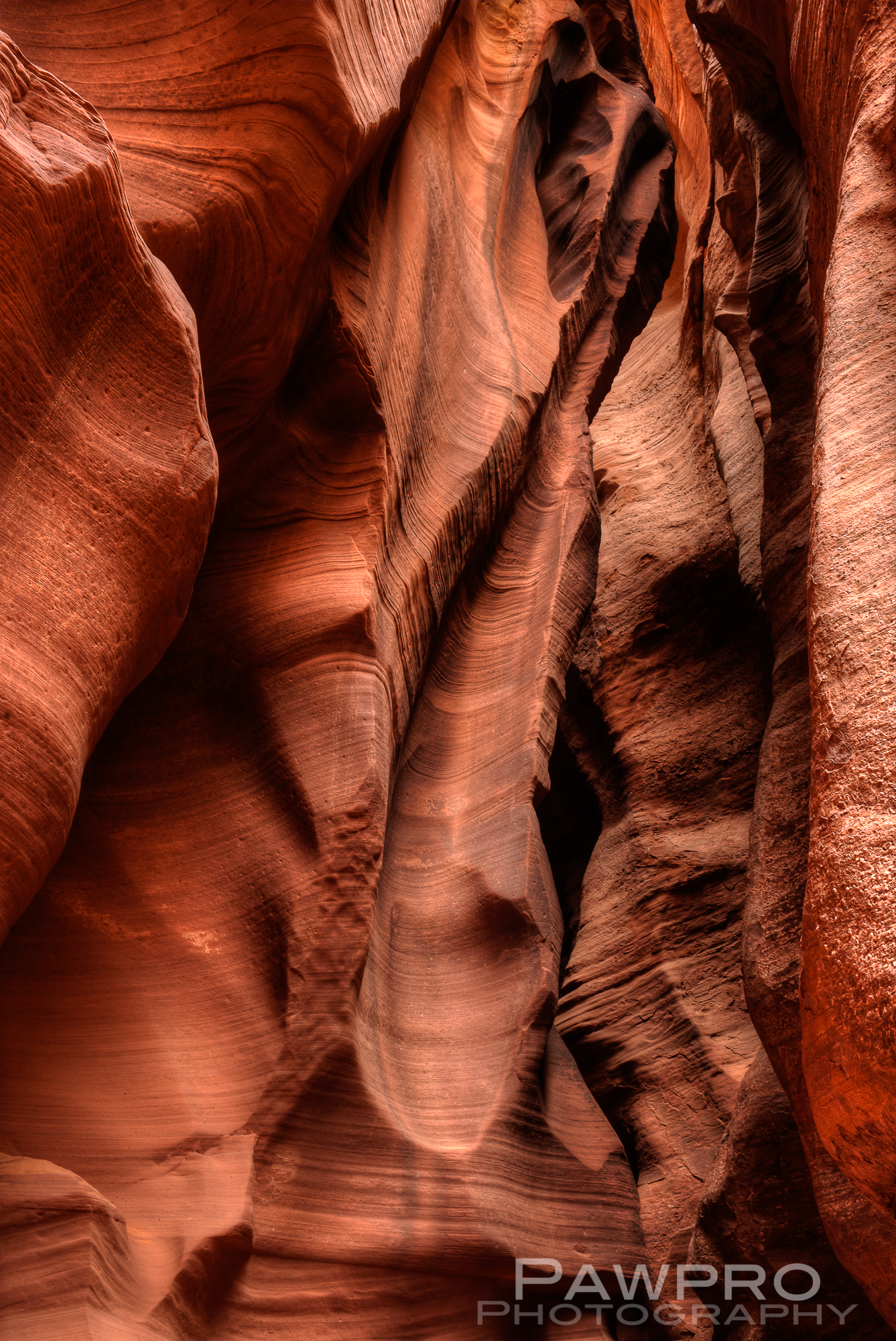
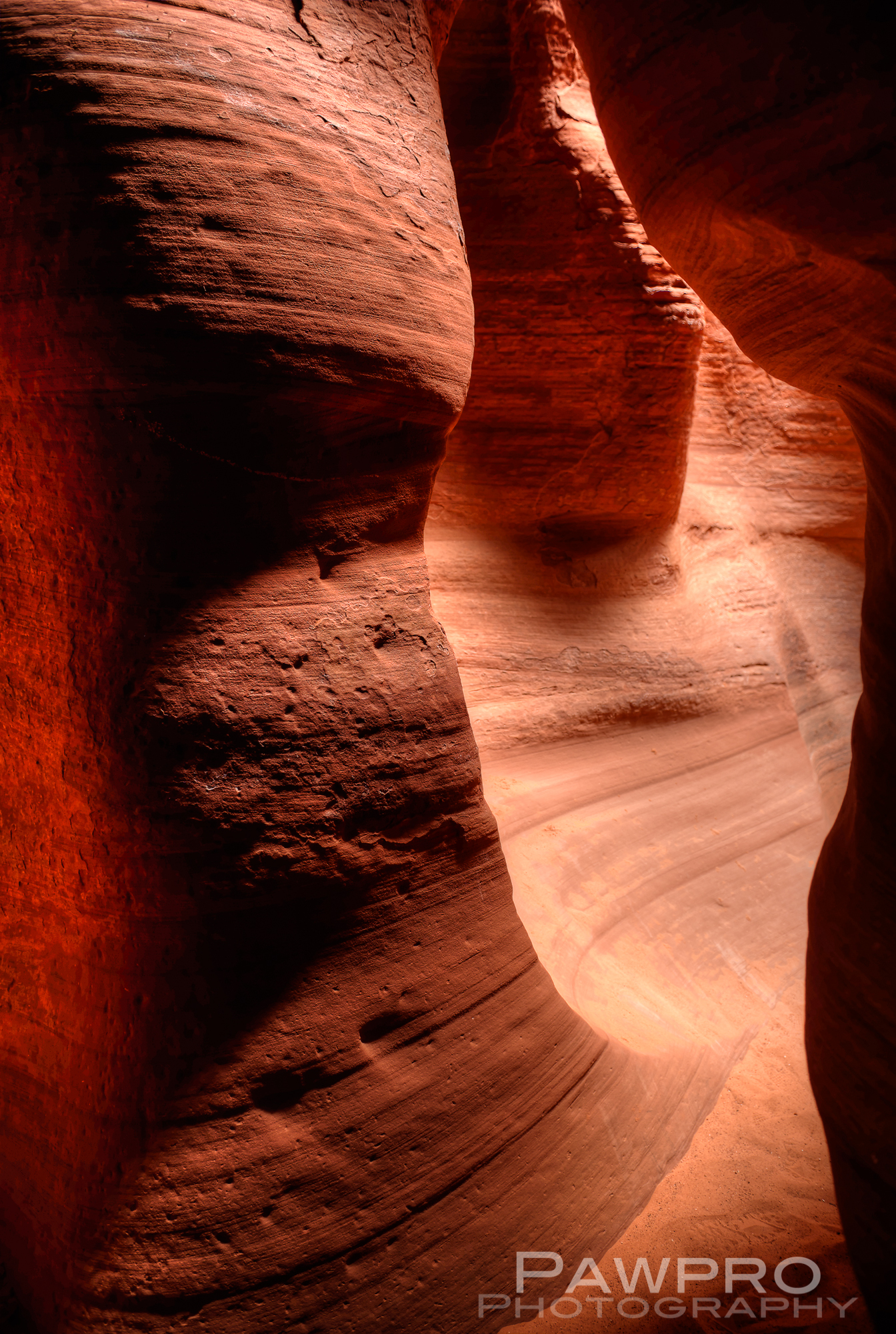
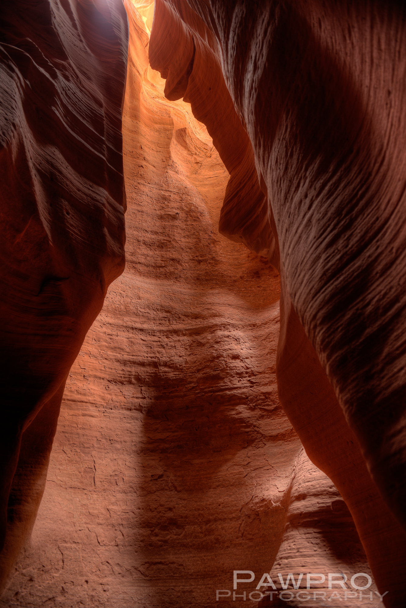
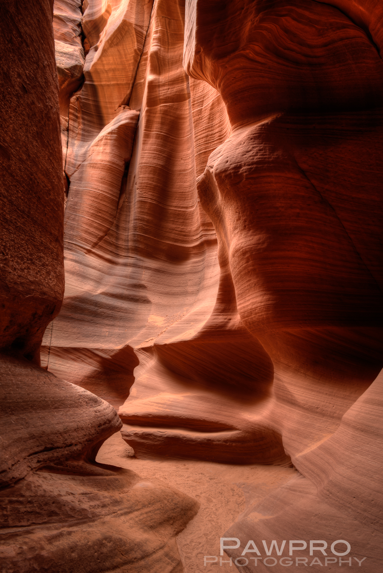
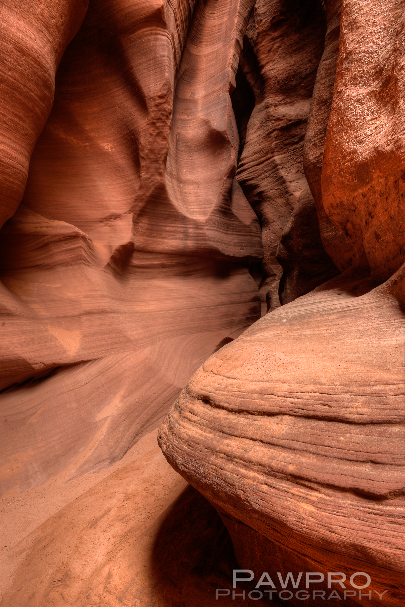
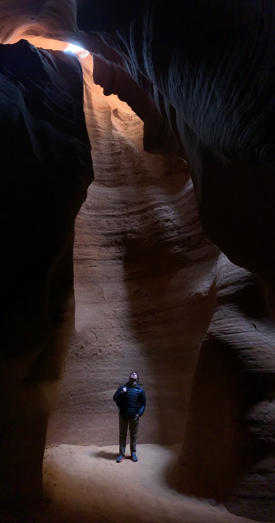
Many slot canyons in America’s southwest have been hidden, spiritual gems kept close and private in the Native American cultures where they are frequently found. A sense of spirituality and church are common and understandable as one walks through gazing upward at the architectural design of wind, water and time—just as a tourist in a large cathedral anywhere in the world might experience. Navajo guides recount stories of tribal hunting, celebrations, rituals and using the canyons as retreats during travel, as well as storms of nature and man. The church parallels continue as visitors contemplate the way sunlight filters in against the sandstone walls, coloring and decorating the spaces every bit as much as any stained-glass window. Visitors linger to watch the mood and light change as the places of dark and light move.
I had the pleasure of visiting two slot canyons near Page, Arizona this year. The first was the high profile and well-worn Lower Antelope Canyon and the second, Canyon X, only open to the public since 2016–an amazing fact to me–millions of years in the making and to be among the first, relatively speaking, to see it. Both of these slot canyons are the by-products of the same 18 mile stream known as Antelope Creek near Lake Powell.
Lower Antelope Canyon offered more sultry, sensual shapes at almost every head turn. Some of my shots from Canyon X reminded me of medical micro photography with the abrupt changes in texture and wear.
It’s worth reminding everyone that the forces that continue to forge these grand caverns of red rock can and will gobble up a patron or guide who fails to respect the powers that be. Just as the Mid-Atlantic region is experiencing changing weather patterns, recently this area has experienced a lot of rain and snow. Over the years, many have made the mistake of underestimating the potential power within these canyons, which is simultaneously creative and destructive.
Please support and help preserve our public lands and natural treasures. #FindYourPark amydoherty.zenfolio.com
Unauthorized use and/or duplication of this material without express and written permission from this blog’s author and/or owner is strictly prohibited. Excerpts and links may be used, provided that full and clear credit is given to Amy Linn Doherty with appropriate and specific direction to the original content.
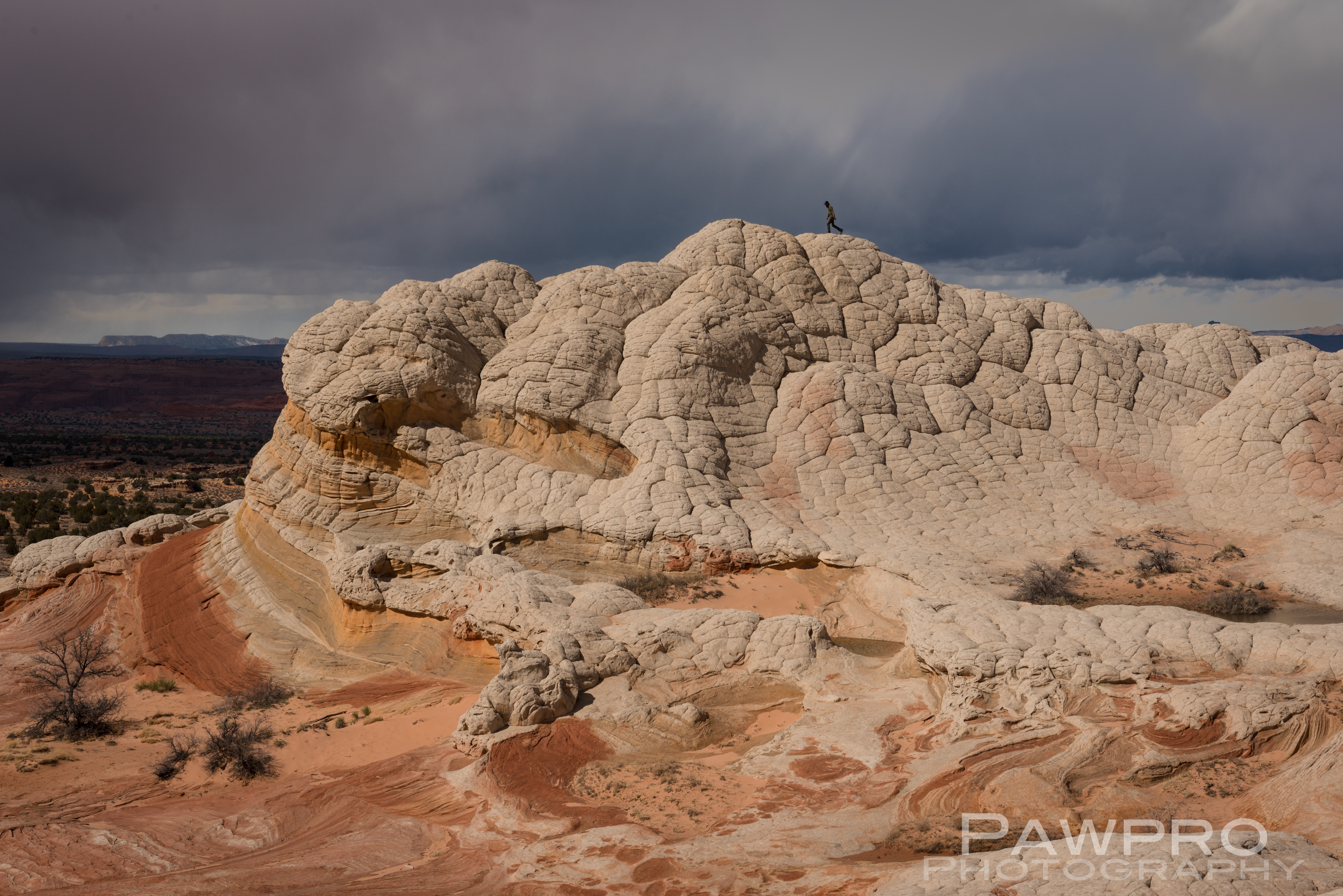
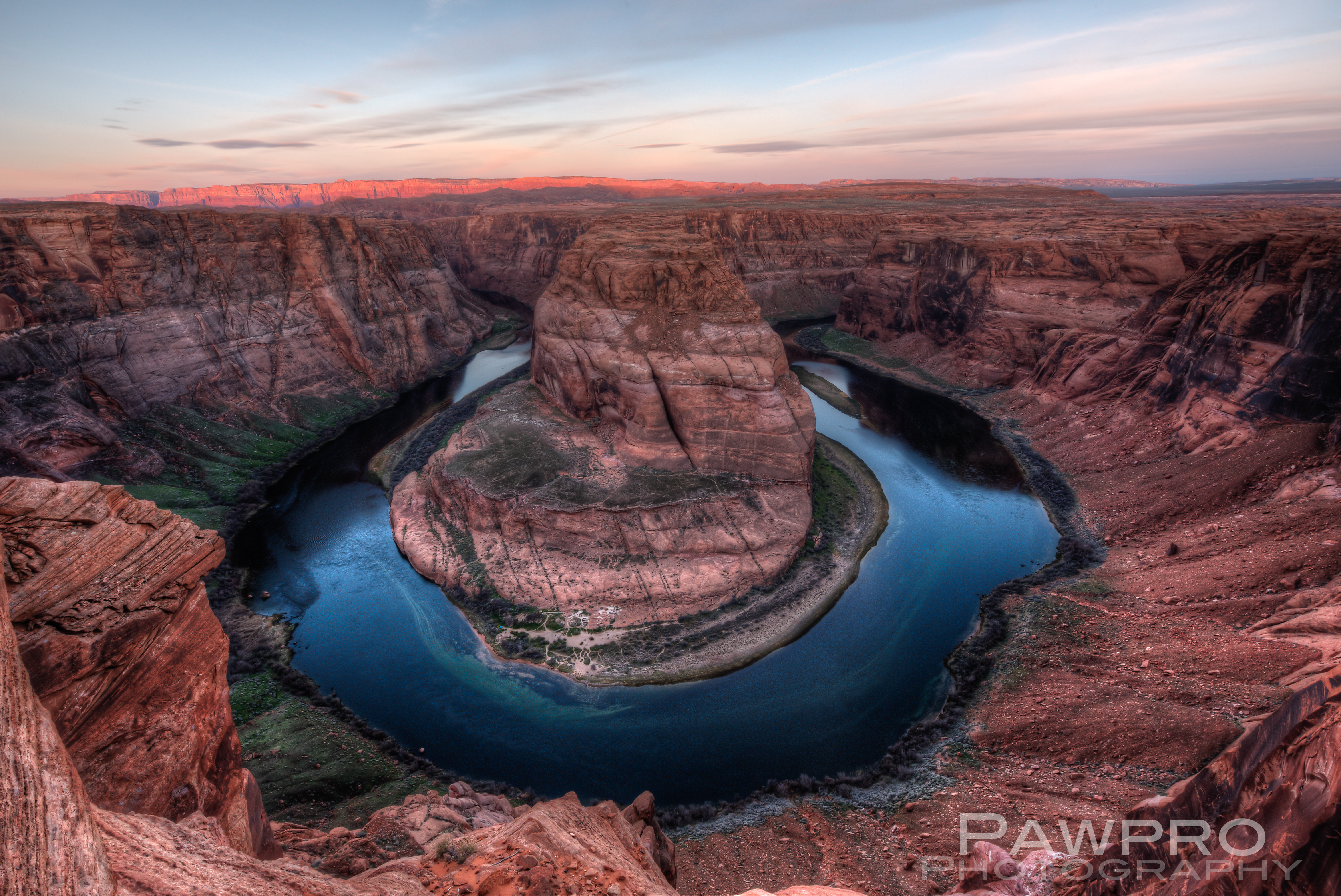
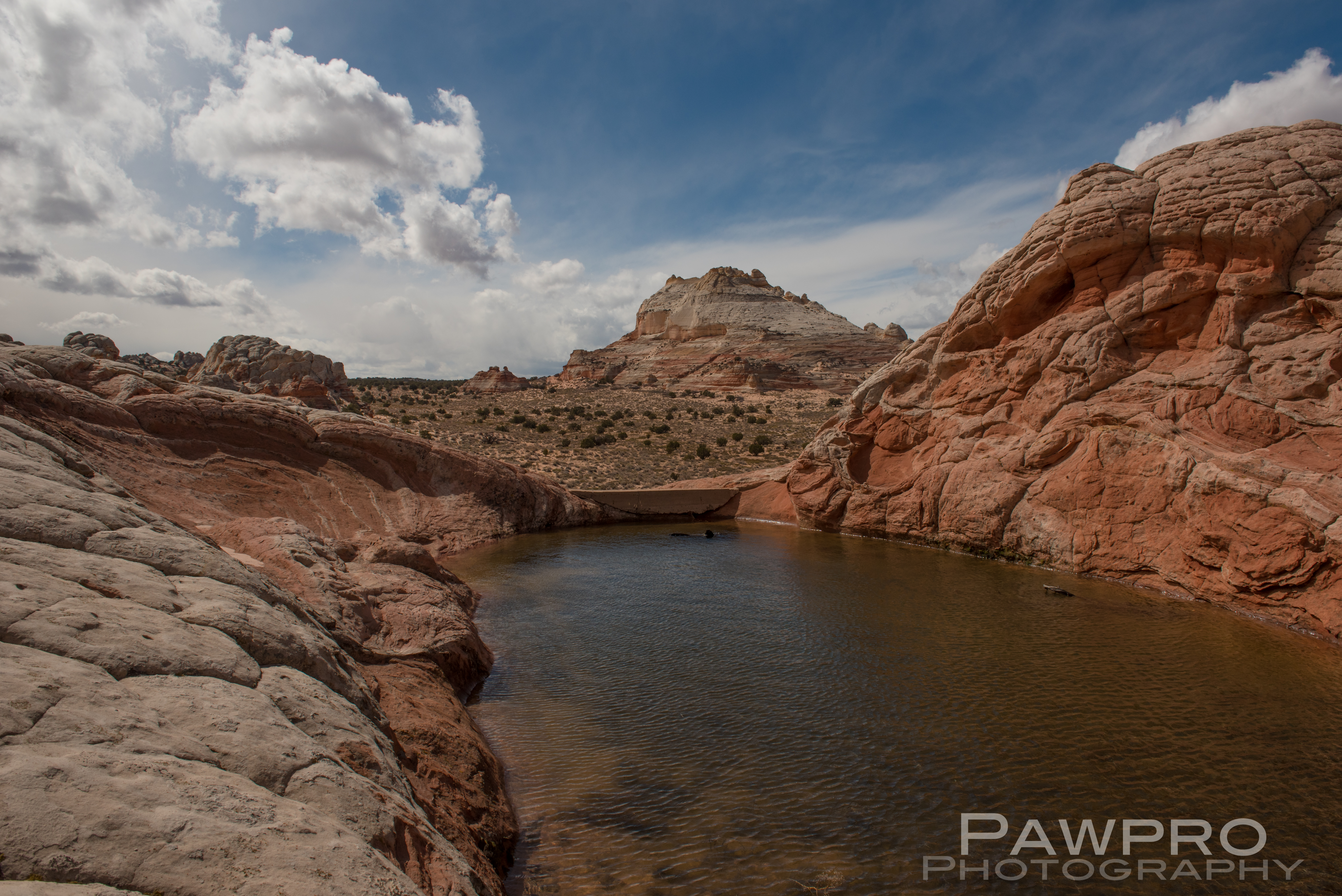
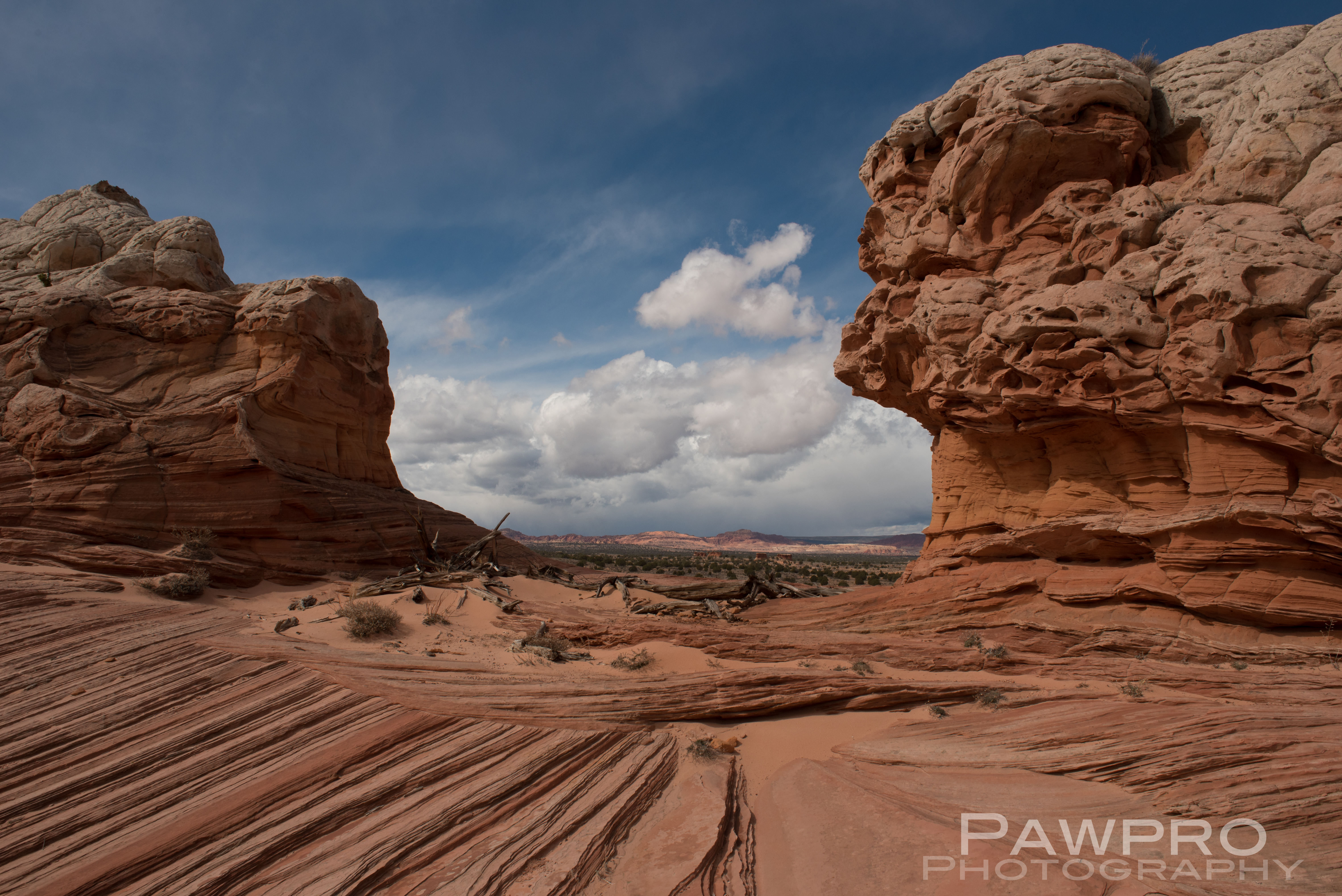
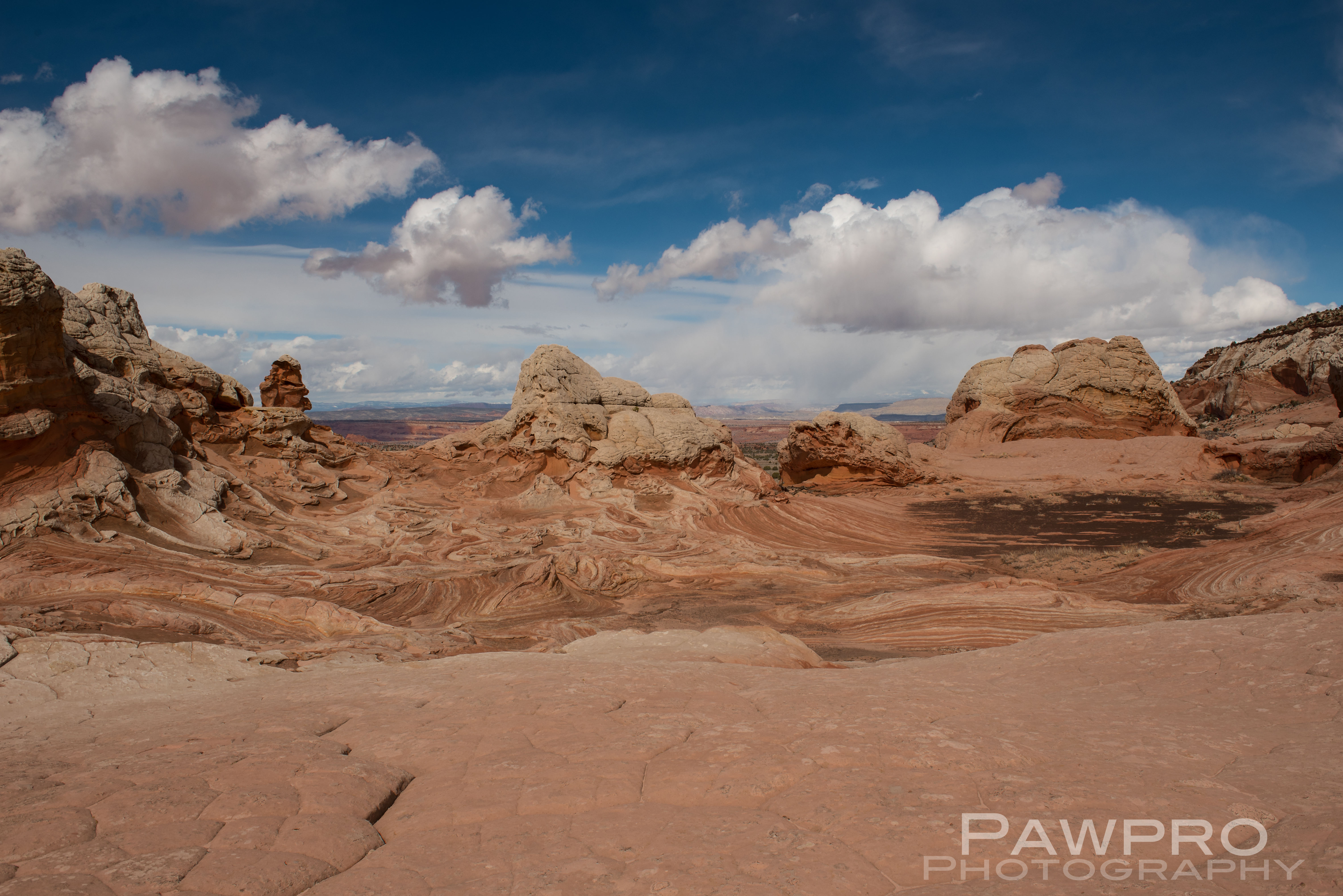
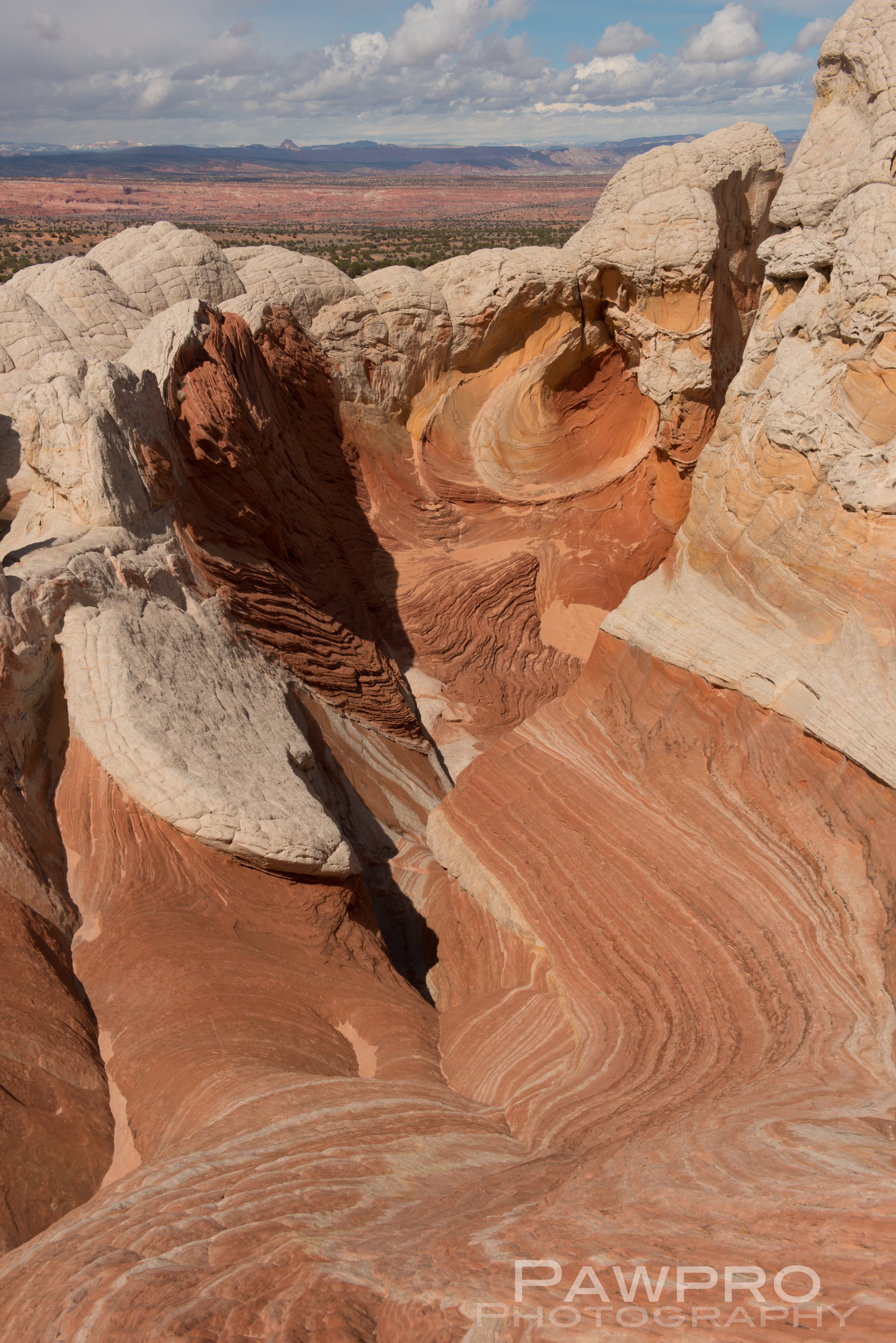
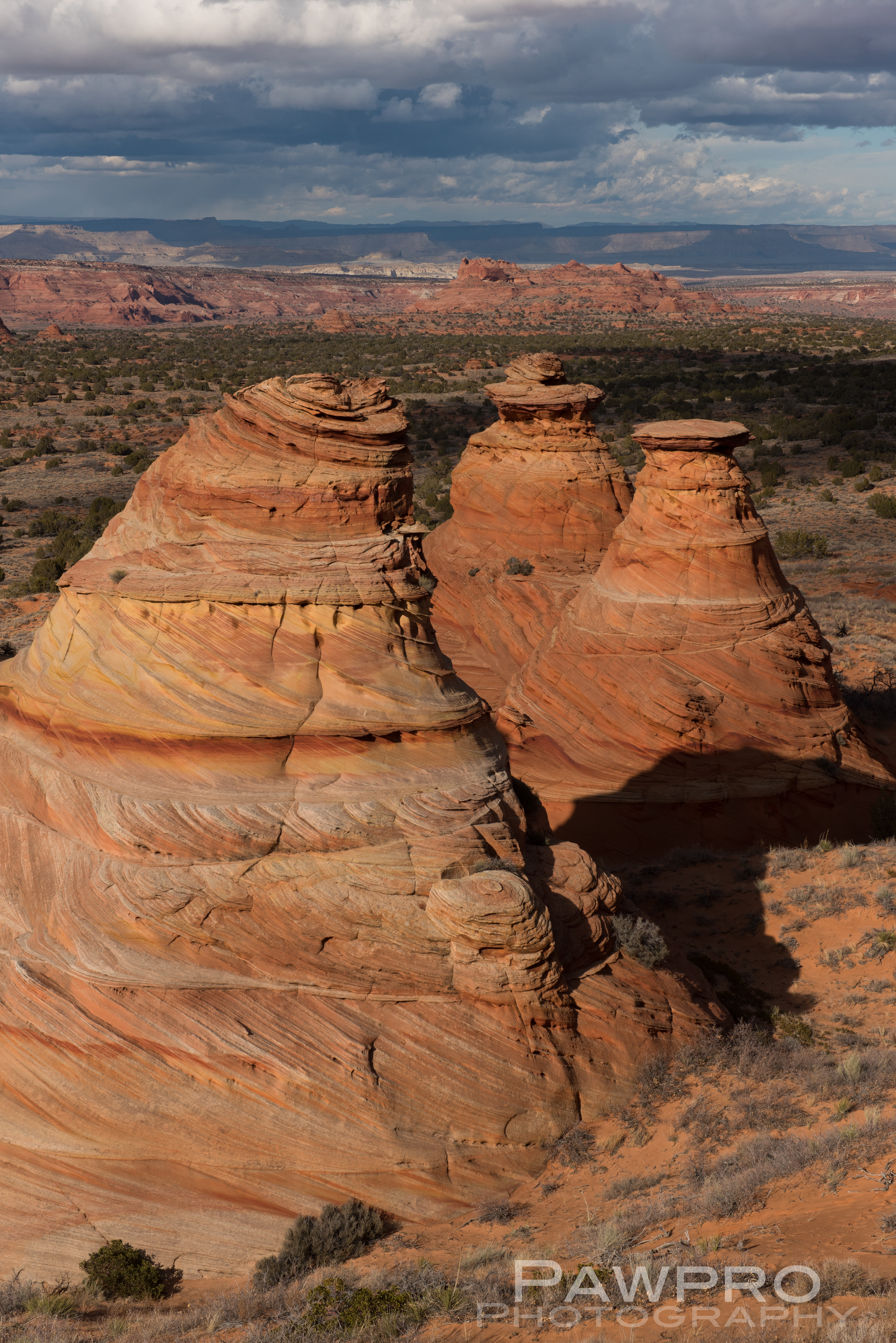
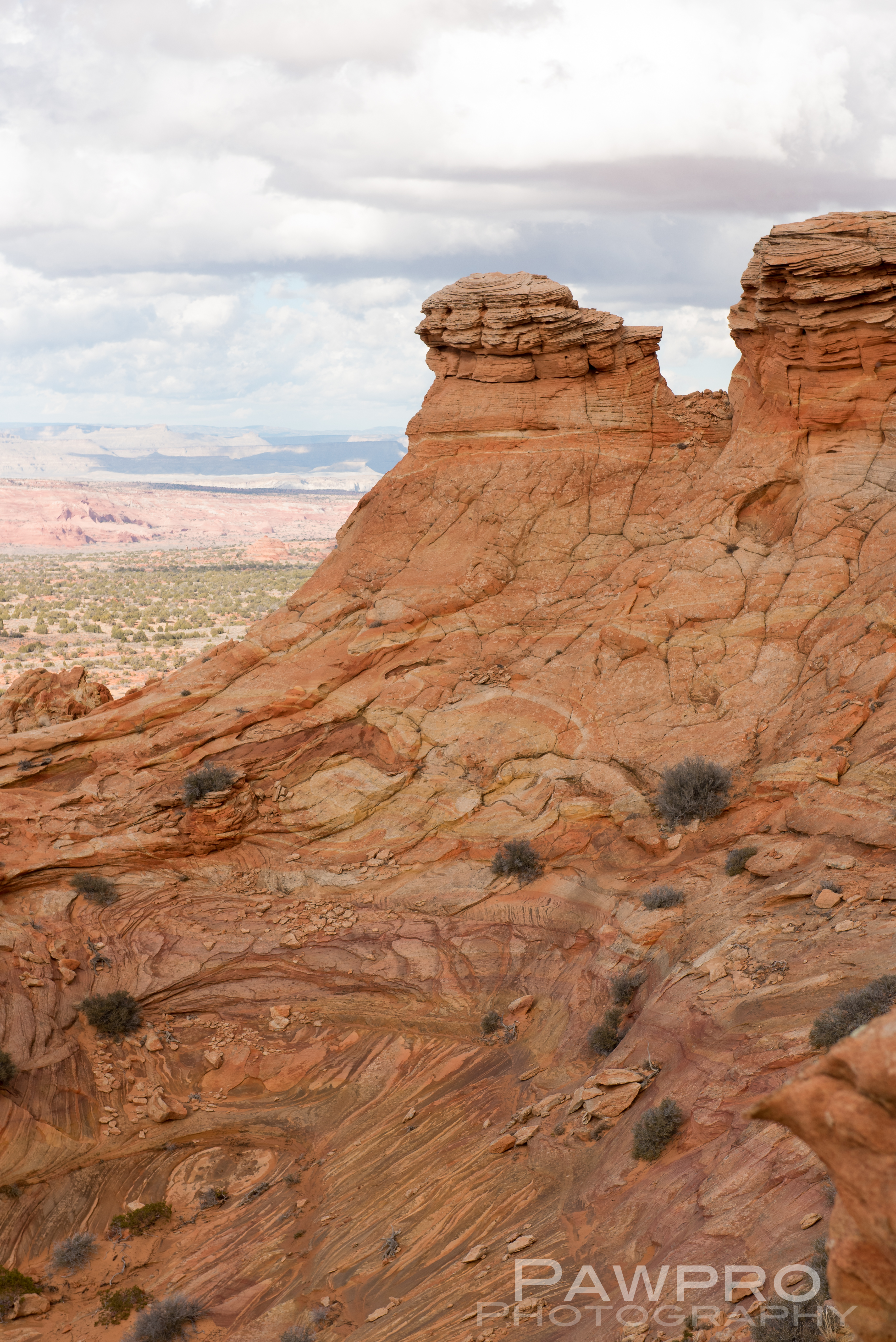
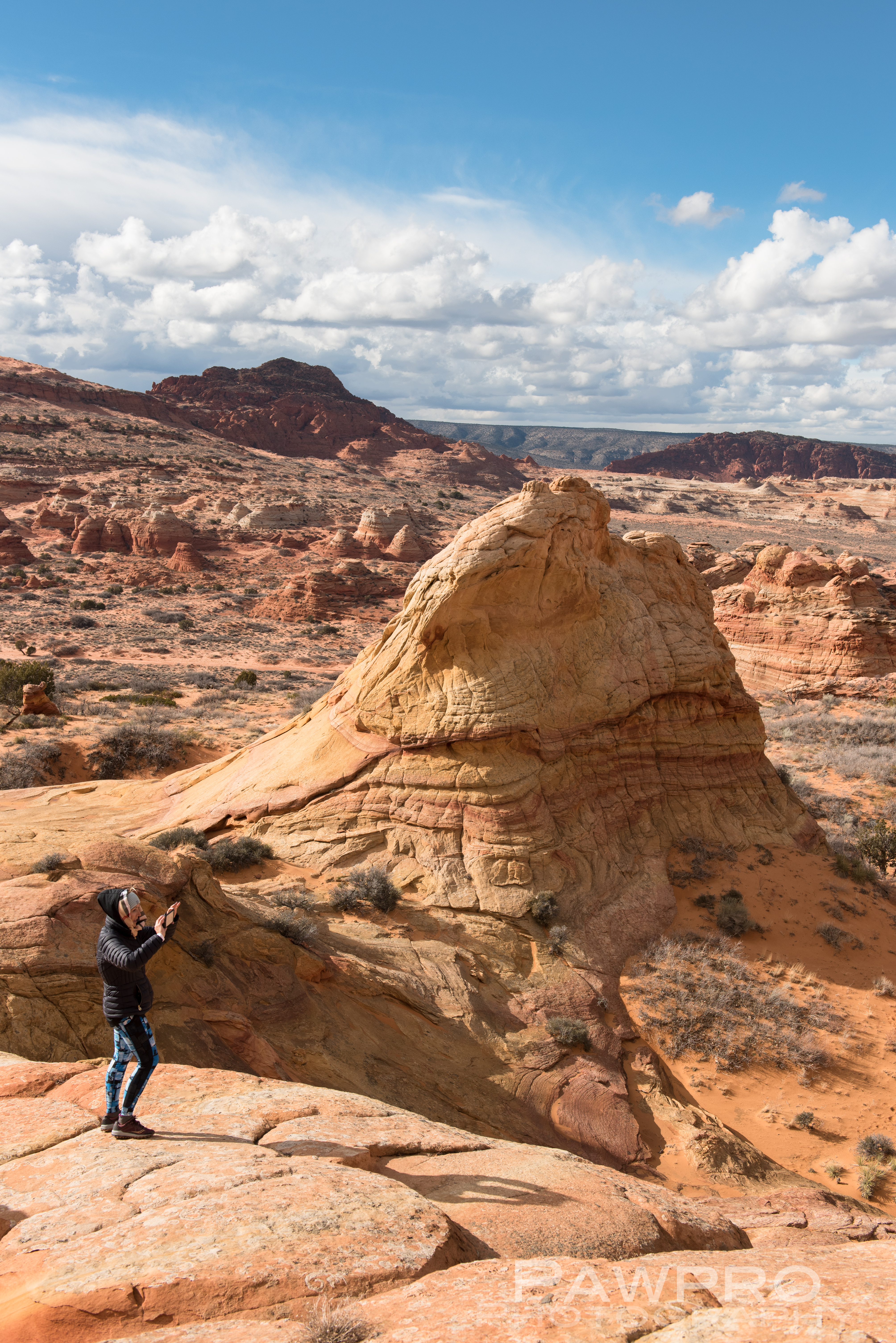
As we get ready to celebrate 50 years since man landed Apollo 11 on the Moon this July, I recently had the privilege of visiting a location on Earth that resembles a lunar landing. The White Pocket area of Paria Canyon-Vermilion Cliffs National Monument, a spot that feels out of this world, is nestled between Page, Arizona and Kanab, Utah. It’s guarded by remote, and rugged terrain, so it sees far fewer visitors each year than its neighbors at Zion, Bryce and the Grand Canyon. However, each year its recognition among photographers and adventurers grows.
If you’ve visited Horseshoe Bend, AZ for a sunrise photo facing west you couldn’t miss the Vermilion Cliffs and the Paria Plateau 10 miles in the distance because the first light of sunrise illuminates this elevated, red rock wilderness before anything else.
Horseshoe Bend with Paria Canyon-Vermilion Cliffs getting first light.
This 112,500 acre “island in the sky”, as some have referred to it, is accessed from the west and north sides via Kanab and 89A where the dramatic step off becomes invisible once you’re on it. Stretches of 89A are said to roughly follow the path of early Franciscan explorers, as well as the route taken by early Mormons on their way to be married at the nearest temple. Once you’re off the pavement, it’s a long trail to reach these relatively small geological masterpieces on primitive automobile paths mostly maintained by usage.
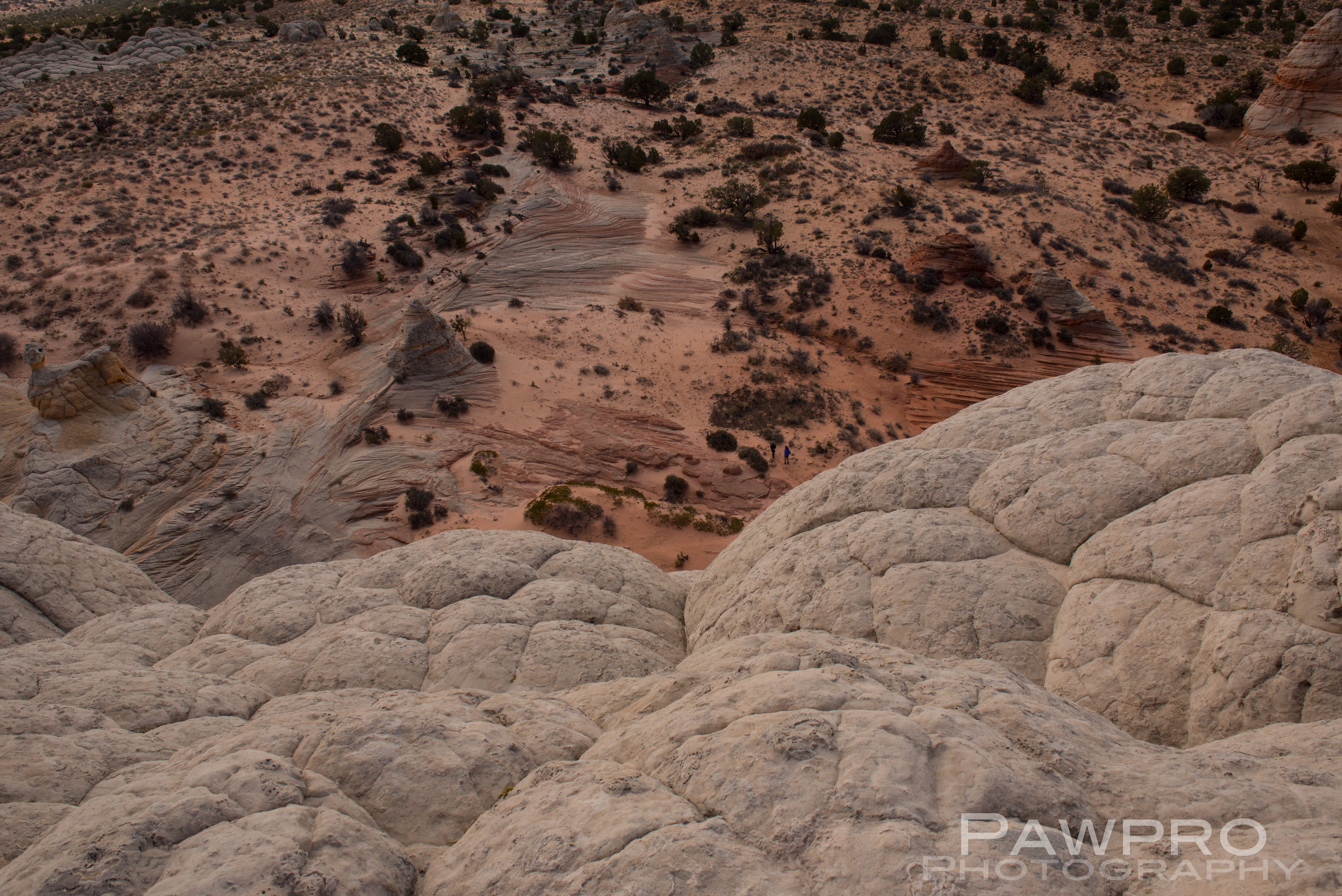
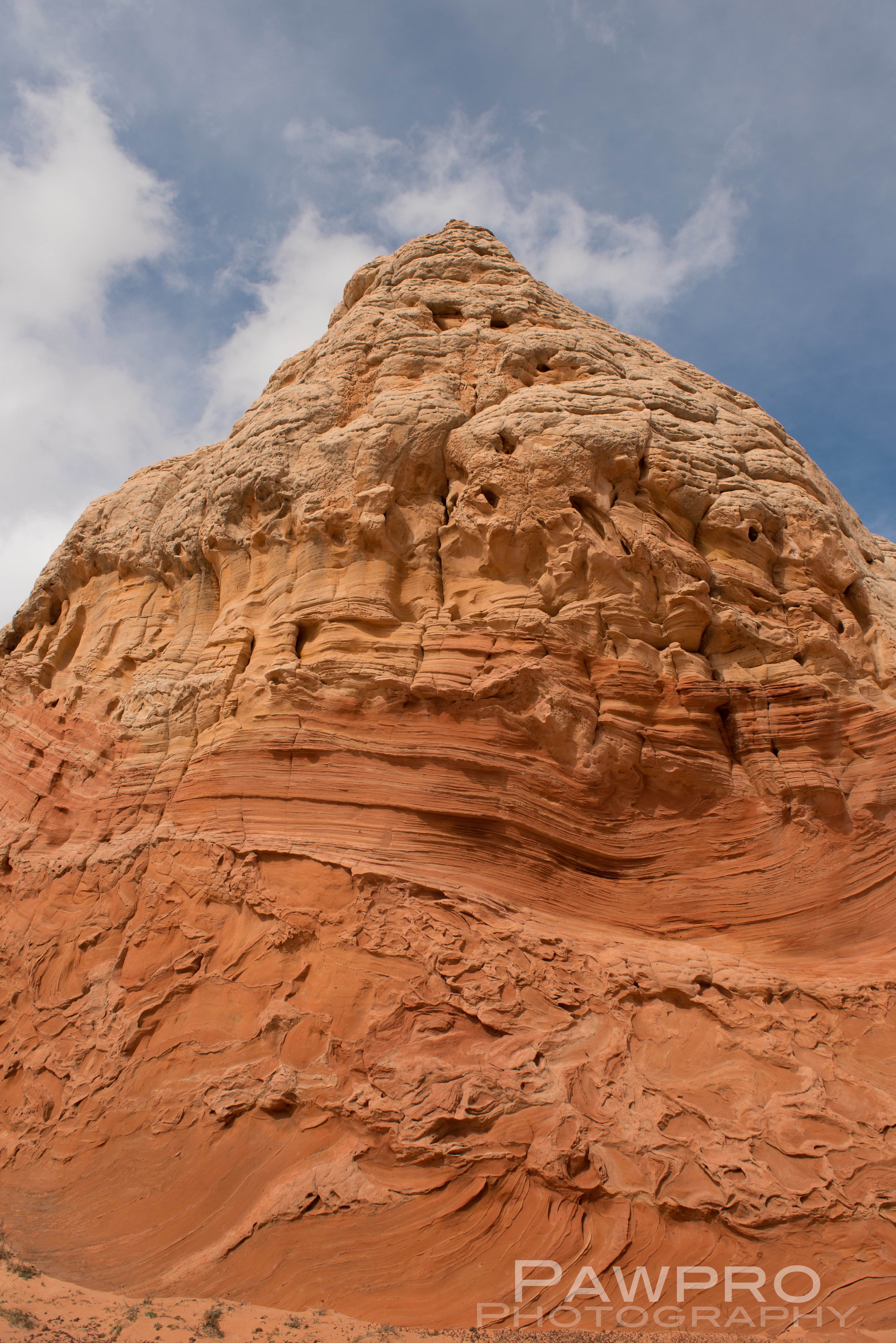
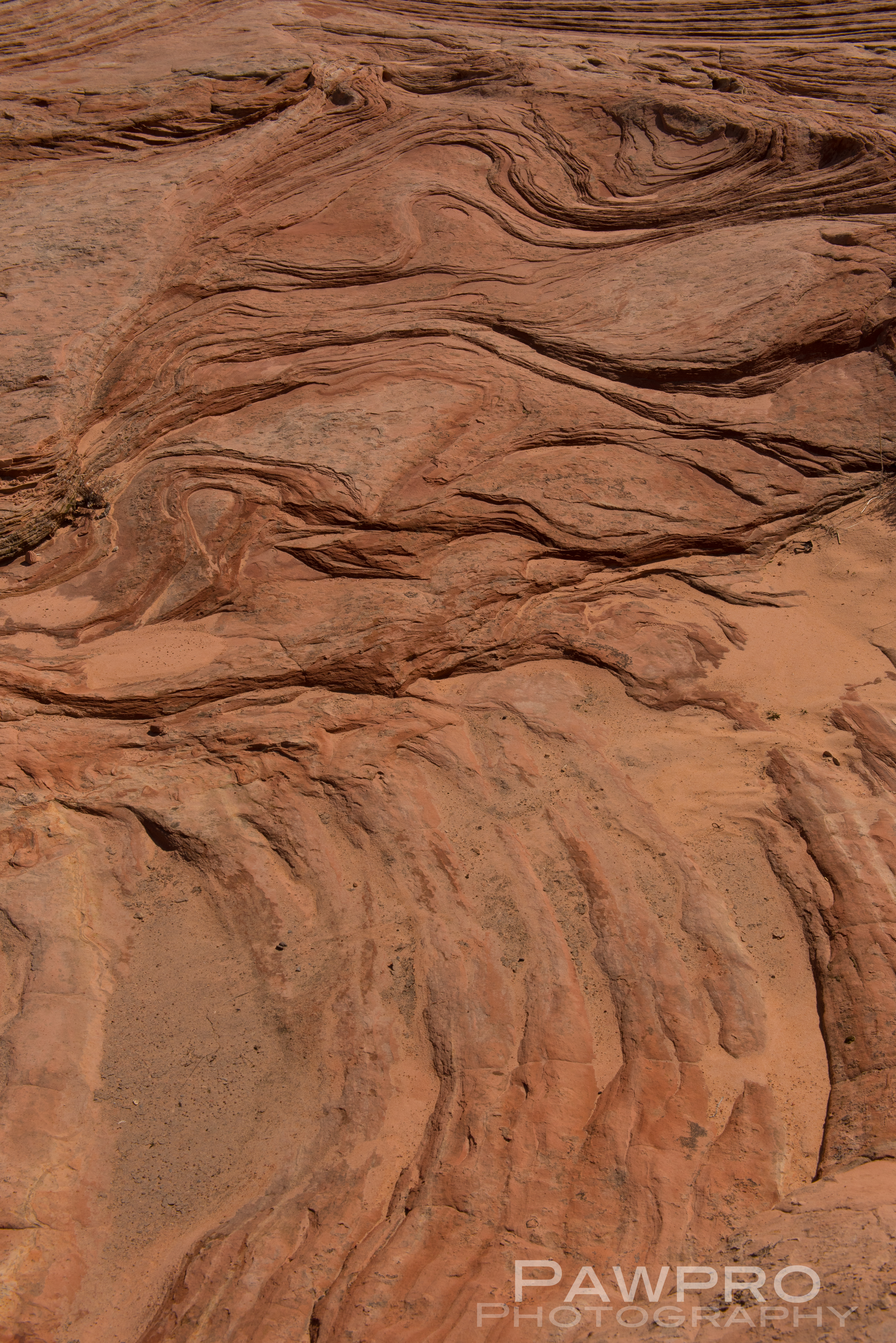
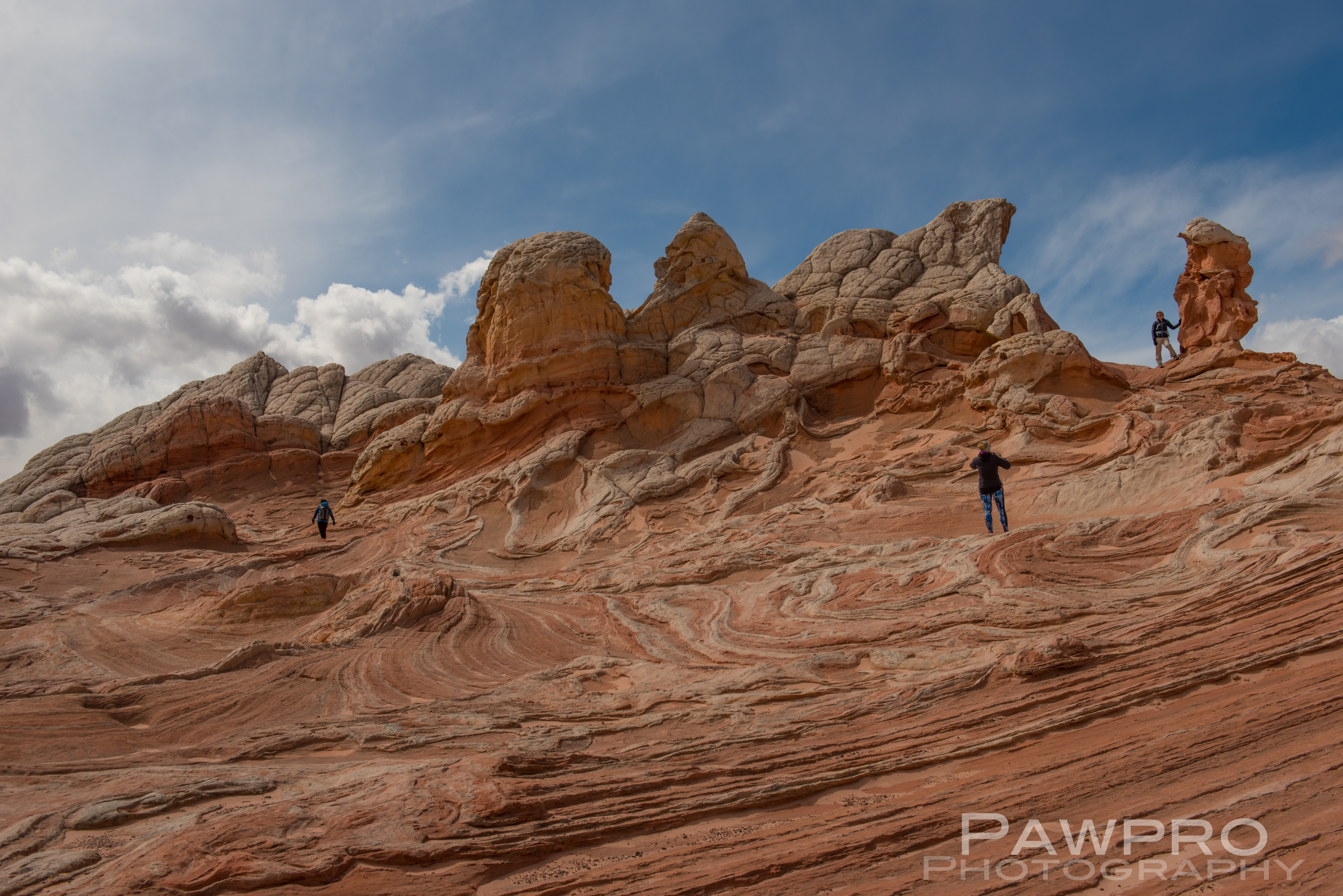
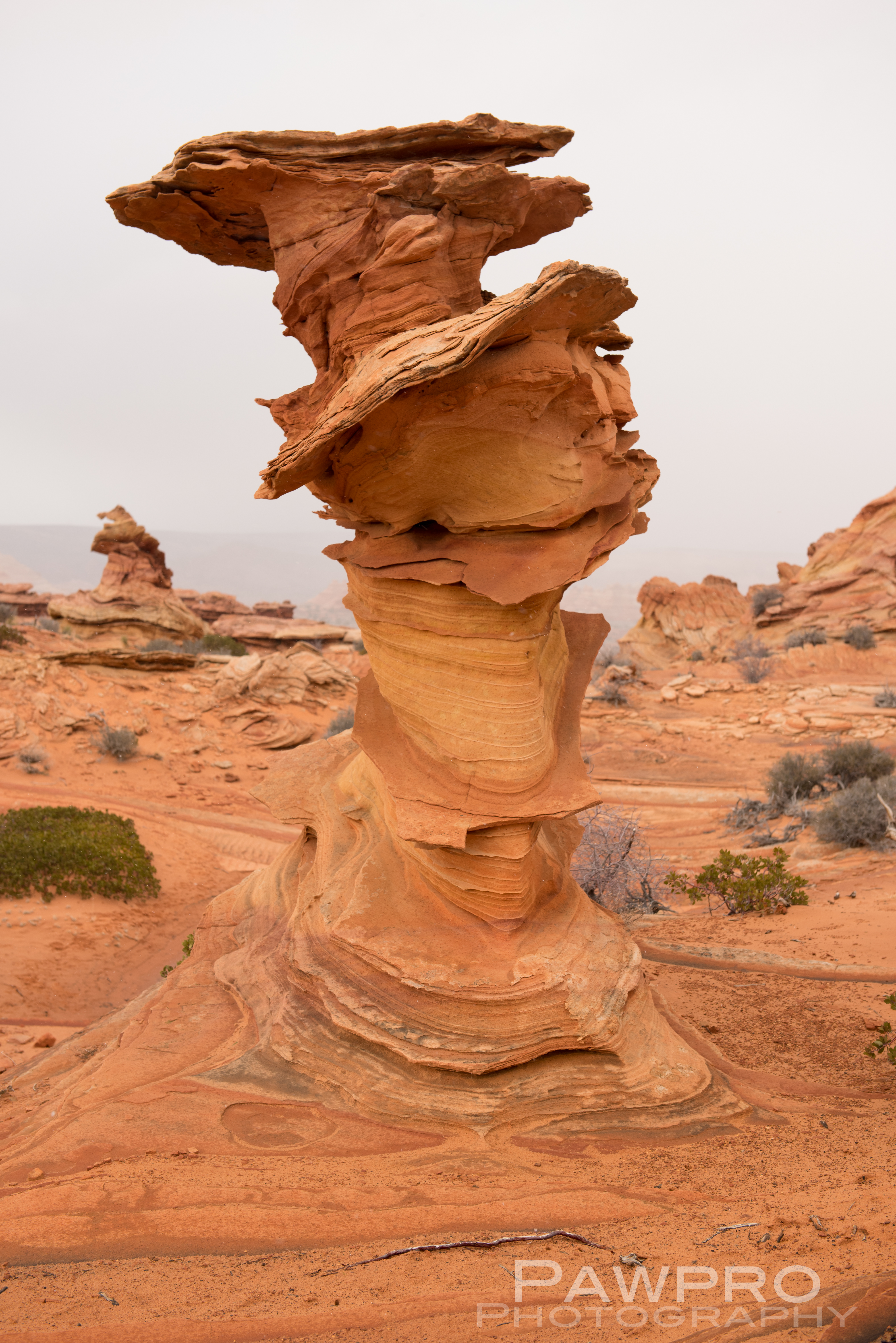
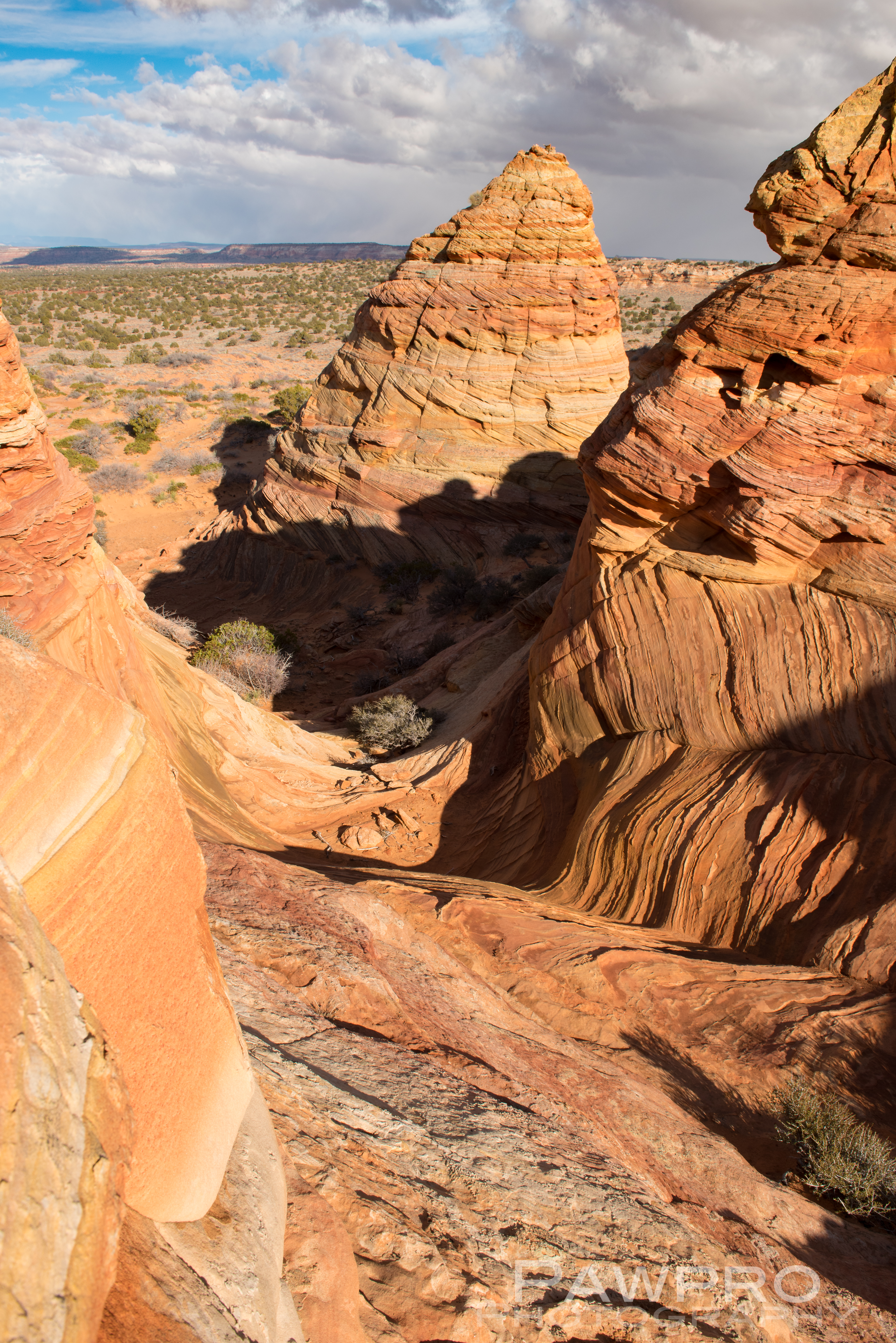
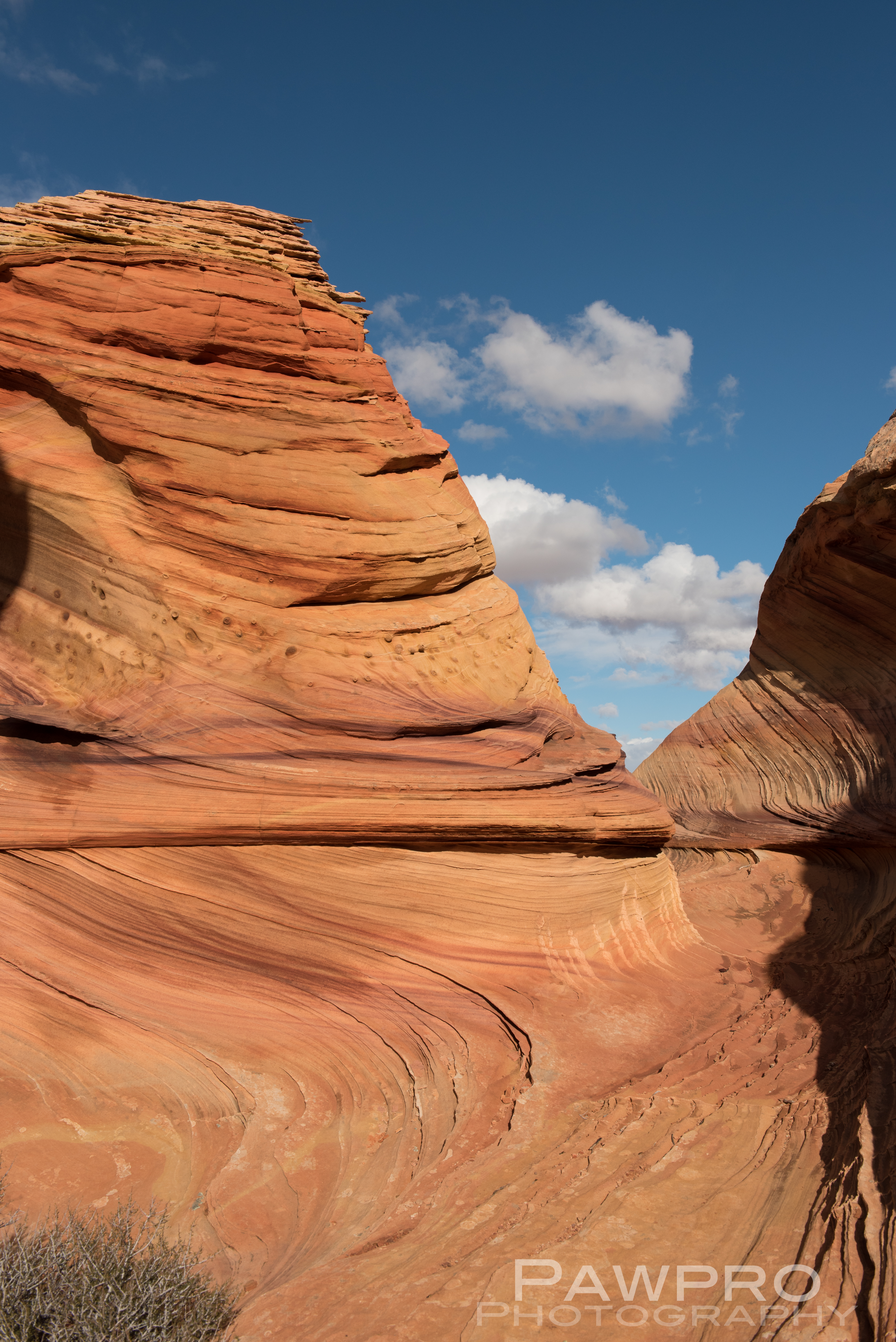
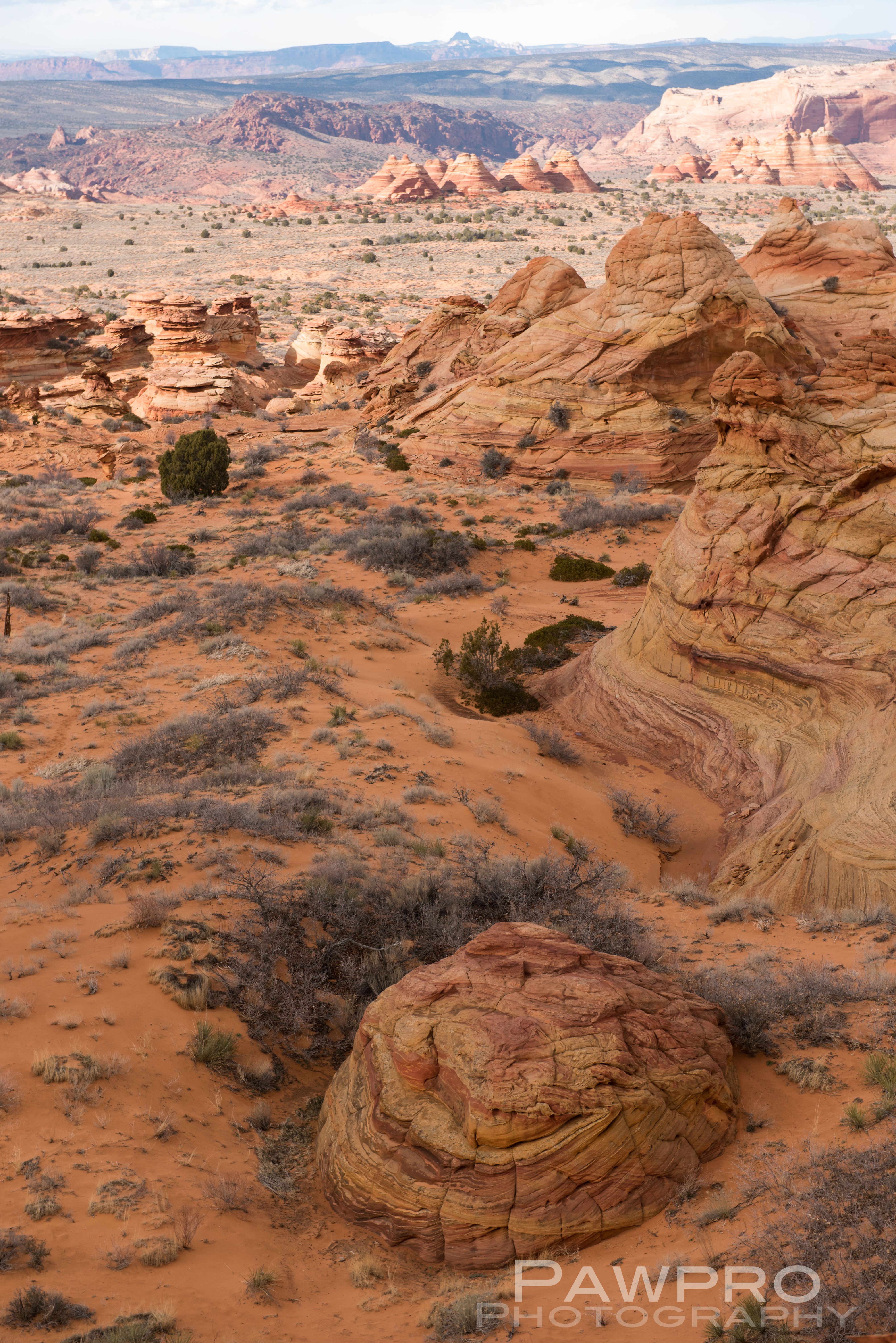
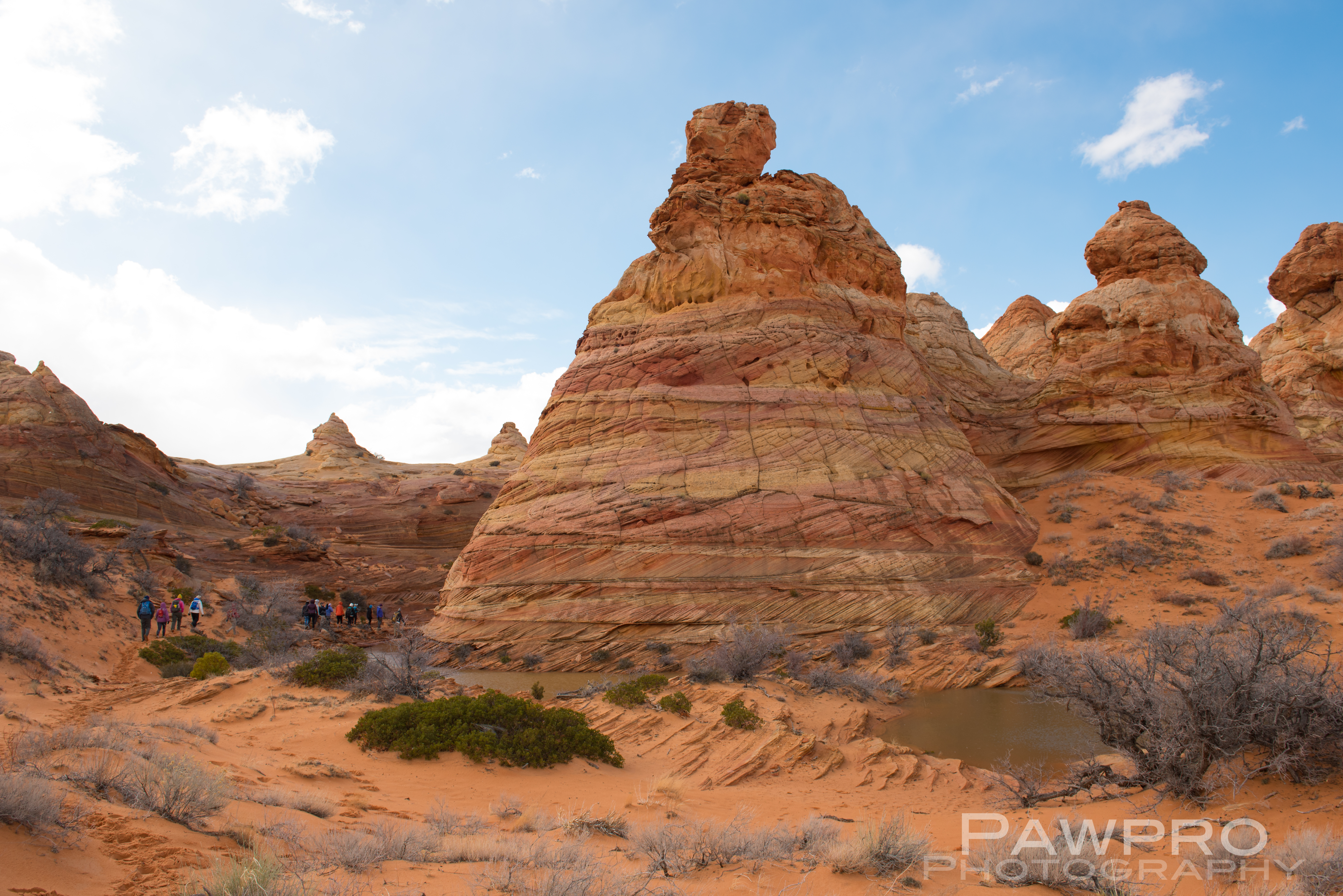
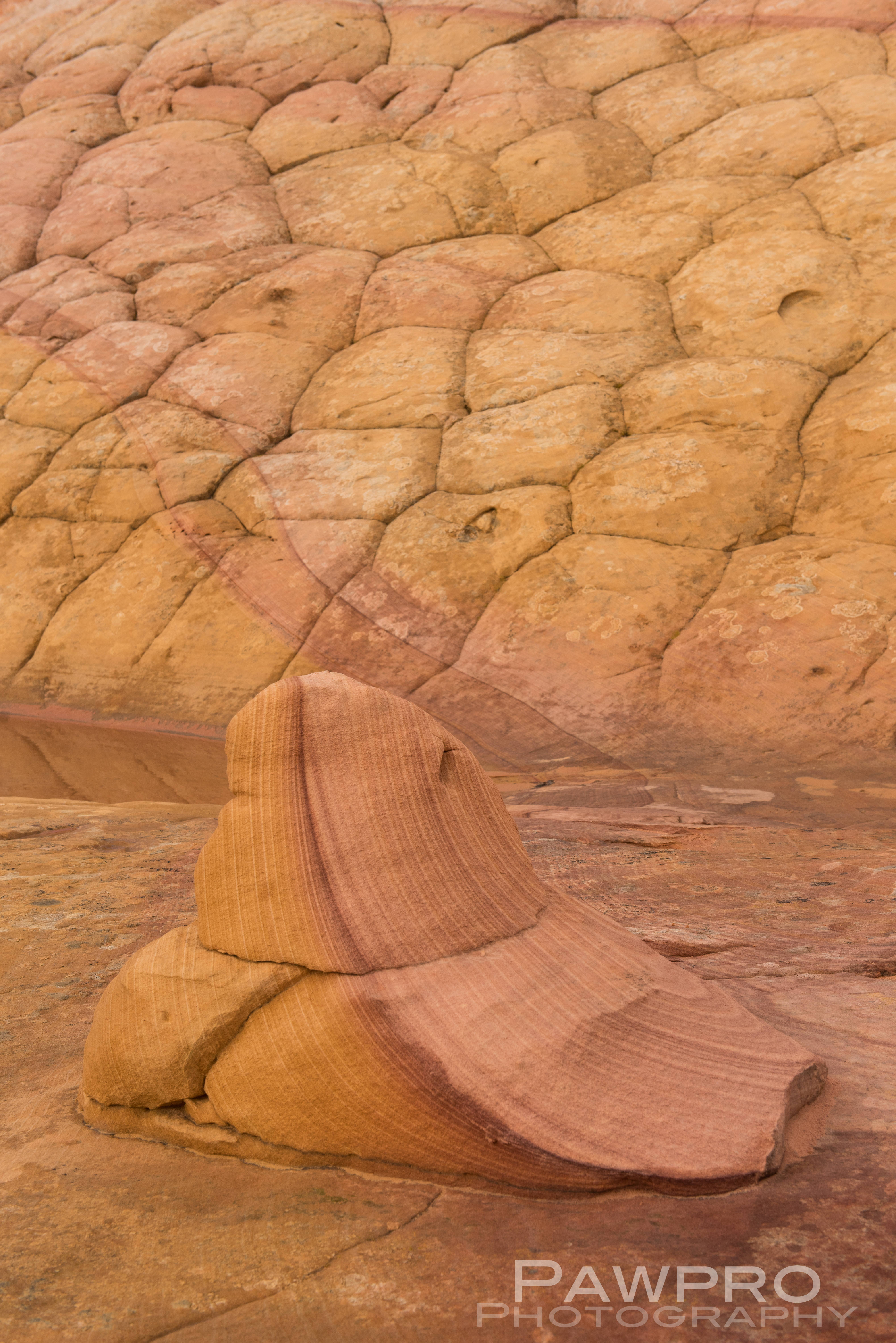
Geologically, White Pocket is one of a kind with its relatively thin, drippy coating of white stone resembling cauliflower or brain matter on the surface–giving rise to the lunar sensation. Just beneath is the striated, slick rock, sedimentary, Navajo, red sandstone of various hardnesses, so common to the area.
What’s uncommon is the well-preserved and chaotic layering where time and clearly violent movement tell the untold, almost photographic, story of what occurred here. Some geologists theorize that the area was created by a massive sand slide during the Jurassic Period, probably triggered by an earthquake, where soft, saturated sediment deep below the surface rapidly descended over a large pond or oasis resulting in unstable pockets of trapped water and wet sand shifting, burping, bending beneath like layers of rubbery rock.
As sedimentary layers settled under the weight of the new surface, trapped water bubbled and migrated, forcing its way to different places in volcanic-like movements of soil. What’s left are a varied and unusual array of hoodoos, fins, cones, ridges and ravines coated in white polygonal shaped icing that at times can resemble marble cake. There is the unmistakable feeling that while the rock was still wet a large hand was sculpting and working it; as if you were dropped inside the deep layered topography of paints—red, orange, yellow, pink, and white– within a Van Gogh painting where heavy-handed brush strokes and the gouges and smears of a palette knife prevailed to create a masterful depth. That’s as close as I can come to describing it. Hopefully, the photos help.
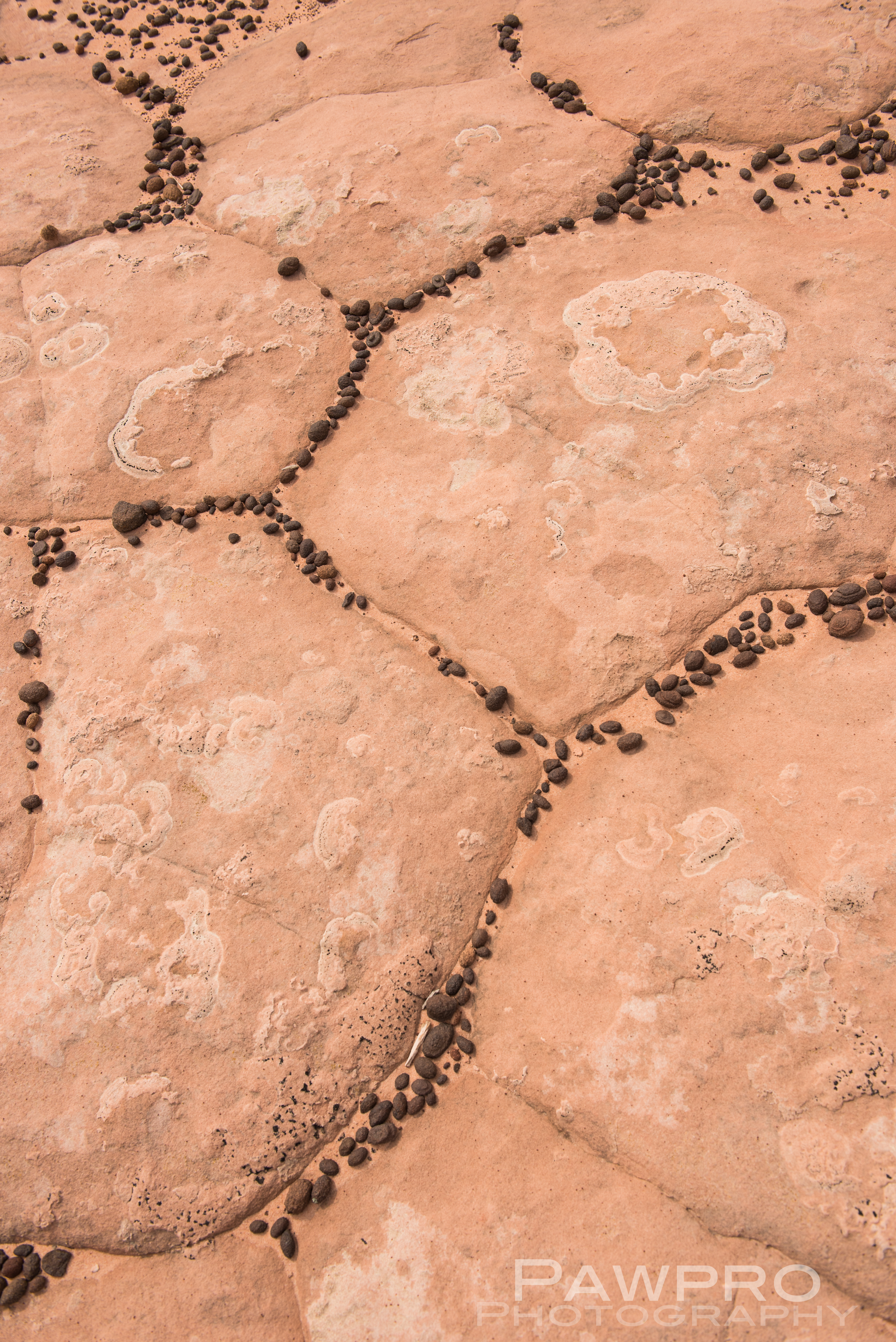
Moqui Marbles
White Pocket Gallery
We learned that the little black pebbles in-between many of the fractured polygonal formations are called Moqui Marbles which are iron oxide concretions that form underground where iron minerals collect in the form of a shell with a sandstone core. Similar formations were discovered on Mars in 2004 by the Mars Exploration Rover.
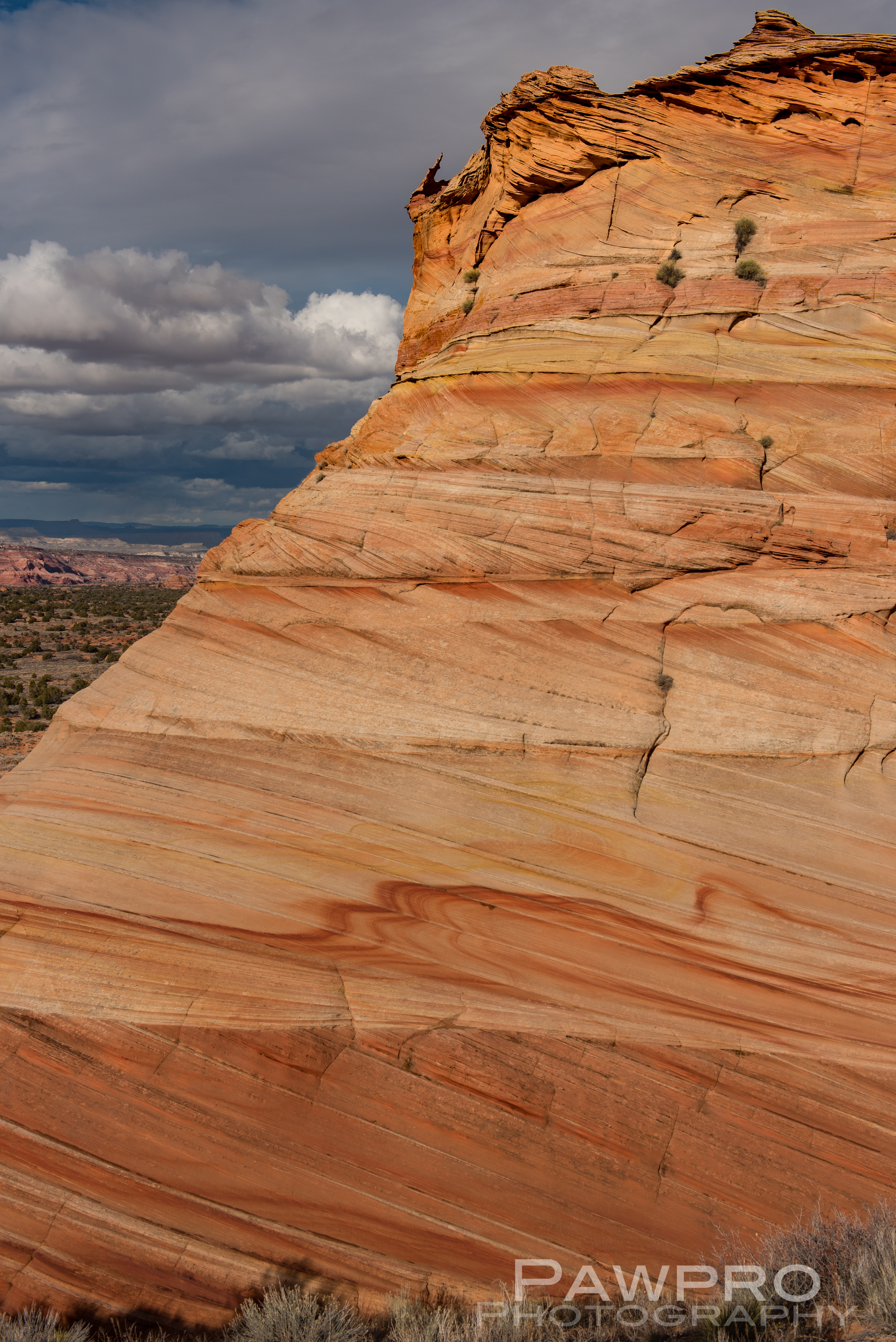
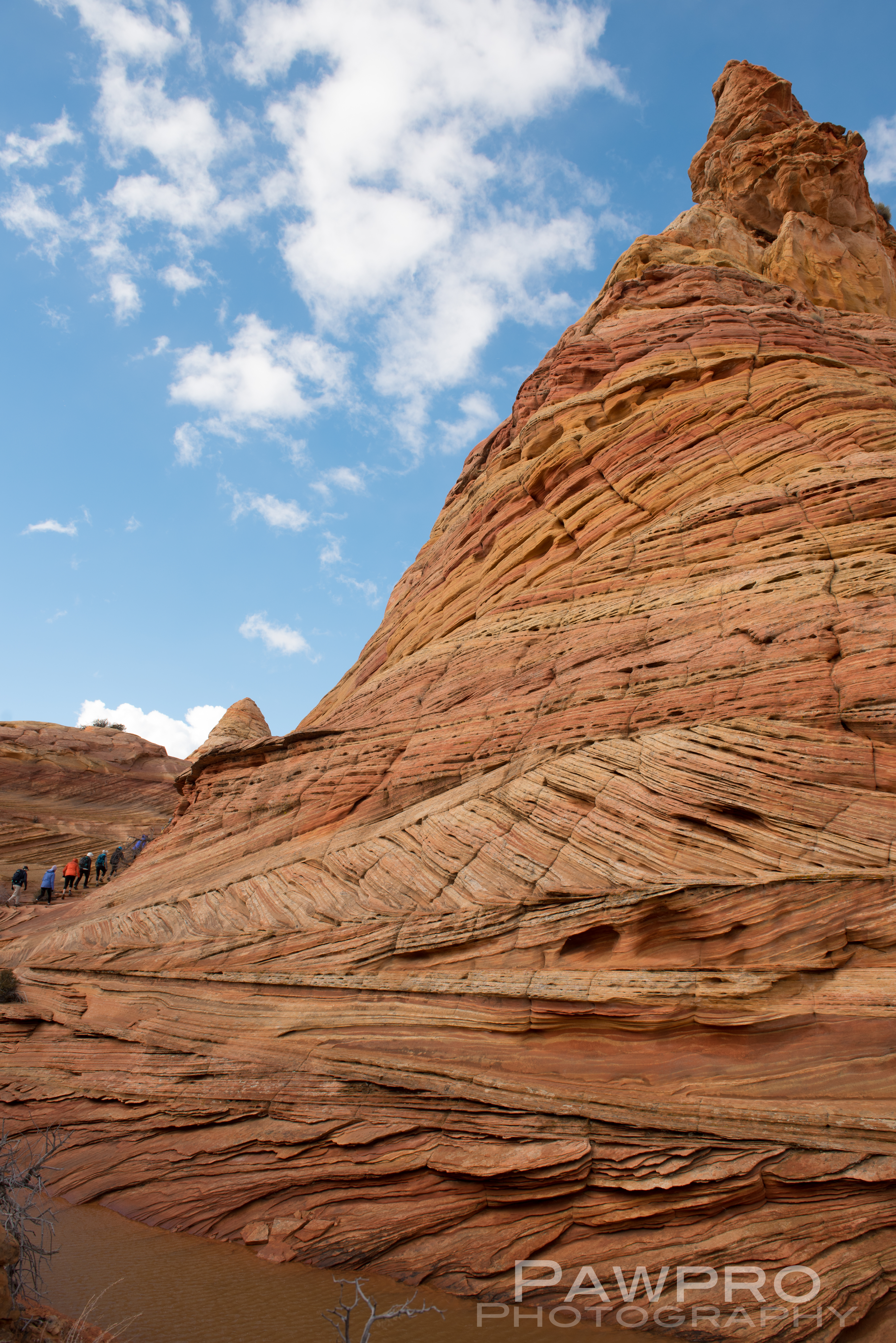
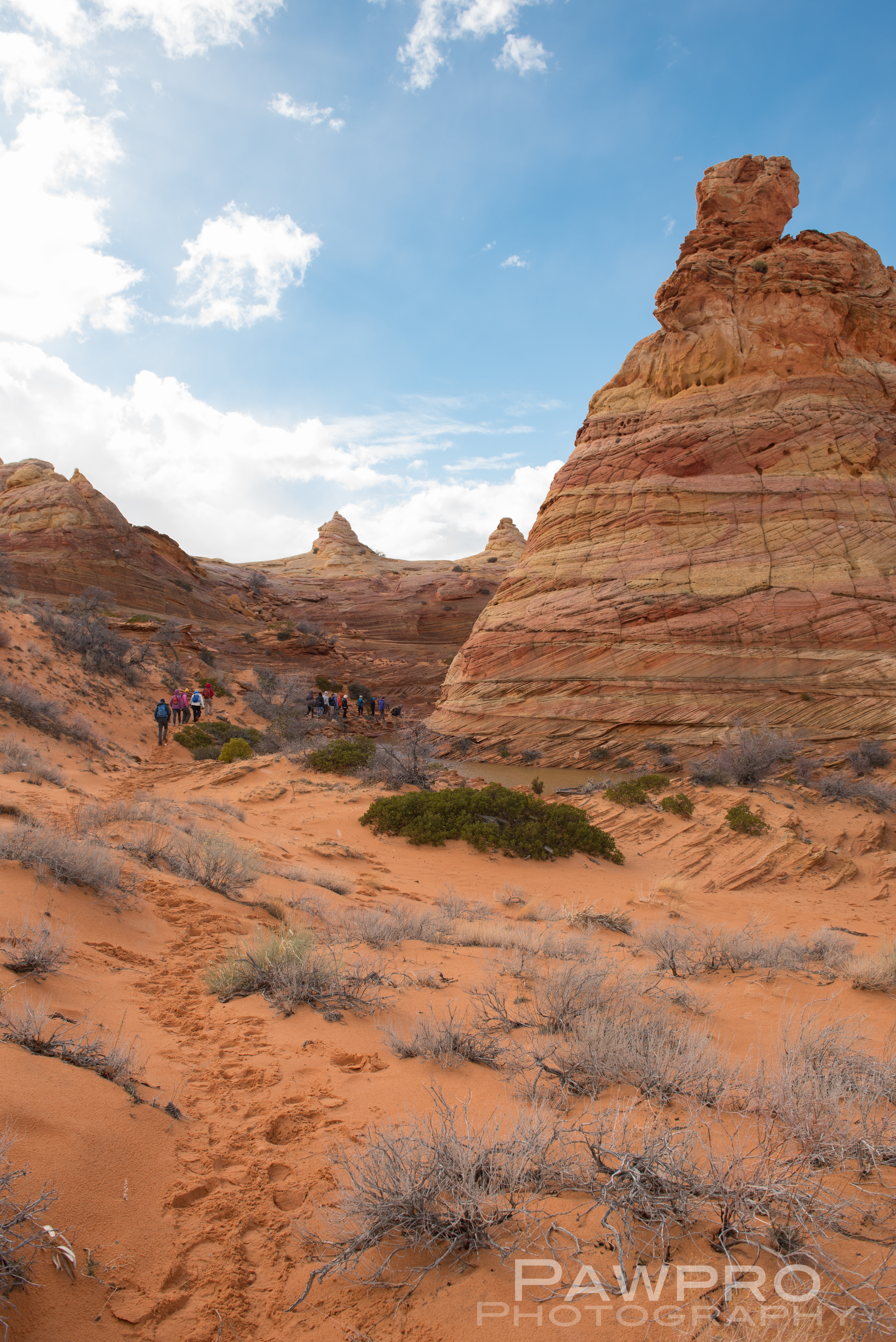
Nearby is the more well-known, North Coyote Buttes commonly referred to as, The Wave, where access is limited to 20 visitors a day by lottery, and South Coyote Buttes which requires daily permits and limits, as well–even if you have a guide. (BLM Coyote Buttes Permits) White Canyon doesn’t require a permit. The Bureau of Land Management (BLM) oversees all of these areas.
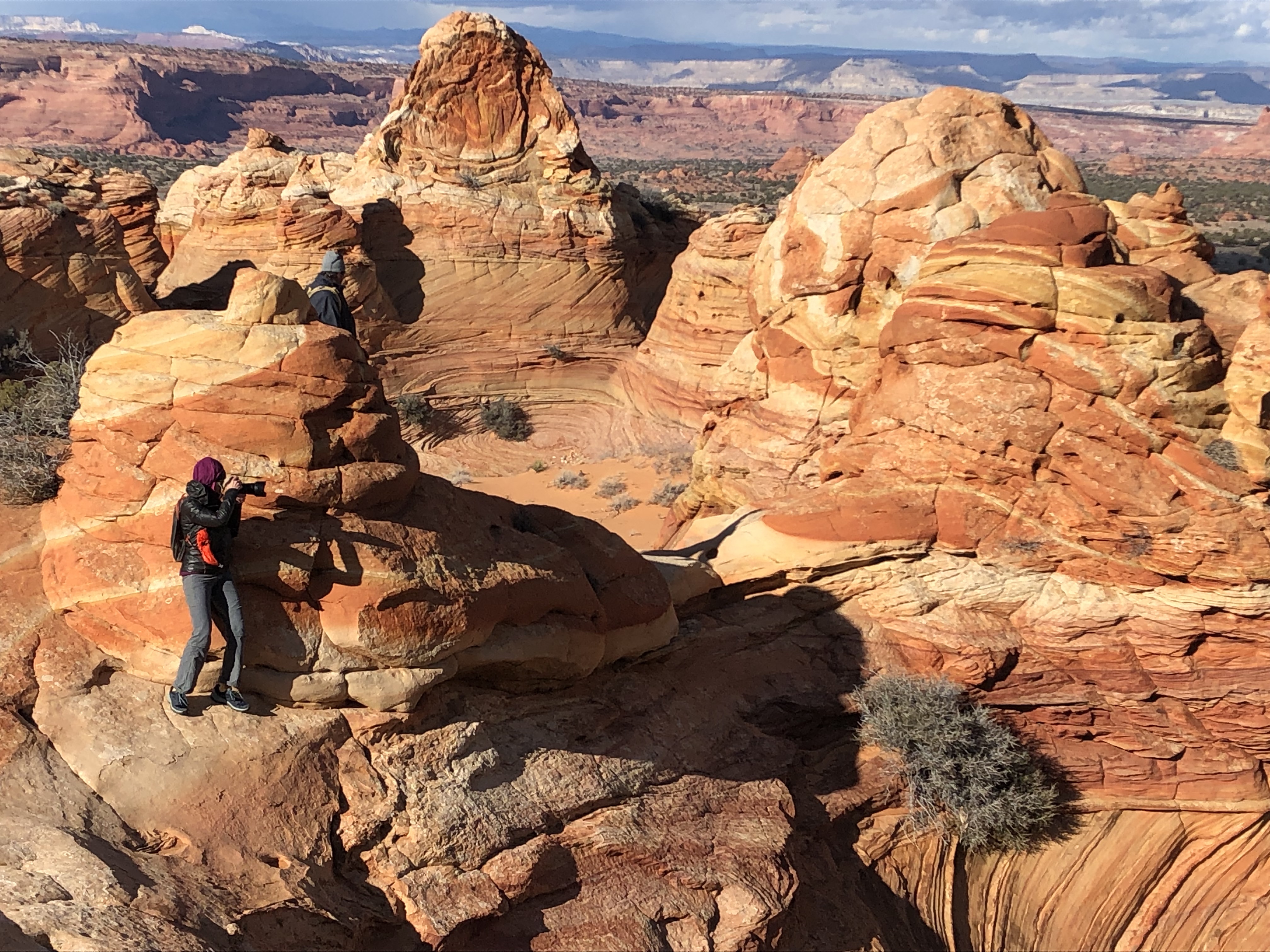
South Coyote Buttes Gallery
South Coyote Buttes colorful teepees.South Coyote Buttes Control TowerHalf and Half Rock
Getting There
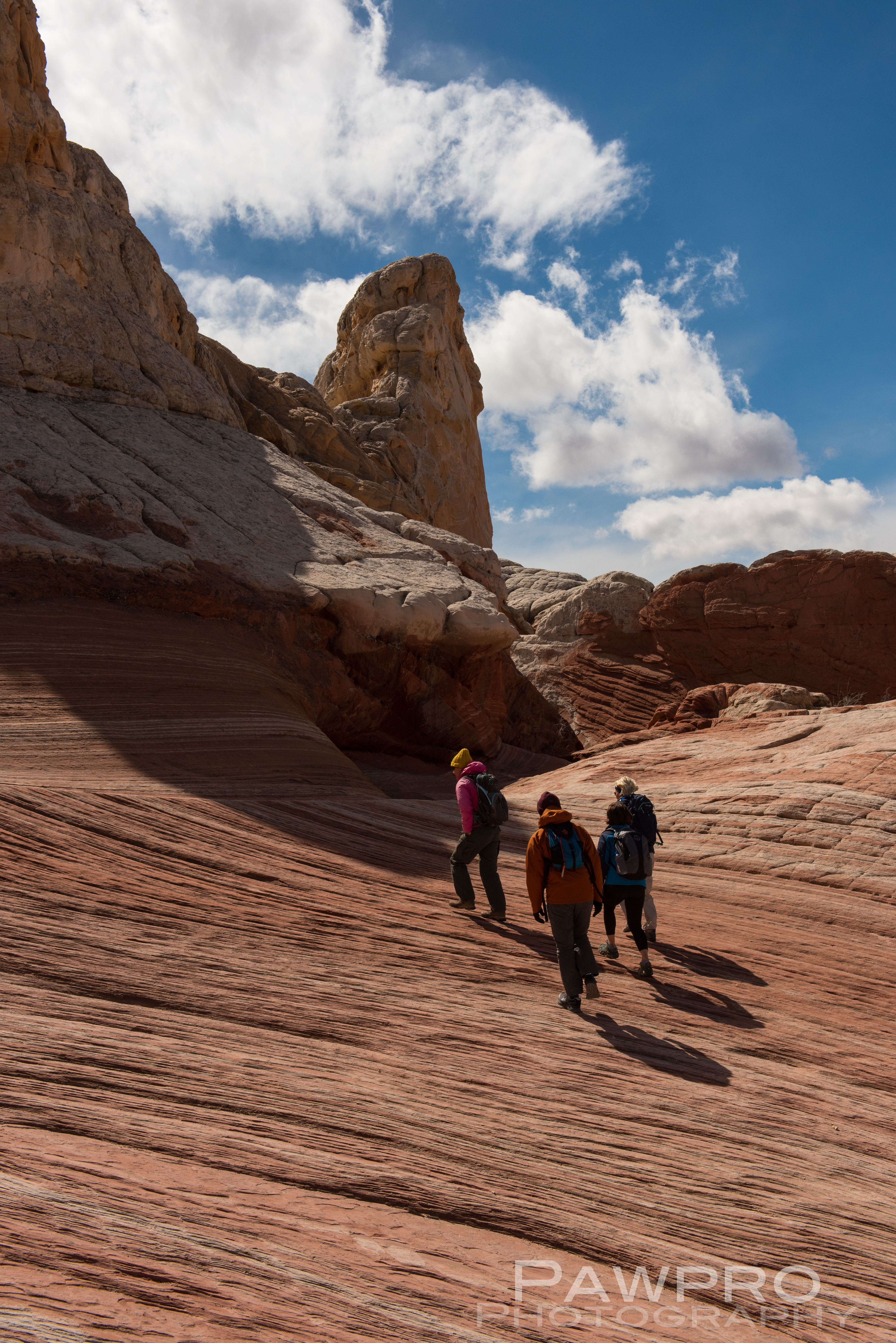
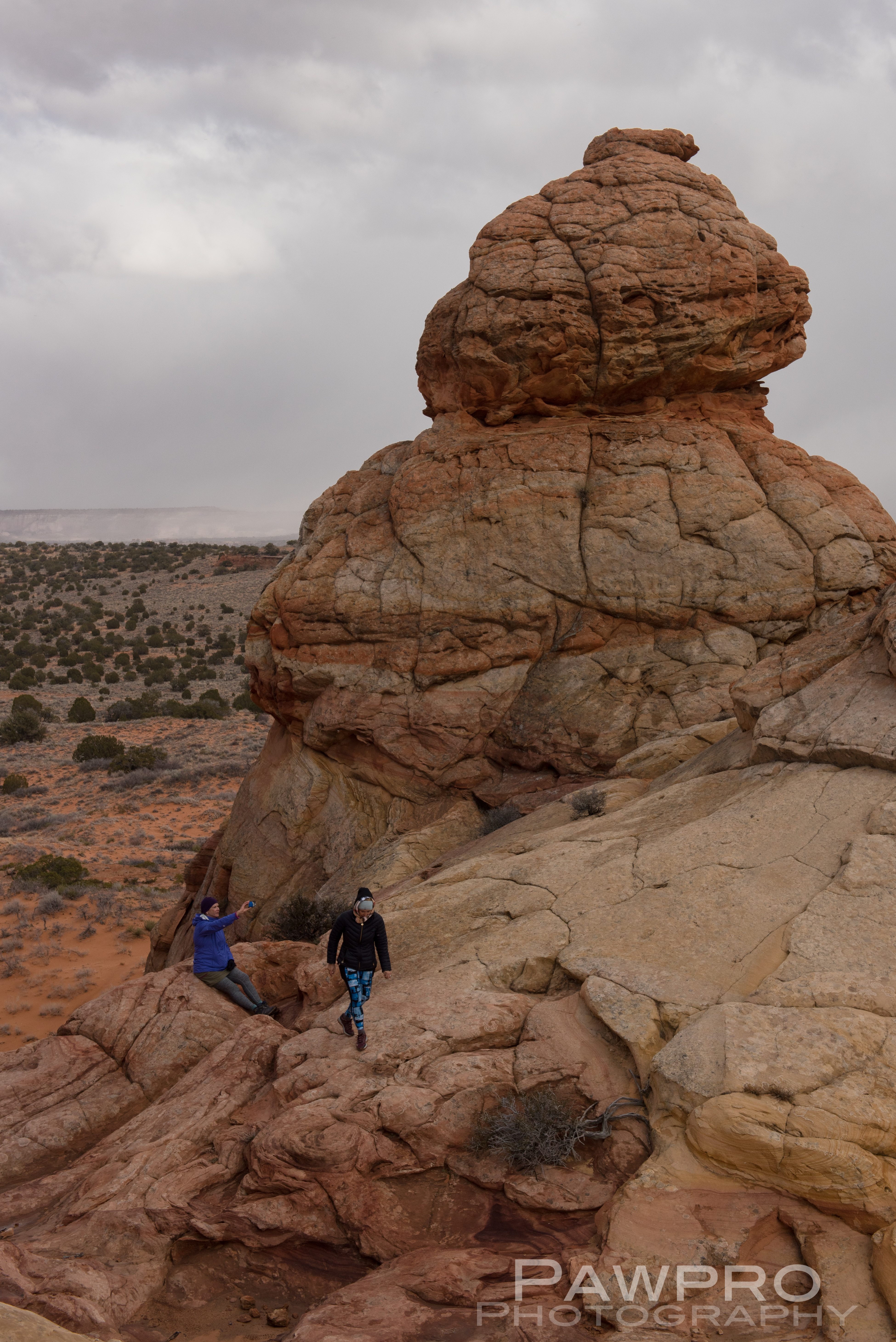
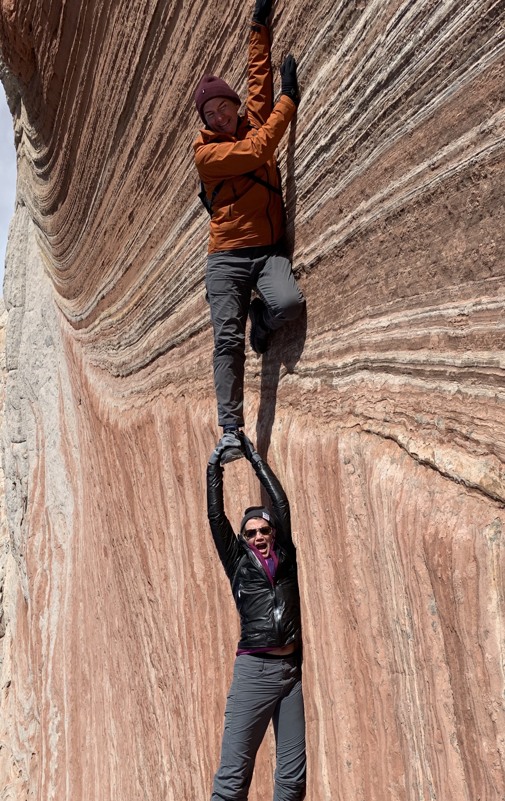
I considered trying to access South Coyote Buttes on my own, BLM permits in hand, but was glad I didn’t once I saw the conditions. The roads are tough and require a true high clearance, 4X4 vehicle. Your basic AWD, rental vehicle probably won’t cut it in the deep sand, potential deep mud, combined with steep inclines, large rocks and ditches. It’s also easy to forget the elevation because of the plateau. As with any mountainous region, conditions can change quickly. I spent most of the day in the area that started out with sunny blue skies, but quickly devolved into a disorienting, extended snow squall. If you get stranded or stuck you’re not likely to see a passerby until the next day. Ignorance, isolation and preparedness are formidable and the most common predators of visitors, say the locals. Even if you have the proper vehicle and feel comfortable behind the wheel in these conditions, navigating the infrequently marked, dirt trails, from one area to another could be another wheel spinner.
That being said, I can’t imagine how hot and uncomfortable it must be here in the summer months, an added danger for visitors. To me, March, April, and October are an ideal time to visit for this very reason. The temperatures can vary wildly but generally remains in a manageable range. Again, visitors must stay aware of conditions and be prepared for quick changes.
Our Guides and What I Wore?
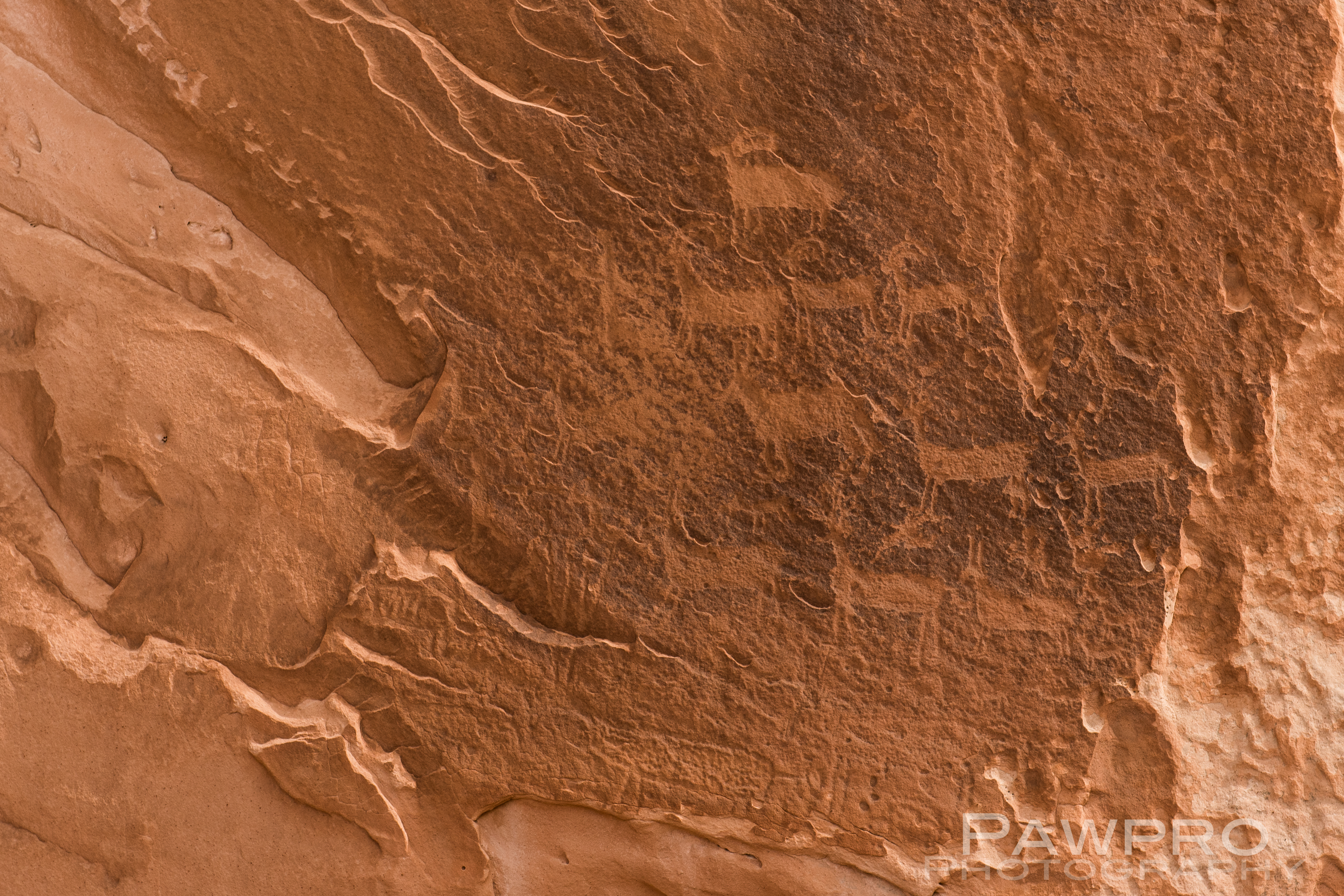
Witnessing the Native American petroglyphs, abandoned and deteriorating corrals and cabins now protected within this National Monument makes a visitor imagine what life was like for those early inhabitants. Early Native Americans–especially Puebloans– were thought to use the area for refuge while moving from one area to the next. During the wild, wild, west the formations functioned as hideouts. The remote, small, wooden structures along the primitive one lane roads are served by the ubiquitous wind mill-powered wells spinning nearby; an ode to turn of the century West. I imagined hearing the squeak of the spinning blades during the still of the night.
We chugged along safe and sound in our large SUVs equipped with satellite phones in case of an emergency. Getting stuck and having to spend the night out here is a reality for any visitor—no matter how prepared. Our guides from Dreamland
Safaris Tours were professional, well-equipped, knowledgeable and fun—most importantly. Each guide had their own individual style and stories about the places we visited. We had a great time getting to know them. (#DreamlandSafariTours)
Goofing around
We were treated to many archeological and geological artifacts throughout the exploration, but reminded not to take souvenirs.
As far as my outwear, I was happy to have many layers to keep myself warm as the temperature fluctuated and then dropped precipitously. During the snow squall the wind was howling and the temperature probably dropped 20˚, or more. A hard shell is a must to stop the wind and to stay dry. As a person who can feel cold when the temperature drops below 72˚ F, I am a big proponent of wool base layers, or any base layer for much of the year.
Being comfortable and knowing what you need in terms of layers is a learned skill. (See more specific selections below.) It’s different for each person. If you want to be certain you have the right outerwear, you must do some homework and know what works for you–wool, synthetic, down, fitted or loose, bluesign®, ethically sourced, etc. I prefer efficient, fitted, lightweight layers that breath and dry quickly, so that I don’t feel restricted by my clothing. And, always be prepared for the unexpected, whether that’s heat or cold. As far as shoes are concerned, a hiking shoe for extra traction will be helpful on this mild hiking experience. You might also want to wear gaiters to keep the sand out of your shoes, but it’s not a necessity.
During this adventure I also ran in the Antelope Half Marathon, visited Monument Valley, as well as several slot canyons. Check back for posts about those experiences very soon. Please do me a favor and take a moment to follow me here on my blog and on Instagram–especially if you found this entry helpful. More to come!
Unauthorized use and/or duplication of this material without express and written permission from this blog’s author and/or owner is strictly prohibited. Excerpts and links may be used, provided that full and clear credit is given to Amy Linn Doherty with appropriate and specific direction to the original content.
OUTERWEAR
•250 weight wool base layer (#Smartwool, #KariTraa, #REI, #Odlo are my favorites.)
•lightweight polar tech fleece (#OutdoorResearch Deviator or Patagonia R1/R2® w/ Polartec®, Alpha® Power Grid™ fleece is lightweight and efficient.)
•synthetic or down mid-layer (Patagonia Nano Air®, Arc’teryx Atom LT® are my favorites)
•Lightweight, Waterproof, Hard Shell Gore-tex® (The North Face® HyperAir® a favorite of mine because it’s lightweight and breathable.)
What started as a crazy Grand Canyon notion among an assorted group of empty nesters, mid-lifers, one twenty-something, and an eleven-year-old from Northern Virginia became a collective reality, and a substantial Southwestern adventure accomplishment for me and my son back in 2014.
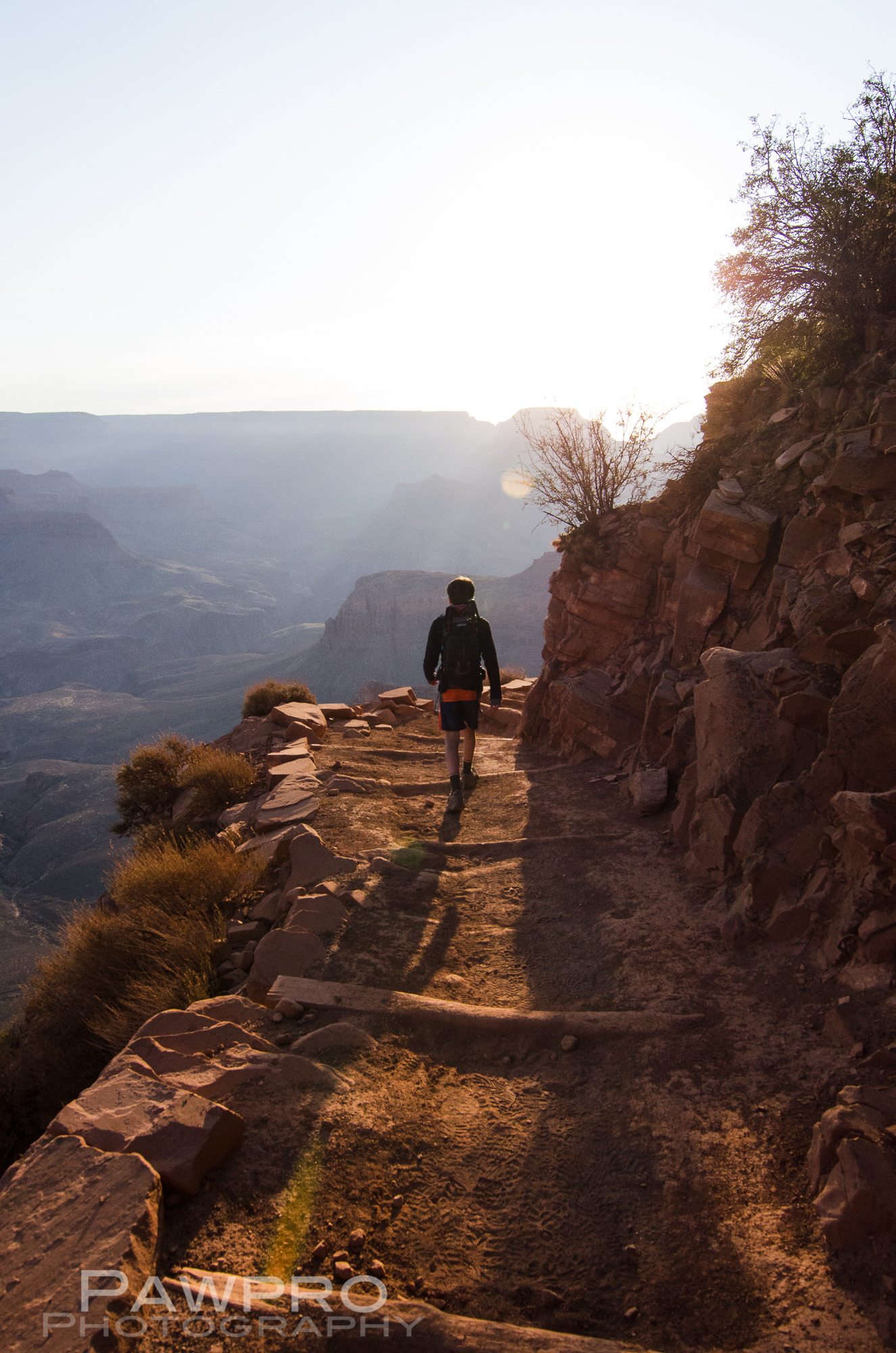
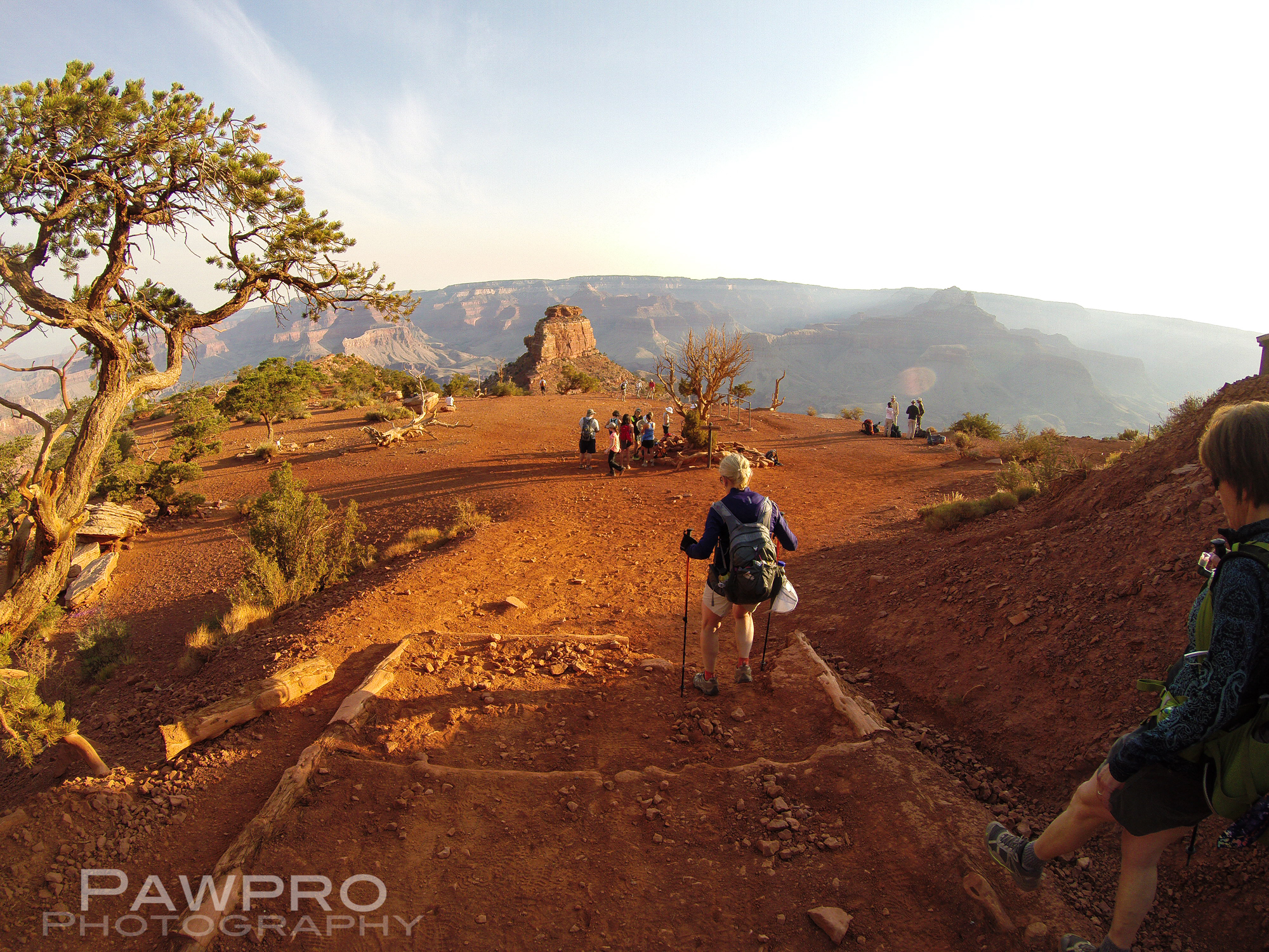
All I wanted to do was take my youngest child–on the precipice of becoming a teenager–on a memorable, somewhat significant trip. In all honesty, I had never heard of hiking the Grand Canyon from rim-to-rim, and I certainly never imagined doing it in one day. The more conventional experience is to hike down to the famed Phantom Ranch, spend a night or two camping at the bottom of the canyon, and then hike out to the North Rim. Instead, we were going to hike from one rim to the other in one day
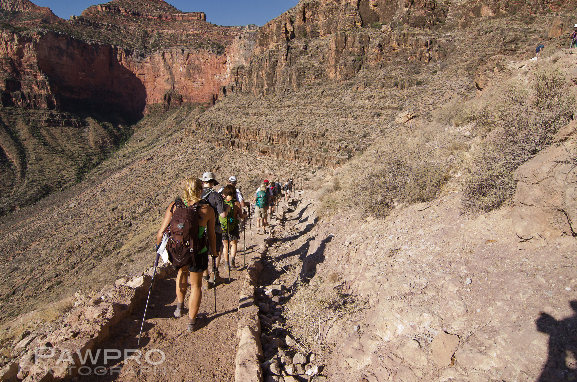
Ranging in age from 11 to 62, our group of 15 men and women, and one child hiked the rim-to-rim in 2014. This undertaking includes 23.4 miles, 11.5 hours, 7 miles down the South Rim, 9 miles across, and 7 vertical, winding miles up and out to the North Rim. Weather conditions can make any crossing experience vastly different and more-or-less extreme from one day to the next.
Entering Cedar Ridge
This isn’t a hike recommended by park rangers, I assume because hikers so frequently misjudge hydration and fitness needs even for the shorter hikes, and become stranded. Indeed, not long after we attempted this hike the National Park Service made similar hiking groups acquire a Special Use Permit in order to attempt a rim-to-rim in a group of this size. You’ll see online that some websites specifically discourage rim-to-rim hiking, while others promote ultra-style, rim-to-rim-to-rim runs of the canyon, and the like. All I can tell you is, as we began our ascent up to the North Rim, we passed a tiny helipad, and minutes later a small aircraft took off with a woman who had reportedly broken her ankle. The risks and logistics are real, and the rescues difficult, not guaranteed, and expensive.
That said, we too had a new hip in the group, knees that needed replacement, tendinitis, tight IT Bands, lower back issues, poison ivy, and blisters. In fact, my son had been rushed to an urgent care after landing in Phoenix two days earlier because of a sudden ear infection. So, while we were a tough, conditioned group–most of whom met via a 6a.m., all-year-round, outdoor, boot camp–we had plenty of potential health issues that could have become an issue at any point.
An Early Start
The day of the hike started at 4:40 AM when we all met outside our South Rim cabins to catch the shuttle to the South Kaibab Trailhead, the shorter, but more steep way down. It was an ideal 38˚F. We were told no water is guaranteed on these trails until you hit the bottom, so everyone carries their own. We paused at the start of the trail in the company of other hiking groups heading out for adventures of their own.
Along the South Kaibab Trail of the Grand Canyon.
By the time we reached the bottom the temperature could reach 90˚F or higher, but we were lucky and these extreme conditions didn’t materialize on this late May day. However, there was a little lightning as we hiked, another regular threat, but it stayed well in the distance. (Distance being a relative term on foot and within the Grand Canyon.) We each also carried a change of clothes and toiletries for when we reached the North Rim Lodge, which seemed more like a dream as the day progressed and the miles underfoot accumulated.
Hiking within the canyon, lightning in the distance.
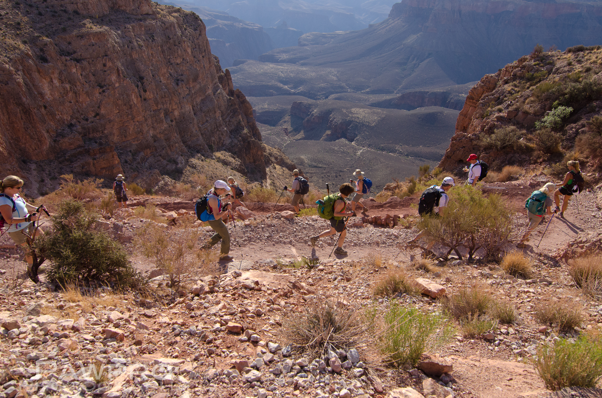
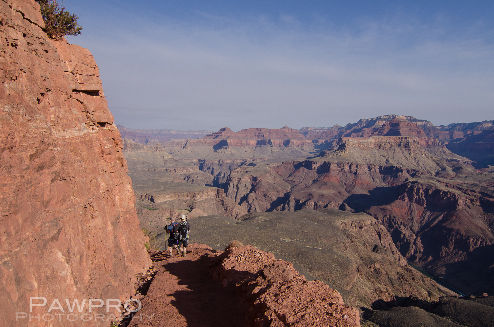
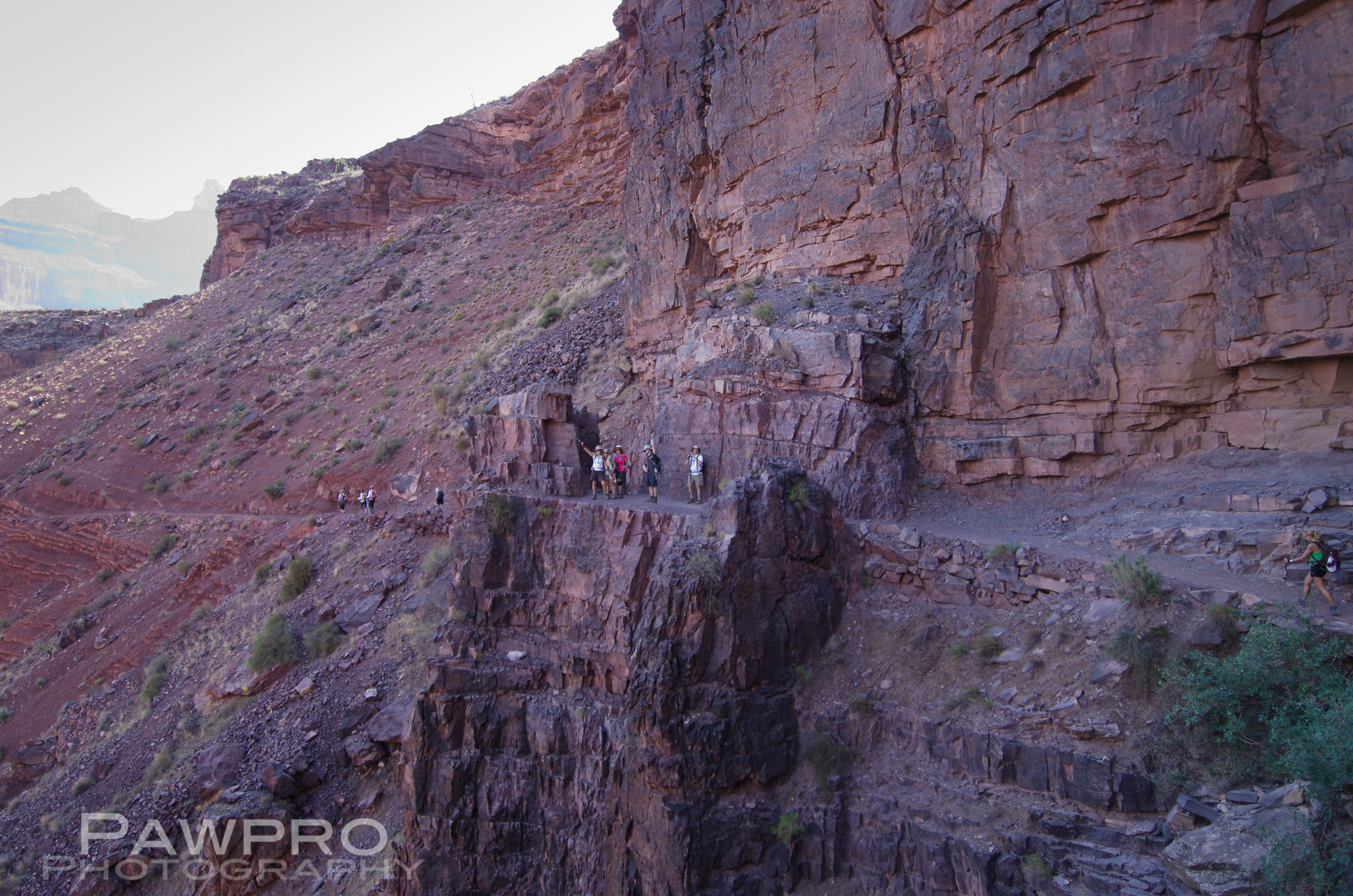
We marveled at the awesome natural spectacle of the early morning canyon, the tips of the layered, red rock walls painted with a warm glow of sunlight as our feet and toes hammered down the well-traversed, sometimes stepped trail, spattered by mule dung and giant, puddles of vaporizing mule urine that by the time we reached the North Rim functioned as smelling salts for at least one in the group–me. I can only imagine how more intense this smell would have been on a hot day.
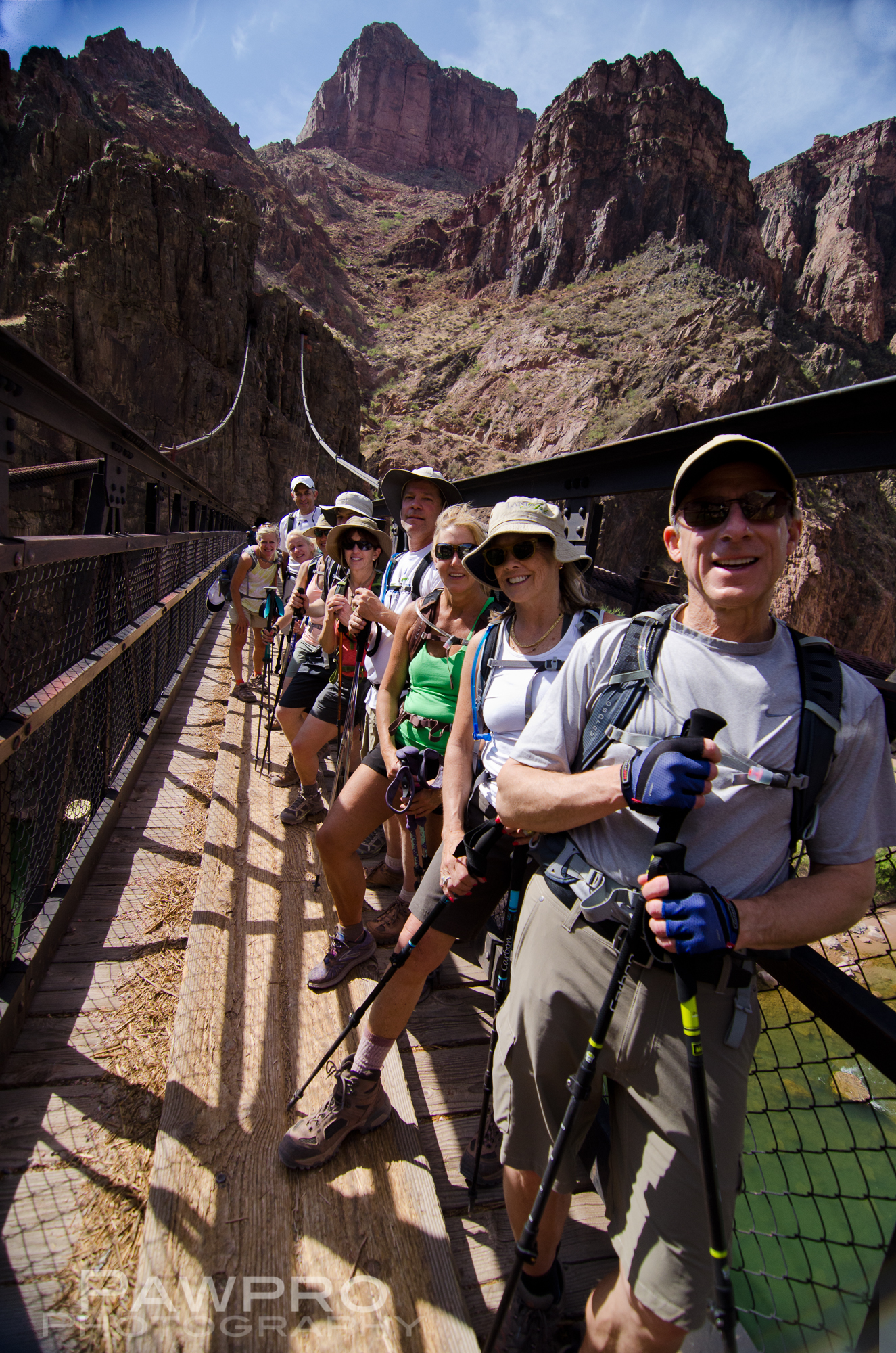
As we descended, the excitement grew as we caught the first glimpses of the distant, calm, emerald green portion of the Colorado River we would soon cross on the heavy gauge wire and plank suspension bridge.
We stopped and ate the boxed lunches at Phantom Ranch, which we’d pre-arranged via the National Park Service system. Some of us soaked our feet in the super cold water of the nearby stream, which was a mistake I would later regret.
Soaking my feet mistake.
Rain, thunder and lightning could not dampen the group spirit as we headed towards our last break at the encampment called Cottonwood early in the long 5400 foot climb up the North Kaibab Trail. The average grade is 21%. We took only two extended breaks during the day to eat and use the rustic, hole in the ground bathroom facilities, and limited our time at these spots. We wanted to finish in daylight, but were prepared with headlamps if we didn’t make it in time. We nibbled on trail mix and various incarnations of jerky. We continued to be amazed by the grandeur of the canyon at every turn, but more and more our gazes remained on our feet, and the strikes of the hiking poles getting deeper as we began the long climb out.
As the Day Wore On
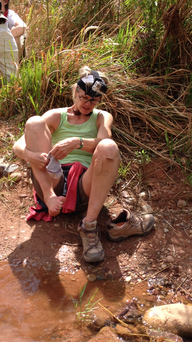
While we stopped and posed for photos frequently on the way down, this activity became an unnecessary use of valuable time and energy on the climb out. I had developed a few blisters, and the pounding of my toes within shoes not quite sized right had started taking a toll. At least that was the slightly dehydrated thinking that was going through my brain. The camera mounted on my forehead was beginning to chafe the skin as it bounced up and down, but that pain was nothing compared to the one manifesting in my feet and thought process. I had long since packed away my Nikon D7000. I took only two photos on the climb out, while being chided by the climber sporting a new hip for not taking in all the scenic points behind me. I was in too much pain. Plus, I failed to dry my feet completely after soaking them in the stream earlier, which spurred the hot spots developing. During some relentlessly steep stretches and endless switchbacks my breathing sounded as if I had just completed a series of wind sprints. “I was in better than average shape.” I was saying to myself, “And this climb is kicking my ass!” Thinking back, I was probably carrying too much water and too much camera gear, AND had spent too much time making sure my son was eating and drinking enough.
Me as I finally saw the end.
Grand Canyon North Rim Cabin
In the end, it was the 11-year-old and twenty-something who finished first, youth and two days of antibiotics working their magic, I tell myself. The rest of us finished in small clusters, grateful for the chance, the place, the cool temperatures, and the camaraderie. We had all done it! We had successfully hiked the Grand Canyon from rim-to-rim in one day.
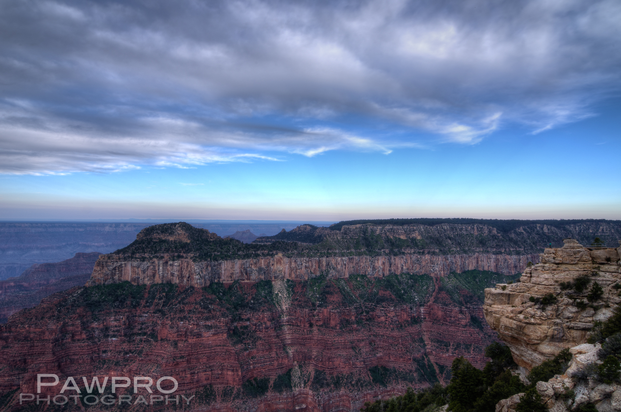
We spent a glorious night at the North Rim Lodge. I couldn’t tell you what I ate that night. The dining room overlooks the canyon. We could see the lights of the South Rim as nighttime came. My son fell asleep at dinner, the table served as his pillow. We woke the next morning to the full scale glory of a sunrise at the Grand Canyon’s North Rim.
This slideshow requires JavaScript.
These places face a growing threat–economically and environmentally. The Grand Canyon was officially protected and preserved 100 years ago so that future generations can enjoy it. We must remember we aren’t the first, and we shouldn’t be the last to see it and experience it.
Unauthorized use and/or duplication of this material without express and written permission from this blog’s author and/or owner is strictly prohibited. Excerpts and links may be used, provided that full and clear credit is given to Amy Linn Doherty with appropriate and specific direction to the original content.
Adventure seeking and adventure travel is fairly mainstream these days. Folks don’t think twice about flying all over the world to hike or run a trail, to see mountain ranges and views we’ve previously only seen in books and magazines. In my family, a hike was something I might get my father to do for an hour or two somewhere, usually in woods walking distance from home. Fast forward to a new millennium and an outdoor industry that dwarfs what it was thirty and forty years ago, and the world is seemingly smaller, all places more accessible, and companies and guides aplenty to help you find your way wherever you want to go.
This, “everything is possible” adventure seeking attitude has gotten out of control in some extreme places such as Mount Everest, where folks, who don’t have the skills or physical conditioning to be there, climb to their deaths, and dangerous conditions are amplified by the sheer numbers of people finding guides willing to take them. (Not to mention the risks and dangers they are asking sherpas to make and the consequences to the environment.) I wasn’t planning to go extreme, but I did want adventure, to be within and somewhat at the mercy of my abilities and in proximity to a natural wonder.
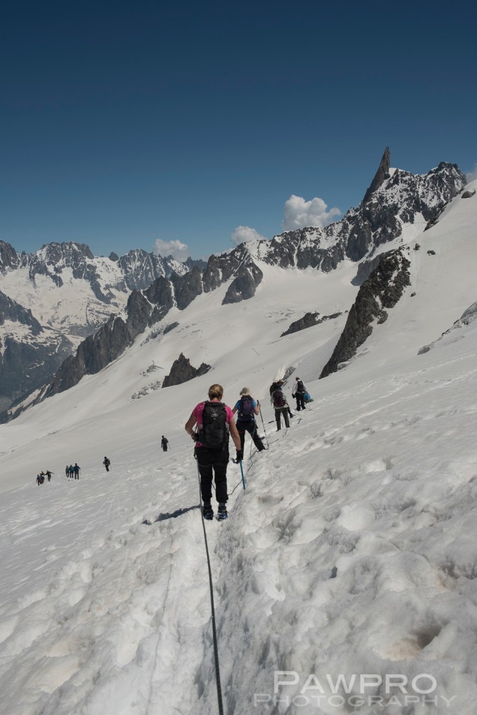
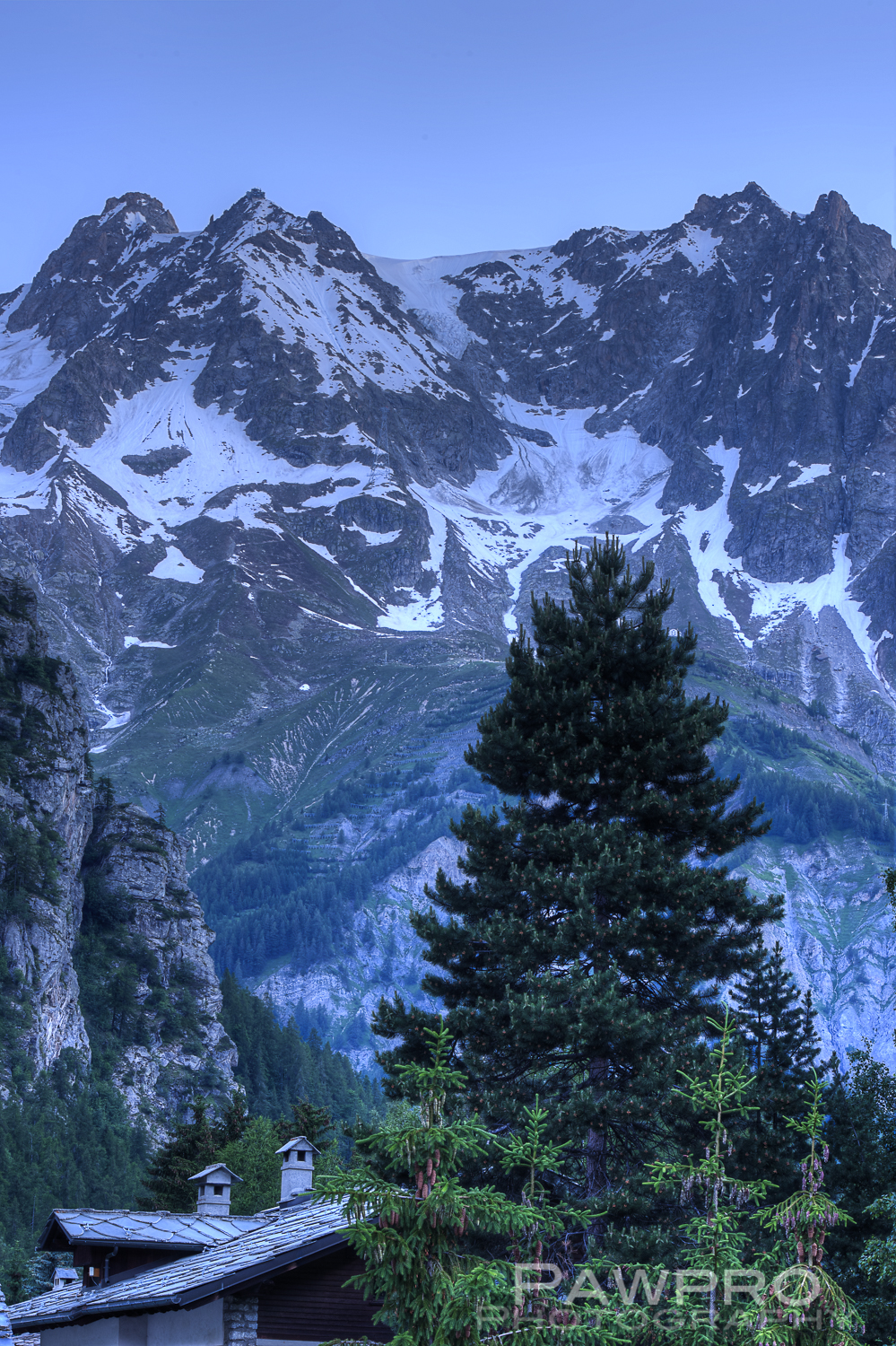
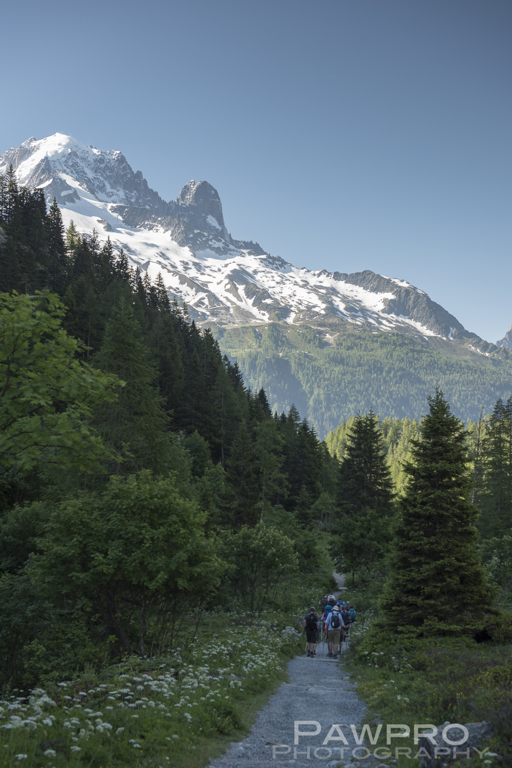
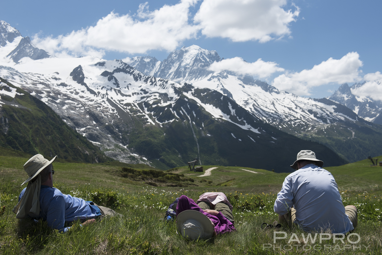
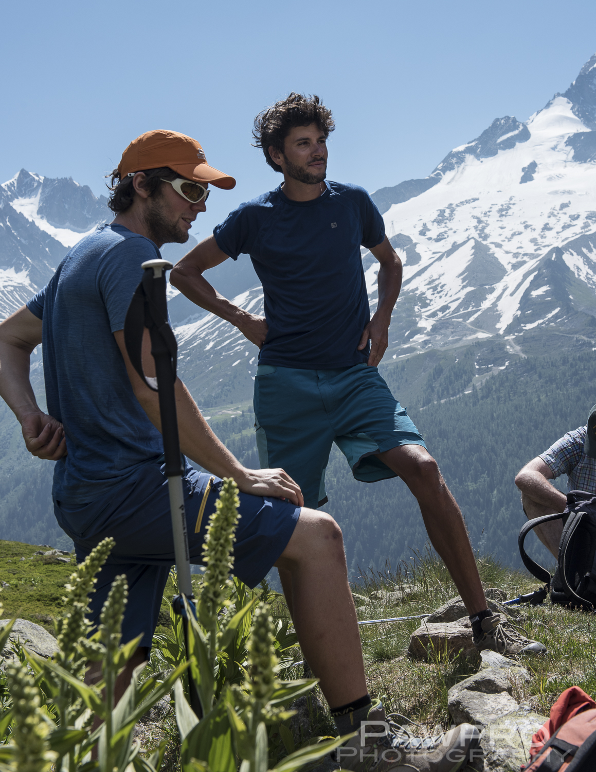
In June, I decided to bite off a chunk of adventure on a manageable scale, and headed to Chamonix, France to hike in the Alps on the infamous circuit surrounding the Mont Blanc massif, commonly known as Tour du Mont Blanc (TMB). A more reasonable, but still challenging morsel of exploration. For good measure, I threw in a glacier hike because why the hell not, when I’m surrounded by world famous, mammoth glaciers.
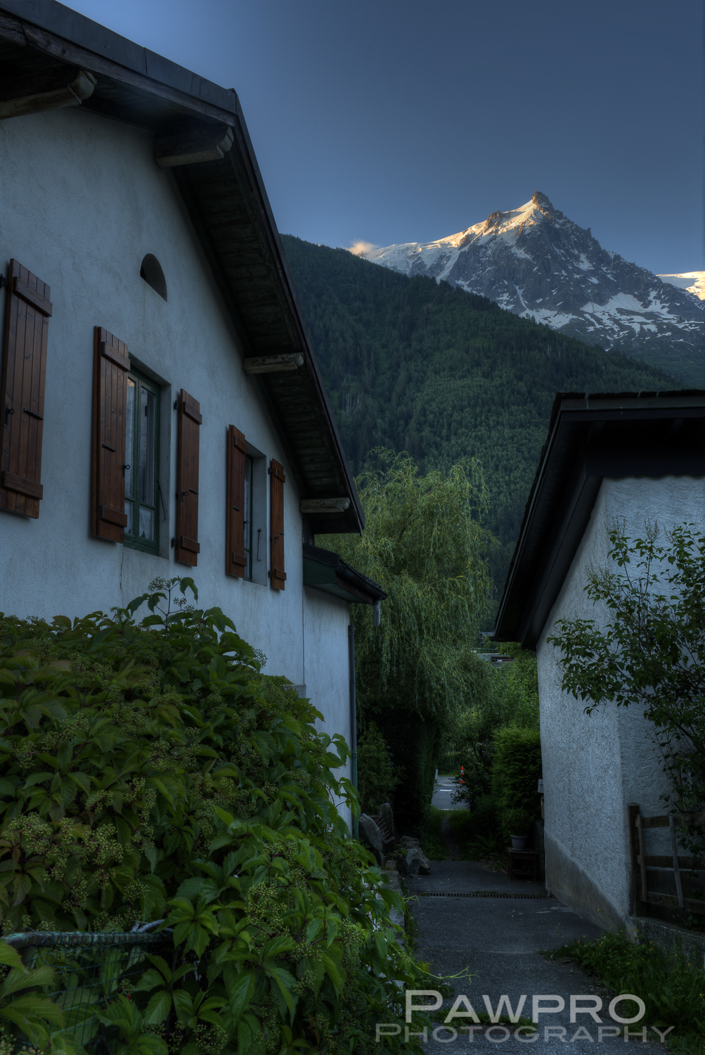
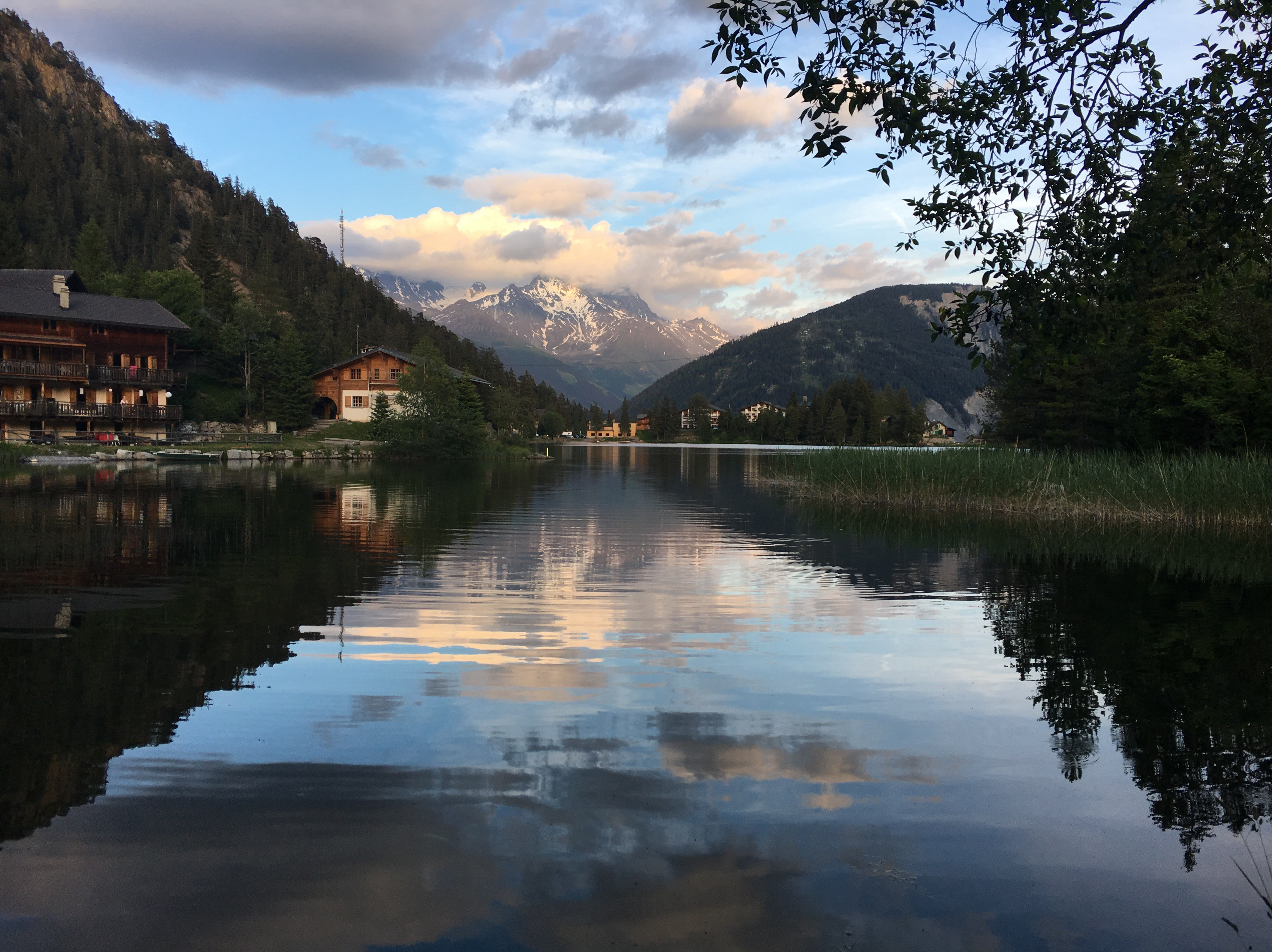
Early morning of Mont Blanc from Chamonix.
Glacier Hike
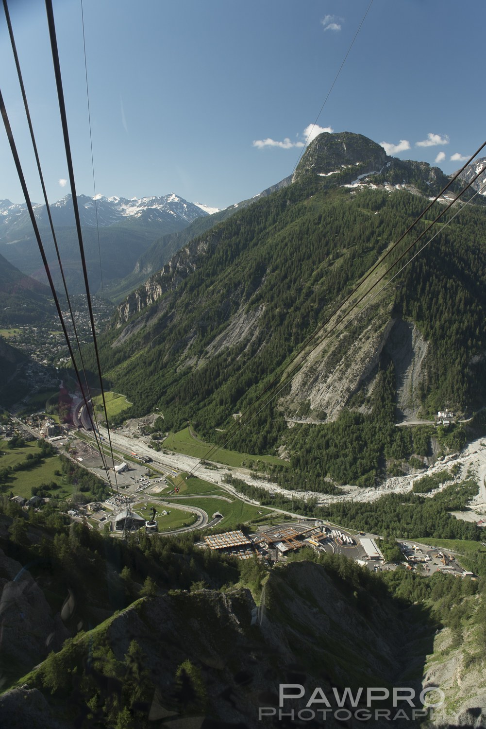
A group of 12 of us staying in Chamonix were picked up early by two guides (Mountain Spirit Guides for our glacier hike. We had all previously communicated with the guides about having suitable boots that can accommodate crampons, and the rest of the gear, ice ax and harness, was supplied. We each brought our own lunch. We had planned to step out of our hotel’s front door at Hotel l’Heliopic and head up the Aiguille du Midi cable car, but the lift, literally just outside the front doors, wasn’t working. We were to hike down the ridge from Aiguille du Midi to Pointe Helbronner, a four hour hike across Vallée Blanche to the Italian side of the mountain range overlooking Courmayeur, but it wasn’t to be with the Midi cable out of order. That was a huge disappointment as I had hoped to get some early morning photos from this famous vantage.
The vantage from the Pointe Helbronner gondola.
Hiking past a giant opening during our glacier hike.
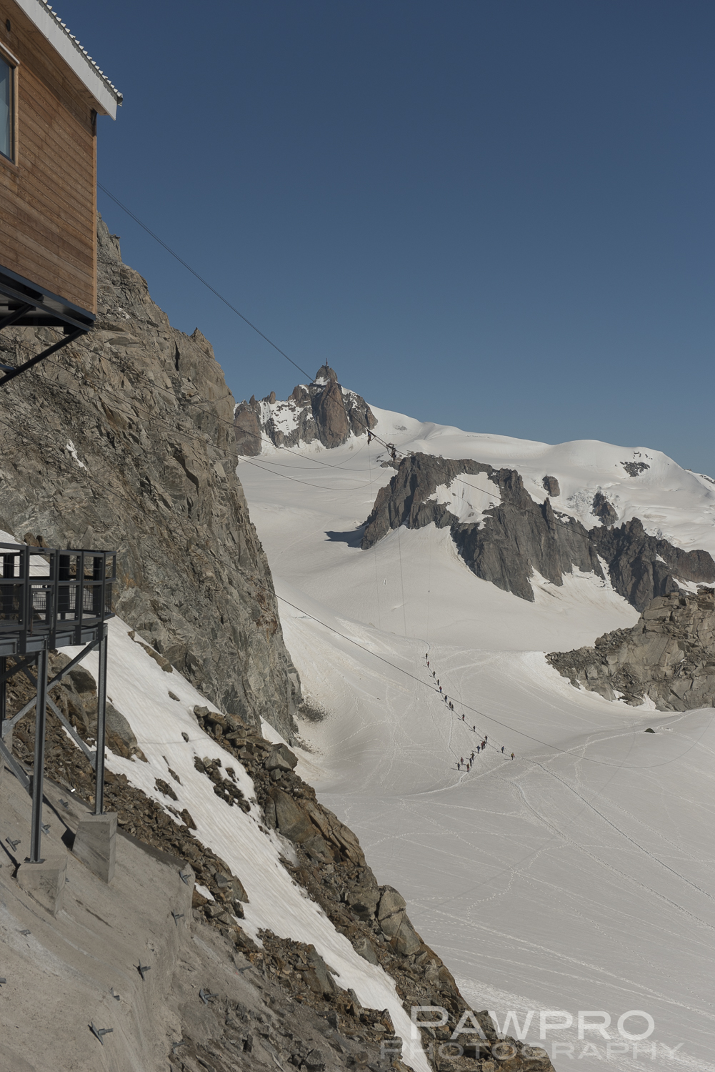
So, we headed through the 8 mile tunnel under Mont Blanc towards Courmayeur, Italy. After we were briefly detained at the border by the Italian police, whose flamboyant feathered hats seem to contradict the cradled machine guns in their arms, we were allowed to proceed. It was a beautiful, sunny day as we headed up to Pointe Helbronner on a relatively new, rotating gondola that held probably 40 people on each trip up. Two different cables get you to the top at Pointe Helbronner (3462m) station, which is an impressive, modern facility that appears well-equipped to handle the severe conditions and crowds of all kinds, but we didn’t hang around long enough to enjoy it.
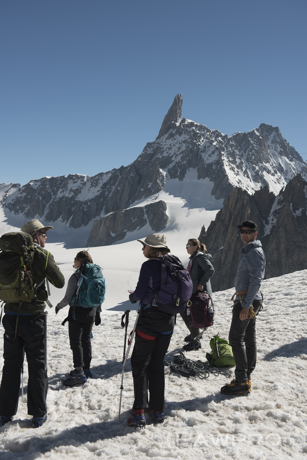
As we headed down the platform to get on the glacier there was a waist high bar. We tried to find a way to release or swing it open. We struggled a few moments wondering what we were doing wrong. Our guides corrected us, “Just climb over.” Pretty sure there was a mental “stupid” ending that broken English sentence. Not sure if it was a subtle test to weed out those who probably shouldn’t head out on the glacier, but it struck me as an #SNL way to do it. If our guides were testing our experience level, we’d probably already either failed or received a very low score in the parking lot as they watched us struggle to put on our harnesses.
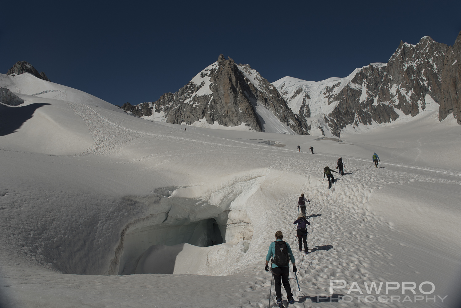
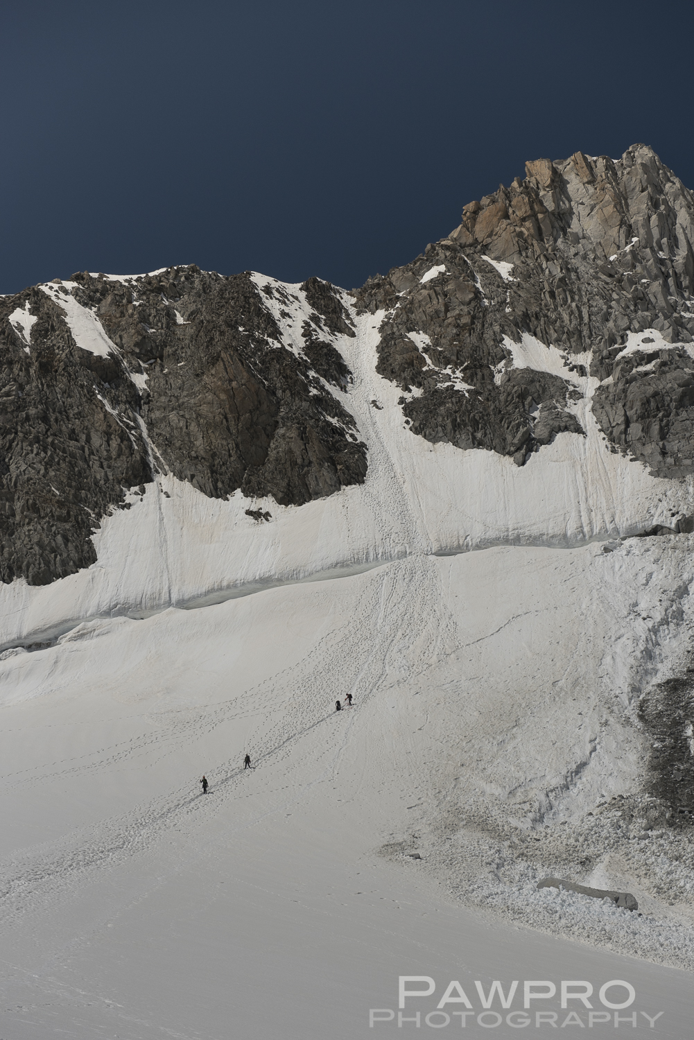
Glacier hikers descending from Aiguille du Midi on the distant peak.
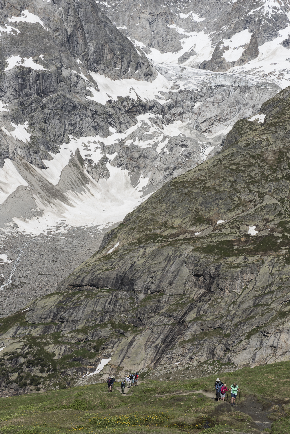
I was placed at the back of one of two tethered hiking groups we formed, so I could take photos. The sun was strong and the snow soft and slushy even at 8:30 AM. In the distance we could see ant sized lines of people heading in multiple directions on the various glacier fields and rocky landmarks poking through. None of us had hiked on a glacier previously, so we listened to the safety talk in earnest–keep our spacing in case someone falls through, follow the path of footprints, use the ice ax upside down as a trekking pole, if someone falls through just sit and wait for a guide to come help. Each directive seemed to end with the phrase, “. . . in case someone falls through”. I had purchased the special travel insurance that includes rescues and medical evacuations precisely because of this idea. We passed large, two or three story glacial outcrops, and jumped across an area where there was some undefined crevasse below without incident. There are no danger signs, just the natural kind from knowing the area and understanding changes in the snow’s surface and the patterns that form. That’s why you have guides. We stopped occasionally to catch our breath. It didn’t take long in the warm conditions to begin sweating as if we were back in Virginia doing the boot camp that brought most of this group together as travel companions.
I’ve hiked a rim-to-rim at the Grand Canyon, Angel’s Landing at Zion after running a half marathon, and numerous other destination halfs. It didn’t take long for my legs to feel the effects of hiking in the wet snow, which wasn’t altogether different than running in sand up and down dunes. If you’ve ever been to Jockey’s Ridge in North Carolina, it was similar to that sensation. At one point, I started to think maybe I shouldn’t have scheduled this the day before starting the TMB; my hips were not enjoying the sliding movement. As we hiked up to our lunch spot we saw climbers on the rocky outcrops far enough way that, at first, they didn’t look like humans. How long did it take them to get there, I wondered. Distances were skewed in the vastness and the clearness of the air. There were occasional tents off in the distance, belonging to climbers who spend days and nights near areas they want to climb.
Hikers descending from a climb up one of the rocky summits along the Mont Blanc massif.
We hiked two hours on the Cirque du Maudit, a circuit down into the depths of Glacier du Géant in a U-shape fashion swinging wide around Petit Flambeau and then ascending up to another ridge known as Col d’Entreves where we sat down for lunch overlooking Courmayeur. The temperature dropped probably twenty, or more, degrees and the wind picked up considerably at the summit. Our huffing and puffing on the climb up left us all sweaty. We added another layer to stay warm. There wasn’t any wondering around for different vantages because we remained tethered while we ate, and we didn’t want to become entangled.
We retraced our steps back to Pointe Helbronner after lunch where we were all grateful for the ride back down on the cable. Climbing the last part out of the valley up to the cable car you could imagine, to some extent, how hard climbing Everest must be. The hiking was fairly slow going, yet, we had ideal, downright pleasant, 60 degree, conditions. Our guides urged us to move faster to stay on schedule, which was met with general disregard from many in our group. By now, the crowd was very large at Pointe Helbronner with hiking groups.
After a shower and a steam back at l’Heliopic, I walked around Chamonix taking photos and shopping as dusk approached. The rest of the evening I spent nursing a sunburn on my face and lips. Four hours on a glacier on a perfectly clear day, and I hadn’t re-applied lotion. This was a costly mistake in terms of my comfort in the following days. Don’t underestimate the amount of discomfort caused by severely chapped lips.
Early morning street scene in Chamonix.
The next morning we were to start the Tour du Mont Blanc.
Tour du Mont Blanc (TMB)
A mutual friend had used a small, boutique outfit in Switzerland, called HappyTracks GmbH the previous year, and returned with only good memories and great photos. The owner, Raphi, short for Raphael, a native of Switzerland, splits his time serving in the army, as is mandatory for Swiss men of a certain age, and his trail guide business centered out of Trient, a tiny Swiss town along the TMB. He creates personalized tours based on the needs and timeframe of guests. This year he added a hostel/refuge to the repertoire that serves hikers en route. Hiking the entire circuit takes roughly eleven days, but there are endless alternate legs and add-ons, so it would be easy to spend more time exploring. Our plan was to hike for five days, averaging about 10 miles a day, and left it to Raphael to choose the segments, as well as the hotels where we stayed. We ended up hiking the northern half of the trail. A second guide was necessary because of the size of our group.
Days 1 and 2 TMB
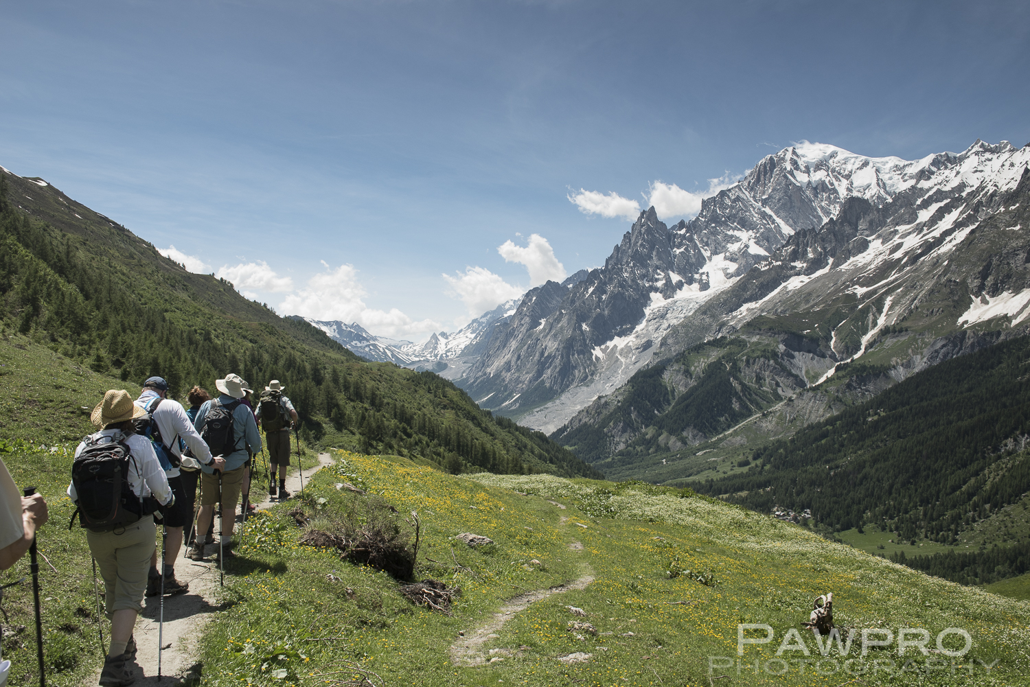
Our first and second days started from the Val Ferret in Italy heading in opposite directions. On the first, we had a moderate climb heading back towards Courmayeur in a southerly direction, along a natural balcony overlooking the valley with Mont Blanc in the distance the entire day.
Mont Blanc on the right as we spent our first day on the TMB overlooking Val Ferret.
The TMB is ornamented with an assortment of rifugios where hikers may spend the night or stop for a bite to eat along their journey. Some are known for their desserts, as well as coffees, teas, beer, wine and food are available, and most have spectacular views. Sleeping accommodations in these refuges are either open dormitory style, and some do offer more private options. They are usually quaint, stone and wood structures built to withstand the heavy, deep snow. They’re generally filled with trekkers and overnight guests sitting outside resting and enjoying the views that are hard to accept as reality. On the first day we stopped at two; Rifugio Bonatti was first and we ate our own packed lunches on the patio terrace, which they didn’t mind.
Heading down to Courmayeur from the TMB on day 1.
Our guide didn’t have to suggest too strongly that we patronize more than the picnic tables and restrooms. Most of us enjoyed some coffee, or more. Later on the first day, as we began our descent to Courmayeur, we enjoyed a beer at Rifugio Bertone that has a front row seat on Mont Blanc. One can only imagine what alpine spectacles one might see from this spot at sunrise and sunset throughout the year.
After our beer, the two plus hour climb down was impressively long into Courmayeur. As we left the forested trail towards our hotel for the night, we were revived by the details and beauty of the homes along the small roads. The town is clean, old world, somewhat Bavarian feeling. We made our way to the Hotel Crampon on foot, a family owned small hotel where we initially overwhelmed the ladies at the reception by arriving all at once. Our dirty boots were taken and placed in a common mudroom with cubbies as we were given our room keys, and we decide to meet in the bar after getting settled.
As with many of the hotels we stayed, the buildings were old and filled with the kind of charm that only time can bring. Our room was large, renovated and clean with heavy French doors constructed long ago, leading to a generous balcony overlooking town, and the very section of the Alps we had hiked the day before on the glacier. It was a perfect vantage for photos at sunrise. I was sharing a room with my friend Kathy, and we were very comfortable. We showered and headed downstairs to meet up for dinner and a drink. Cautiously, we asked the woman at the reception area, who checked us in, for directions to the bar. She had been a little frazzled earlier. She kindly showed us, and instantaneously transitioned to our server/bartender. As she poured our drinks we talked, she warmed up and we learned that she is a part of the Grivel family that owns the hotel, and her great grandfather and uncle were well-known mountain guides and forgers in the area who also developed the first 10-point crampons, followed by a 12-point version. In later years a newer, lighter model known as the “Super Light Grivel” was used by world famous mountaineers such as Sir Edmund Hillary as he attempted Mt. Everest. We had a great conversation with her. It was my favorite hotel and town of the trip. I got up early to take photos of the mountains from our balcony vantage.
Our balcony view of the Alps from our Courmayeur hotel.
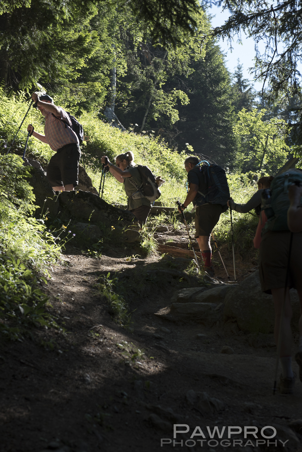
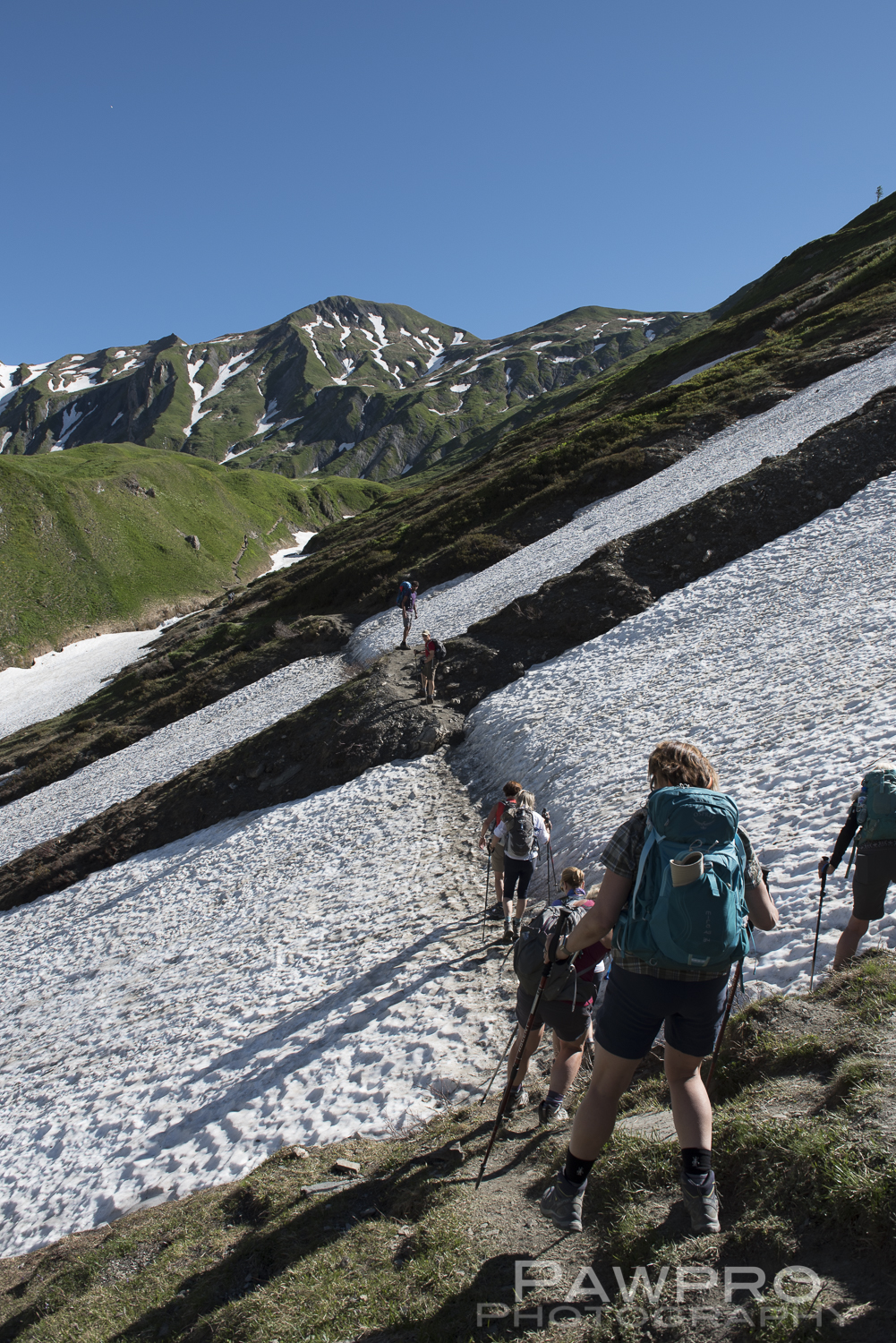
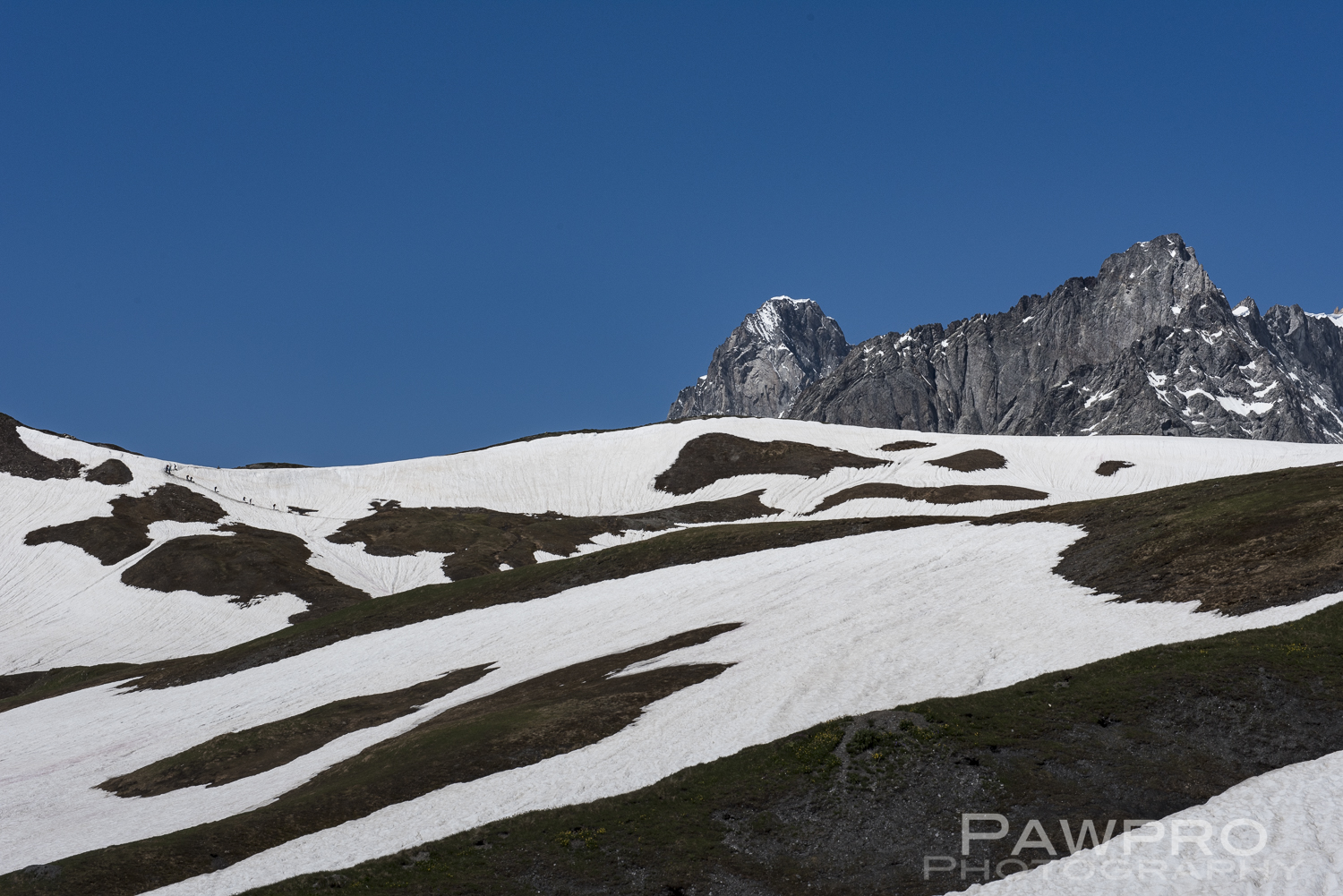
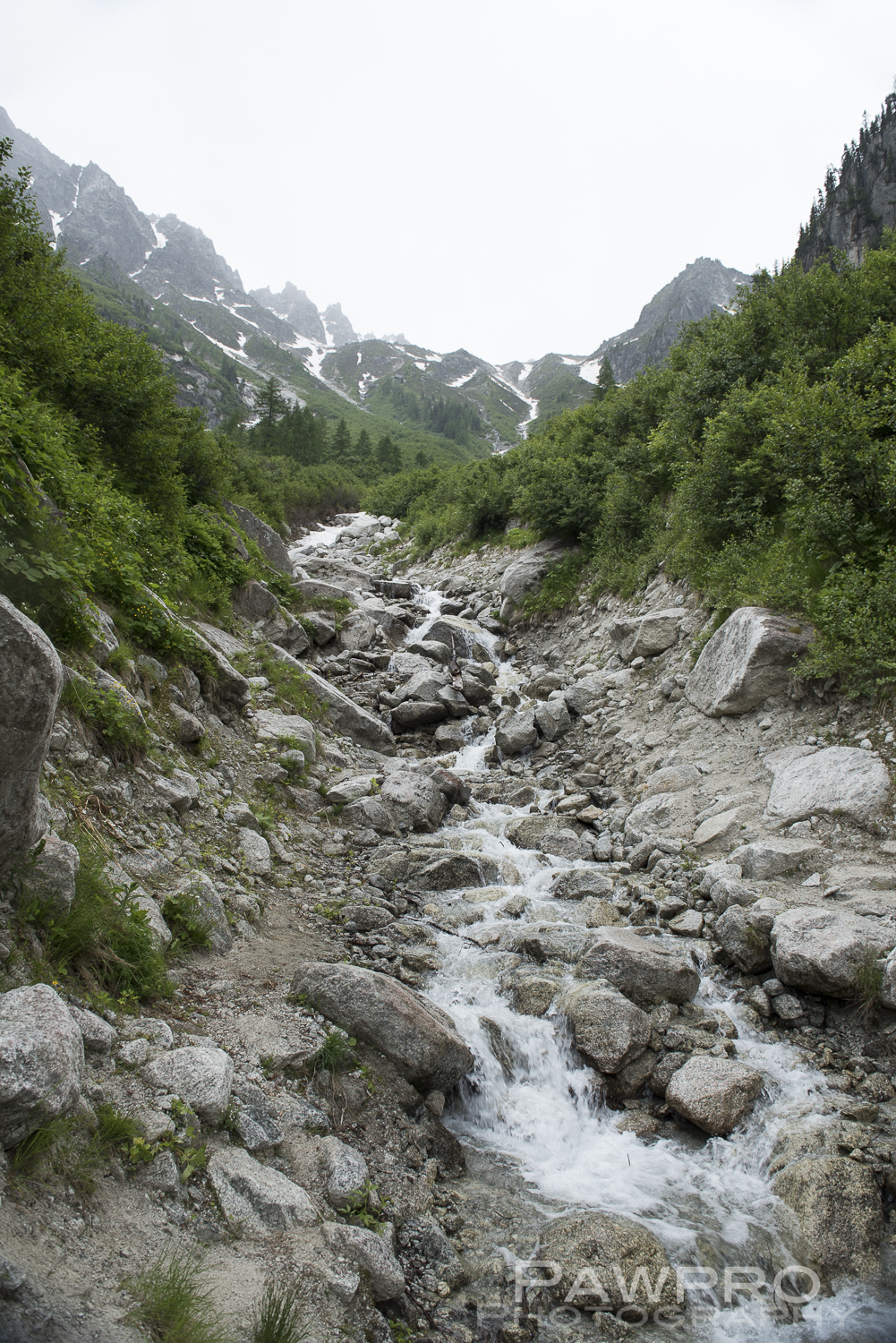
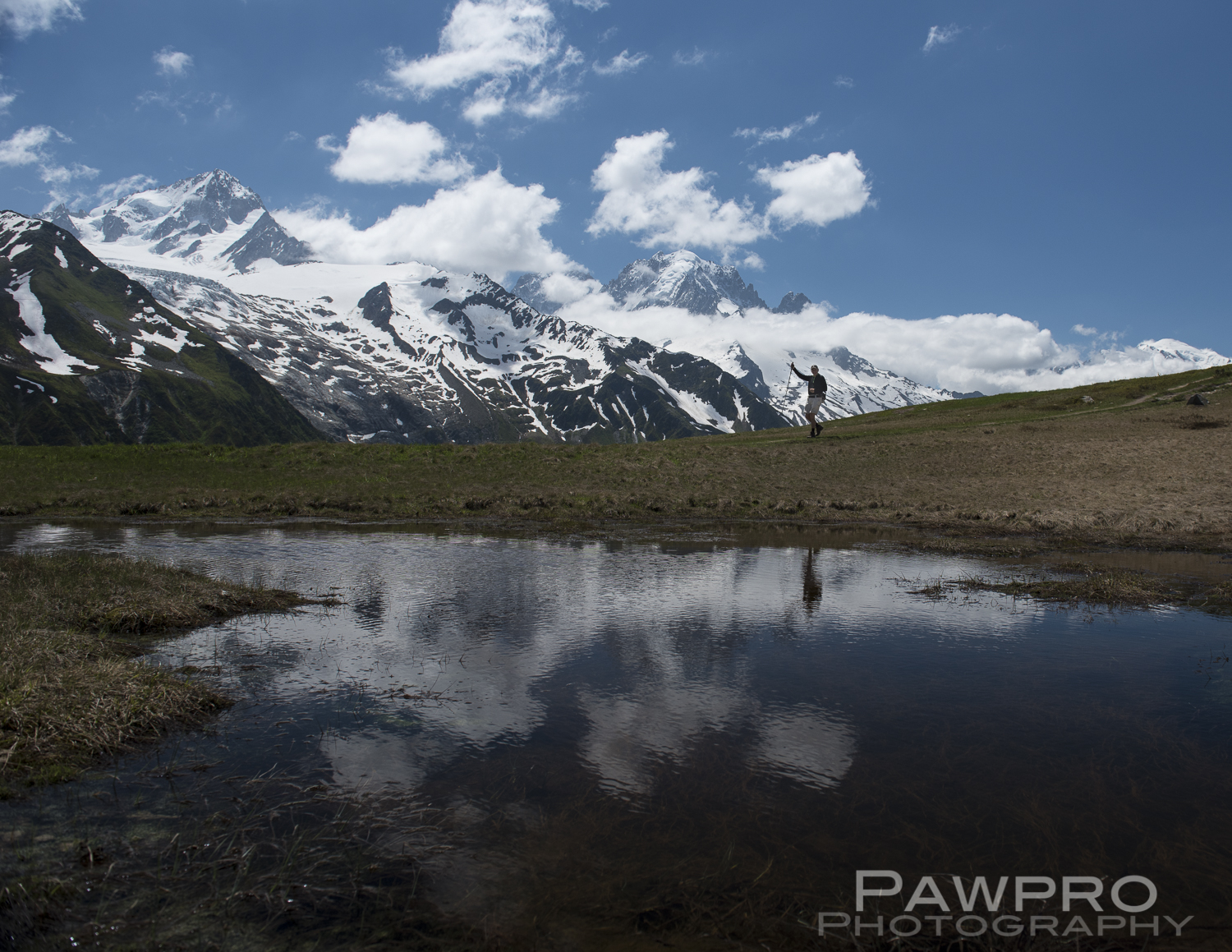
After breakfast in the hotel’s white clothed table dining room, we were picked up by our guides and driven back to Val Ferret. Today we headed up to Grand Col Ferret the summit separating Italy and Switzerland and the two valleys that make up Val Ferret in these respective countries. On our second day we were now more comfortable crossing the occasional snow flows that adorn the mountainsides. Some were 30 or 40 yards across and the grade just steep enough, and the snow just wet enough that one slip could see you sliding down the side of the mountain a great distance that would culminate in either falling through the snow and ice to the fast running stream of water beneath, colliding into a boulder, or falling off some precipice to a rocky landing of a greater or less significance further down slope. It was the kind of surface that if you have a fear of heights or feel unsure of your footing, your nervousness could amplify the danger. As long as you remained loose and agile you were relatively safe. In these spots the trekking poles were critical for all.
One of many snow flows, for lack of a better term, we crossed.
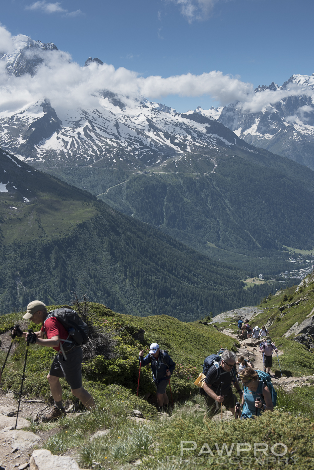
Unlike the previous day which included open meadows of flower covered mountainside, so very “Sound of Music” looking with the occasional forested patches, today, was lush and green with many snow flows. There were no trees after about twenty minutes into the hike. The temperature fluctuated more dramatically, but steadily dropped as we neared the peak two and a half hours later. Shortly before the summit we got our only sighting of ibex in the distance, resting on a grassy terrace overlooking the valley. Unfortunately, there was no time to attempt an approach for a closer view. Not long after we reached the Grand Col Ferret at 2537 meters, where the wind blasted us as it had on the glacier hike summit. I would say we had 40 mph sustained winds. I struggled to find my hard shell and was shivering. Hikers took turns and jockeyed for position to take photos beside the summit and border marker.
As we headed down the Swiss side of Val Ferret it was primarily snow for the first 30 minutes, which was a little treacherous just off the summit wearing nothing but hiking shoes. We slipped and slid down the slope using our trekking poles as if we were skiing. In the distance the mountain sides were lush and green with the snow flows and streams decorating their steep faces. Once we were out of the colder and stronger wind and temps we settled on a bluff to eat our pre-packed lunches. Our preparers had listened to our whining about the soggy tuna wraps the day before and researched how to pack a dry sandwich. A good move, and much appreciated.
Notice the tiny people on the trail at the left coming down from the summit a Grand Col Ferret.
Besides the awesomeness and scale of seeing Mont Blanc this area was my favorite because the mountainside appeared so velvety, broken up by the myriad streams detailing the contours of the steep slopes. I remember commenting in an Instagram post that each turn was a lesson in scale and beauty. In any direction I turned the views were amazing.
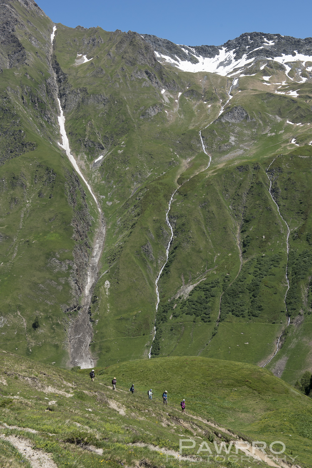
My favorite portion of the hike heading down to Alpage de la Peule.
As we descended the sound of cow bells ringing in the distance became more and more distinct until we arrived at Alpage de la Peule, another refugio tucked on the mountainside and surrounded by cows in pastures milling about or resting in the sun. Again, we had some coffee and used the bathrooms. It was all downhill, about 6 kilometers, from here into La Fouly where we were picked up by our vans and driven to Champex for the night. As if we needed more walking, we walked around Lac de Champex, a 45 minute walk, where we experience one of those cell phone, Shangri-La, picture moments of perfect light and legendary scenery after dinner. It all came together.
Again, our hotel for the night had special cubbies for our dirty boots in the main hallway. This one looked antique and was painted decoratively with doors on the front of each space. No boots allowed beyond the lobby. There was a bar and comfortable lounge where a crowd gathered to watch World Cup soccer. We ate in the adjoining hotel restaurant where the food and service was comforting. The dining room was large, and the service quick. Honestly, I can’t remember what I ate. I guess I was a little tired. The structure was old and the hallways were often dark. The lights, operating on a sensor, didn’t always come on, so finding your way through the darkened hallways added to the experience. I fell asleep early on this night in a comfortable and clean bed.
Day 3 TMB
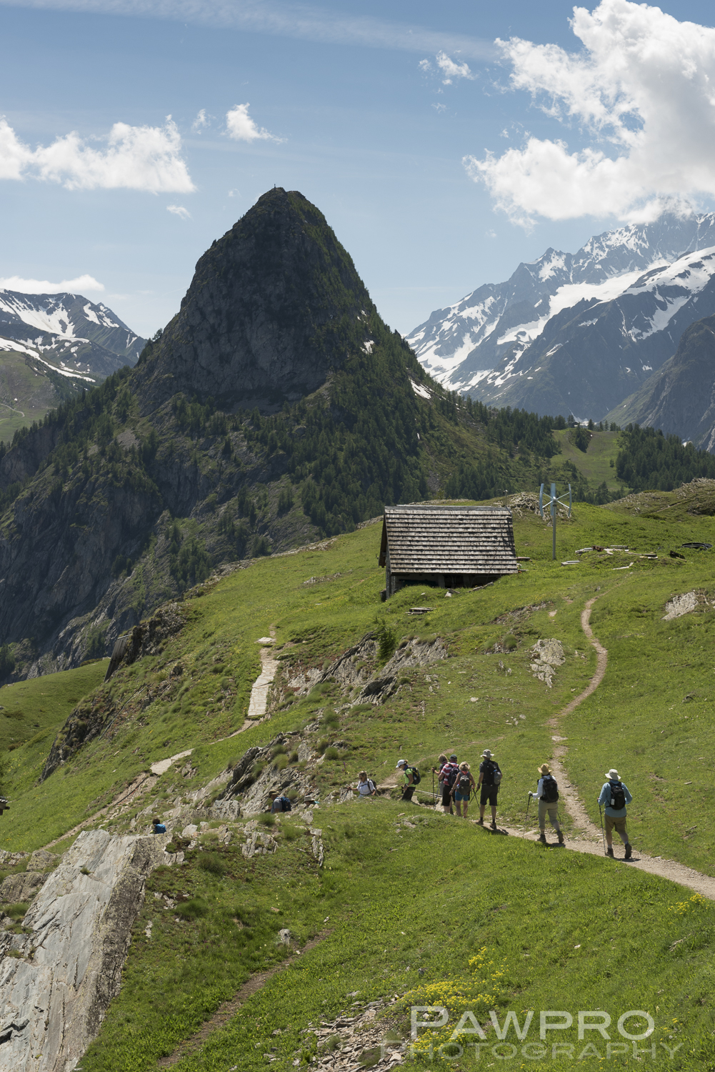
The next morning we packed our lunches after breakfast, as was the routine, and walked out of Champex along the main road towards our trail. Unlike the first two mornings, we headed downhill towards Champex d’en Bas for the first four miles, rather than up, among private ski chalets scattered across a rolling countryside. As we started to ascend, the trail became forested, and the weather turned more damp, gray and foggy. The climb was steep and rocky for several miles. In these moments, I felt the extra weight of my camera gear. I was carrying about 20-25 pounds in my pack. Raphael warned us this was an intense, but short lived ascent. We crossed rocky, mountain streams, rather than snowy ones, reminiscent of Shenandoah, and around seven miles in left the forest behind. The mountainside opened up to grassy meadows, where we circled around to a ridge with a tremendous view of the valley below and the city of Martigny-Bourg. Not long after this we came to the refuge of the day where we had heard all morning that the desserts were worth the climb. They were, and accompanied with a delightful coffee. I thoroughly enjoyed my treat, and the time off my feet, but it was crowded with other hikers. The line was not as long as it was at La Peuty, but there was a line for the bathrooms and the food. This was often a good time to meet fellow travelers.
On our descent into Trient we stopped briefly in Col de la Forclaz which is a sharp switchback in the road where several touristy gift shops, restaurants and bathrooms are strategically situated. We left our trekking poles outside one shop. When it came time to leave one person’s poles were missing. Another recurring issue related to trekking poles was leaving them behind after a break. The longer the trip went on the more this seemed to happen. It’s easy to do, especially when your not terribly inclined to their use, and you’re fatigued. For many in our group this was their first time using poles. In almost every town where we stopped, their were outfitters where new trekking poles could be purchased, so it was only a temporary and minor inconvenience.
We walked into the tiny town of Trient and were shown to our guide’s hostel called Refuge Le Peuty overseen by both Raphael and his partner Anja. We waited in their side yard with a view of the mountain we’d just climbed down while Anja prepared a special refreshment for us. A few local men sat at a table watching us as they enjoyed a beverage or two, or three, but resisted attempts to engage with us, which was amusing. Raphael’s refuge is a two story structure that resembles a renovated barn. The upper level is only accessed by an exterior set of metal steps, and inside features rows of rustic styled, wooden bunks. It’s a cozy and clean environment, but not a private one. A shower is available, as well as homemade, open fire prepared meals, homemade cocktails and other snacks are available. If I were in a large group and could rent out the whole place, or a 20 something again, I would be interested in staying. Otherwise, sleeping in a room with 20 people, some complete strangers, listening to them snore, or whatever, wasn’t so appealing for our older group, prone to crankiness.
Tour du Mont Blanc, Val Ferret, Italy on the way to Grand Col Ferret
After enjoying our complimentary cocktail at Happy Tracks our transport vans arrived to take us to our most memorable hotel on the trip, Hotel du Buet, in Vallorcine, France. This chalet style inn was set very close to a winding country road. The area reminded me of any number of spots on most any small rural road in West Virginia or Pennsylvania, but with more impressive mountains and linguistic accents all around. Inside, the entry hallway and staircase were dark despite being open. A set of small French doors separated the hallway with a naturally lit large bar area that had a local feel. The old handrail made you wonder about previous guests and years gone by, and the hallways had framed vintage photographs of people traipsing across giant, icy crevasses on ladders in their turn of the 20th Century day clothes. The wallpaper was old world and in some circles probably fashionably retro. Each room was unique, a result of the structure’s age and renovations over the years. As an example, our room had a two door entrance–not to be confused with French doors. This was literally one door, immediately followed by a second door. I walked through another dimly lit staircase to our second floor room. The bathroom was renovated and large but with little or no thought to design of its elements. It was placement based on practicality and presumably cost. Inside our room I felt suddenly transported into Van Gogh’s bedroom painting, but with decorative touches spanning the 30’s through the 60’s, rather than 19th Century Dutch. I couldn’t help but post about it at the time.
I took a glorious shower while it seemed there was an endless stream of motorcycles passing by the hotel as Sunday evening and the weekend were coming to a close, foreshadowing our final night on the trek. I headed down for dinner, which was to be served at the hotel. As I entered the bar where our tour group had strung several tables together, I was met almost immediately by a fellow hiker advising me to order a beer, BUT be patient with the service, and be sure to say merci. Evidently, the female barkeep wasn’t too welcoming, so far. I approached the bar cautiously, and stood waiting to be acknowledged. It wasn’t happening. There was what appeared a local patron sitting at the small, eight foot bar talking with the attendant. The snub did seem purposeful as time passed, and I continued to be ignored. I finally inserted myself with as pleasant an,”Excusez moi.” as I could muster. I spoke my version of broken French with a typical American version of a French accent. The same one that made my fluent French speaking daughter cringe when we visited Paris years before. I just wanted a beer. I don’t remember exactly what I said beyond the initial greeting. I got my beer and got away from the situation, as fast as possible.
It was a beautiful evening so we soon moved outside with our drinks to a table and chairs on the lawn beside the hotel, and discussed the not so warm welcome we were receiving. At just about this time another person in the group was ordering some wine and it wasn’t going well because of the language barrier on both sides. Someone reported that we were getting boxed wine, not the bottled good stuff. The serious wine drinkers weren’t pleased. It was starting to get more uncomfortable as the same lady bartender and apparent hotel manager brought out several wine options trying to satisfy a clearly unhappy, perhaps hard to please guest. Some started asking her questions and joking with her to ease the tension. Soon she was joking with us, telling us about herself and the hotel. Similar to the woman at Le Hotel Crampon, the hotel had been passed down within the family from one generation to the next. She lives in the house next door to the hotel. She treated us to what tasted and felt like a homemade meat and potatoes meal served family style. It was just what we needed and our beds were only steps away after we were full. So, as it turns out, all that was needed was a little icebreaking, wine, and bread breaking to bring familiarity, for both sides.
Day 4 TMB
Not long after daybreak on the fourth day we crossed the small road in front Hotel du Buet and followed it for some time before hitting our trail in earnest. It was a clear day but we were shaded within the two summits sandwiching us, so it felt cooler. This morning it was back to the grind of a steady intense climb through a forested trail that lasted for five miles, several hours and peaked at Col de Balme (2204m) Here lies the border between France and Switzerland. As we cleared the trees we were treated to a new angle on Mont Blanc which sported a wispy cloud cap that morning. We were seeing it on the opposite side from our first two days of the trek. The peak we were climbing was somewhat rocky with bigger steps as we neared the summit. A coating of low lying flowers and ground cover draped over the tiers of rock we passed. I was starting to become accustomed to these views. This was our shortest hike of the trip at a little over eight and a half miles.
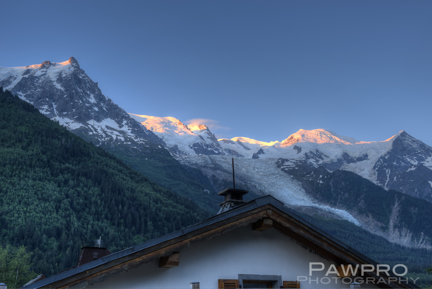
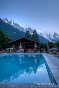
We took a brief train ride to reach our hotel for the night at the Excelsior Chamonix. This was the most modern hotel during the TMB hiking portion of the trip, and as it turned out, my least favorite. While this hotel was clean and well appointed with a lovely pool and spectacular views of Mont Blanc and Aiguille du Midi, the stay was made unpleasant by an overbearing motorcycle club spending the night. It started out humorously, as they mistakenly identified one person in our group as Peter Fonda, presumably an “Easy Rider” fantasy almost come true, but as the night wore on their over the top partying became more and more disruptive. Well into the early hours of the next morning, Kathy and I listened to their drunken screams and singing through our open windows. So much for trying to enjoy the refreshing mountain air. At 1 A.M., it ceased being funny or reasonable, and the hotel didn’t seem to be doing much about it. I was anxious to leave the next morning, but we had to share one more meal with them before the rumble of their Harley’s churned in the air and they drove off down the road to “Sweet Home Alabama” blaring from an onboard stereo. Not a scene I would have imagined occurring in France. So, I woke up early to take photos of sunrise on Mont Blanc and Aiguille du Midi from poolside, not terribly well rested.
Aiguille du Midi at dawn.
Day 5 TMB
Our last day of TMB started in Argentièr with a group photo in matching t-shirts and a stop at the local apothecary for, in my case, a chapped lip ointment. Everyone had some-something to remedy, it seemed. Five days later and my lips and forehead, cracked and peeling, looked as if I’d summited somewhere. I guess I had, but the severity of the burn didn’t match the severity of the hiking achievement, at least not in my mind. The dry alpine air only added to the dryness. I was a bit of a mess with gobs of lotion covering my lips.
Two hours later we broke through the tree line on a steep incline with many switchbacks. Raphael had pointed out this trail from the mountainside we climbed the day before.
TMB hikers resting with Mont Blanc in the distance
In many spots this was a trail filled with loose rocks. It was a warm day, and we were in the open, but thankfully the air was getting cooler and cooler as we climbed. Just like the first day, we were treated to different angles on Mont Blanc as we headed back towards Chamonix. We saw folks hang gliding over Chamonix Valley, tacking back and forth across the opening. It seemed they could stay aloft for as long as they wished riding the dependable winds of the valley’s vast air currents.
Alpine reflecting pool along TMB, Mont Blanc in the background
By this time, even with the grandeur of the Alps at our doorstep each day, there was a certain monotony to the daily routine–wake, eat, climb a mountain, take it in, take photos at the peak, stop to eat, climb down, shower, eat dinner, and repeat. I would have liked to spend a night or two at one of the refuges, so I could wake up and capture the landscape during that golden hour of first light. This is a selfish, photographer’s idea of how to spend a day, and not practical for a group. Also, our group was simply too large for the average refuge stay, unless we were willing to spend the night in one of the dormitory settings, which most of our group was not willing to do, myself included. At the same time, the repetition made each of us hone our attention to packing the gear we needed to get through a long day of semi challenging hiking.
On this last day we sat on a field of boulders and ate our final lunch along the TMB. We passed a wonderful waterfall with a bubbling stream at its base, we passed dormant ski venues where Raphi told us about the rockus partying that goes on when they’re open during ski season.
Our guides Raphael and Jack from Happy Track Gmbh
Then our Alps mountain adventure came to an unceremonious end at the Flégère cable station. Some had decided to ride the rest of the way down, and some were going to finish off the trail on foot. We paused for another group photo with Mont Blanc in the background before we separated. As I recall it was another two hours on foot down to Chamonix. The trail passed by a wonderful spot called Chalet de la Flora tucked neatly on the forested mountainside with potted flowering plants draping the walls and window sills. Tables with umbrellas lined the rustic stone terrace with yet another view of Mont Blanc. Unfortunately, we were rushing to get to Chamonix to meet up for a final drink together, so we only passed through this quaint spot. It was full of tourists and we passed several hikers on their way up asking, “How much further?” Hiking up to this spot is a long, steep climb. By the time we made it to Chamonix our feet were tired from pounding downhill with pace. It felt good to be back in Chamonix with its small streets and familiar sites. Walking through town, fresh off the TMB, felt a little like coming home from a great expedition. We were dusty, sweaty and ripe from the trail. We sat outside together at a corner bistro with Raphael and enjoyed an Aperol Spritz which was wonderfully refreshing. My feet were glad to be done.
The TMB was an immersive experience. It was challenging, but not extreme, and very easily tailored to many fitness levels. A few years ago I completed a rim-to-rim at the Grand Canyon, a trip I was destined to make. No more can I stand at the edge of a natural jewel and watch it sparkle from afar, on tv or from a car window, than I can do without food, love or companionship. It isn’t the same as being within it, touching it, smelling it, sweating for it.
Unauthorized use and/or duplication of this material without express and written permission from this blog’s author and/or owner is strictly prohibited. Excerpts and links may be used, provided that full and clear credit is given to Amy Linn Doherty with appropriate and specific direction to the original content.


You must be logged in to post a comment.