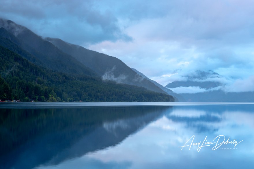
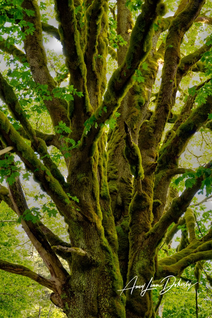
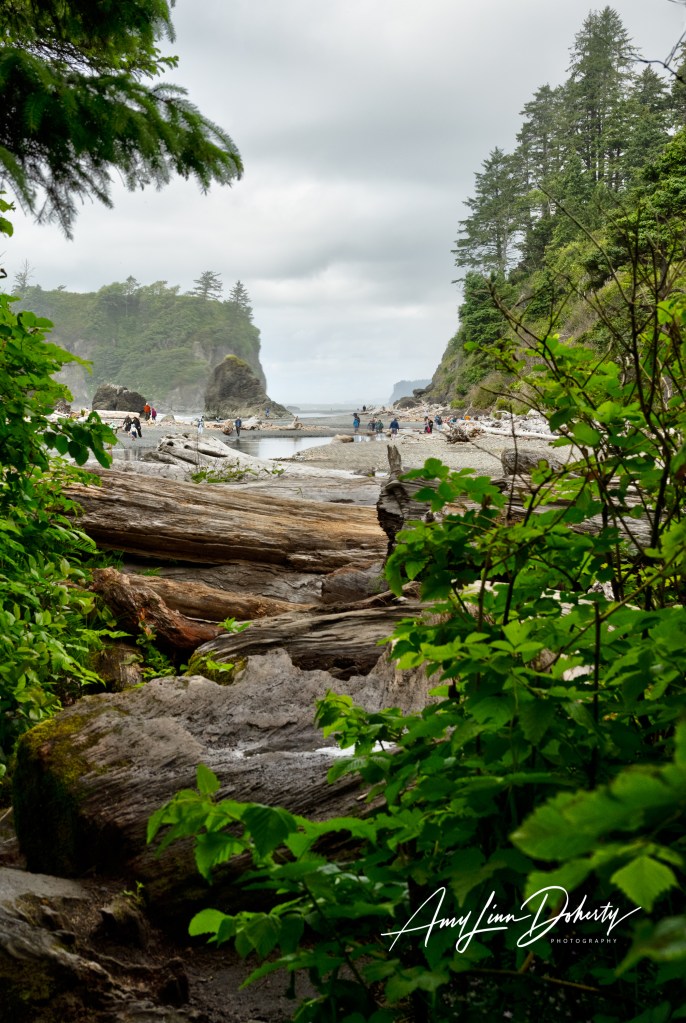
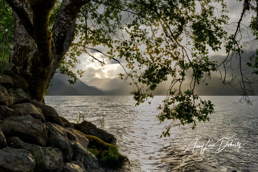
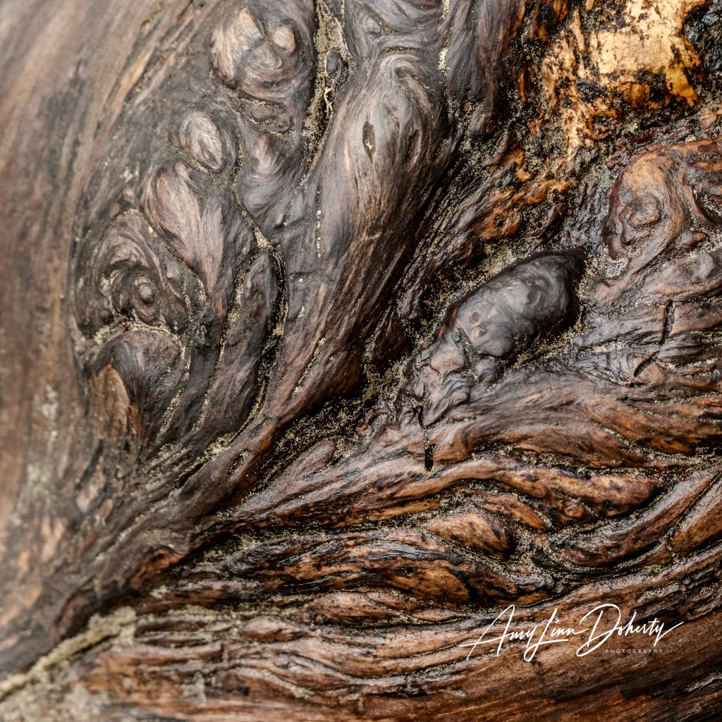
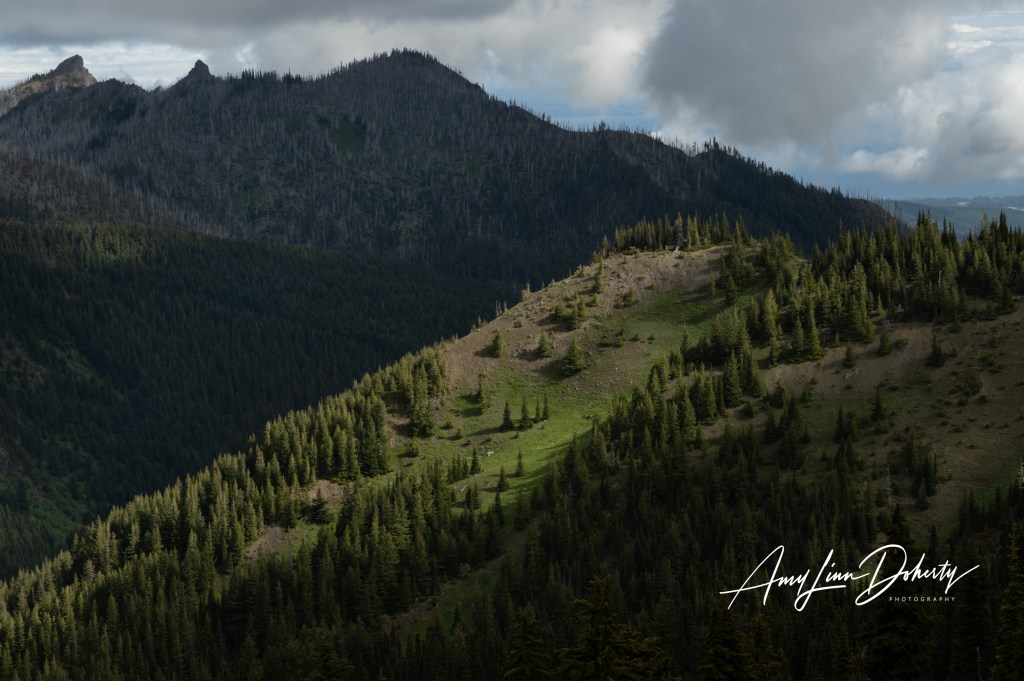
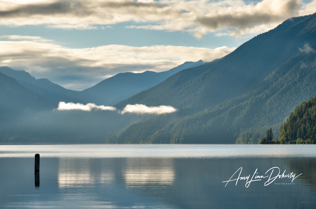
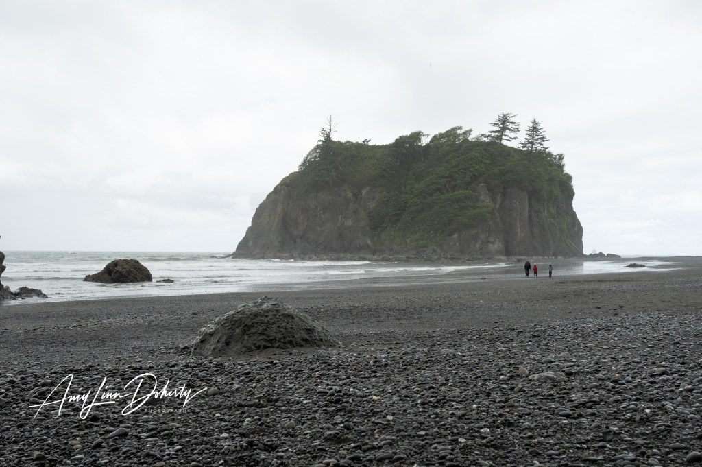
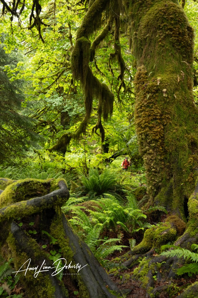
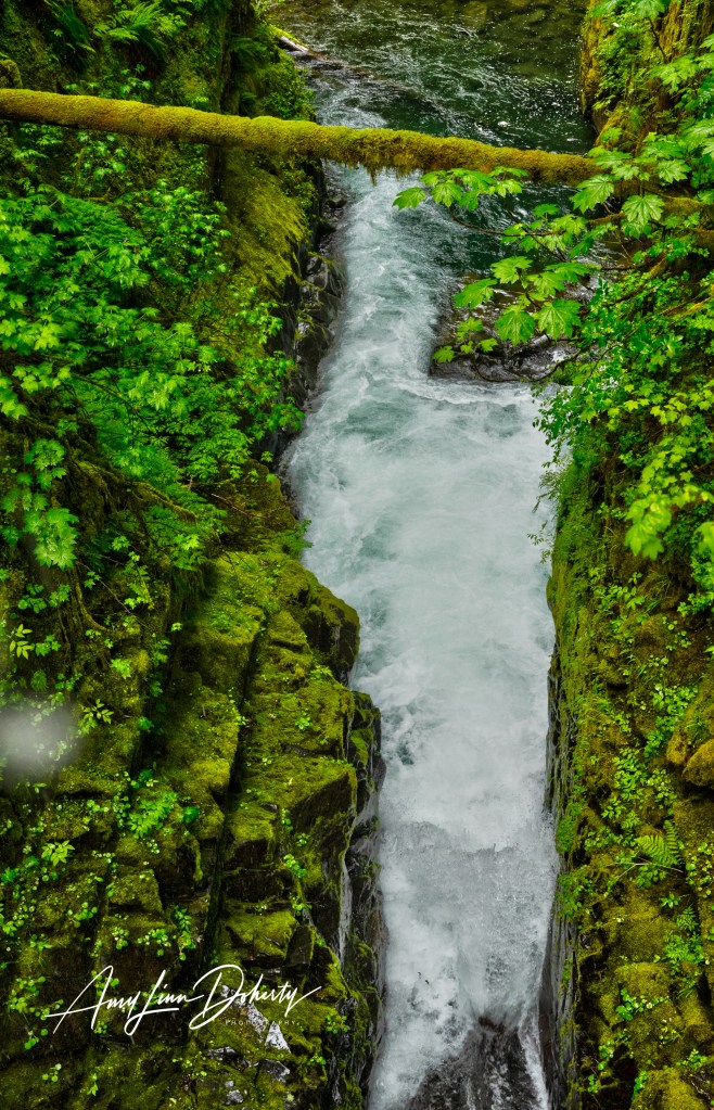
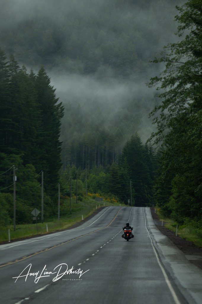
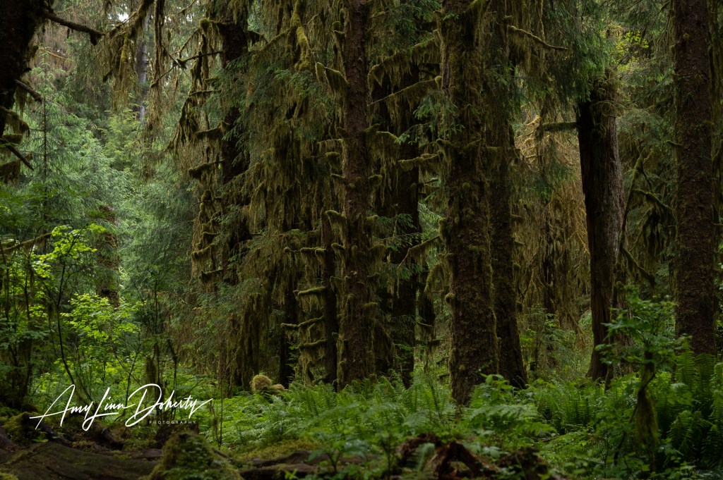
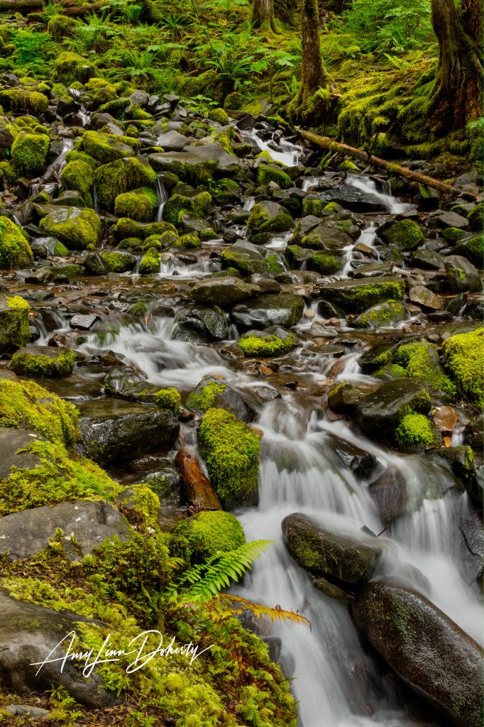
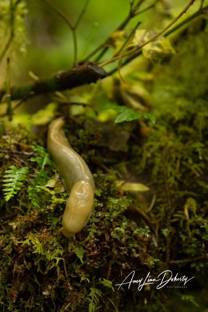
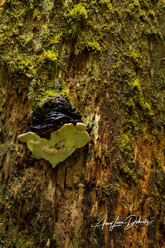
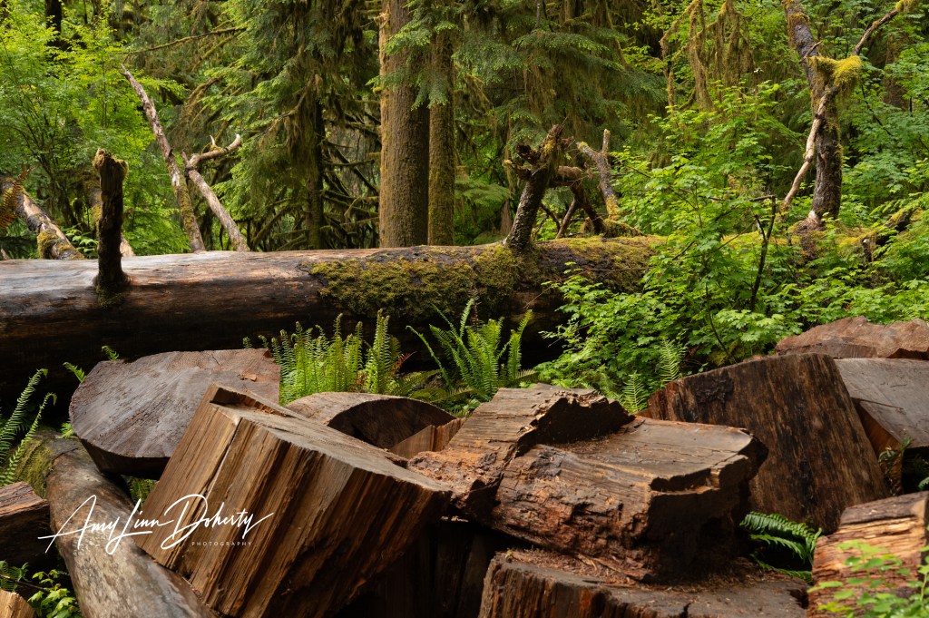
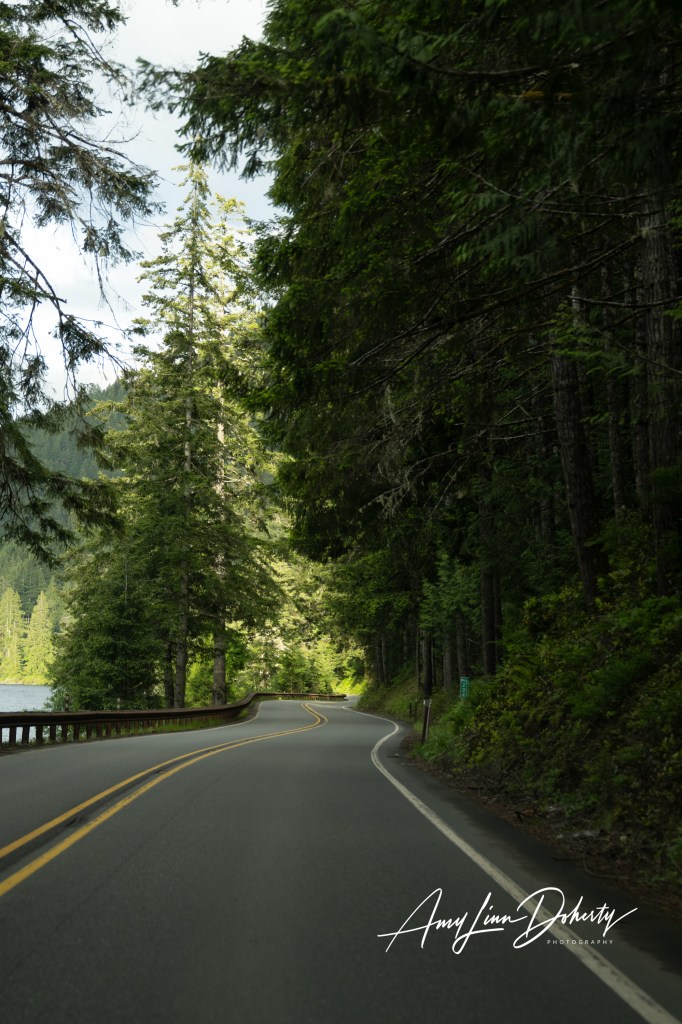
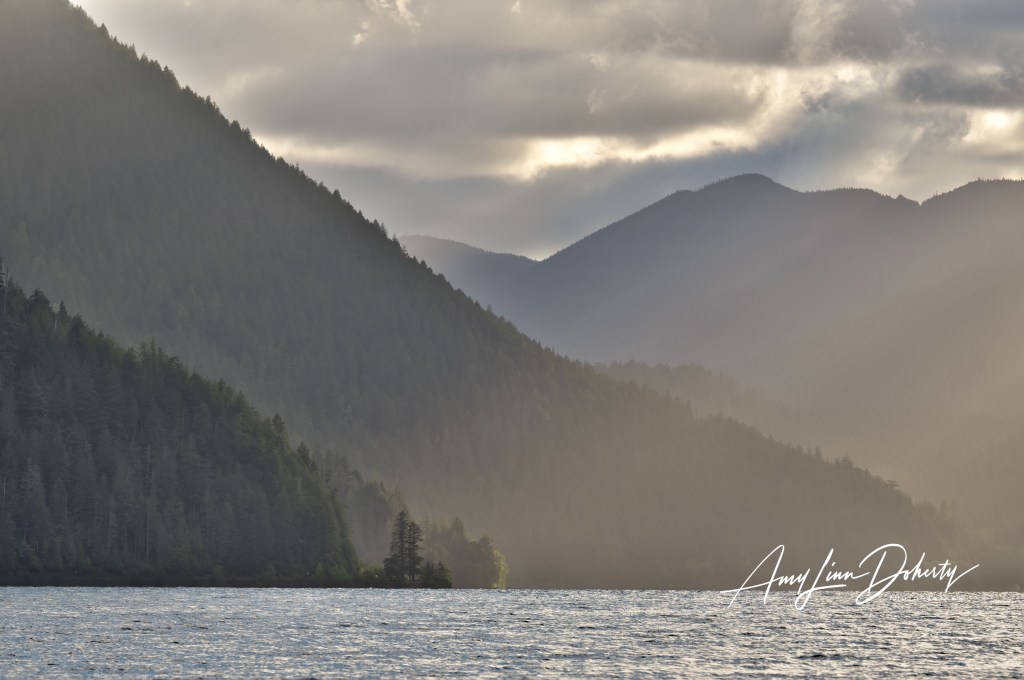
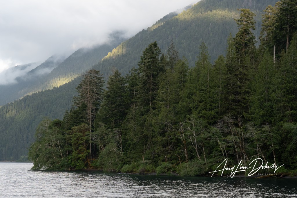
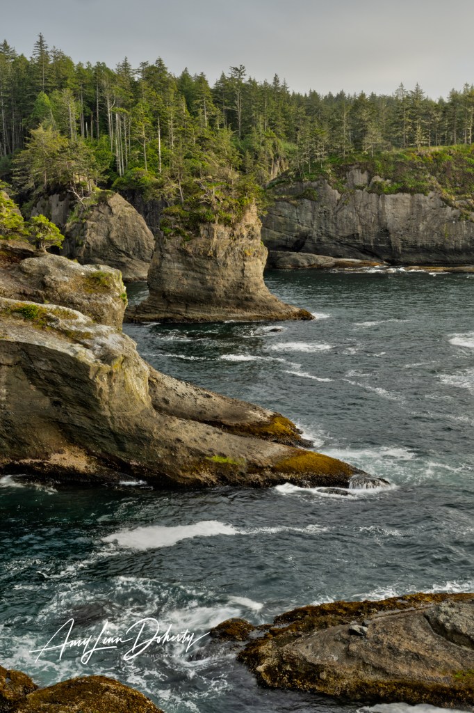
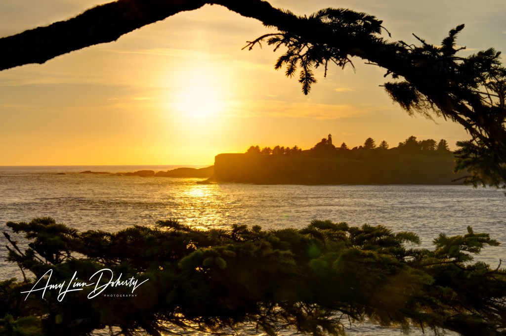
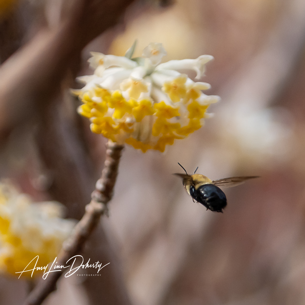
A recent trip to Washington State offered me a first trip into Olympic National Park. It was all about the trees from my perspective. We were able to visit most of the northern and central hotspots–Hoh Rain Forest, Sol Duc Falls, Lake Crescent, Hurricane Ridge, Ruby Beach, the Tree of Life and Cape Flattery, which technically isn’t part of Olympic National Park. June Gloom was in full possession of the skies, so there was very little sunshine while we were there.
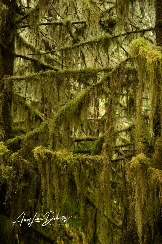
We stayed in a two person Airbnb cabin situated nicely on the northern perimeter of the park, enabling a sunrise trip to the Hoh Rain Forest, which was about an hour south. This is one spot where it’s highly recommended to arrive early.
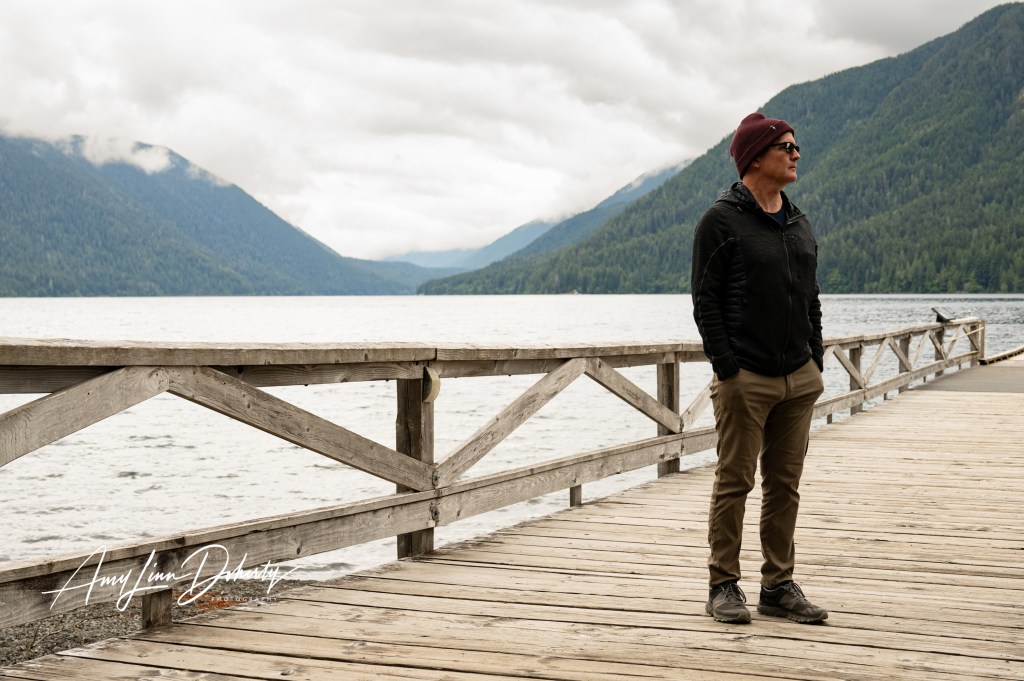
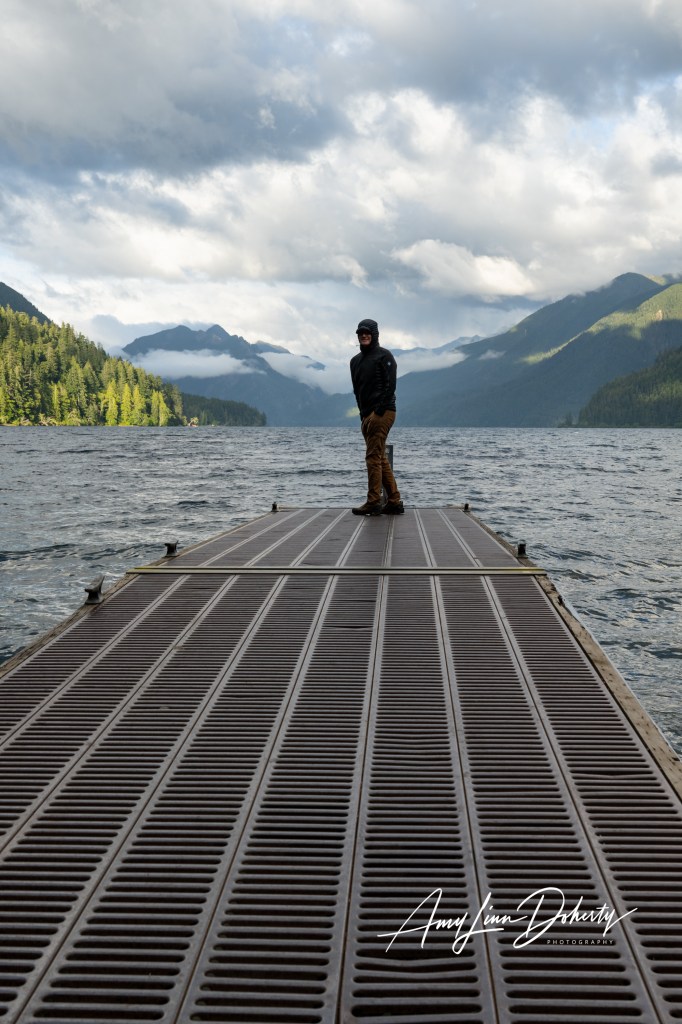
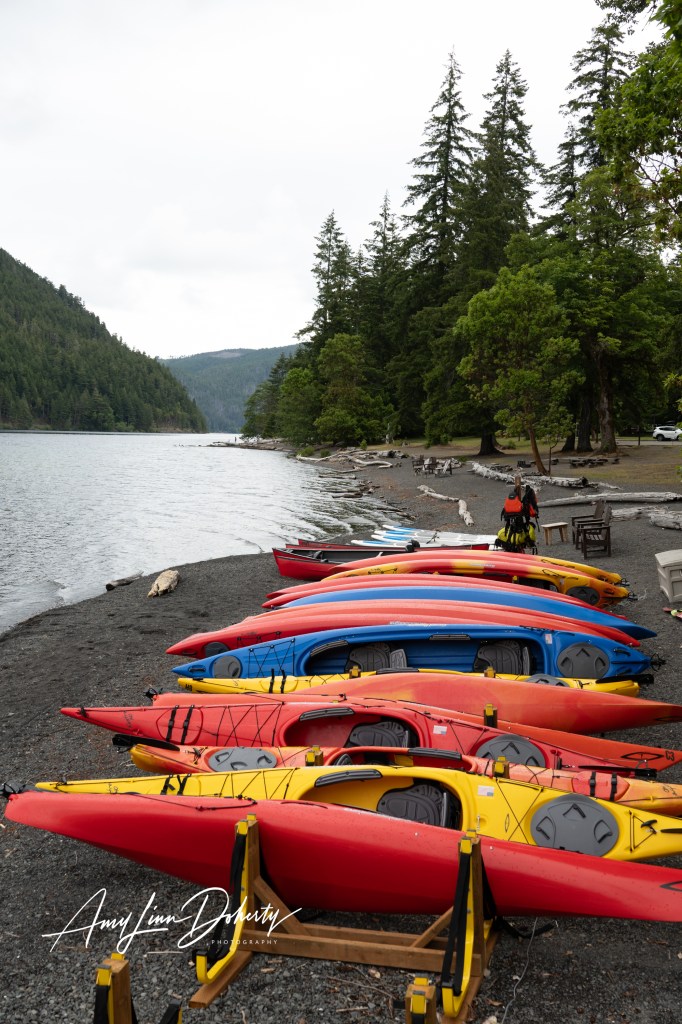
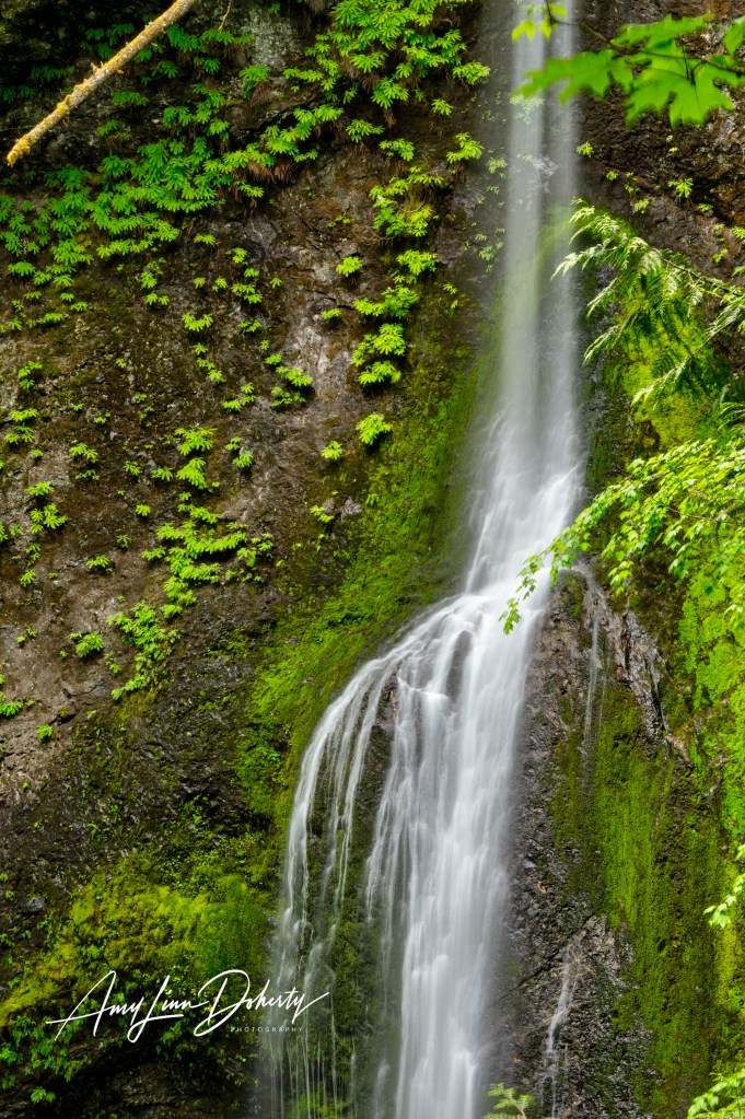
On another morning, we knocked-off the most popular local hike before breakfast—Marymere Falls. Very pleasant short hike, which we followed with a lovely breakfast at Lake Crescent Lodge. I could spend some time here.
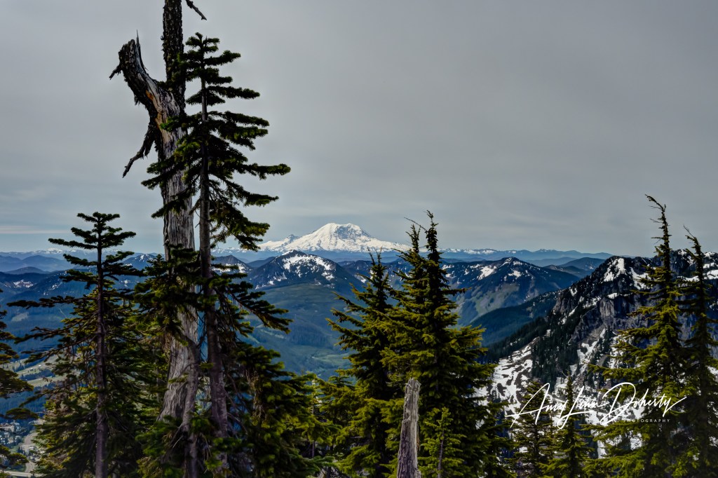
Regretfully, we weren’t able to visit Mount Rainier, but I did get to snap a few photos as I climbed Snoqualmie Pass, a short but intense hike with over 2,500 feet of elevation gain and a great view of Rainier. Thankfully, we had great weather for the hike. Getting back down this steep trail was hard enough in dry conditions. I’ve yet to get to Mt. Rainier or Mt. Hood when I was in the vicinity in recent years.
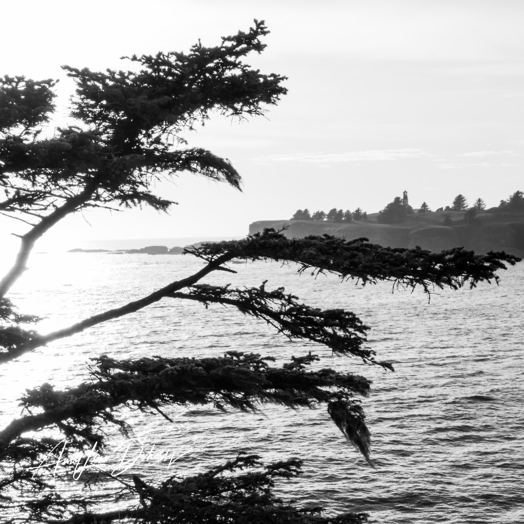
Cape Flattery was a surprising gem. It’s an interesting little trek out to the lookout after acquiring a recreational permit, as this area falls within Micah Tribal land. It is the furthest north, western point of the contiguous 48 states. This was also about an hour away from our rental cabin. Worked out perfectly and walked away with some interesting shots.
copyright Amy Linn Doherty
Unauthorized use and/or duplication of this material without express and written permission from this blog’s author and/or owner is strictly prohibited. Excerpts and links may be used, provided that full and clear credit is given to Amy Linn Doherty with appropriate and specific direction to the original content.
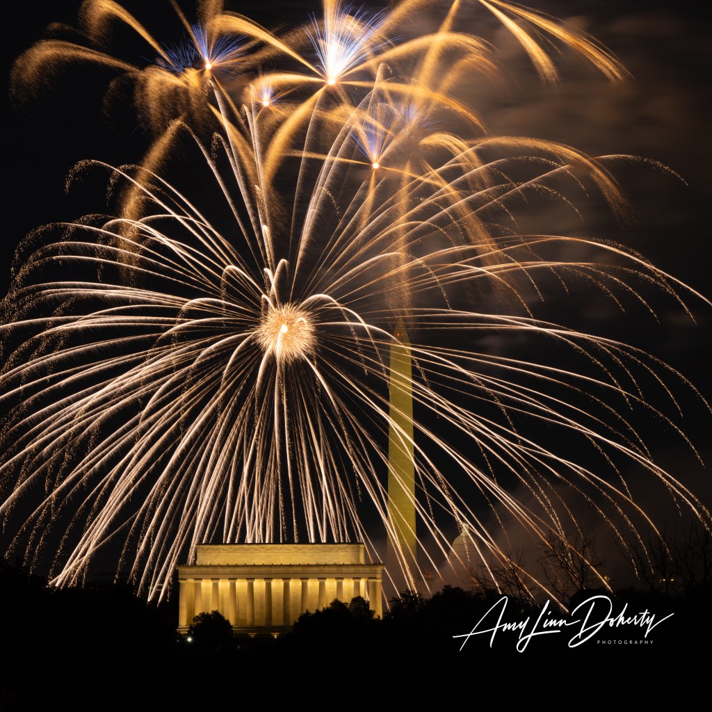
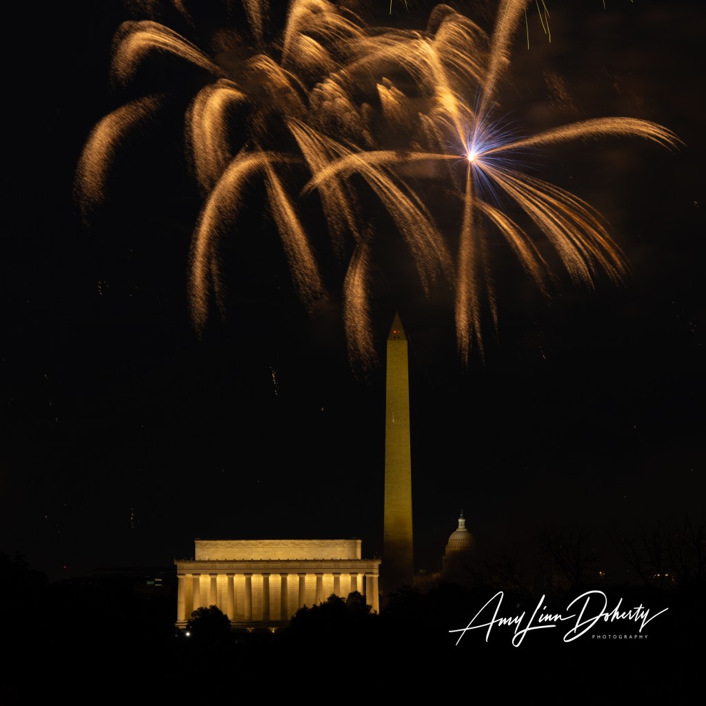
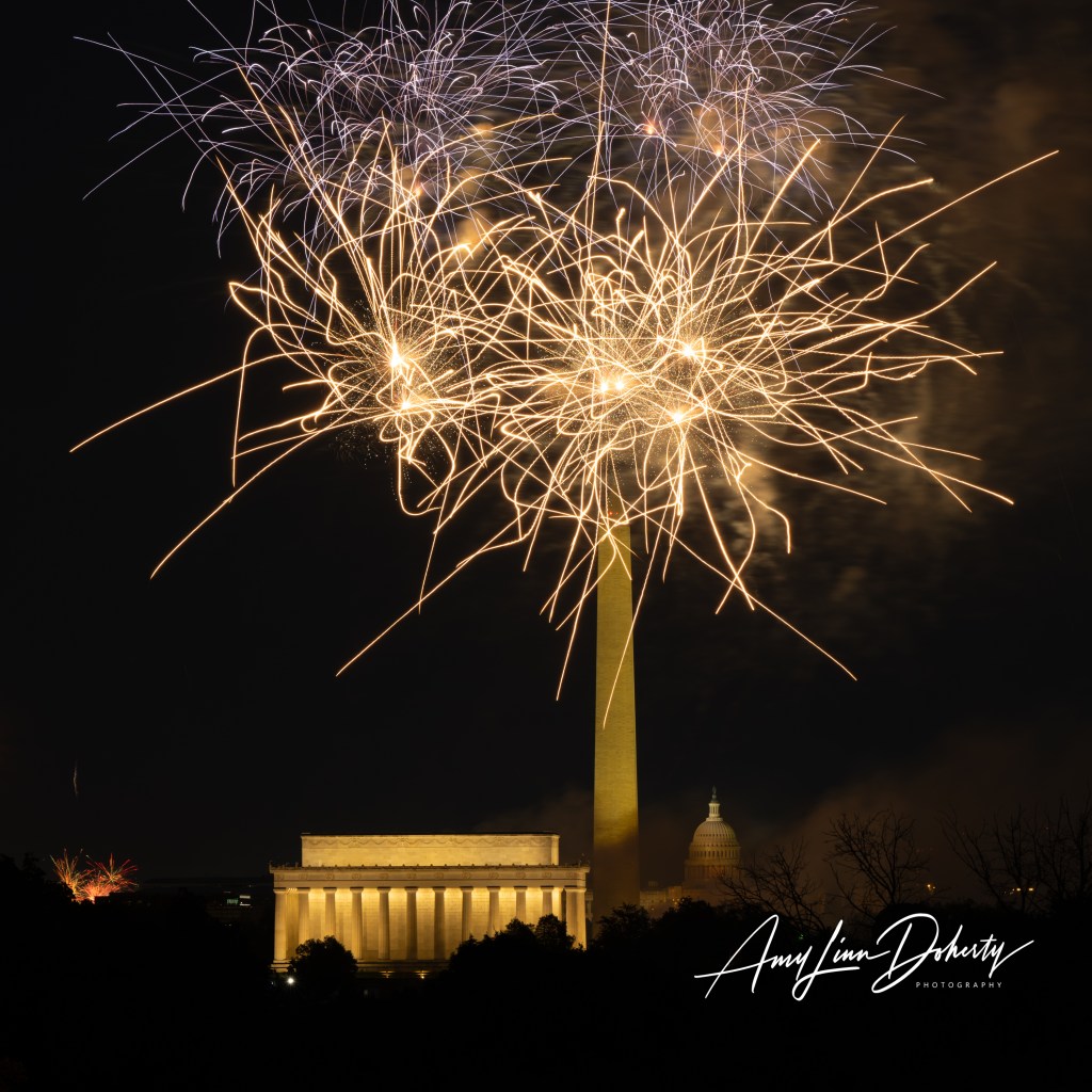
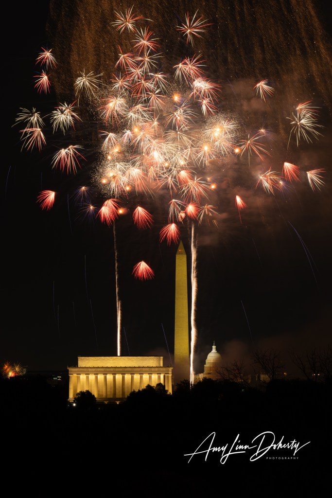
Here are some of my photos from the July 4, fireworks from the National Mall. I’ve never been positioned so low on the hilltop in front of the Netherlands Carillon. Certainly better from a little higher up, but not too bad. Enjoy.
Unauthorized use and/or duplication of this material without express and written permission from this blog’s author and/or owner is strictly prohibited. Excerpts and links may be used, provided that full and clear credit is given to Amy Linn Doherty and Amy Linn Doherty Photography with appropriate and specific direction to the original content.
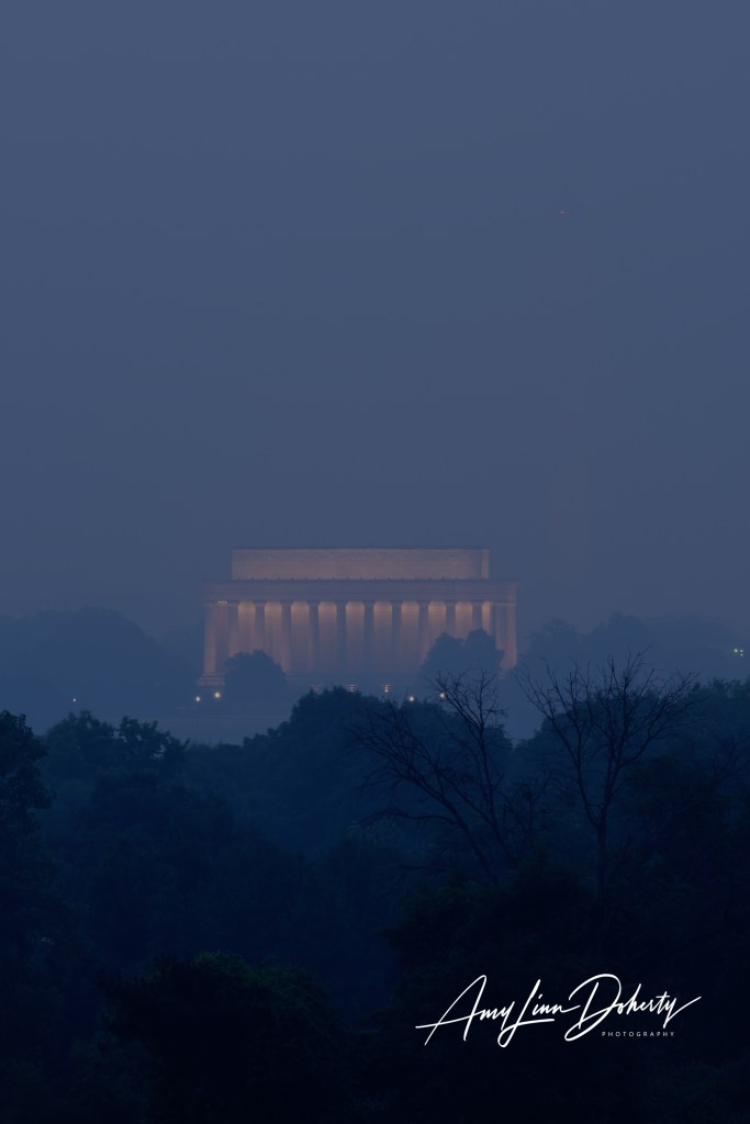
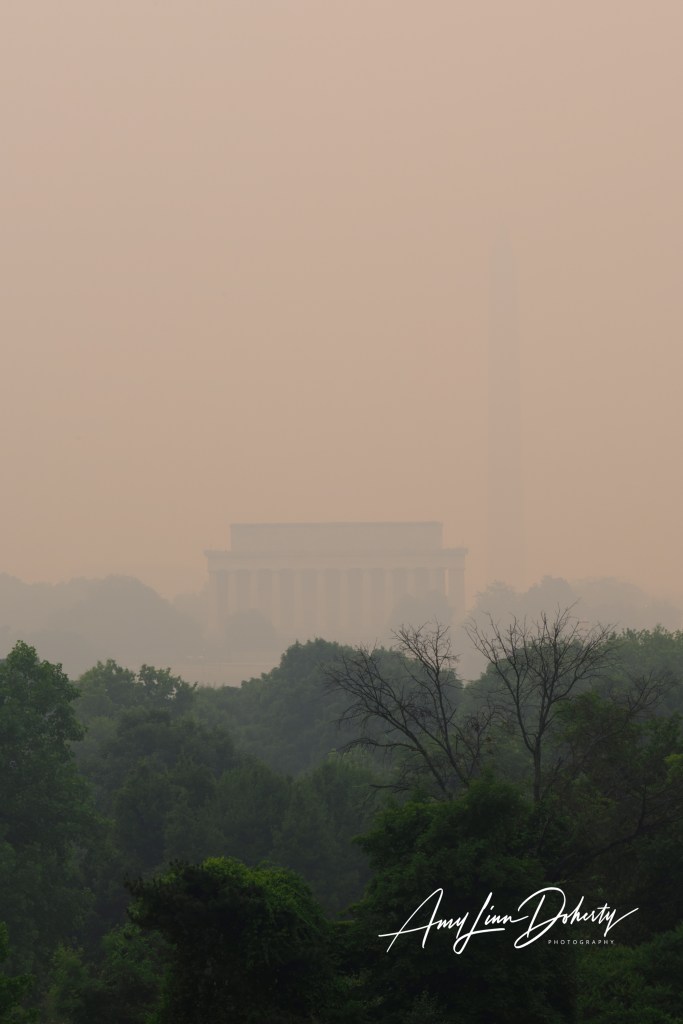
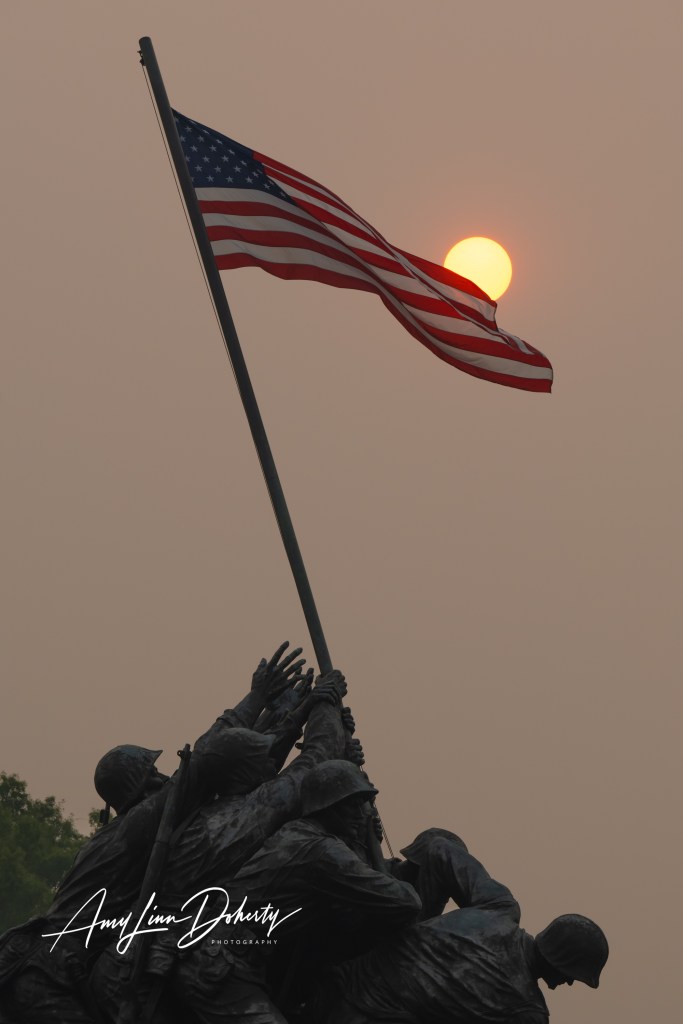
I wanted to show how bad the smoke was in the D.C. Region from the Canadian wildfires. I went to the spot that normally offers an iconic view of Washington, D.C. It’s where I go often for a quick sunrise photography outing. Up at the hilltop where the Netherlands Carillon is located usually offers one of the best views. Below is a photo of a normal morning without smoke and then a few shots from last Thursday when the smoke was at its worst.
Unauthorized use and/or duplication of this material without express and written permission from this blog’s author and/or owner is strictly prohibited. Excerpts and links may be used, provided that full and clear credit is given to Amy Linn Doherty with appropriate and specific direction to the original content.
The long overdue time has come for me to retire Pawpro Media, as a company name. While there is a sentimental attachment to the name and original logo, the footprint of a childhood dog named Buffy who has long since passed away, it’s time. Now I don’t have to explain that my company is not pet or dog related in any way. And it just plain makes for sense online to those who discover my website by accident or on purpose.
Whomever is mounting metal birds to road signs in the McLean area has been at it again. Over a year ago I noticed a new bird. This wise guy is both obvious and invisible. Blink and you’ll miss him. I’ve seen other new additions, too!
You are so busy, bird maker! How do you do it?
In scavenger hunt terms, this one is nothing to write home to Forrest Fenn about–if he was alive–but it’s a fun little adventure.
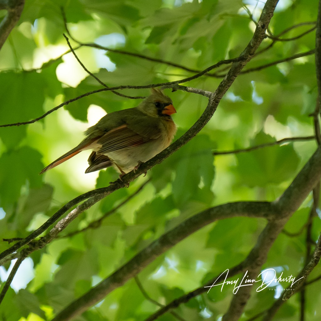
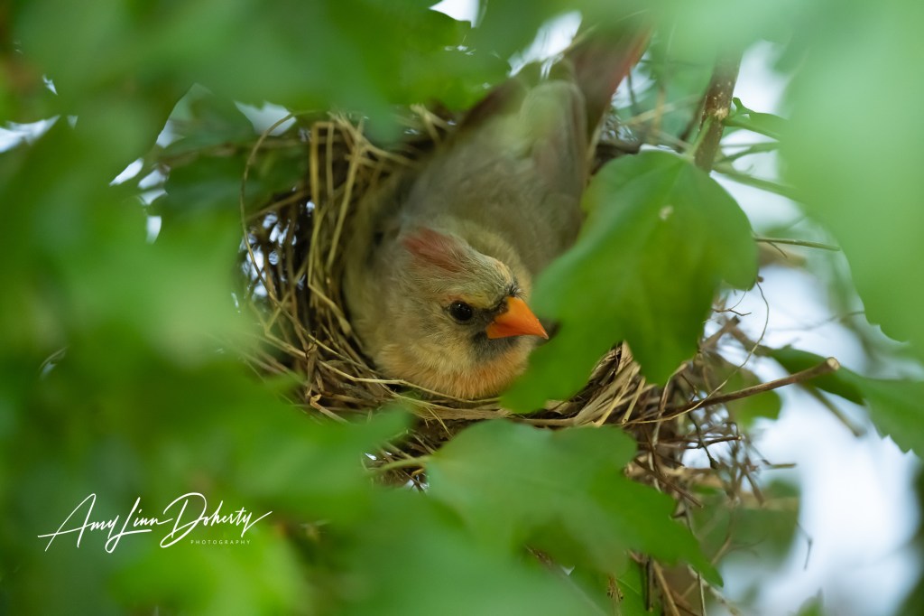
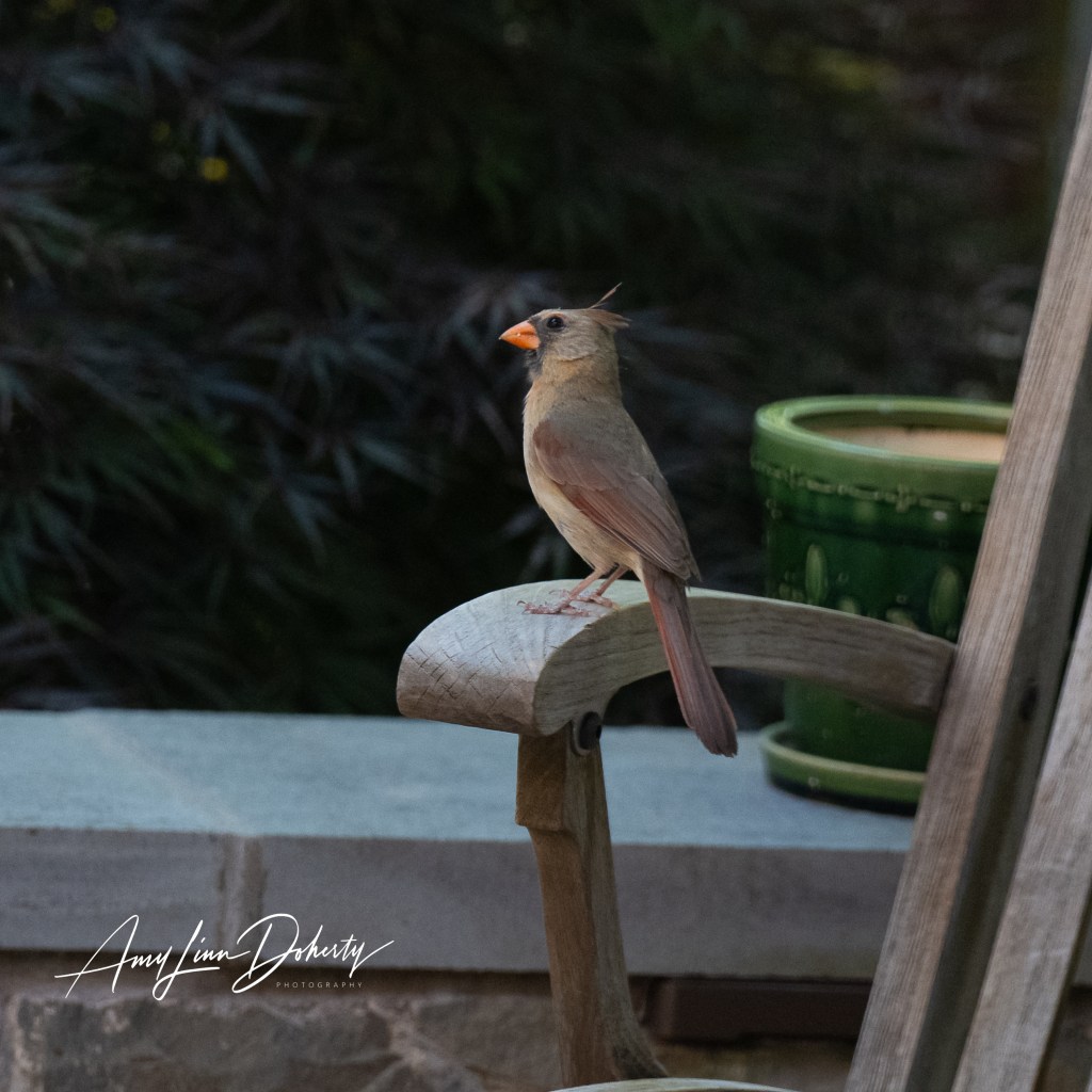
We were lucky to have a nest of cardinals just outside a window over the last 6 weeks. The whole nesting and fledgling process played out in front of us.
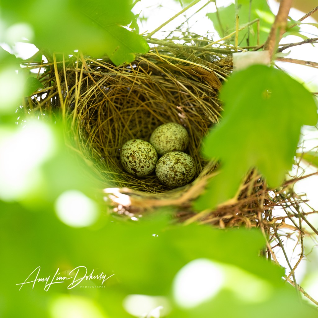
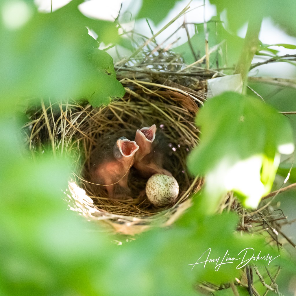
Nature loves the number three, I’ve learned, so three eggs it was. She layed one egg a day. The mom was dutiful in staying on the nest for days on end. Nine, or so, days later two babies were born overnight. We were hopeful the third egg would hatch.
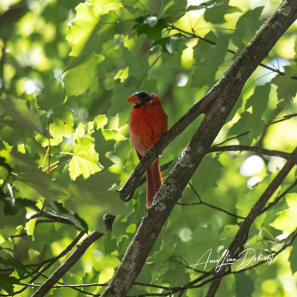
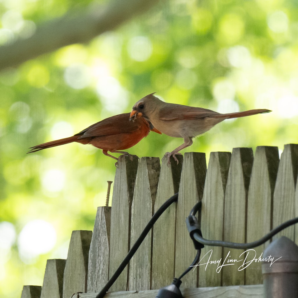
The father was in the middle of a catastrophic molt where he loses all of his head feathers. This wasn’t something I knew about. I was afraid he wasn’t well, but turns out it’s normal for the male Northern Cardinal during nesting season. While he wasn’t impressive to look at, I found he was more attentive to the nest and the fledgelings, especially once they jumped ship.
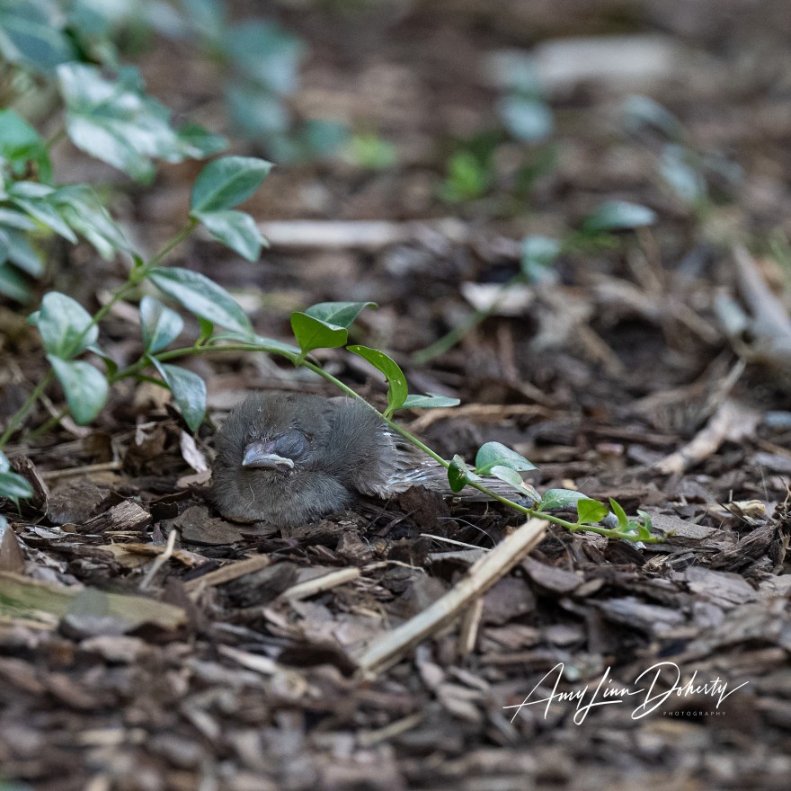
Sadly, the third egg never did hatch. It remains in the nest.
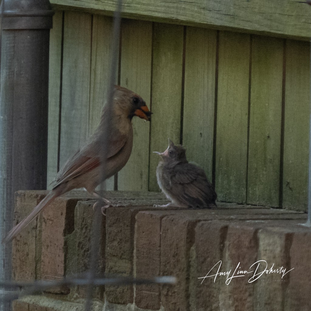
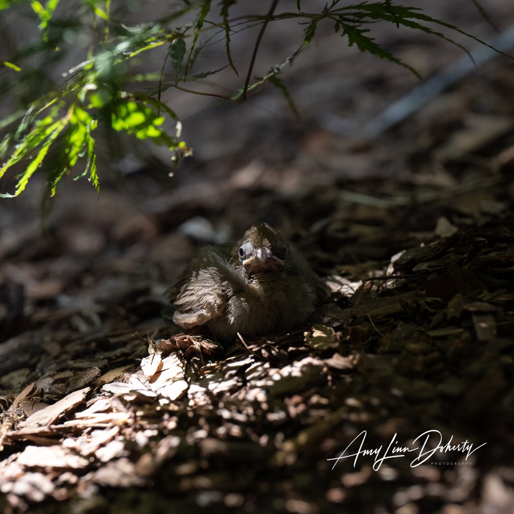
On the ninth or tenth day the babies jumped out of the nest. After perching on limbs outside of the nest for a while they eventually fell from the tree. The parents hovered nearby watching as they moved around in the mulch beds and under bushes and trees in the backyard. They were hiding in plain sight. They did seem like sitting ducks, ripe for a bluejay or some other predator to pick-off, even though the camouflaging was good. Had I not known they were there I probably wouldn’t have seen them. The parents were ever present, watching, feeding, alerting, and threatening if we got close.
“Nature does not hurry, yet everything is accomplished.”
Lao Tzu
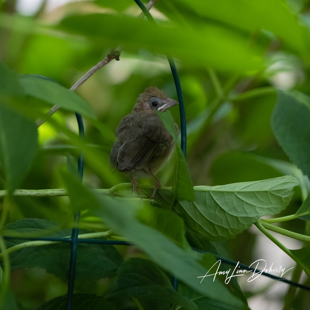
It’s a miracle that any of these birds make it to adulthood after seeing how it goes. Such a haphazard and clumsy process. At one point I did pick one up that was headed under the gate as a dog on a leash was approaching. I wore a gardening glove and place him on top of a short wall. I probably should have just put him back on the ground where he was more camouflaged. He jumped down on his own.
The two made it through the first night. At some point on that second day out of the nest one of the birds was killed by something just outside of our gate. The other one stayed in the backyard hiding in the hydrangea. It remained in the yard for another day, and when I checked on the third morning it was gone.
Out of three eggs, only one fledgeling seems to have made it, but I don’t know for sure. Didn’t see him fly or leave. He was just gone from his hiding place the next morning. No signs of a disturbance. No sign of him (a presumptive “him”). No sign of the parents.
Unauthorized use and/or duplication of this material without express and written permission from this blog’s author and/or owner is strictly prohibited. Excerpts and links may be used, provided that full and clear credit is given to Amy Linn Doherty with appropriate and specific direction to the original content.
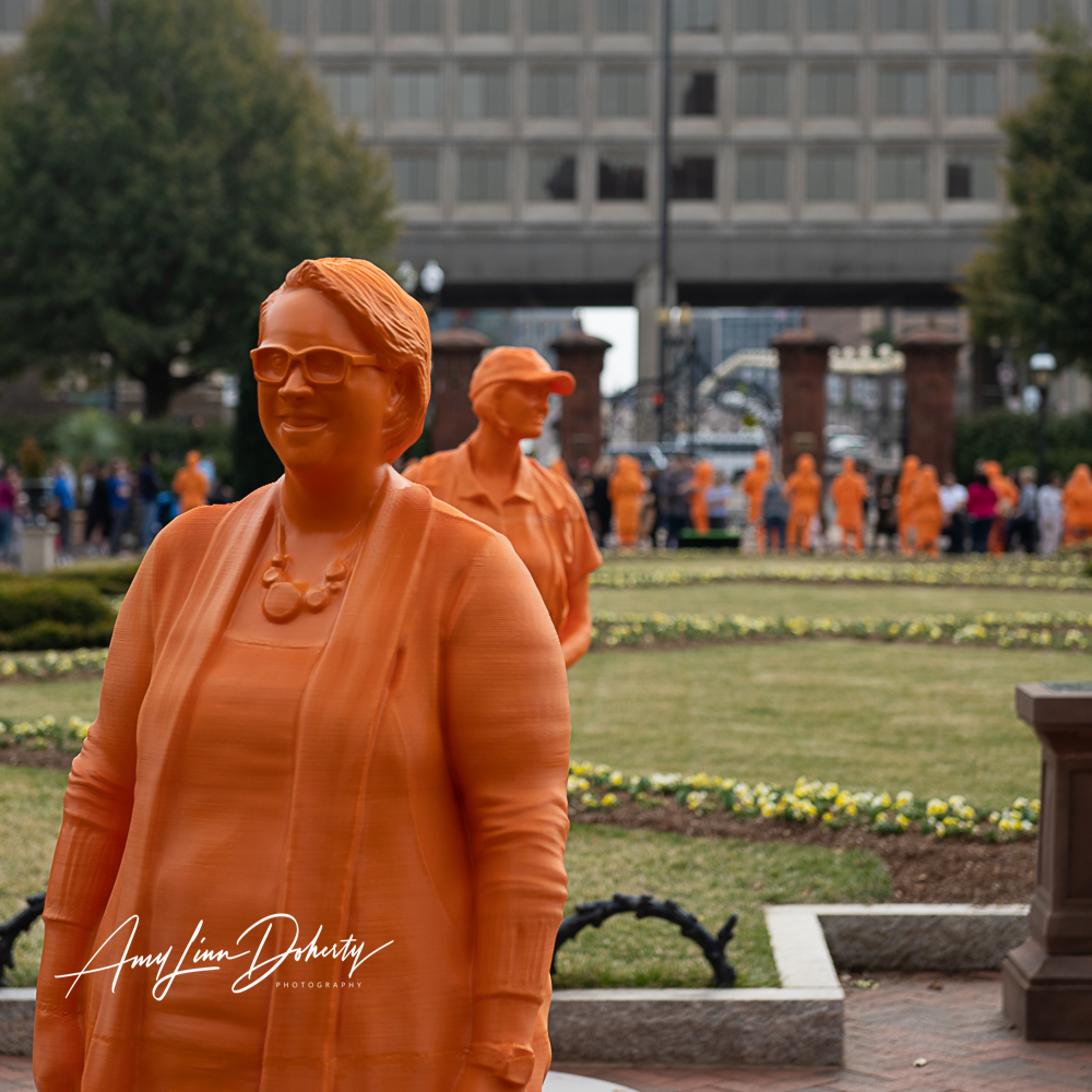
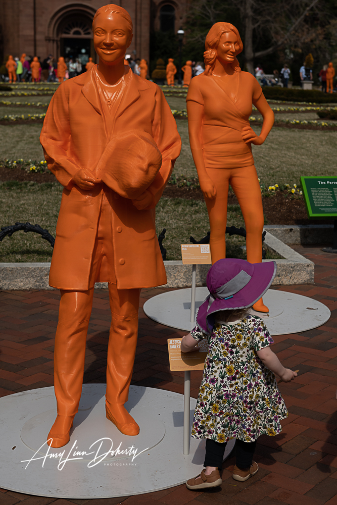
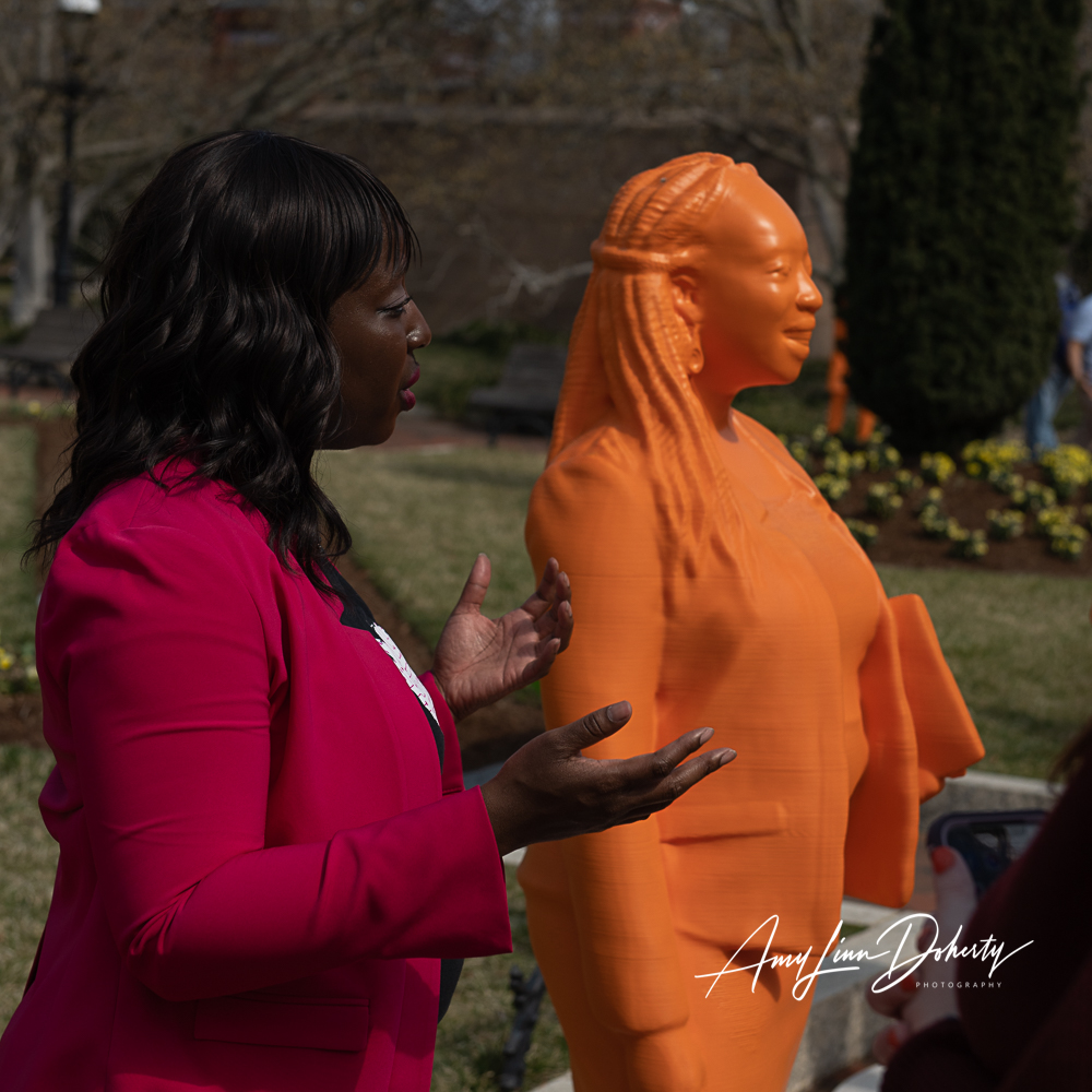
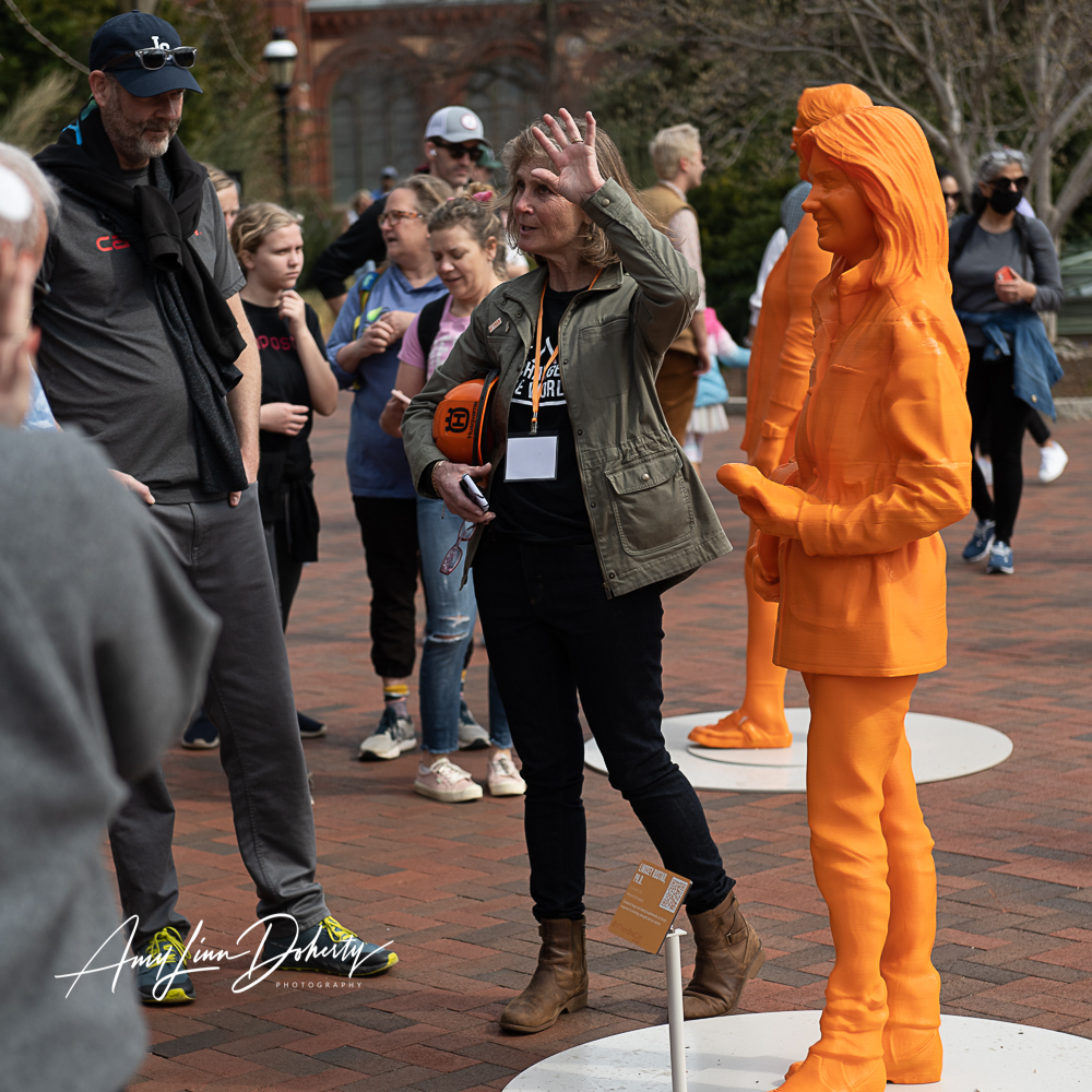
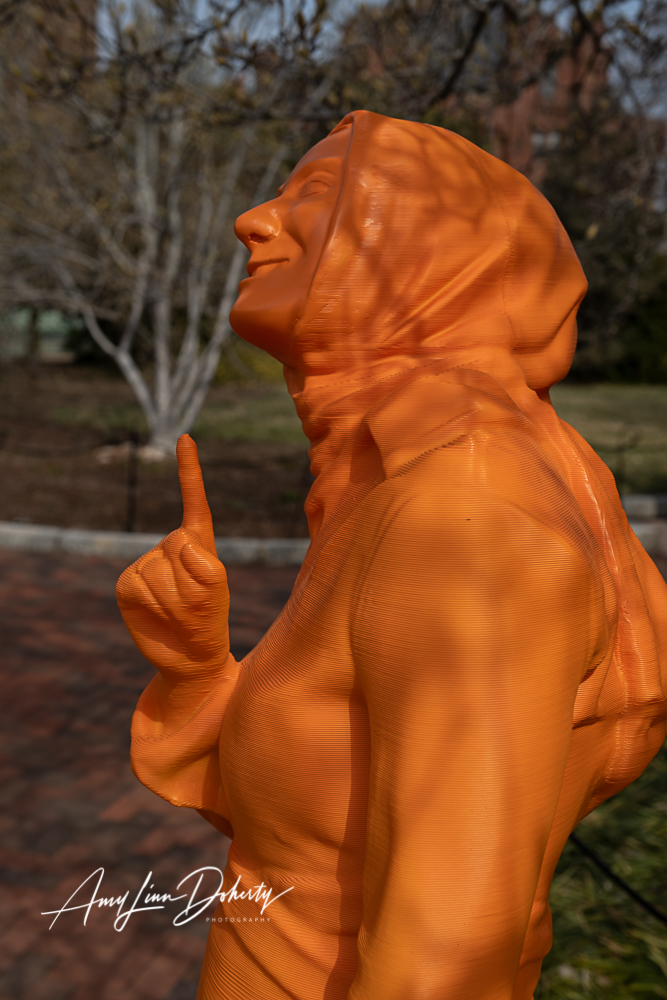
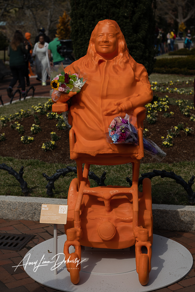
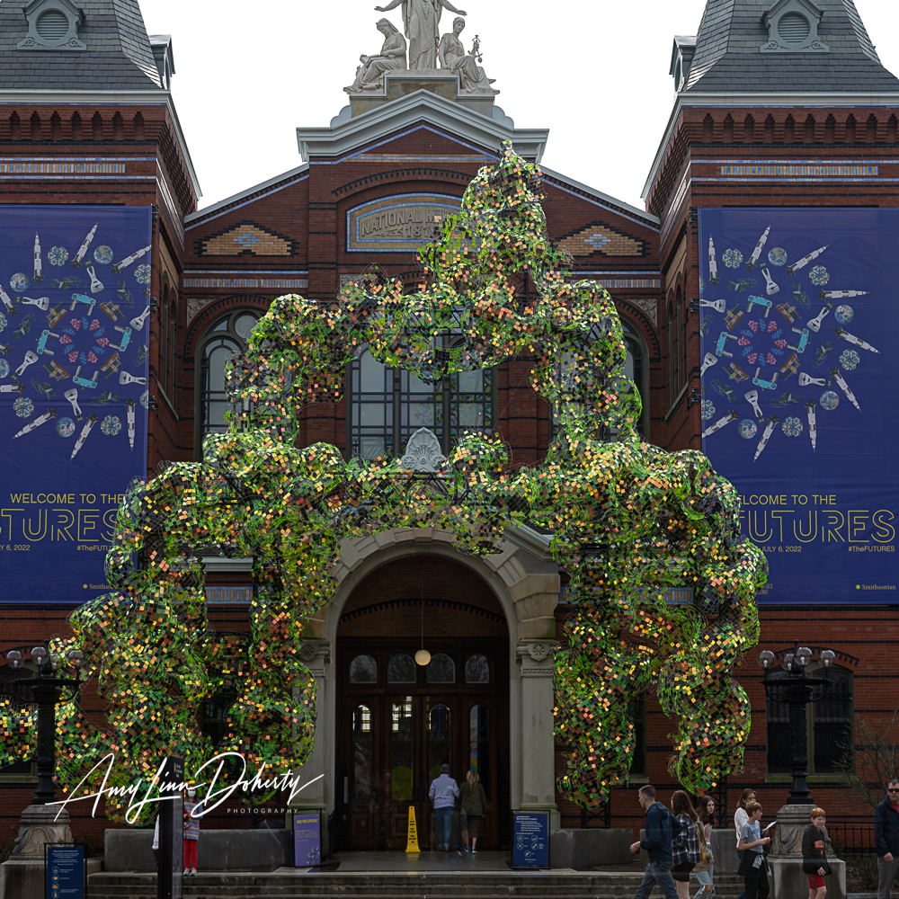
I visited the Smithsonian Castle last weekend and the #IfThenSheCan–The Exhibit celebrating prominent women working in STEM. The exhibit includes 120, 3-D printed statues in the Enid A. Haupt Garden adjacent to the original Smithsonian building along the Mall in DC.
Some of the featured women were actually present and standing alongside their orange, plastic statues talking and answering questions from visitors. The exhibit is here for a limited time and coincides with #womenshistorymonth, as well as the garden’s spring bloom; so it’s a beautiful scene on many levels.
Take the virtual tour if you can’t make it in-person.
While you’re there . . .
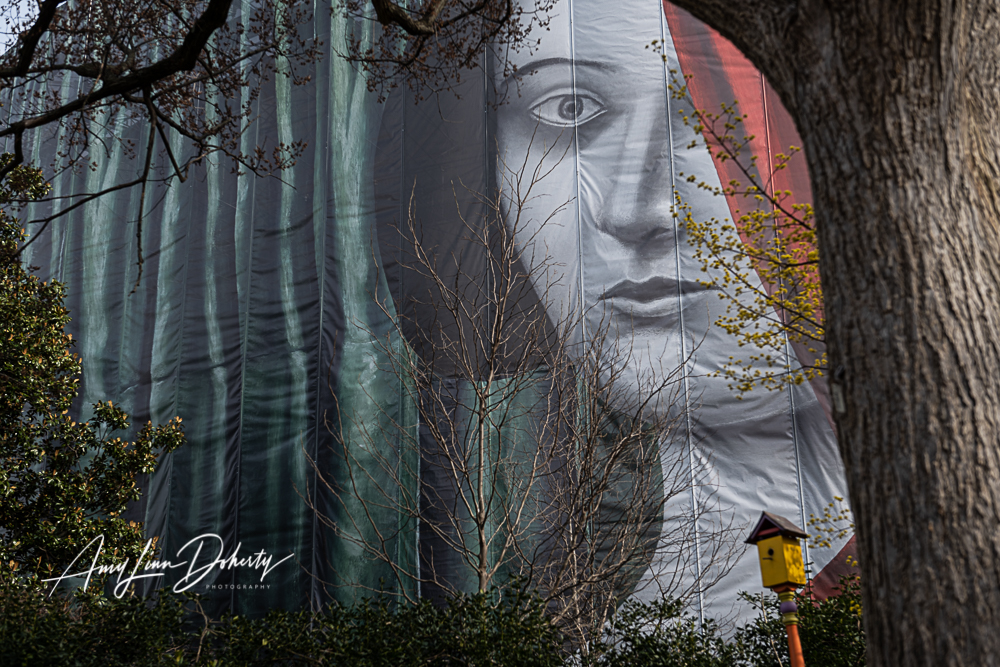
Alongside, the Hirshhorne Museum is undergoing a renovation and the exterior has been covered by an artful drape since September 2021 called “Draw The Curtain” designed by the Swiss artist Nicolas Party which makes for some interesting photo compositions.
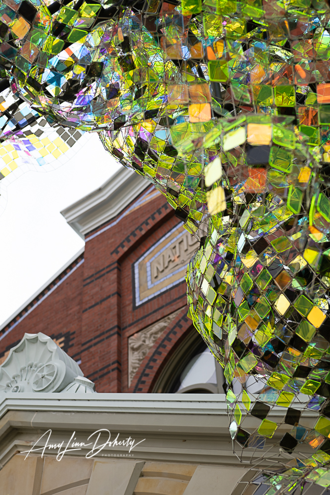
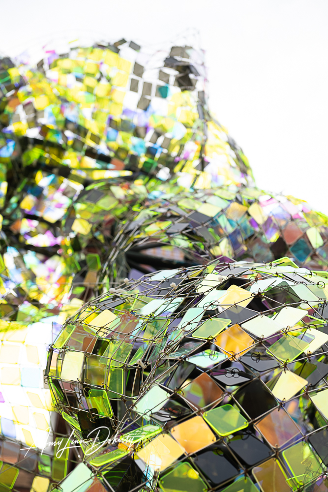
Attached to the front of the Smithsonian Castle’s main entrance is a colorful, organically shaped, sculpture made of a steel framework with colored, plexiglass squares. Depending on the direction and quality of the light its appearance changes all day.
I love the way these testimonials turned out for one of the most dedicated fitness professionals I’ve ever met, Ellen Yates of N2Shape. Getting clients to communicate what drives their patronage can be hard–though capturing genuine feelings can convert online views into real business. In some cases it may be the thing that motivates action.
Preparation and planning ahead can make that easier. I know what I want to hear from each person before I meet them. I already know their story and I’ve planned my questions.
Contact me if you need testimonials for your website or social media content.
The following are photos left in the attic of a New Jersey home of a distant relative who I did not know, or even know of until 2010. I came into possession and knowledge of the photographs via a fellow genealogy researcher who stumbled on a large collection of photos attached with her purchase of an old baseball uniform recovered from the same attic of a deceased resident in Westfield, NJ. She became curious about the drama unfolding in the photos and searched for family members online, which is where I came into the picture. From these pictures I’ve pieced together a story of affluence and artistic experimentation during storied days in New York City of the ’20s, ’30s, and ’40s. The human story which is captured in the photos is ultimately a sad one, sprinkled with beauty, art and history.
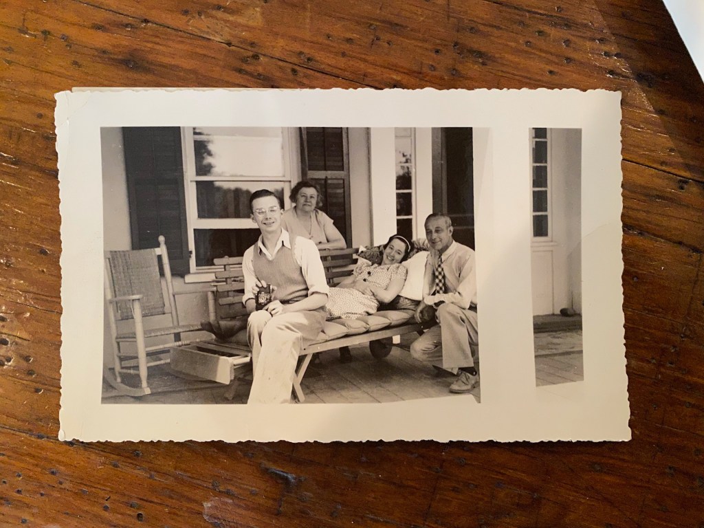
Kenneth A. Linn (camera in hand) with ailing sister Betty and parents.
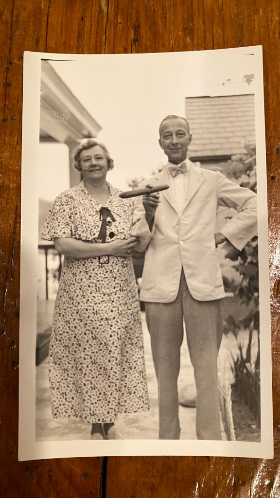
I’ve written previously about this line of my family which lived in NYC. My 1st cousin twice removed, Kenneth A. Linn was a student and later executive director* of the avant-garde Clarence H. White School of Photography whose students include Dorothea Lange and Margaret Bourke-White. His father Allen, my grandfather’s uncle, was a silk manufacturer. Allen was a handsome young man and appears to have enjoyed nice clothes and the occasional cigar. He married into a wealthy family and experienced success in his own right. The family lived in the Upper West Side of Manhattan in a brownstone just off of Central Park West. They had a live-in maid named Mary who maybe had a daughter living with her based on photos and Census records.
Allen and Sadie Linn
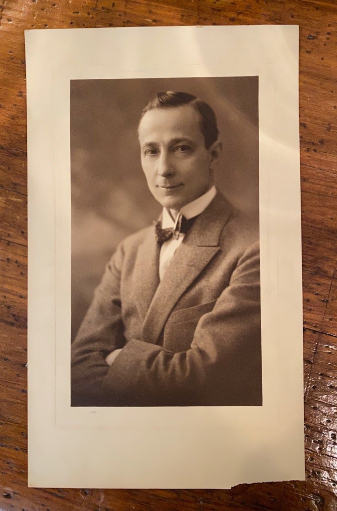
Below is a photo of Allen Linn which I presume was taken by his son Kenneth. I make that assumption based on his apparent age (knowing that Kenneth was already studying photography), there are no studio markings on it, and its professional quality. Whomever took it was a professional. Allen’s expression in the photo is personal and confident.
Allen Linn circa 1920s
Robert Linn, Allen’s brother and my great grandfather.
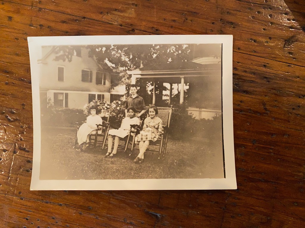
Kenneth was the oldest of three children. His sisters were Betty and Helen who favored each other at an early age. Helen appears more bookish as she grows older. Except for their wealth they seemed to be average kids. Some of the photos of Betty seemed to belie a theatrical ambition. I wonder if they might have been headshots for auditioning. She was a modern and striking young woman. There is mention of a young gentleman in her life.
SS Paris Lounge photo by Kenneth A. Linn
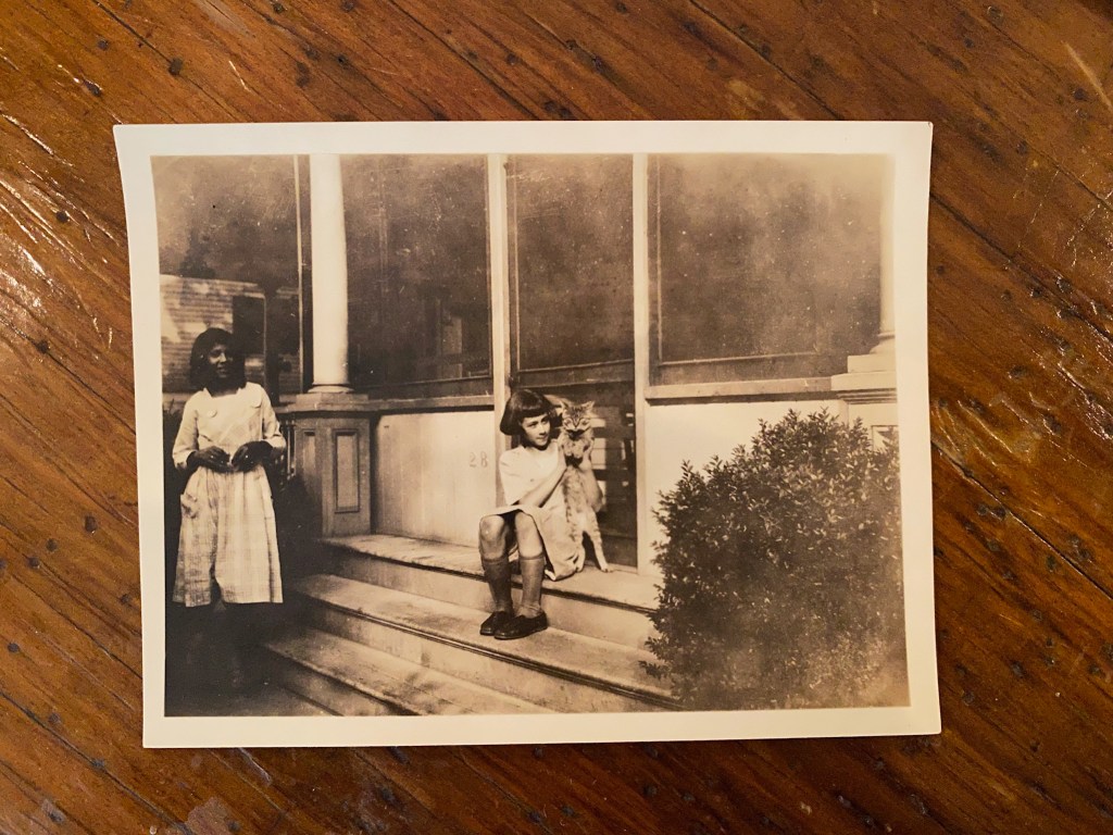
Helen with cat and unknown young girl
Helen (left), unknown girl, Kenneth (standing) Betty
As a family they traveled to Europe together by ship many times. In at least one instance Kenneth was on the S.S. Paris, a luxury ocean liner historically riddled with nautical mishaps which later caught fire while docked at Le Havre, France and capsized. It lay in place during WWII. One of Kenneth’s noted and collected photos is from the Art Nouveau styled lounge of this vessel. The family also returned to Ohio to visit Allen’s parents and siblings. They summered in New Jersey, it appears, where the mother, Sarah, had family.
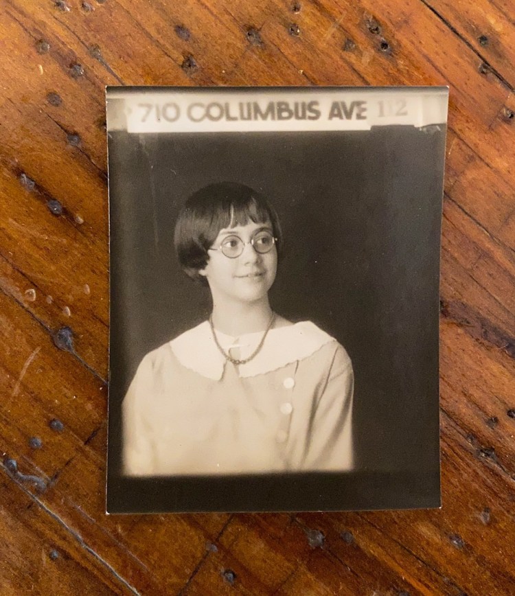
Helen Linn
Betty Linn
A Sudden Change
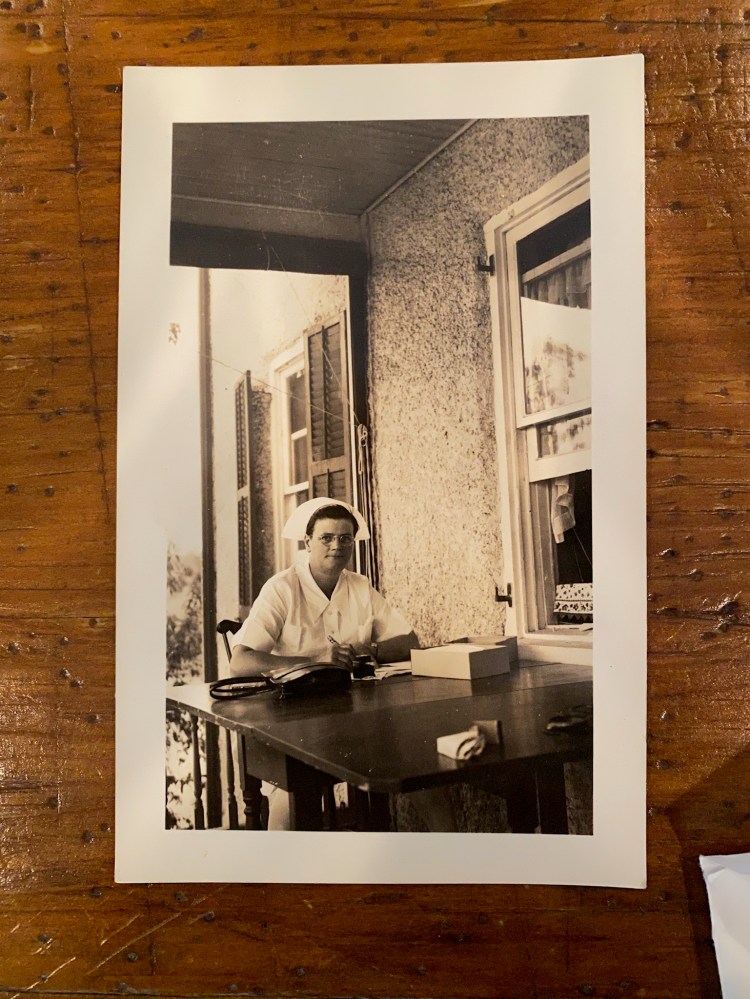
Betty’s nurse.
Nurse and Betty
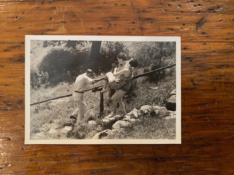
Kenneth guiding the nurse’s steps to the water.
Betty gets water therapy
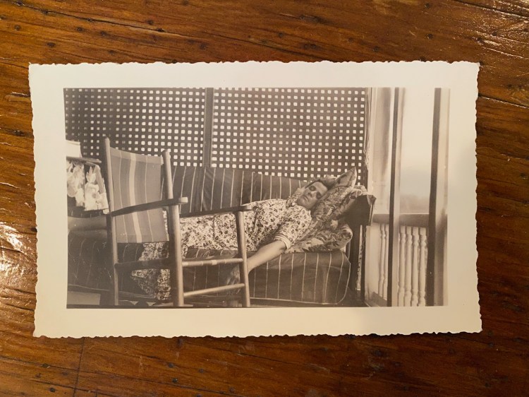
Nurse sleeping (photo presumably taken by Kenneth A. Linn)
All things seemed to be going along fine until the mid ’30s when Betty’s appearance changes dramatically. Suddenly there is a nurse living with them. They leave New York City entirely. Allen is retired by now. The photos seem to depict a severe and sudden decline in Betty that resembles Polio or MS. In one photo the nurse is carrying Betty to a body of water with Kenneth guiding her steps down a set of stairs for water therapy. She dies in June of 1939 at the age of 30.
In my research I’ve never been able to find a death certificate for Betty, yet I did visit her grave in Brooklyn’s amazing Green-Wood Cemetery where the family and some of New York City’s world famous political and artistic residents are buried including Boss Tweed, Leonard Bernstein, Horace Greeley, and Jean-Michel Basquiat.
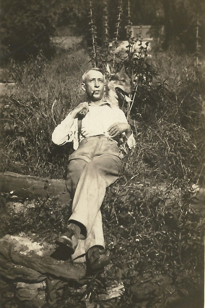
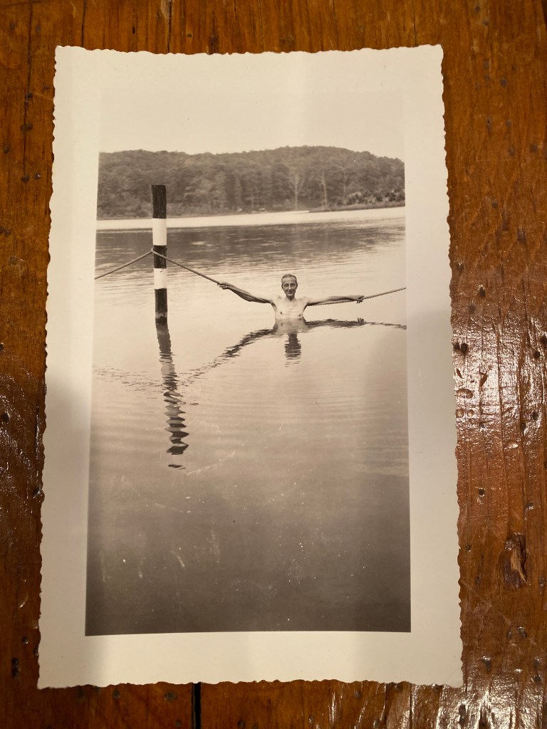
Allen swimming. (Presume photo was taken by Kenneth)
Allen and his wife Sarah die ten years apart–bookending WWII. Ken serves in the Army’s Signal Corp during the war. After their parents’ passings Helen and Ken live out the rest of their lives, together, I believe, unmarried and childless in New Jersey; she as a bookkeeper for the YWCA until 1953 and freelance writer for Scribners, and he seemed to juggle stints teaching photography at his alma mater (Trinity College) and The Progressive School of Photography in Connecticut as well as working in Morristown, NJ.
Some of Kenneth’s photos from this period, in the midst of a developing family tragedy, still manage to show his artistry—or maybe it’s more aptly, detachment in the form of his safe place. I can’t know for sure.
Personally, given my own photography work and interest this connection has even greater significance, as you might imagine. I originally intended to post this during Thanksgiving, as it is a story I am thankful to now know, to whatever extent. I hope it serves as a reminder to those who read it that those family photos in your attic, or your grandparent’s attic can be a treasure trove for relatives and researchers down the road. Share them, keep them and don’t throw them all away!
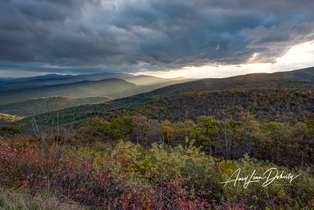
I am very pleased to have a large print on display at the Tysons Corner, REI in Virginia (Go see it.). It’s a photo I took several years ago in Shenandoah National Park’s Northern District of an approaching storm front. It’s a pretty dramatic shot.
The print is a 30″ x 45″ , 1/4″ acrylic face mounted with a DiBond backing. It has a non-glare surface.
For a Good Cause, too!
I’m going to donate 25% of the proceeds to REI’s Cooperative Action Fund which supports building ” . . . a new outdoor culture . . .” that seeks more equitable accessibility to parks and public lands so more people experience the universal benefit of time outside, as well as protecting public lands and waters. The print is priced at $1,500.
I was asked a few months ago if I was interested in hanging my photography work, and I’m very pleased to see it on the walls of my local store. Many thanks to my REI family–local and distant– for making this happen, as well as your ongoing support of my work!
Please contact me if you have questions or interest.


You must be logged in to post a comment.